MATTHEWS c1856 Map Of Upper Canada Ontario Indian Land Agency Divisions Scarce!Luis Porretta Fine Arts4.3(10)See Sold PriceMar 02, 2024
DEVINE c1856 Dr Salters Map Of Lake Huron Ontario Indian Lands etc. No. 7 ScarceLuis Porretta Fine Arts4.3(10)See Sold PriceMar 02, 2024
DUNLEVIE c1856 Map Counties Of Gaspe & Bonaventure Quebec Canada SCARCE! #1Luis Porretta Fine Arts4.3(10)See Sold PriceMar 02, 2024
DUNLEVIE c1856 Map Counties Of Gaspe & Bonaventure Quebec Canada SCARCE! #2Luis Porretta Fine Arts4.3(10)See Sold PriceMar 02, 2024
Map UNITED COUNTIES LEEDS & GRENVILLE by Walling 1861 Rare Canada Map 5ft x 5ftLuis Porretta Fine Arts4.3(10)See Sold PriceMar 02, 2024
Ambroise TARDIEU c1822 Map Venice Napoleon Italian Campaign 17" x 11"Luis Porretta Fine Arts4.3(10)See Sold PriceMar 02, 2024
Geographical, Statistical, Historical Map of AmericaTitle/Content of Map: Geographical, Statistical, and Historical Map of America. Date Printed: 1820 Cartographer: FINDLAYSON, J./YOUNG & DELLEKER, sc. Size: 8.75X15.75 Maps of both North and South AmerSee Sold Price
Geographical, Statistical, & Historical Map of AmericaTitle/Content of Map: Geographical, Statistical, and Historical Map of America. Date Printed: 1820 Cartographer: FINDLAYSON, J./YOUNG & DELLEKER, sc. Size (inches): 10.3x10.6 Maps of both North and SoSee Sold Price
Geographical, Statistical and Historical Map of AmericaTitle: Geographical, Statistical and Historical Map of America Prublication Date: 1827 Publisher: CAREY & LEA Size: 8.5Height - 15Width Additional Information: Two maps surrounded by text. One map ofSee Sold Price
Geographical, Statistical and Historical Map of AmericaTitle/Content of Map: Geographical, Statistical and Historical Map of America Date: 1822 Cartographer: YOUNG & DELLEKER Size: 10.75X15.1 No. 1.Two small maps of both continents surrounded by history aSee Sold Price
SoldGeographical, Statistical, and Historical Map of AGeographical, Statistical, and Historical Map of America Detached from Carey and Lea's American Atlas of 1823, Philadelphia: H. C. Carey and I. Lea, 1822, sight size 20.5" x 16.5"See Sold Price
Geographical, Statistical, and Historical Map ofReserve Reduced! Title: Geographical, Statistical, and Historical Map of America. Publication Date: 1825 Cartographer: FINDLAYSON, J./YOUNG & DELLEKER, sc. Publisher: CAREY & LEA Size: 8.75 x 15.75 MaSee Sold Price
Geographical, Statistical, and Historical Map ofTitle: Geographical, Statistical, and Historical Map of America. Publication Date: 1820 Cartographer: FINDLAYSON, J./YOUNG & DELLEKER, sc. Publisher: CAREY & LEA Size: 8.75Height - 15.75Width Maps ofSee Sold Price
Geographical, Statistical, and Historical Map ofTitle/Content of Map: Geographical, Statistical, and Historical Map of America. Date Printed: 1825 Cartographer: FINDLAYSON, J./YOUNG & DELLEKER, sc. Size: 8.75X15.75 Maps of both North and South AmerSee Sold Price
Sold1821 Carey & Lea Map of North and South America1821 Carey & Lea map of North and South America. 1821 Geographical, Historical, and Statistical Map of America. from the third Philadelphia Edition. Printed by T. H. Palmer for M. Carey & Son, from thSee Sold Price
SoldLavoisne: North and South America, 1821Map: Geographical, Historical, and Statistical Map of America. North America / South America Maker: Lavoisne Publisher: "Aspin, J. / E. Paguenaud. Philadelphia. M. Carey & Son. 1821 Size: North AmericSee Sold Price
SoldEngraved Map of AmericaYoung & Delleker, 1821, "Geographical, Historical, and Statistical Map of America" with engraved maps, original coloring, 17" x 21 1/2" sight size, 24" x 29 3/4" framed.See Sold Price
Geographical, Statistical, and Historical Map of theTitle: Geographical, Statistical, and Historical Map of the United Provinces of South America. Publication Date: 1822 Cartographer: FINLAYSON, J. Publisher: CAREY & LEA Size: 13.1X9 No.49. First attemSee Sold Price
Geographical, Statistical, and Historical Map of theTitle: Geographical, Statistical, and Historical Map of the United Provinces of South America. Publication Date: 1822 Cartographer: FINLAYSON, J. Publisher: CAREY & LEA Size: 13.1Height - 9Width No.49See Sold Price
Geographical, Statistical and Historical Map of theTitle: Geographical, Statistical and Historical Map of the United Provinces of South America. Prublication Date: 1828 Cartographer: FINLAYSON, J. Publisher: CAREY & LEA Size: 13Height - 9Width AdditioSee Sold Price
Geographical, Statistical and Historical Map of theMap: Geographical, Statistical and Historical Map of the United Provinces of South America. Publication Date: 1828 Cartographer: FINLAYSON, J. Publisher: CAREY & LEA Size (inches): 13X9 From the thirdSee Sold Price
SoldCarey & Lea: Antique Map of North America, 1822Map: Geographical, Statistical, and Historical Map of North America Publication Date: 1822 Authors: CAREY & LEA, FINLAYSON, J./J. YEAGER Publisher: CAREY & LEA Size: Double Folio – 13.75 H x 13.30 WSee Sold Price
Geographical, Statistical, and Historical Map of UpperTitle: Geographical, Statistical, and Historical Map of Upper and Lower Canada, And the Other British Possessions in North America. Prublication Date: 1826 Cartographer: LUCAS, FIELDING, JR./YOUNG & DSee Sold Price
SoldGEOGRAPHICAL & STATISTICAL MAP OF CANADA, 1823Hand-colored map surrounded by statistical data, 'Geographical, Statistical and Historical Map of Upper and Lower Canada, and the Other British Possessions in North America.' Sight size 17 x 21, overaSee Sold Price
Geographical Historical Map of Upper/Lower Canada, 1826Map: Geographical, Statistical, and Historical Map of Upper and Lower Canada, And the Other British Possessions in North America. Publication Date: 1826 Author: CAREY & LEA, LUCAS, FIELDING, JR./YOUNGSee Sold Price
Set of four colored engraved maps, geographical,Set of four colored engraved maps, geographical, statistical and historical map of the Windward Islands, Leeward Islands, United provinces of South America and map of Hispaniola or St. Domingo. sightSee Sold Price
Carey & Lea: Antique Map of Upper/Lower Canada, 1826Map: Geographical, Statistical, and Historical Map of Upper and Lower Canada, And the Other British Possessions in North America. Publication Date: 1826 Authors: CAREY & LEA, LUCAS, FIELDING, JR./YOUNSee Sold Price
Geographical & Historical Map of Upper & Lower CanadaTitle/Content of Map: Geographical, Statistical, and Historical Map of Upper and Lower Canada, And the Other British Possessions in North America. Date Printed: 1826 Cartographer: LUCAS, FIELDING, JR.See Sold Price
SoldSix maps to include set of three color copper engravedSix maps to include set of three color copper engraved geographical maps, historical and statistical map of North America, map of the principal rivers throughout the world and map and description of tSee Sold Price
Set of three color copper engraved geographical maps,Set of three color copper engraved geographical maps, historical and statistical map of North America, map of the principal rivers throughout the world and map and description of the principal mountaiSee Sold Price
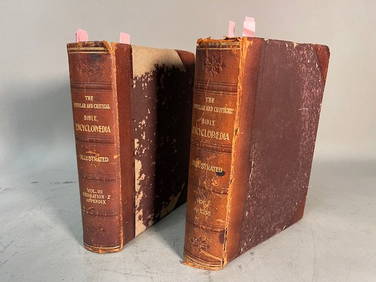
THE POPULAR AND CRITICAL BIBLE ENCYCLOPEDIA Scriptural Dictionary, 1901Neo FineArts Inc4.4(12)See Sold PriceFeb 25, 2024
[MAP]. [ALBRIZZI, Giambatista, 1698-1777]. Carta Geografica...Potter & Potter Auctions4.6(539)See Sold PriceMar 07, 2024
Audubon, NYSE Best Watercolor Ed - Pair: Brown Pelican & Reddish EgretTrillium Antique Prints & Rare Books4.5(30)See Sold PriceFeb 24, 2024
1822 MAP of LEEWARD ISLANDS GEOGRAPHICAL STATISTICAL HISTORICAL antique 17.5x22"Jasper524.5(9.8k)See Sold PriceFeb 27, 2024
1822 MAP of SOUTH AMERICA GEOGRAPHICAL STATISTICAL HISTORICAL antique 17.5x 22"Jasper524.5(9.8k)See Sold PriceFeb 27, 2024
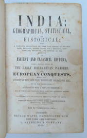
1858 INDIA HISTORY ILLUSTRATED antique Geographical, Statistical, and HistoricalJasper524.5(9.8k)See Sold PriceFeb 27, 2024
1822 MAP of NORTH & SOUTH AMERICA GEOGRAPHICAL STATISTICAL HISTORICAL antiqueJasper524.5(9.8k)See Sold PriceFeb 27, 2024
1822 MAP of CHILI GEOGRAPHICAL STATISTICAL HISTORICAL antique 17.5x 22" CHILEJasper524.5(9.8k)See Sold PriceFeb 27, 2024
Geographical, Statistical, and Historical Map of the Leeward Islands.Jasper524.5(9.8k)See Sold PriceFeb 27, 2024
Geographical Statistical and Historical Map of the Windward IslandsJasper524.5(9.8k)See Sold PriceFeb 27, 2024
Geographical, Statistical, and Historical Map of the West Indies.Jasper524.5(9.8k)See Sold PriceFeb 27, 2024
Guthrie, William 1812 Antique Map. Spain and PortugalAlbion Auctions4.6(336)See Sold PriceMar 01, 2024
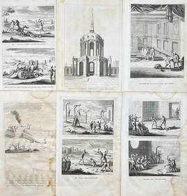
Antoine Augustin Calmet (1672-1757) - Set of 6 Religious Engravings - Tomb of Zechariah - Grotto ofProverde Auctions4.3(3)See Sold PriceFeb 28, 2024
Antoine Augustin Calmet (1672-1757) - Set of 6 Jewish Engravings - Tomb monument of the kings ofProverde Auctions4.3(3)See Sold PriceFeb 28, 2024
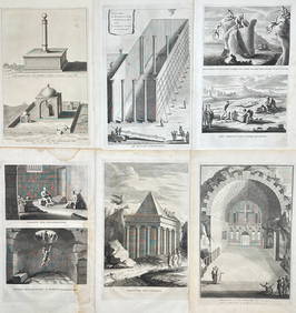
Antoine Augustin Calmet (1672-1757) - Set of 6 Architecture Engraving - Temple of Jerusalem -Proverde Auctions4.3(3)See Sold PriceFeb 28, 2024
George F. Cram - Historical Map of Pittsburgh Allegheny PennsylvaniaProverde Auctions4.3(3)See Sold PriceFeb 28, 2024


![[MAP]. [ALBRIZZI, Giambatista, 1698-1777]. Carta Geografica... (1 of 1)](https://p1.liveauctioneers.com/928/318880/171361280_1_x.jpg?height=282&quality=70&version=1707501302)