SoldGeographical, Statistical & Historical Map Canada, 1823Map: Geographical, Statistical and Historical Map of Upper and Lower Canada, and the other British Possessions in North America Cartographer: F. Lucas Publishing: Philadelphia / Baltimore, 1823 Size:See Sold Price
SoldGEOGRAPHICAL & STATISTICAL MAP OF CANADA, 1823Hand-colored map surrounded by statistical data, 'Geographical, Statistical and Historical Map of Upper and Lower Canada, and the Other British Possessions in North America.' Sight size 17 x 21, overaSee Sold Price
Geographical, Statistical & Historical Map Canada, 1826Map: Geographical, Statistical, and Historical Map of Upper and Lower Canada, and the Other British Possessions in North America Publishing: Carey & Lea, Lucas, Fielding, Jr. / Young & Delleker, sc.,See Sold Price
SoldFIRST ATLAS MAP OF MISSOURI IN STATEHOOD, 1823Geographical, Statistical and Historical Map of Missouri 1823 The hand colored engraving from first edition of Carey & Lea's Atlas, an early example shortly following statehood, details only a few towSee Sold Price
Historical Map of Upper and Lower Canada, 1827Map: Geographical, Statistical and Historical Map of Upper and Lower Canada And the Other British Possessions in North America Publisher: Carey & Lea, Philadelphia 1827 Size: Double Folio – 10.00 HSee Sold Price
Geographical Historical Map of Upper/Lower Canada, 1826Map: Geographical, Statistical, and Historical Map of Upper and Lower Canada, And the Other British Possessions in North America. Publication Date: 1826 Author: CAREY & LEA, LUCAS, FIELDING, JR./YOUNGSee Sold Price
Carey & Lea: Antique Map of Upper/Lower Canada, 1826Map: Geographical, Statistical, and Historical Map of Upper and Lower Canada, And the Other British Possessions in North America. Publication Date: 1826 Authors: CAREY & LEA, LUCAS, FIELDING, JR./YOUNSee Sold Price
Geographical & Historical Map of Upper & Lower CanadaTitle/Content of Map: Geographical, Statistical, and Historical Map of Upper and Lower Canada, And the Other British Possessions in North America. Date Printed: 1826 Cartographer: LUCAS, FIELDING, JR.See Sold Price
Leeward Islands Map C. 1823Geographical, Statistical and Historical Map of the Leeward Islands. 1823. Engraver: J. Yeagar. Publisher: Carey & Lea. Hand-colored. Condition: Some discoloration.; 17 1/2" x 22"See Sold Price
Geographical, Statistical, and Historical Map of UpperTitle: Geographical, Statistical, and Historical Map of Upper and Lower Canada, And the Other British Possessions in North America. Prublication Date: 1826 Cartographer: LUCAS, FIELDING, JR./YOUNG & DSee Sold Price
Geograph. Instituts: Scarce 1823 Map of Chile, 1823Description: The Chile map from the scarce German version of the Carey & Lea Geographical, Statistical, and Historical Atlas. As in the original American edition, the Weimar map is surrounded on threeSee Sold Price
Geograph. Instituts: Scarce 1823 Map of ChileThe Chile map from the scarce German version of the Carey & Lea Geographical, Statistical, and Historical Atlas. As in the original American edition, the Weimar map is surrounded on three sides by desSee Sold Price
Geograph. Instituts: Scarce 1823 Map of BrazilDescription: The Brazil map from the scarce German version of the Carey & Lea Geographical, Statistical, and Historical Atlas. As in the original American edition, the Weimar map is surrounded on threSee Sold Price
Geograph. Instituts: Scarce 1823 Map of BrazilThe Brazil map from the scarce German version of the Carey & Lea Geographical, Statistical, and Historical Atlas. As in the original American edition, the Weimar map is surrounded on three sides by deSee Sold Price
Geograph. Instituts: Scarce 1823 Map of PeruThe Peru map from the scarce German version of the Carey & Lea Geographical, Statistical, and Historical Atlas. As in the original American edition, the Weimar map is surrounded on three sides by descSee Sold Price
SoldGeographical, Statistical, and Historical Map of AGeographical, Statistical, and Historical Map of America Detached from Carey and Lea's American Atlas of 1823, Philadelphia: H. C. Carey and I. Lea, 1822, sight size 20.5" x 16.5"See Sold Price
Sold(2) Geographical, Statistical, and Historical Maps(2) Geographical, Statistical, and Historical Maps, of Massachusetts and New Hampshire, from Carey and Lea's American Atlas of 1823, sight size 20.5" x 16.5"See Sold Price
SoldMap of West Canada by TallisHand coloured. From The Illustrated Atlas, And Modern History Of The World Geographical, Political, Commercial & Statistical c. 1851, published by John Tallis and Company Unframed: 10 1/2 in. x 13 in.See Sold Price
4 Maps (1838) North America, 2 Canada, West Indies[North America] 4 Maps from T. G. Bradford, “An Illustrated Atlas, Geographical, Statistical, And Historical, Of The United States, And Adjacent Countries,” Bos: Weeks, Jordan, and Company/ NY: WiSee Sold Price
Sold1831 Woodbridge Map of the United States -- Geographical & Statistical Map of the United States.Title: 1831 Woodbridge Map of the United States -- Geographical & Statistical Map of the United States. Adapted to Woodbridge's Geography Cartographer: W. Woodbridge Year / Place: 1831, Hartford Map DSee Sold Price
SoldCarey: Geographical & Statistical Map of Europe, 1822Geographical and Statistical Map of Europe. M. Carey, Young & Delleker 1822. Restriking of map, Europe: drawn from the best authorities for the illustration of Lavoisne's genealogical, historical, chrSee Sold Price
SoldGEOGRAPHICAL & STATISTICAL MAPS OF DENMARK, SWEDEN & NODenmark, Sweden and Norway after the fall of Napolean 1820 by M. Carey & Son, hand-colored map surrounded by statistical data. Sight size 17 x 21 inches, overall 26.75 x 29.See Sold Price
Sold1815 POLAND HUNGARY GEOGRAPHICAL & STATISTICAL MAP1815 POLAND HUNGARY GEOGRAPHICAL & STATISTICAL MAP Size: 27.5 x 23.5" including frame Condition: Very good, crease to center.See Sold Price
Lavoisne: Geographical & Statistical Map of France 1820Map: Geographical and Statistical Map of France Cartographer: M. Lavoisne Date: 1820 Origin: Philadelphia Size: 16.5 x 20.5 inches Colorful map of France. This Copper Plate map shows geographical featSee Sold Price
Map UNITED COUNTIES LEEDS & GRENVILLE by Walling 1861 Rare Canada Map 5ft x 5ftLuis Porretta Fine Arts4.3(10)See Sold PriceMar 02, 2024
Nova Totius Full Color Geographical World MapThe Benefit Shop Foundation Inc.4.3(2.9k)See Sold PriceFeb 28, 2024
Vintage County Map Of NY State Plate EngravingThe Benefit Shop Foundation Inc.4.3(2.9k)See Sold PriceFeb 28, 2024
Vintage Framed Pine Island & Lacoste Island MapThe Benefit Shop Foundation Inc.4.3(2.9k)See Sold PriceMar 06, 2024
[MAP]. [ALBRIZZI, Giambatista, 1698-1777]. Carta Geografica...Potter & Potter Auctions4.6(545)See Sold PriceMar 07, 2024
1822 MAP of LEEWARD ISLANDS GEOGRAPHICAL STATISTICAL HISTORICAL antique 17.5x22"Jasper524.5(9.9k)See Sold PriceFeb 27, 2024
1822 MAP of SOUTH AMERICA GEOGRAPHICAL STATISTICAL HISTORICAL antique 17.5x 22"Jasper524.5(9.9k)See Sold PriceFeb 27, 2024
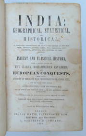
1858 INDIA HISTORY ILLUSTRATED antique Geographical, Statistical, and HistoricalJasper524.5(9.9k)See Sold PriceFeb 27, 2024
1822 MAP of NORTH & SOUTH AMERICA GEOGRAPHICAL STATISTICAL HISTORICAL antiqueJasper524.5(9.9k)See Sold PriceFeb 27, 2024
1822 MAP of CHILI GEOGRAPHICAL STATISTICAL HISTORICAL antique 17.5x 22" CHILEJasper524.5(9.9k)See Sold PriceFeb 27, 2024
Geographical, Statistical, and Historical Map of the Leeward Islands.Jasper524.5(9.9k)See Sold PriceFeb 27, 2024
Geographical Statistical and Historical Map of the Windward IslandsJasper524.5(9.9k)See Sold PriceFeb 27, 2024
Geographical, Statistical, and Historical Map of the West Indies.Jasper524.5(9.9k)See Sold PriceFeb 27, 2024
JOYCE WIELAND: TRUE PATRIOT LOVE. 1971, 1st. ED.Toronto Book Auctions4.3(13)See Sold PriceMar 07, 2024
Robert de Vaugondy - Map of Canada - Mer de l' Ouest or Sea of the West and a Northwest PassageProverde Auctions4.3(3)See Sold PriceFeb 28, 2024
Mostly U.S., Some Canada Maps etc (40 Pcs)Grant Zahajko Auctions, LLC4.7(1k)See Sold PriceMar 06, 2024


![[MAP]. [ALBRIZZI, Giambatista, 1698-1777]. Carta Geografica... (1 of 1)](https://p1.liveauctioneers.com/928/318880/171361280_1_x.jpg?height=282&quality=70&version=1707501302)