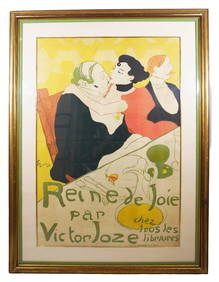
Henri De Toulouse-Lautrec "La Reine de Joie" LithographNapoleon's Fine Art4.4(75)See Sold PriceFeb 25, 2024
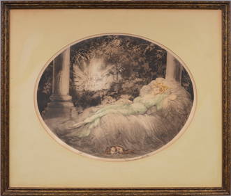
Louis Icart (1888-1950) Signed French Art Deco Elegant Woman & Dog Portrait Hand SignedCurated Gallery Auctions4.6(138)See Sold PriceFeb 25, 2024
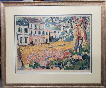
Maurice Vlaminck French Lithograph ed50 Pencil Signed Post Impressionist Street SceneHess Fine Auctions4.5(213)See Sold PriceMar 02, 2024
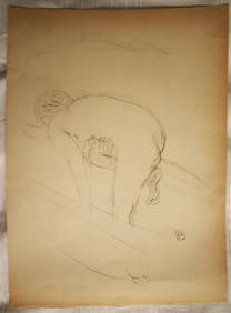
PIERRE BONNARD (1867-1947) Original Lithograph 1/180 by Manuel Broker 1946 BatheLuis Porretta Fine Arts4.3(10)See Sold PriceMar 02, 2024
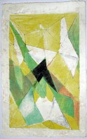
JAQUES VILLON (1875-1963) Hand Colored Cubist Lithograph ca1950Luis Porretta Fine Arts4.3(10)See Sold PriceMar 02, 2024
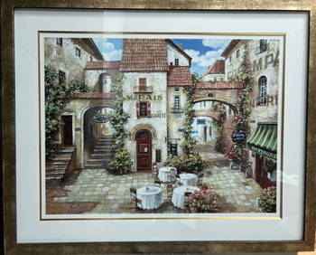
" Le MARAIS" BY ROBERT DUVAL LARGE FRAMED LITHOGRAPH SIGNED LOWER RIGHTAlice Callahan Auction House4.5(61)See Sold PriceMar 02, 2024
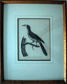
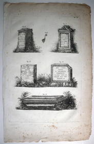
Le Valliant Crowned Hornbill Calao Couronne Rare Engraving ca1802 Framed OrnithologyLuis Porretta Fine Arts4.3(10)See Sold PriceMar 02, 2024
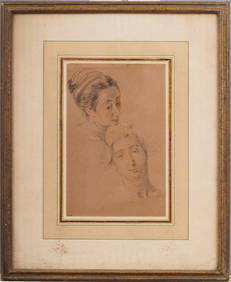
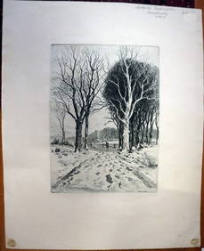
PAUL BERDANIER (1879-1961) Original Engraving Landscape Listed Artist CollectibleLuis Porretta Fine Arts4.3(10)See Sold PriceMar 02, 2024
Vintage litho print Henri Matisse French Expressionism blue human figuresVintage Art Finder Gallery4.2(4)See Sold PriceApr 07, 2024
VENET / DEBUCOURT (1755-1832) Set 3 x Aquatint Engraved Hunting Scenes 23" x 16"Luis Porretta Fine Arts4.3(10)See Sold PriceMar 02, 2024
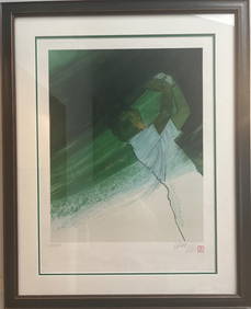
"NERI" ORIGINAL GREEN AND WHITE GOLF HAND SIGNED NUMBERED FRAMED UNDER GLASSAlice Callahan Auction House4.5(61)See Sold PriceMar 02, 2024
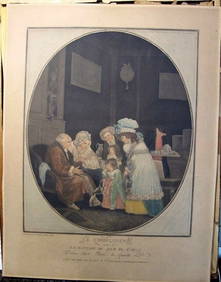
Philibert-Louis Debucourt Original Engraving Le Compliment 1787 VERY RARE!Luis Porretta Fine Arts4.3(10)See Sold PriceMar 02, 2024
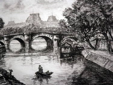
AIME EDMOND DALLEMAGNE (1882-1971) Engraving Paris Numbered & Pencil SignedLuis Porretta Fine Arts4.3(10)See Sold PriceMar 02, 2024
ORGIAZZI 14 x Folio Sized Engravings Roman Road Signs etc. c1802 Aix FranceLuis Porretta Fine Arts4.3(10)See Sold PriceMar 02, 2024
SoldFrench world map Andriveau-GoujonFramed lithograph ''Mappemonde en deux Hemispheres,'' published by J. Andriveau-Goujon in 1843 in a French atlas, overall: 23''h x 29''w.See Sold Price
MAPS - World. Andriveau-GoujonWorld. E. Andriveau-Goujon, [Lot of 2] Courants et Mouvements Generaux de la Mer d'Apres le Lt. F. Maury [and] Courants de l'Atmosphere d'Apres le Lt. F. Maury, 1850 (circa). Printed Color. These twoSee Sold Price
Sold4pc 19th C French Maps of China- LaPie, Andriveau4pc 19th Century French Maps of China by Lapie and Andriveau-Goujon. Includes 2pc Lapie 'L' Empire Chinois' 1832 (19.5x23.5'') and 1851 (20x27''), and 2pc Andriveau-Goujon ''L' Empire Chinois' 1834 (1See Sold Price
French Map of Western U.S. c.1870Title: Etats-Unis (Etats l'Ouest) Author: Andriveau-Goujon Description: Engraved map, hand-colored. 62.2x45.7 cm. (24½x18").Attractive and brightly colored map of the American West and Mexico, with iSee Sold Price
French Map of Western U.S. c.1870Title: Etats-Unis (Etats l'Ouest) Author: Andriveau-Goujon Description: Engraved map, hand-colored. 62.2x45.7 cm. (24½x18").Attractive and brightly colored map of the American West and Mexico, with iSee Sold Price
SoldAndriveau-Goujon (J) double-hemisphere worldAndriveau-Goujon (J) After. Mappemonde en deux Hémispheres,double-hemisphere world map, with title centre above and additional comparative diagram of mountain heights, centre below, with relatSee Sold Price
SoldMaps, Andriveau-Goujon, Atlas, 1845(lot of 14) Unframed handcolored engraved maps, from ''Atlas Classique et Universel de Geographie Ancienne et Moderne,'' c.1850, by J. Andriveau-Goujon (French, 19th Century), largest plate: 21.75''hSee Sold Price
SoldMaps, Andriveau-Goujon, Atlas, 1845(lot of 14) Unframed handcolored engraved maps, from ''Atlas Classique et Universel de Geographie Ancienne et Moderne,'' c.1850, by J. Andriveau-Goujon (French, 19th Century), largest plate: 21.75''hSee Sold Price
SoldAndriveau-Goujon (E) Planisphere TerrestreAndriveau-Goujon (Eugene) Planisphere Terrestre, school map of the world, depicting the principle empires, with inset maps of the poles and mountain elevations, lithographic map, printed in coSee Sold Price
Andriveau-Goujon: Antique Map of Paris, 1889Map: Paris Plan Nouveau. Publication Date: 1889 Cartographer: ANDRIVEAU-GOUJON, EMILE Publisher: BARRERE Size: Pocket – 24.00 H x 31.00 W Inches Cased issue sold in London by Edward Stanford, of a FSee Sold Price
SoldAndriveau-Goujon (Eugene) - Planisphère présentantwall map of the world on Mercator's projection, showing the directions of sea currents and winds, with insets of the poles, Suez, Panama, Antilles and southern Mexico, engraved map in original hand-coSee Sold Price
1875 Carte Generale des Etats-Unis et du MexiqueThis is an authentic antique map of the United States and Mexico, with inserts of Central America and the Lesser Antilles by E. Andriveau-Goujon. The map came out of Paris and is dated 1875. This largSee Sold Price
Paris Plan Nouveau.Title/Content of Map: Paris Plan Nouveau. Date: 1889 Cartographer: ANDRIVEAU-GOUJON, EMILE Size: 24X31 Cased issue sold in London by Edward Stanford, of a French plan lithographed in colors by L. WuhrSee Sold Price
SoldMAPS, Pacific Ocean, U.S. NavyPacific Ocean. U.S. Navy/Andriveau-Goujon, [Lot of 2] Naval Chart of the Pacific and Western Atlantic [and] Oceanie, 1860-1901 (circa). This lot contains two maps focused on colonial ownership in theSee Sold Price
SoldAtlas of the world by Andriveau-Goujon, 1835Heading: Author: Andriveau-Goujon, J. Title: Atlas Classique et Universel de Géographie Ancienne et Moderne contenant les Découvertes et les Divisions les plus Nouvelles dans les Cinq Parties du MoSee Sold Price
SoldCarte Genrale Des Etats-Unis Et Du Mexique 1862Map Title: Carte Genrale Des Etats-Unis Et Du Mexique Date: 1862 Publisher: Andriveau-Goujon: Paris Size: 24.3 x 18.25 inches Eastern sheet only. Only east of the Mississippi shown, only Yucatan shownSee Sold Price
Paris Plan Nouveau.Title: Paris Plan Nouveau. Publication Date: 1889 Cartographer: ANDRIVEAU-GOUJON, EMILE Publisher: BARRERE Size: 24 x 31 Description: Cased issue sold in London by Edward Stanford, of a French plan liSee Sold Price
Asie Méridionale,comprenant La Presqu’ile deAtlas Usuel, No. 24; Atlas Universel, No. 37 E. Andriveau-Goujon, éditeur, Paris, 1873 46.5 cm x 62.5 cm Original color (British administrative divisions, tributary states, and independent states).See Sold Price
SoldTwo 18th Century French World MapsA nautical world map, signed at the lower right corner "Moithey Ing.Geo. del et sculp Herault Scrip" and a world map published by Delmarche. Both hand colored. Dimensions: Each frame is 13" x 18 1/2".See Sold Price
SoldFrench World Map, Hand ColoredHand colored French world map dated 1792, titled Mappe Monde ou Description Du Globe Terrestre & Aquatique Suivant les Dernieres & Meilleures, A. Amsterdam, Ches I.B Elwe, MDCCXCII. Matted and framedSee Sold Price
Sold18TH CENTURY DE l'ISLE FRENCH WORLD MAP18TH CENTURY DE l'ISLE FRENCH WORLD MAP: Circa mid 18th century, double hemisphere map of the world with alternate views in all 4 corners. Top cartouche with banner and motto, partial title ''Mappe-MoSee Sold Price
Sold1752 French World Map With Explorers RoutesMaps1752 French World Map With Explorers’ Routes & Dates 1752, World Map, “Mappe Monde au Description du Glove Terrestre,” by Robert de Vaugondy, published by Robert and Boudet in PaSee Sold Price
Sold1761 Vaugondy French World Map"Mappe Monde / suivant la projection / des cartes redmites. par ls S. Robert de Vaugondy..../ A Paris Chez l' Auteur... "French, 1761." [hand colored out lines.] 10 7/8" h x 17 1/2" w = sheet 14 7/8"See Sold Price
Sold1752 French World Map With Explorers RoutesHistoric Maps1752 French World Map With Explorers' Routes & Dates 1752, World Map, "Mappe Monde au Description du Glove Terrestre," by Robert de Vaugondy, published by Robert and Boudet inSee Sold Price
LATE 17TH C. FRENCH MAP OF THE NEW WORLD BY ALEXIS-HUBERT JAILLOT (1632-1712)Thomaston Place Auction Galleries4.4(394)See Sold PriceFeb 24, 2024
Museum of Horrors - King of Pigs -Emil Zola - 1899Levy Auction House4.3(11)See Sold PriceFeb 27, 2024
Railways & Transport.- [Prospectus] The Dorking, Brighton, and Arundel Atmospheric Railway, byForum Auctions4.4(54)See Sold PriceFeb 29, 2024
Carte de L'Algérie et de la Régence de Tunis' ANDRIVEAU-GOUJON Algeria 1850 mapJasper524.5(9.9k)See Sold PriceFeb 28, 2024


![Railways & Transport.- [Prospectus] The Dorking, Brighton, and Arundel Atmospheric Railway, by (1 of 1)](https://p1.liveauctioneers.com/5458/319736/171654703_1_x.jpg?height=282&quality=70&version=1708010439)


