SoldFRAMED & GLAZED MAP OF CRIPPLEGATE WARDWITHIN & WITHOUT, PRINTED FOR R. BALDWIN 47, PATER-NOSTER ROW. 1773, 8 X 10See Sold Price
London: Noorthouck’s Ward Plan of Walbrook & DowgateMap Title: Walbrook and Dowgate Wards divided in two Parifhes Accordint to a New Survey Year: 1772 Taken from: For Noorthouck's History of London 1772 Dimentions: Plate size 25x19 cm Note: Hand coloreSee Sold Price
Old Plain of Walbrook and Dowgate Wards in LondonTitle/Content of Map: Old Plain of Walbrook and Dowgate Wards in London Publisher: From: "For Noorthouck's History of London 1772 Date Printed: 1772 Material/Medium:Copper etching on paper Size: SizeSee Sold Price
Old Plain of Walbrook and Dowgate Wards in LondonTitle/Content of Map: Old Plain of Walbrook and Dowgate Wards in London Publisher: From: "For Noorthouck's History of London 1772 Date Printed: 1772 Material/Medium:Copper etching on paper Size: SizeSee Sold Price
1772 - Old Plain of Walbrook and Dowgate Wards inTitle/Content of Map: 1772 - Old Plain of Walbrook and Dowgate Wards in London Publisher: From: "For Noorthouck's History of London 1772 Date Printed: 1772 Description: Hand colored with Passepartou aSee Sold Price
Sold1720 Strype Map of London around Cannon Street --Title/Content of Map: 1720 Strype Map of London around Cannon Street -- Walbrook Ward and Dowgate Ward with its Division into Parishes … Date: 1720, London Cartographer: J Strype Size: 12.2 X 7.1 inSee Sold Price
SoldJOHNSON AND WARD, MAP OF THE UNITED STATES, 1864JOHNSON AND WARD, MAP OF THE UNITED STATES, 1864 (CIVIL WAR ISSUE). SHEET 18 X 26 1/2"; FRAMED AND GLAZED-22 X 31"See Sold Price
SoldEARLY FRAMED & GLAZED MAP OF CARIBBEANFRENCH PARM. RIZZI ZANNONI PARIS, 12" X 17 3/4"See Sold Price
SoldFRAMED & GLAZED MAP DEPICTING SWANSEA & SOMERSETMASS, INCLUDING POTTERSVILLE, 15 1/2" X 23 1/2" SIGHTSee Sold Price
SoldFRAMED & GLAZED MAP OF FLORIDA, FROMRAND McNALLY & COMPANY, LATE 19TH C., 19 1/4" X 15"See Sold Price
SoldFRAMED & GLAZED MAP OF MARYLAND,BY THOMAS COWPERTHWAIT, CIRCA 1850, SHOWS ONE INCH TEAR, 12" X 15"See Sold Price
SoldFRAMED & GLAZED MAP OF EASTERN UNITED STATESPUBLISHED MAY 1ST, 1819 BY J. MAWMAN & OTHER PROPRIETORS, 8 1/4 X 10See Sold Price
SoldFRAMED & GLAZED MAP OF IRELAND, 7 1/2 X 6 1/2CIRCA 1680, PUBLISHED IN PARIS BY PIERRE DUVALSee Sold Price
SoldTWO FRAMED & GLAZED MAPS, ONE OF MILFORDDELAWARE, TOGETHER WITH MAP OF BOROUGH OF DOWNINGTOWN, 14 1/2" X 15"See Sold Price
1937 Holland, Michigan, Tulip Time Map Guide, FramedLakeshore Event Center4.6(112)See Sold PriceMar 02, 2024
2 Midcentury Modern Glazed Clay Pottery TilesEpic Auctions and Estate Sales4.6(210)See Sold PriceMar 02, 2024
Hand Colored Map of the city of Amsterdam 1720Global Auctions Company4.3(36)See Sold PriceMar 03, 2024
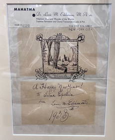
Louis Michel Eilshemius Pen and Ink Drawing 1933 YosemiteGlobal Auctions Company4.3(36)See Sold PriceMar 03, 2024
1867 Map of the Railroads of The State of New YorkRail & Road Auctions4.6(165)See Sold PriceMar 08, 2024
17th Century Hand Colored Engraved Map of GermanyGlobal Auctions Company4.3(36)See Sold PriceMar 03, 2024
18th Century Hess Germany Hand colored Engraved MapGlobal Auctions Company4.3(36)See Sold PriceMar 03, 2024
David Hockney signed lithograph The East Yorkshire Landscape LA Louver GalleryGlobal Auctions Company4.3(36)See Sold PriceMar 03, 2024
R. C. Gorman Lithograph in colors Doreen 1981 SIgnedGlobal Auctions Company4.3(36)See Sold PriceMar 03, 2024
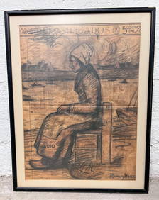
Alfredo Ramos Martinez Charcoal Drawing on printed newspaper Seated WomanGlobal Auctions Company4.3(36)See Sold PriceMar 03, 2024
Maurice Nespor Pastel Drawing landscape Umpqua Salt MarshGlobal Auctions Company4.3(36)See Sold PriceMar 03, 2024
A MAP OF THE STRAND OF THE NORTH SIDE OF CHANNEL OF RIVER ANNA LIFFE, 1811 Engraving, 680 x 480mmAdam's Auctioneers4.3(5)See Sold PriceFeb 27, 2024
Don Hong-Oai "Solitary Wooden Boat" Gelatin PrintAuctions at Showplace4.6(744)See Sold PriceMar 17, 2024
Don Hong-Oai "Four Boats..." Gelatin Silver PrintAuctions at Showplace4.6(744)See Sold PriceMar 17, 2024
Map of St. Kitts and Nevis Depot de la Marine, Paris, 1758Global Auctions Company4.3(36)See Sold PriceMar 03, 2024
Two (2) Antique 18th C. Copper Engraved Framed Maps - America & EuropeMagnusson Art Group4.5(53)See Sold PriceMar 14, 2024
Framed Space Age Rand McNally Map of Planets Poster, 1958PUBLIC SALE4.7(227)See Sold PriceMar 02, 2024