2 Illuminated Books of Hours LeavesSchmidt's Antiques Inc. Since 19114.8(431)See Sold PriceMar 02, 2024
Illuminated Manuscript Leaf of The CrucifixionSchmidt's Antiques Inc. Since 19114.8(431)See Sold PriceMar 02, 2024
RARE 1930s AUTOGRAPH BOOK FEATURING RUTH & GEHRIGJohn McInnis Auctioneers,LLC4.5(505)See Sold PriceFeb 25, 2024
Timetable, Paper and Ephemera Lot-Eastern USA RailroadsJM Hobby Supply and Railroad Artifact Auctions4.4(127)See Sold PriceFeb 24, 2024
SCARCE 1971 Kim Il Sung Signed Book "ON THE WORK OF THE WOMAN'S UNION"Rbfinearts4.5(578)See Sold PriceFeb 24, 2024
1885 CIVIL WAR 1ed Famous Memoirs US Grant Sheridan Sherman 6v RARE LOT MapsSchilb Antiquarian Rare Books4.8(428)See Sold PriceMar 10, 2024
"WINTER AND SUMMER IN MAINE" 1904 PHOTO ALBUMJohn McInnis Auctioneers,LLC4.5(505)See Sold PriceFeb 25, 2024
1821 THE (3) VOYAGES of CAPT JAMES COOK VOL. I-VIIJohn McInnis Auctioneers,LLC4.5(505)See Sold PriceFeb 24, 2024
[BASEBALL]. [SHEET MUSIC]. KALBFLEISCH, J. H. The Live Oak ...Potter & Potter Auctions4.6(545)See Sold PriceMar 07, 2024
Illuminated Manuscript Leaf of The VisitationSchmidt's Antiques Inc. Since 19114.8(431)See Sold PriceMar 02, 2024
Illuminated Manuscript Leaf of GethsemaneSchmidt's Antiques Inc. Since 19114.8(431)See Sold PriceMar 02, 2024
c1700s RARE Arabic Handwritten Manuscript Middle East Persia Journal ARABIASchilb Antiquarian Rare Books4.8(428)See Sold PriceMar 10, 2024
Folk-Lore from the Cape Verde Islands: Part I & IITwo Volumes Book Title: Folk-Lore from the Cape Verde Islands: Part I and Part II Author: Elsie Clews Parsons Publisher: New York: The American Folk-Lore Society, 1923 First Edition Size: 9.8 x 6.5 inSee Sold Price
SoldCape Verde.- Coronelli (Vincenzo Maria), Bocche delCape Verde.- Coronelli (Vincenzo Maria) Bocche del Fiume Negro et Isole di Capo Verde, showing Cape Verde Islands and of part of the coast of Senegal to the right, engraved map, an excellent impressioSee Sold Price
Cape Verde.- Coronelli (Vincenzo Maria), Bocche delCape Verde.- Coronelli (Vincenzo Maria) Bocche del Fiume Negro et Isole di Capo Verde, engraved map of the Cape Verde Islands and of part of the coast of Senegal to the right, 460 x 615 mm., large decSee Sold Price
Bellin: Cape Verde with Goree Island ViewTwo Cape Verde maps on a single sheet from the atlas of Prevost d'Exiles' influential travel book, Histoire Generale des Voyages. On the left is Bellin's lovely plan of St. Vincent Bay, with parts ofSee Sold Price
SoldCape Verde.- Portugal.- Mount (Richard) A Chart of theCape Verde.- Portugal.- Mount (Richard) A Chart of the Islands of Cape Verd; A Sea Chart of part of the Coasts of Gallisia and Portugall, two sea charts, engravings on laid paper without watermarks, eSee Sold Price
SoldCape Verde Islands Bellin, 1758 MapCarte Des Isles Du Cap Verd'. Cape Verde Islands. Bellin, 1758 Antique Map. Size: Approx 23.5 x 30.0cm, 9.25 x 11.75 inches; Please note that this is a folding map. Antique 18th century copperplate maSee Sold Price
SoldOriginal 19th-Century Chart of Cape Verde IslandsOriginal mariners chart of the Cape Verde Islands from 1851 by J. W. Norie. Chart shows all relevant islands and notes several bays, points, and towns. Matted and mounted into an antiqued silver frameSee Sold Price
SoldMallet: Antique Map of Cape Verde Islands, 1683Isles du Cap-Verd' The map shows the Cape Verde islands: St Antonio (Santo Antão/Antao), St Vicente (Sao/São Vicente), Sal, St Nicholas (Sao Nicolau), Sta Lucia (Santa Luzia), St Jago (Santiago), BoSee Sold Price
Walker: Antique Map of Playa Bay, Cape Verde IslandsTitle/Content of Map: 1782 Walker Map of Playa Bay, Cape Verde Islands -- Praya Bay in the Island of St. Iago Date Printed: 1782, London Cartographer: Walker (?) Size: 7.2 x 8.8 in. This is a very intSee Sold Price
Didot Bellin: West Coast of Africa, Cape Verde IslandsMap: "Plan De La Ville Et Des Forts De St. Yago" Maker: Didot, Bellin, Jacques Nicolas, Elder (1703-1772) Published: Didot 1747 Paris Village and fort of the west coast of Africa in the Cape Verde IslSee Sold Price
1782 Walker Map of Playa Bay, Cape Verde Islands --Reserve Reduced! Title/Content of Map: 1782 Walker Map of Playa Bay, Cape Verde Islands -- Praya Bay in the Island of St. Iago Date: 1782, London Cartographer: Walker (?) Size: 7.2 x 8.8 in. This is aSee Sold Price
SoldBellin: Antique Map of Cape Verde Islands, 1748Title/Content of Map: Karte von den Eylanden des Grunen Vorgeburges Cartographer: Bellin Place & Date: Leipzig / 1748 Size: 11" x 8 1/4" Condition: old color; overall age toning and some staining andSee Sold Price
19th-Century Chart - Cape Verde IslandsOriginal chart of the Cape Verde Islands from 1851 by J. W. Norie. Chart shows all relevant islands and notes several bays, points, and towns. Matted and mounted into an antiqued silver frame. OverallSee Sold Price
SoldBellin: Cape Verde IslandsMap Title: Carte des Isles du Cap Verd Cartographer: Bellin Place / Date: Paris / 1746/1760 Size: 11" x 8 1/4" Bellin's attractive and well detailed map of the Atlantic islands of Cape Verde, "drawn fSee Sold Price
Bellin: Antique Map of Cape Verde Islands, 1746Map: Carte des Isles du Cap Verd Cartographer: Bellin Place & Date: Paris / 1746/1757 Size: 11" x 8 1/4" Condition: b&w; folds as issued; light overprinting Bellin's attractive and well detaileSee Sold Price
Bonne: Map of Guinea & Cape Verde Islands, 1771Map: 'Carte de la Guinée, contenant les Isles du Cap Verd, le Senegal, la Côte de Guinée proprement dite, les Royaumes de Loango, Congo, Angola et Benguela, avec les Pays voisins autant qu'ils sontSee Sold Price
1782 Walker Map of Playa Bay, Cape Verde Islands -- Praya Bay in the Island of St. IagoTitle: 1782 Walker Map of Playa Bay, Cape Verde Islands -- Praya Bay in the Island of St. Iago Cartographer: Walker (?) Year / Place: 1782, London Map Dimension (in.): 7.2 x 8.8 in. This is a very intSee Sold Price
Iles du Cap Vert, La Praia, Cape Verde Islands. c1893Iles du Cap Vert, La Praia, Cape Verde Islands. December 1893. Cyanotype. Good contrast and tonality.Unidentified photographer. 3.125 x 4.5 in. In archival mat. 11 x 14 inSee Sold Price
1782 Walker Map of Playa Bay, Cape Verde Islands --Title/Content of Map: 1782 Walker Map of Playa Bay, Cape Verde Islands -- Praya Bay in the Island of St. Iago Date: 1782, London Cartographer: Walker (?) Size: 7.2 x 8.8 in. This is a very interestingSee Sold Price
Carte des Isles du Cap-Verd'. Cape Verde islands. SalTITLE/CONTENT OF MAP: 'Carte des Isles du Cap-Verd, dressée sur les Journaux et les Remarques des plus habiles Navigateurs [Map of the Cap Verde islands]' DATE PRINTED: 1746 IMAGE SIZE: Approx 22.5 xSee Sold Price
1782 Walker Map of Playa Bay, Cape Verde Islands --Title: 1782 Walker Map of Playa Bay, Cape Verde Islands -- Praya Bay in the Island of St. Iago Date: 1782, London Cartographer: Walker (?) Size: 7.2 x 8.8 in. Additional Information: This is a very inSee Sold Price
Iles du Cap Vert, La Praia, Cape Verde Islands. 1893Iles du Cap Vert, La Praia, Cape Verde Islands. December 1893. Cyanotype. 3.125 x 4.5 in.See Sold Price
Walker: Antique Map of Cape Verde Islands, 1782Title/Content of Map: 1782 Walker Map of Playa Bay, Cape Verde Islands -- Praya Bay in the Island of St. Iago Date Printed: 1782, London Cartographer: Walker (?) Size: 7.2 x 8.8 in. Condition: Very goSee Sold Price
SoldBellin: Cape Verde IslandsReserve Reduced! Title of Map: Carte des Isles du Cap Verd Cartographer: Bellin Place / Date: Paris / 1746/1757 Size: 11" x 8 1/4" Condition: b&w; folds as issued; light overprinting Bellin's attractiSee Sold Price
1861 Mythical Folklore Fairy Tale Monsters German Literature Musaus MermaidsSchilb Antiquarian Rare Books4.8(428)See Sold PriceMar 10, 2024
MATTHEWS c1856 Map Of Upper Canada Ontario Indian Land Agency Divisions Scarce!Luis Porretta Fine Arts4.3(10)See Sold PriceMar 02, 2024
1839 BIRDS Ornithology Jardine Naturalist Library Goldfinch Warbler Ravens WrensSchilb Antiquarian Rare Books4.8(428)See Sold PriceMar 31, 2024
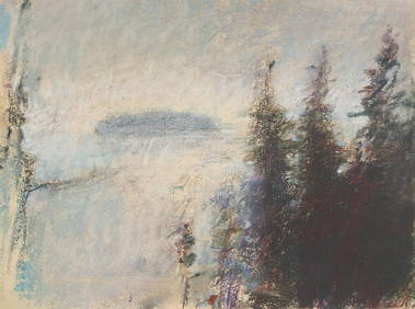
Wolf Kahn (American/German, 1927-2020) - Lifting FogFreeman's | Hindman4.5(158)See Sold PriceFeb 28, 2024
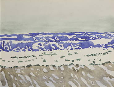
Fairfield Porter (American, 1907-1975) - SeascapeFreeman's | Hindman4.5(158)See Sold PriceFeb 28, 2024
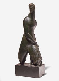
Alexander Archipenko (American/Ukrainian, 1887-1964) - Walking, SchreitendeFreeman's | Hindman4.5(158)See Sold PriceFeb 28, 2024
Louise Nevelson (American, 1899-1988) - Volcano Magic VIFreeman's | Hindman4.5(158)See Sold PriceFeb 28, 2024
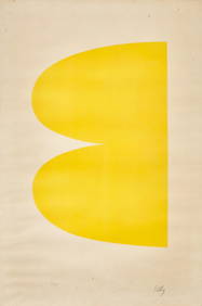
Ellsworth Kelly (American, 1923-2015) - Yellow (Jaune) (from Suite of Twenty-Seven ColorFreeman's | Hindman4.5(158)See Sold PriceFeb 28, 2024
SOVIET JUDAICA LITHOGRAPH PRINT BY ANATOLI KAPLANAntique Arena Inc.4.5(878)See Sold PriceFeb 24, 2024
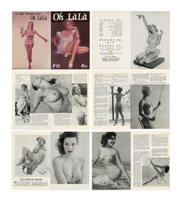
BACK TO THE FUTURE PART II (1989) - Oh La La Magazine Cover and Two InsertsPropstore4.2(6)See Sold PriceMar 12, 2024
BACK TO THE FUTURE PART II (1989) - Cast-Autographed Marty McFly Hoverboard ReplicaPropstore4.2(6)See Sold PriceMar 13, 2024
BACK TO THE FUTURE PART II (1989) - Grays Sports Almanac Dust JacketPropstore4.2(6)See Sold PriceMar 13, 2024
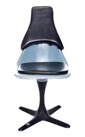
STAR TREK: ENTERPRISE (T.V. SERIES, 2005) - USS Defiant ChairPropstore4.2(6)See Sold PriceMar 13, 2024
Framed & Signed "Cape II" Serigraph By NelsonRapid Estate Liquidators and Auction Gallery4.5(1.1k)See Sold PriceFeb 24, 2024
Carte de la Guinée, contenant…'. Guinea & Cape Verde islands. BONNE 1771 mapJasper524.5(9.9k)See Sold PriceFeb 28, 2024
Johnson's Africa. Colonies & tribes. Liberia Nile Delta Cape Colony 1866 mapJasper524.5(9.9k)See Sold PriceFeb 28, 2024
Partie Occidentale de l’Afrique. West Africa coast Canary islands BONNE 1788 mapJasper524.5(9.9k)See Sold PriceFeb 28, 2024
French West Africa. Gold Coast. Sahara desert sand dunes. TIMES 1956 mapJasper524.5(9.9k)See Sold PriceFeb 28, 2024
Partie Occidentale de l'Ancien Continent… W Africa Macaronesia. BONNE 1780 mapJasper524.5(9.9k)See Sold PriceFeb 28, 2024


![[BASEBALL]. [SHEET MUSIC]. KALBFLEISCH, J. H. The Live Oak ... (1 of 5)](https://p1.liveauctioneers.com/928/318880/171361400_1_x.jpg?height=282&quality=70&version=1707501302)