F. L. Gussefeld maps of GermanyCartographer: Franz Ludwig Gssefeld Title: [Map 1] Charte von Teutschland [in a set with Map 2] Charte von Teutschland zuerst entworfen in Septbr. 1807 Subject: Germany Published: (Maps 1-2) Weimar: GSee Sold Price
Sold1 piece. Hand-Colored Engraved Map. Gus1 piece. Hand-Colored Engraved Map. Gussefeld, F.L. "Charte das Erzstiftu Churfurstenhum Trier." Nuremberg, 1789. 18 1/4 x 22 inches; 464 x 560 mm. Some age toning. Framed.See Sold Price
SoldHAND COLORED ENGRAVED MAP OF UTRECHT, GUSSEFELDHAND COLORED ENGRAVED MAP OF UTRECHT, F.L. GUSSEFELD C.1787. FRAMED & GLAZED 20 X 25 1/2" **DUE TO THE SIZE AND/OR FRAGILITY OF THIS LOT, STANDARD IN-HOUSE SHIPPING IS NOT AVAILABLE. PLEASE CONTACT THSee Sold Price
Sold1805 Map of Nord America Gussefeld, F. L. German1805 map of Nord America, copper engraved and hand colored, by Franz Ludwig Gussefeld, published by Homann Heirs. The map focuses on New America, from the Atlantic Coast west to the Mississippi River,See Sold Price
Sold3 maps: Asia, Africa, Europe. 1780-1817.[Asia/Africa/Europe]. 3 engraved maps, contemporary hand-coloring. ++ F.L. Gussefeld. Charte Von Africa Nach Afronomischen Beobachtungen... Nurem: Homman Heirs, 1804. 20 1/2 x 20 7/8 in. Some breaks aSee Sold Price
Homann (Heirs of) Charte von AsienHomann (Heirs of) Charte von Asien,after F.L. Gussefeld, chinoiserie title cartouche lower left, engraved map with original hand-colouring, 500 x 590mm., a horizontal fold, marginal handling cSee Sold Price
SoldA 17th century road map engravingA 17th century road map engraving by John Ogleby, London to Poole, showing the stretch from Alresford to Poole and then Lymington to Southampton 34 x 45 cm to/w Charte von Africa by F L Gussefeld, NurSee Sold Price
Sold2 handcol maps: Northern Asia, 1786 + Asia, [1793[Russia & Asia]. 2 engraved double-page maps in early hand-coloring. Condition noted. ++ F.L. Gussefeld. Chart Von Asien. Nuremberg: Homman Heirs, 1793. 18 3/8 x 22 3/8 in. Lightly toned. ++ F.L. GussSee Sold Price
Antique German map. Obersächsische Kreises oder dieAntique German map. Obersächsische Kreises oder die Mark Brandenburg und Herzogthum Pomerania. Auctore F. L. Güssefeld. Circa 1780 Engraving on paper. Size: 49 x H, B 60 cm. In good condition.See Sold Price
SoldGussefeld/Homann, 1784. Map of US[United States: East]. F.L. Gussefeld after Homann. Charte Uber Die XIII Vereingte Staaten Von Nord-America Entworsen Durch F.L. Gussefeld, Und Her Augsgegeben Von Den Homaennischen Erben...1784. DoubSee Sold Price
Landkarte 'Bistum Lüttich nördlicher Teil'/ Map, dat.Landkarte 'Bistum Lüttich nördlicher Teil'/ Map, dat. 1790 Technik: kolorierter Kupferstich, hinter Glas gerahmt, Datierung: laut Beschriftung entworfen von F.L. Güssefeld, Nürnberg 1790, Homann ESee Sold Price
Forlani Map of Germany, 1564FORLANI, Paolo (fl. 1560-1571) - GASTALDI, Giacomo (c. 1500-1566). [Northern Europe] Germania del Gastaldo. Engraved map. Venice: Paulo Forlani, Veronese, 1564. 20 1/2" x 28 1/4" sheet; 32" x 39 3/4"See Sold Price
Lily & Beatrizet Engraved Map of Germany, 1553LILY, George (Cartographer: fl.1528-1559); BEATRIZET, Nicolas (Engraver). Nove Germaniae description evm adiacentibus Italiae, Galliae, Britanniae, Poloniae, et Pannoniae partibus. Engraved map. VenicSee Sold Price
SoldForlani's Great Map of GermanyFORLANI, Paolo (fl. 1560-1571) - GASTALDI, Giacomo (c. 1500-1566).[Northern Europe] Germania del Gastaldo.Engraved map.Venice: Paulo Forlani, Veronese, 156420 1/2" x 28 1/4" sheet; 32" x 39 3/4" frameSee Sold Price
SoldGussefeld (F.L.) Charte von West IndienGussefeld (F.L.) Charte von West IndienWest Indies and the north coast of South America, engraved map with original outline hand-colouring, 435 x 610mm., central vertical fold, light browningSee Sold Price
SoldGussefeld (F.L.) Charte das Russische ReichGussefeld (F.L.) Charte das Russische Reich und die von den Tatarn,Russian Empire with title vignette showing large galleon (uncoloured), engraved map with original hand-colouring, 465 x 610mmSee Sold Price
SoldGussefeld (F.L.) Charte das Russische ReichGussefeld (Franz Ludwig) Charte das Russische Reich, Russia, with northern China and Japan, engraved map with original hand-colouring, decorative cartouche, 465 x 610mm., short repair to margiSee Sold Price
SoldStolberg F LGermany, Switzerland, ItalyStolberg F L (Count) Travels through Germany, Switzerland, Italy and Sicily,translated by Thomas Holcroft, 4 vol., engraved folding map and 17 plates, occasional spotting or light foxing, bookSee Sold Price
2 FL Maps, Johnson Atlas 1863 & Survey Map 1854Two mid 19th century maps of Florida. 1st Item: Colored steel engraved map of Florida titled "Johnson's Florida" by A. J. Johnson, published by Johnson and Ward 1863, from Johnson's New Illustrated FaSee Sold Price
SoldPolk County FL map used for real estate transactionsHeading: (Florida - Polk County) Author: Title: Map of Polk County, Florida Place Published: Miami, FL Publisher:The Associated Map Co. Date Published: 1926 Description: PrintedSee Sold Price
SoldSammlung von fünf Landkarten. Nord- und Südamerika.Amerika Sammlung von fünf Landkarten. Nord- und Südamerika. Enthält: Charte über die XIII. vereinigte Staaten von Nord-America. Teilkolor. Kupferstich von F. L. Güssefeld bei Homann Erben NürnbeSee Sold Price
SoldNorwegen: Charte vom KönigreichNorwegen. Charte vom Königreich Norwegen. Zeitgenöss. grenz- und flächenkolorierter Kupferstich mit dekorativer Kartusche und zwei Nebenkarten. 61 x 49 cm. Entworfen von F. L. Güssefeld. NürnbergSee Sold Price
SoldNorth America at end of 18th centuryHeading: Author: Homann Heirs Title: Charte von Nord America Nach astronomischen Bestimmungen und den neuesten Charten von Dalrymple, Arrowsmith, Edwards, u.a.m. neu entwofen von F.L. Güssefeld PlacSee Sold Price
Sevilla "Sevilla Regnum in suos ArchiepiscopatosSevilla "Sevilla Regnum in suos Archiepiscopatos Episcopatos et Praefecturas divisum". Kol. Kupferstichkarte mit ausgem. Titelkartusche, von F.L. Güssefeld bei Homann-Erben, 1781. 43,7x56,7 cm.See Sold Price
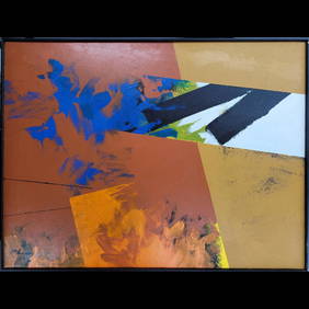
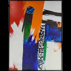
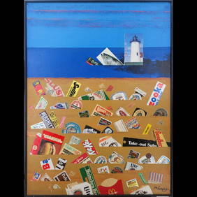
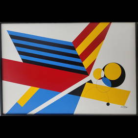
Jon Henry 1916-90 O/C Painting Titled "Orange Then Blue" 1985Rbfinearts4.4(571)See Sold PriceFeb 24, 2024
Jon Henry 1916-90 O/C Painting Titled "Prism Series #11" 1989Rbfinearts4.4(571)See Sold PriceFeb 24, 2024
Jon Henry 1916-90 O/C Painting Titled "Prism Series #41" 1989Rbfinearts4.4(571)See Sold PriceFeb 24, 2024
Jon Henry 1916-90 O/C Painting Titled "Prism Series #5" 1988Rbfinearts4.4(571)See Sold PriceFeb 24, 2024
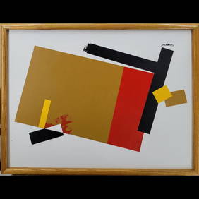
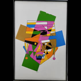
Jon Henry 1916-90 O/C Painting Titled "Mask Series #5" 1989Rbfinearts4.4(571)See Sold PriceFeb 24, 2024
AMBROISE TARDIEU c1822 Napoleonic War Map GermanyLuis Porretta Fine Arts4.3(10)See Sold PriceMar 02, 2024
MAP - AMBROISE TARDIEU c1822 Napoleonic Miltary Map GermanyLuis Porretta Fine Arts4.3(10)See Sold PriceMar 02, 2024
F.L. Carsten Princes And Parliaments In Germany. 1959 EditionChurchill Galleries3.7(213)See Sold PriceFeb 26, 2024