SoldGoldsmith 1842 Group of 3 Maps. Europe, Asia, AfricaSteel Engraved Maps Published 1842, London for "Goldsmith's Grammar of Geography" by W. S. Kenny and the Rev. Goldsmith. Folds as issued. Paper Size: 7.5 x 6 inch (19 x 15cm) One with minor toning. TiSee Sold Price
SoldGrp: 3 Maps Eastern Europe Ukraine Romania BlaeuGroup of three maps of Eastern Europe. Includes one map of Walachia, Serbia, Bulgaria, and Romania by Willem Janszoon Blaeu (1571-1638); one map of Slovenia, Croatia, and Bosnia by Blaeu after GerarduSee Sold Price
SoldAtlas School Supply Co. Map Cabinet and Maps 1907Outstanding oak panel cabinet with eight maps, Africa, Canada, Asia, World, United States, South America, North America and Europe Each map is 3 dimensional, in original molded oak frames, 1907 Size oSee Sold Price
Tallis: 3 Maps of Russia in Asia, Europe, Tartary, 1851Map: 1851 Three Tallis Maps of Russia in Europe, Russia in Asia, Tartary, all in Book -- The History of Russia containing Russia in Asia; Part of Russia and Independent Tartary; Russia in Europe ShowiSee Sold Price
Tallis: 3 Antique Maps of Russia, 1851Title/Content of Map: 1851 Three Tallis Maps of Russia in Europe, Russia in Asia, Tartary, all in Book -- The History of Russia containing Russia in Asia; Part of Russia and Independent Tartary; RussiSee Sold Price
Sold1813 Embroidered Map of EuropeTitle: 1813 Embroidered Map of Europe Dimension: 20 3/4" x 24 1/4" framed. Materials: Silk on wool Additional Information: G. Smerdon Embroidered Map of Europe Probably Southern English dated 1813 CarSee Sold Price
SoldArrowsmith: Map of Europe, 1806Map: Europe. Publication Date: 1806 Authors: Aaron Arrowsmith Publisher: Aaron Arrowsmith Size: 7.5 H x 9.3 W Inches From Arrowsmiths 4 Sheet Map of Europe Please note that this lot has a confidentialSee Sold Price
SoldSet 3 Propaganda Posters UK WWII India Europe GreeceSet of three posters. 1. Original vintage propaganda poster – The Bureau Of Current Affairs – Map Review No. 2, 1946. Printed by Fosh & Cross Ltd., London. Contents: Map of changes in EuSee Sold Price
Sold19th C. French Map - The Port of Vera Cruz Mexico100% of the Hammer price of all lots sold in this auction will be donated to Community Food Share by Artemis Gallery. $1.00 = 3 meals! **First Time At Auction** Europe, France, ca. 19th century CE.See Sold Price
SoldJean-Baptiste Louis Clouet: Europe 1767Map: De l'Europe Maker: Jean-Baptiste Louis Clouet From Geographe Moderne Origin: Paris Date: 1767 Medium: Engraving hand-colored at publication Sheet Size: 19 3/4 x 26 7/8 inches No Reserve: This lotSee Sold Price
SoldSet of five Corey's Atlas maps including Italy andSet of five Corey's Atlas maps including Italy and Sardinia, Turkey in Europe and Hungary, France, East Indies, and Spain and Portugal. plate sizes (9" x 11 1/2") to (14 1/4" x 17 3/4") Provenance:See Sold Price
Sold4 Maps by Covens & Mortier [ca. 1720-1740].[Greece/Persia/Crimea/Europe]. 4 Maps. Engraved Amst: Covens & Mortier, [Ca. 1720 to 1740.] Reworkings from a plate engraved by Guillaume de L’Isle. The first 3 listed have a cartouche title (listedSee Sold Price
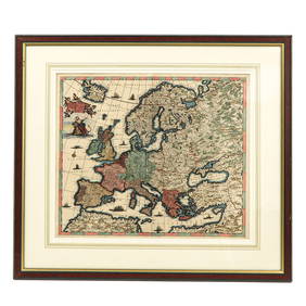
Sold24 misc. Maps on Europe/World. 18th-19th century.[Various] 24 maps. Miscellaneous group of 24 18th-19th century maps depicting Europe and the World. Measurements range from approximately 10” x 7 3/4” to 21 1/4” x 15 5/8”. A fSee Sold Price
Sold7 Views: 2 London, 2 Paris, Berlin, Rome, Vienna.[Britain/Europe/Views] 7 Views (6 bird’s-eye maps & 1 profile). Smallest: Largest: 7 5/8” x 13 3/8”. Later hand-coloring. Good to near fine. ++ A PLAN OF THE CITY AND SUBURBS OF LONDON AS FORTIFSee Sold Price
Sold3 Map Prints2 are approx 21" x 23" and other is 21" x 24".Believed to be decorator prints.See Sold Price
SoldPICTURESQUE EUROPE. 3 Vols. (1879). 63 plates.[Views]. Taylor (ed.). PICTURESQUE EUROPE. 3 Vols. NY: D. Appleton and Company, (1875-1879). Thick 4to. Original 1/2 leather and cloth, gilt titles on spines and front covers, in the state where thereSee Sold Price
SoldEarly New York, MacCoun, (3) maps, 1909Early New York, MacCoun, (3) maps, 1909, Townsend MacCoun, Early New York. (3) color maps (of 5 called for) in a paper covered linen folder, printed by L. L. Poates, "New Amsterdam 1653-1664" and "NewSee Sold Price
SoldJ.H. Colton: Turkey In Europe MapTurkey in Europe, 17 x 14 in, 1857, J. H. Colton Please note that this lot has a confidential reserve. When you leave a bid in advance of the auction, submit your maximum. Jasper52 will bid on your beSee Sold Price
SoldGrp: 3 Maps of New York CityGroup of three maps of New York City. Includes Mark Tiddeman, "A Draught of New York from the Hook to New York Town," London: W. Mount & T. Page; "Map of New York and the Adjacent Cities," New York: JSee Sold Price
Sold3 maps incl: De Vaugondy. L'EMPIRE DE LA CHINE.[Asia/China/Britain/Mideast] 3 Maps: ++ Robert de Vaugondy. L’EMPIRE DE LA CHINE Dressee d’Apries les Cartes de l’Atlas Chinois. [No date in cartouche. The same engraving plate was used for theSee Sold Price
Sold(3) Maps of Civil War Washington DC Inc. Johnson'sGroup of (3) maps of Civil War-era Washington, DC: a) 1863 Johnson’s Georgetown And The City Of Washington The Capital Of The United States Of America. Johnson and Ward, (nd). From an edition oSee Sold Price
Sold3 MAPS - SAVANNAH RIVER GEORGIA, EAST INDIA3 MAPS - SAVANNAH RIVER GEORGIA APPROX. 22.5" X 33.5" , AND 2 EAST INDIA - APPROX. 26" X 41"See Sold Price
SoldRichard William Seale (1732-1775), "Foldable 3 Map SetRichard William Seale (1732-1775), "Foldable 3 Map Set of England, Ireland, and Scotland," 1750, paper on linen, Each.- H.- W. - 46 in. (3 Pcs.)See Sold Price
SoldGrp: 3 Maps of the Caribbean and BarbadosGroup of three maps of the Caribbean. Includes two maps of the overall region, one by Nicolaes Visscher, which depict the Gulf Coast, Florida, the Caribbean, and northern South America. With one map oSee Sold Price
DUNLEVIE c1856 Map Counties Of Gaspe & Bonaventure Quebec Canada SCARCE! #1Luis Porretta Fine Arts4.3(10)See Sold PriceMar 02, 2024
Hand Colored Engraved Map of Europe, Jean Baptiste Bourguignon Anville 1754Global Auctions Company4.3(36)See Sold PriceMar 03, 2024
Chatelain - 3 Maps of the British Isles (England, Ireland, Scotland)Trillium Antique Prints & Rare Books4.5(32)See Sold PriceFeb 24, 2024
Clarke & Neele 1815 Map. Europe - Recent Political ChangesAlbion Auctions4.6(341)See Sold PriceMar 01, 2024
Set of 3 Maps - Netherlands - Belgien - Switzerland - J. BarlowProverde Auctions4.3(3)See Sold PriceFeb 28, 2024
![[Europe]. 3 Maps. First Image](https://p1.liveauctioneers.com/179/1435/617490_1_x.jpg?height=282&quality=95&width=282)

![[Europe]. 3 Maps. First Image](https://p1.liveauctioneers.com/179/1435/617490_1_x.jpg?height=282&quality=1&width=282)


![4 Maps by Covens & Mortier [ca. 1720-1740]. (1 of 8)](https://p1.liveauctioneers.com/179/47316/21802731_1_x.jpg?height=282&quality=70&version=1383851649)