Poster "Les jardins de Paris", illustrated map and plan of Paris with its parcs, gardens, monuments,Proverde Auctions4.3(3)See Sold PriceFeb 28, 2024
WEST CENTRAL AFRICA. Congo Angola Gabon Cameroon Sao Tome. MALLET 1683 old mapJasper524.5(9.8k)See Sold PriceFeb 28, 2024
SoldEton College Modern Atlas, 34 maps, index of 32,000Eton College Modern Atlas, 34 maps, index of 32,000 names, Price One GuineaSee Sold Price
SoldBacon (George W) editor A New General Atlas of MoBacon (George W) Editor. A New General Atlas of Modern Geography,containing All The Latest Geographical Discoveries, with General Description, Gazetteer, and Alphabetical Index, 34 lithographeSee Sold Price
SoldStandard Classic atlas for Schools and Colleges withTitle/Content of Map: Standard Classic atlas for Schools and Colleges with an Alphabetical Index giving the latitudes and longitudes of 20,000 places Date: ©1885 Cartographer: Publisher: Ivison, BlSee Sold Price
(3) FRAMED 1922 SURVEY OF EGYPT MAPSAll from the 1922 Survey of Egypt, in matching pine bullnose frame, matted and glazed, including: "Temple of Karnak", linen-backed, scale 1:2,000, OS: 34 1/2" x 27 1/2"; SS: 32 1/2" x 25 1/2", repaireSee Sold Price
(3) FRAMED 1922 SURVEY OF EGYPT MAPSAll from the 1922 Survey of Egypt, in matching pine bullnose frame, matted and glazed, including: "Temple of Karnak", linen-backed, scale 1:2,000, OS: 34 1/2" x 27 1/2"; SS: 32 1/2" x 25 1/2", repaireSee Sold Price
Western Hemisphere of the Earth on a plane. Davis Land. BOWEN 1776 old mapTITLE/CONTENT OF MAP: 'A new projection of the Western Hemisphere of the Earth on a plane (shewing the proportions of its several parts nearly as on a globe), by J. Hardy at Eton College' Marked on thSee Sold Price
New projection of the Eastern Hemisphere of the Earth on a plane. BOWEN 1776 mapTITLE/CONTENT OF MAP: 'A new projection of the Eastern Hemisphere of the Earth on a plane (shewing the proportions of its several parts nearly as on a globe), by J. Hardy at Eton College' DATE PRINTEDSee Sold Price
SoldPRR Property Atlas, Overbrook to Malvern (c. 1887)J.L. Smith. Atlas of Properties Along the Pennsylvania Railroad from Overbrook to Malvern, with index map & 34 area maps. Philadelphia, c. 1887.CONDITION: Covers lacking; partially disbound, most mapsSee Sold Price
Cram's Quick Reference Atlas and Gazetteer of the WorldTitle/Content of Map: Cram's Quick Reference Atlas and Gazetteer of the World Containing 105 newly engraved maps and over 40,000 index entries with the latest areas and census statistics. Primary AuthSee Sold Price
SoldHarmsworth Atlas and Gazetteer, published in London,Harmsworth Atlas and Gazetteer, published in London, featuring 500 maps and diagrams in colour, with commericial statistics and gazetteer index of 105,000 names Category: BooksSee Sold Price
Sold5V ANTIQUE HISTORY Decorative Victorian Gilt Fold&5V ANTIQUE HISTORY Decorative Victorian Gilt Fold‐Out Map Mexico Leatherbound Canada A Lillie History of America William Robertson Ancient Modern Geography Eton School Aaron Arrowsmith Rev CSee Sold Price
SoldWWII U.S. ARMY AIR FORCE SILK MAPS (3)3 silk maps including 1) Two 1945 34" x 32" maps of Japan and South China one one side and the East China Sea on the reverse, 2) a 1943 36" x 31.5" map of Timor Southwest Pacific area on one side andSee Sold Price
Sold1888 ATLAS CITY OF ROCHESTER NY BY ROBINSON.1888 ATLAS CITY OF ROCHESTER NY BY ROBINSON. 34 HAND COLORED MAP PLATES AND INDEX TO STREETS INCLUDED. PUBLISHED BY E. ROBINSON, NY, 1888. REBOUND HARD COVER MAROON CLOTH BOARDS. ORIGINAL CONTENTS WITSee Sold Price
Sold1814 Abyssinia Nubia by Cadell & Davis1814 Abyssinia Nubia published by Cadell & Davis, London hand colored map from Pinkerton's Modern Atlas, 22 1/4" x 32 1/4"See Sold Price
Rand, McNally & Co.Title: Rand, McNally & Co.'S Oregon. Publication Date: c1901 Cartographer: GLOBUS Publisher: Rand, McNally & Co. Size: 19Height - 25.6Width Inserted into a 12mo index and shipper's guide of 32 pages.See Sold Price
SoldOriginal WW1 Era France Map, Sheet 36B Ed. 6, 1917Original WW1 Era France Map, Sheet 36B Edition 6, 1917. Scale 1:40,000. Very good condition. Map measures 34 inches by 25-3/4 inches when completely unfolded.See Sold Price
SoldHarmsworth Atlas and Gazzetteer etcThe Harmsworth Atlas and Gazetteer five hundred maps and diagrams in colour with commercial statistics and gazzetteer index of 105,000 names published by Carmlite House, Carmelite Street, London; andSee Sold Price
SoldWorld.- [Barthelemy (Jean Jacques)] - [Voyage du jAtlas vol. only, 32 engraved maps and views only (of 40), some folding, some light damp-stainging to margins, modern cloth-back boards, Paris, 1817 § Cormenin (Jules Janin) Pictures of the FrenchSee Sold Price
SoldModern British School (20th Century) - View of EtonModern British School (20th Century) View of Eton College quad; together with another of Eton signed indistinctly lower left, oil on board, 21 x 29cm the first unsigned oil on board (2) 32 x 36cm (12See Sold Price
SoldCreek Indians.Sitgreaves, Lorenzo; & Israel CarleCreek Indians.Sitgreaves, Lorenzo; & Israel Carle Woodruff. Northern and Western Boundary Line of the Creek Country. Large folding map. 32 pages. 8vo, modern cloth-backed boards, gilt-lettered leatherSee Sold Price
SoldWorld.- Butler (Samuel) A General Atlas of Ancient andWorld.- Butler (Samuel) A General Atlas of Ancient and Modern Geography, engraved title, index and 43 maps, by Sidney Hall, including a double-page double hemisphere map of the World, and with ancientSee Sold Price
SoldA School Atlas of Modern Geography, Dower ca. 185[ATLAS]. John Dower. A School Atlas Of Modern Geography Containing Forty Maps, Prepared from the Best Authorities and Including the Latest Discoveries With a Copious Index. Lon: Ward, Lock & Tyler, caSee Sold Price
World.- Butler (Samuel) A General Atlas of Ancient andWorld.- Butler (Samuel) A General Atlas of Ancient and Modern Geography, engraved title, index and 43 maps, by Sidney Hall, including a double-page double hemisphere map of the World, and with ancientSee Sold Price
Butler (Samuel) A General Atlas of Ancient and ModButler (Samuel) A General Atlas of Ancient and Modern Geography,engraved title, index and 43 maps, by Sidney Hall, including a double-page double hemisphere map of the World, and with ancientSee Sold Price
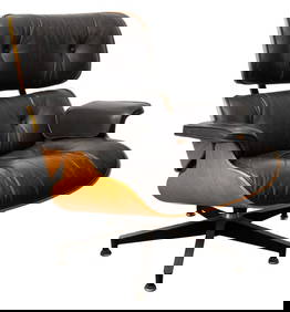
Charles & Ray Eames for Herman Miller Lounge ChairAuctions at Showplace4.5(726)See Sold PriceMar 03, 2024
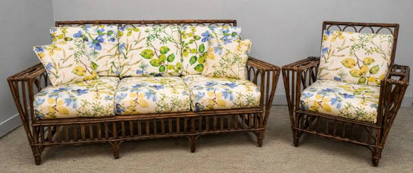
Pair vintage fireside chairs in petit-point upholstery, down cushionsSouth Jersey Auction by Babington Auction Inc4.6(122)See Sold PriceFeb 25, 2024
(24) ENGLISH STERLING & MOTHER OF PEARL FRUIT SERVICE FLATWARE IN CASEAustin Auction Gallery4.7(1.2k)See Sold PriceFeb 25, 2024
Rare vase ''Stellato a canne di murrina''Dr. Fischer Fine Art Auctions4.5(109)See Sold PriceMar 09, 2024
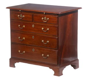
Paul Evans Mid-Century Modern Cabinet, Sideboard, Cityscape Brass, Chrome, 1970sJasper524.5(9.8k)See Sold PriceFeb 28, 2024
Grateful Dead Band Signed Display w/ Jerry GarciaLegacy Auctions & Estate Sales4.6(70)See Sold PriceFeb 25, 2024
Mid Century Modern Chrome Cantilever Chair, Milo Baughman StylePUBLIC SALE4.7(217)See Sold PriceMar 02, 2024
Pair of Mid-Century Modern L. E. Smith Bittersweet Swung Glass 'Smoothie' VasesPUBLIC SALE4.7(217)See Sold PriceMar 02, 2024
WEST AFRICA. British Cameroons & Togoland mandates. Gold Coast Nigeria 1947 mapJasper524.5(9.8k)See Sold PriceFeb 28, 2024
CAP VERT. French/Portuguese Guinea Gambia Senegal Sierra Leone 1947 old mapJasper524.5(9.8k)See Sold PriceFeb 28, 2024
NAMIBIA. South West Africa protectorate. HARMSWORTH 1920 old antique map chartJasper524.5(9.8k)See Sold PriceFeb 28, 2024