Marc Chagall-Limited Edition -Paris Opera Ceiling after ChagallArt Legacy Auctions4.5(217)See Sold PriceFeb 24, 2024
Salvador Dali Pantagruel Limited Edition Lithograph Hand signed and numberedArt Legacy Auctions4.5(217)See Sold PriceFeb 24, 2024
Pablo Picasso Bouquet of Peace Collection Domaine Picasso Limited Edition on paper.Art Legacy Auctions4.5(217)See Sold PriceFeb 24, 2024
A RARE MAXFIELD PARRISH JACK AND THE BEANSTALK PRINTSoulis Auctions4.8(953)See Sold PriceFeb 24, 2024
LARGE MECHANICAL PRINT 'STARS' AFTER MAXFIELD PARRISHSoulis Auctions4.8(953)See Sold PriceFeb 24, 2024
Heinrich Aldegrever, etc. 15 old master prints. 16th-17th centuries. Aldegrever works include "ManTremont Auctions4.6(293)See Sold PriceFeb 25, 2024
SoldEngraving of Map Northern France Dept. of CalvadosEngraving of a map of Northern France, "Dept. du Calvados". Engraving depicts production, commerce of the region. 15 1/2" W x 11" H. In good condition.See Sold Price
SoldMAP, Northern France, Paris, MercatorNorthern France, Paris. Mercator/Hondius, L'Isle de Frace Parisiensis Ager, 1609 (circa). Hand Color. Charming little map of the department with Paris at bottom center, fully engraved with dozens of tSee Sold Price
SoldMAP, Northern France, BlaeuNorthern France. Blaeu Family, Afbeeldinge vande Vermaerde Seehaven ende Stadt van Duynkercken... / Pourtraict de la Fameuse Ville et Havre de Duynckercke..., 1650 (circa). Hand Color. This large seaSee Sold Price
SoldMAP, Northern France, OrteliusNorthern France. Abraham Ortelius, Picardiae, Belgicae Regionis Descriptio. Joanne Surhonio Auctore, 1579 (dated). Hand Color. Superb example of the decorative style of Ortelius, based on the cartograSee Sold Price
MAP, Northern France, BlaeuNorthern France. Blaeu Family, Dioecese de Rheims, et le Pais de Rethel. Par Iean Iubrien Chalonnois, 1638 (circa). Hand Color. Lovely map centered on the town of Reims with north oriented to the topSee Sold Price
MAP, Northern France, Robert de VaugondyNorthern France. Gilles Robert de Vaugondy, Partie Septentrionale du Gouvernem? General de Champagne ou se Trouvent le Retelois, le Rhemois, la Champagne Propre, Partie de la Brie et du Pertois, &c.,See Sold Price
SoldBlaeu Early Map Sedan Northern FranceEarly map: Les Souverainetez de Sedan et de Raucourt. Hand-colored engraving. Blaeu, Amsterdam, 17th Century. 20" x 24".See Sold Price
SoldA. COMBETTE MAP OF NORTHERN FRANCE, CIRCA 1849Hand-colored copper engraving of Nord France, engraved by V. LeVasseur around 1849. From 'Atlas Nationale Illustre.' Professionally matted and framed in archival material. 12 x 17 inch sight size, 21.See Sold Price
Sold19TH CENTURY HAND COLORED DEPT. DE LA CÔTE D'OR MAP FRANCE1857 map of French department of cote d'or France. Part of France's burgundy or bourgogne wine region. decorative engravings around map. published by Victor Levasseur. Atlas National IllustreSee Sold Price
France: Dept. Du Loiret by Levasseur, 1845Original engraving of the Loiret department of France from "Atlas National Illustre" by Victor Levasseur and engraving by A. Combette, Paris, 1845. Victor Levasseur (1800-1870) was a French surveyor aSee Sold Price
Original Etching - Levasseur - Dept de Tarn et GaronneVictor Levasseur (1800–1870) Dept de Tarn et Garonne Engraving 13 x 18 in 33 x 46 cm 1852 France. Original map on steel by Victor Levasseur, engraved by Laguillermie and Rainaud. Hand-coloured. VictSee Sold Price
MAP, Saint-Omer, France, Braun & HogenbergSaint-Omer, France. Braun & Hogenberg, S. Omer, 1620 (circa). Hand Color. A handsome bird's-eye view of the city of Saint-Omer at the northern tip of France. The fortified city is filled with miniaturSee Sold Price
SoldAntique 19th C French Hand Colored Map of CalvadosAntique 19th C map of the French area of Calvados. This area of France is known for its production of Calvados. The engraving is surrounded by scenes showing the region and its products. Published bySee Sold Price
SoldEngraving, Map "France in Departments"Published by John Thomson & Edinburgh. 9 1/2"h x 11 1/2"wSee Sold Price
MAP - Northern France. BlaeuNorthern France. Willem Blaeu, Normandia Ducatus, 1680 (circa). Hand Color. This very detailed map of the Normandy coast extends from Cherbourg and Avranches in the west to Dieppe and Rouen in the easSee Sold Price
MAP - Northern France. DelisleNorthern France. Guillaume Delisle, Carte Topographique du Diocese de Senlis..., 1709 (dated). Hand Color. Beautifully engraved map of the region just north of Paris includes le Plessis Belleville, DaSee Sold Price
Engraving, Map "France in Departments"Published by John Thomson & Edinburgh. 9 1/2"h x 11 1/2"wSee Sold Price
MAP - Northern France. Le ClercNorthern France. Jean Le Clerc (Clericus), Description du Pais de Brie, 1621 (circa). Hand Color. Attractive map of the Brie-producing region with Paris at top left and the cities of Meaux, Chateau-ThSee Sold Price
Sold6 hand-colored engravings maps France LemercierSet of six hand-colored engravings of maps of France by Lemercier. [Paris, 1852]. Plate size 18 x 11 1/2 in. Framed, matted, under glass. This is a live auction at our physical auction gallery, that ySee Sold Price
SoldMap. LIDALIA vel Lidisdalia Regio Lidisdail. CoppMap. LIDALIA vel Lidisdalia Regio Lidisdail. Copper plate engraving. Map: northern England & parts of Scotland. -- Dimensions: H: 15.5 inches: W: 20 inches ---See Sold Price
SoldBlaeu map of northern France 1664Heading: (France) Author: Blaeu, Willem & Joan Title: Comitatus Bellovacum vernacule Beauvais Place Published: Amsterdam Publisher: Date Published: c.1640 Description: CoppeSee Sold Price
SoldBlaeu map of northern France 1664Title: Comitatus Bellovacum vernacule Beauvais Author: Blaeu, Willem & Joan Description: Copper-engraved map, hand-colored in outline. 38x49.5 cm. (15x19½"), matted.Province in France north of ParisSee Sold Price
1917 British Military Map of Northern France andTitle/Content of Map: 1917 British Military Map of Northern France and Southern Belgium (Sheet 27) -- Belgium and France Sheet 27 Date: 1917, London Cartographer: British Army Geographical Services SiSee Sold Price
1917 British Military Map of Northern France & BelgiumTitle/Content of Map: 1917 British Military Map of Northern France and Southern Belgium (Sheet 27) -- Belgium and France Sheet 27 Date Printed: 1917, London Cartographer: British Army Geographical SerSee Sold Price
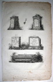
ORGIAZZI 14 x Folio Sized Engravings Roman Road Signs etc. c1802 Aix FranceLuis Porretta Fine Arts4.3(10)See Sold PriceMar 02, 2024
DUNLEVIE c1856 Map Counties Of Gaspe & Bonaventure Quebec Canada SCARCE! #2Luis Porretta Fine Arts4.3(10)See Sold PriceMar 02, 2024
DEVINE c1856 Dr Salters Map Of Lake Huron Ontario Indian Lands etc. No. 7 ScarceLuis Porretta Fine Arts4.3(10)See Sold PriceMar 02, 2024
D'Entrecasteaux - Tasmania, Australia: Map of the Northern Portion of Recherche Bay. 5Trillium Antique Prints & Rare Books4.5(30)See Sold PriceFeb 24, 2024
1816 MAP NORTHERN PART OF RUSSIA or MUSCOVY in EUROPE copper engraving ANTIQUEJasper524.5(9.8k)See Sold PriceFeb 27, 2024