SoldEman Bowen Georg (1714-1767) map, to His Majesty andEman Bowen Georg (1714-1767) map, to His Majesty and John Gibson, Engraver (1750-1792) An Accurate map of North America describing and distinguishing the British and Spanish Dominions on this Great CoSee Sold Price
Early 18thc Engraved Maps, Road to LondonOriginal early 18th century engravings, Emanuel Bowen ( 1714 - 1767 ) "Map of the Road from London to Dover in Kent". 7 1/4" X 9 3/4" along with "Map of the Road from London to Hith." 7 1/4" X 4 3/4".See Sold Price
Early 18thc Engraved Maps, Road to LondonOriginal early 18th century engravings, Emanuel Bowen ( 1714 - 1767 ) "Map of the Road from London to Dover in Kent". 7 1/4" X 9 3/4" along with "Map of the Road from London to Hith." 7 1/4" X 4 3/4".See Sold Price
Early 18thc Engraved Maps, Road to LondonOriginal early 18th century engravings, Emanuel Bowen ( 1714 - 1767 ) "Map of the Road from London to Dover in Kent". 7 1/4" X 9 3/4" along with "Map of the Road from London to Hith." 7 1/4" X 4 3/4".See Sold Price
SoldEarly 18thc Engraved Maps, Road to LondonOriginal early 18th century engravings, Emanuel Bowen ( 1714 - 1767 ) "Map of the Road from London to Dover in Kent". 7 1/4" X 9 3/4" along with "Map of the Road from London to Hith." 7 1/4" X 4 3/4".See Sold Price
Early 18thc Engraved Maps, Road to LondonOriginal early 18th century engravings, Emanuel Bowen ( 1714 - 1767 ) "Map of the Road from London to Dover in Kent". 7 1/4" X 9 3/4" along with "Map of the Road from London to Hith." 7 1/4" X 4 3/4".See Sold Price
Early 18thc Engraved Maps, Road to LondonOriginal early 18th century engravings, Emanuel Bowen ( 1714 - 1767 ) "Map of the Road from London to Dover in Kent". 7 1/4" X 9 3/4" along with "Map of the Road from London to Hith." 7 1/4" X 4 3/4".See Sold Price
Early 18thc Engraved Maps, Road to LondonOriginal early 18th century engravings, Emanuel Bowen ( 1714 - 1767 ) "Map of the Road from London to Dover in Kent". 7 1/4" X 9 3/4" along with "Map of the Road from London to Hith." 7 1/4" X 4 3/4".See Sold Price
Early 18thc Engraved Maps, Road to LondonOriginal early 18th century engravings, Emanuel Bowen ( 1714 - 1767 ) "Map of the Road from London to Dover in Kent". 7 1/4" X 9 3/4" along with "Map of the Road from London to Hith." 7 1/4" X 4 3/4".See Sold Price
Early 18thc Engraved Maps, Road to LondonOriginal early 18th century engravings, Emanuel Bowen ( 1714 - 1767 ) "Map of the Road from London to Dover in Kent". 7 1/4" X 9 3/4" along with "Map of the Road from London to Hith." 7 1/4" X 4 3/4".See Sold Price
Early 18thc Engraved Maps, Road to LondonOriginal early 18th century engravings, Emanuel Bowen ( 1714 - 1767 ) "Map of the Road from London to Dover in Kent". 7 1/4" X 9 3/4" along with "Map of the Road from London to Hith." 7 1/4" X 4 3/4".See Sold Price
Early 18thc Engraved Maps, Road to LondonOriginal early 18th century engravings, Emanuel Bowen ( 1714 - 1767 ) "Map of the Road from London to Dover in Kent". 7 1/4" X 9 3/4" along with "Map of the Road from London to Hith." 7 1/4" X 4 3/4".See Sold Price
Early 18thc Engraved Maps, Road to LondonOriginal early 18th century engravings, Emanuel Bowen ( 1714 - 1767 ) "Map of the Road from London to Dover in Kent". 7 1/4" X 9 3/4" along with "Map of the Road from London to Hith." 7 1/4" X 4 3/4".See Sold Price
Early 18thc Engraved Maps, Road to LondonOriginal early 18th century engravings, Emanuel Bowen ( 1714 - 1767 ) "Map of the Road from London to Dover in Kent". 7 1/4" X 9 3/4" along with "Map of the Road from London to Hith." 7 1/4" X 4 3/4".See Sold Price
Early 18thc Engraved Maps, Road to LondonOriginal early 18th century engravings, Emanuel Bowen ( 1714 - 1767 ) "Map of the Road from London to Dover in Kent". 7 1/4" X 9 3/4" along with "Map of the Road from London to Hith." 7 1/4" X 4 3/4".See Sold Price
Early 18thc Engraved Maps, Road to LondonOriginal early 18th century engravings, Emanuel Bowen ( 1714 - 1767 ) "Map of the Road from London to Dover in Kent". 7 1/4" X 9 3/4" along with "Map of the Road from London to Hith." 7 1/4" X 4 3/4".See Sold Price
Early 18thc Engraved Maps, Road to LondonOriginal early 18th century engravings, Emanuel Bowen ( 1714 - 1767 ) "Map of the Road from London to Dover in Kent". 7 1/4" X 9 3/4" along with "Map of the Road from London to Hith." 7 1/4" X 4 3/4".See Sold Price
Early 18thc Engraved Maps, Road to LondonOriginal early 18th century engravings, Emanuel Bowen ( 1714 - 1767 ) "Map of the Road from London to Dover in Kent". 7 1/4" X 9 3/4" along with "Map of the Road from London to Hith." 7 1/4" X 4 3/4".See Sold Price
Early 18thc Engraved Maps, Road to LondonOriginal early 18th century engravings, Emanuel Bowen ( 1714 - 1767 ) "Map of the Road from London to Dover in Kent". 7 1/4" X 9 3/4" along with "Map of the Road from London to Hith." 7 1/4" X 4 3/4".See Sold Price
Early 18thc Engraved Maps, Road to LondonOriginal early 18th century engravings, Emanuel Bowen ( 1714 - 1767 ) "Map of the Road from London to Dover in Kent". 7 1/4" X 9 3/4" along with "Map of the Road from London to Hith." 7 1/4" X 4 3/4".See Sold Price
SoldEarly 18thc Engraved Maps, Road to LondonOriginal early 18th century engravings, Emanuel Bowen ( 1714 - 1767 ) "Map of the Road from London to Dover in Kent". 7 1/4" X 9 3/4" along with "Map of the Road from London to Hith." 7 1/4" X 4 3/4".See Sold Price
Early 18thc Engraved Maps, Road to LondonOriginal early 18th century engravings, Emanuel Bowen ( 1714 - 1767 ) "Map of the Road from London to Dover in Kent". 7 1/4" X 9 3/4" along with "Map of the Road from London to Hith." 7 1/4" X 4 3/4".See Sold Price
Early 18thc Engraved Maps, Road to LondonOriginal early 18th century engravings, Emanuel Bowen ( 1714 - 1767 ) "Map of the Road from London to Dover in Kent". 7 1/4" X 9 3/4" along with "Map of the Road from London to Hith." 7 1/4" X 4 3/4".See Sold Price
Early 18thc Engraved Maps, Road to LondonOriginal early 18th century engravings, Emanuel Bowen ( 1714 - 1767 ) "Map of the Road from London to Dover in Kent". 7 1/4" X 9 3/4" along with "Map of the Road from London to Hith." 7 1/4" X 4 3/4".See Sold Price
OGILVY & BOWEN c1736 Original Map of Oxfordshire Berkshire Etc.Luis Porretta Fine Arts4.3(10)See Sold PriceMar 02, 2024
An early Dutch hand colored engraving map by Georg Balthasar Probst (1732-1801)Ostantix Auctions4.3(9)See Sold PriceFeb 27, 2024
Antique German Kampen Town Color Copper EtchingHill Auction Gallery 4.7(1000)See Sold PriceFeb 28, 2024
[ARCTIC]. BOWEN, Emanuel. A New & Accurate Map of the North...Potter & Potter Auctions4.6(538)See Sold PriceMar 07, 2024
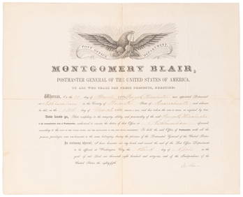
SOMERSET, Lord Charles (1767-1831) and BLAIR, Montgomery (1...Potter & Potter Auctions4.6(538)See Sold PriceMar 07, 2024
Map: An 18thC engraved map of Bedfordshire titled An Accurate Map of the County of Bedford DividedClaydon Auctioneers Ltd4.3(125)See Sold PriceFeb 26, 2024
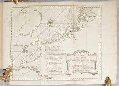
1750 Bowen Map of Bermuda and St. Kitts -- A New & Accurate Map of Bermudas or Sommer's Islands...Jasper524.5(9.7k)See Sold PriceFeb 27, 2024
New and Correct Map of North America With the West India Islands,Jasper524.5(9.7k)See Sold PriceFeb 27, 2024
Georg Bockler Map of Ancient Jerulsaem EtchingAuctions at Showplace4.5(723)See Sold PriceApr 07, 2024
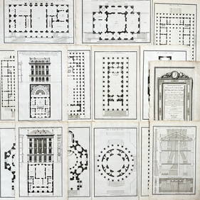
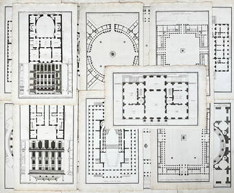
Jean-Francois de Neufforge (1714 - 1791) - Set of 15 Architecture Prints - Development pour unProverde Auctions4.3(3)See Sold PriceFeb 28, 2024
Jean-Francois de Neufforge (1714 - 1791) - Set of 15 Architecture Prints - Plan de l' EdificeProverde Auctions4.3(3)See Sold PriceFeb 28, 2024
Lot of 30 Portraits - Johannes Nikolaus Tetens - Jacob de Witt - Georg Christoph Lichtenberg -Proverde Auctions4.3(3)See Sold PriceFeb 28, 2024


![[ARCTIC]. BOWEN, Emanuel. A New & Accurate Map of the North... (1 of 1)](https://p1.liveauctioneers.com/928/318880/171360917_1_x.jpg?height=282&quality=70&version=1707501302)