SoldEARLY BYZANTINE CONSTANTINOPLE MAP, 13" X 19"EARLY BYZANTINE CONSTANTINOPLE MAP, 13" X 19":See Sold Price
SoldEarly map, hand colored, Horowitz estateEarly map, hand colored,Horowitz estate. Map 13" x 19.5" in a frame 27.5" x 22.5".See Sold Price
SoldEarly 19th Century Map of Pennsylvania.Map titled "The State of Pennsylvania" reduced w/permission from Reading Howell's Map by Samuel Lewis. Engraved for Carey's American Edition of Gutherie's Geography Improved. Map measures 13" x 19" anSee Sold Price
1574 Amsterdam.By: Georg Braun and Franz Hogenberg Date: 1574 (Published) Cologne Dimensions: 13.25 x 19 inches (33.6 x 48.3 cm) This important early map of Amsterdam is from Braun and Hogenberg’s important work CSee Sold Price
SoldIndiae Orientalis, Isularumque Adiacientium Typus.Abraham Ortelius (1527-1598). Antwerp: Gielis Coppens van Diest, 1570. Engraved map. 13 5/8 x 19 1/2 inches sheet. First edition and an attractive example of an early map to show India, China, Japan,See Sold Price
Sold1584 Asia VI Tab.By: Mercator / PtolemyDate: 1584 (circa) Amsterdam.Dimensions: 19 x 13 inches (48.25 x 33 cm)This is an early and scarce map of present day Saudi Arabia, Qatar, United Arab Emirates, Yemen, and Oman.See Sold Price
Thomson: Antique Map of Attica & Aegina, 1817TITLE/CONTENT OF MAP: 'Attica [with ancient and modern names]' DATE PRINTED: 1817 IMAGE SIZE: Approx 48.5 x 35.0cm, 19.25 x 13.75 inches (Large) TYPE: Antique early 19th century atlas map with originaSee Sold Price
SoldHand-Colored Map from 1573 of the WorldMaps[1573], CALETENSIUM... and VEROMANDUORUM, [by Ortelius], Choice Extremely Fine. 13” x 19”, hand-colored. From the 1573 edition of “Theatrum Orbis Terrarum,” Latin text, douSee Sold Price
SoldHand-Colored Map from 1573 of the WorldMaps[1573], CALETENSIUM... and VEROMANDUORUM, [by Ortelius], Choice Extremely Fine. 13” x 19”, hand-colored. From the 1573 edition of “Theatrum Orbis Terrarum,” Latin text, douSee Sold Price
SoldMercator's map of Crete, about 1630Gerard Mercator; "Candia Cum Insulis aliquot curia Graecium;" engraving with early coloring, 13 1/2 X 19 in., p.m.; letterpress text verso; Property from the Hans Goedicke EstateSee Sold Price
Thomson: Antique Map of Attica & Aegina, 1817Title/Content of Map: 'Attica [with ancient and modern names]' Greece. Athens. Date Printed: 1817 Image Size: Approx 48.5 x 35.0cm, 19.25 x 13.75 inches (Large) Type: Antique early 19th century atlasSee Sold Price
SoldLot of 2 Early Hand Colored Engraved MapsLot of two early hand colored engraved maps, to include: "Andegaver Sium Ditionis Vera et Integra Descripto," dated 1579, map of Anjou, France, 13 3/4" h x 18 3/8" w (view), 19" h x 23 5/8" w (frame)See Sold Price
Sold16th/17th century map16th/17th century map.Dr Horowitz collected rare original maps. Frame 17" x 23", map 13" x 19".See Sold Price
SoldAfter Abraham Ortelius (1527-1598) Flemish. "AfricaeAfter Abraham Ortelius (1527-1598) Flemish. "Africae Propriae Tabula", Coloured Map, 13" x 19".See Sold Price
SoldRegi Frederico Li Daniae (17th Century) Norwegian.Regi Frederico Li Daniae (17th Century) Norwegian. "Islandia", Map, 13.25" x 19.25".See Sold Price
SoldHispaniae Novae Nova Descriptio. [ca. 1609.][Mexico]. Mercator - Hondius. HISPANIAE NOVAE NOVA DESCRIPTIO. [Amst: c.1609]. Double-page engraved map, 13 ¾ x 19, full color. One of the earliest maps of the western part of Mexico, inland as far aSee Sold Price
SoldManassas/ Bull Run/ Centreville/ Civil War-Date MapsLot of 3, featuring 2 wonderful war-date maps produced in 1861, each done in four ink colors on onion skin-type paper. The first map measures 13 x 19 in. and covers the area from the Bull Run MountainSee Sold Price
SoldMap Hispaniae Novae Sivae Magnae, ...Hispaniae Novae Sivae Magnae, Recens et Vera Descriptio. 1579 Ortelius, Abraham (1528-1598). Hispaniae Novae Sivae Magnae, Recens et Vera Descriptio. 1579. Hand-colored map; 13.75 x 19.75 in. (35 xSee Sold Price
SoldVintage Map, Jodocus Hondius, Virginae item etJodocus Hondius (Dutch, 1563-1612), "Virginiae item et Floridae," copper engraved map with hand-coloring, map: 13.25"h x 19"w, overall (with frame): 16.5"h x 21.75"wSee Sold Price
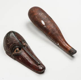
SoldR. MOAI JAPANESE WATERCOLORSIGNED; R. MOAI - "BAMBOO GROVE" - EARLY 20TH CENTURY 13" X 19"See Sold Price
SoldES Braden 13x19 O/B Country HomesteadE.S. Braden (Indianapolis, Ella?, late 19th/early 20th C), 13 x 19 oil on board, signed lower left depicting country homestead with hay, 16x22 as framedSee Sold Price
SoldAbraham Ortelius Maris Pacifici engraved map,Abraham Ortelius Maris Pacifici engraved map, 13 5/8'' x 19 3/4''.See Sold Price
Mongolian Applique Thangka made with antique cloth.The Buddha Gallery4.4(29)See Sold PriceMar 13, 2024
Original Signed Heinrich Hemanns Painting Circa Early 1900sCowboy Joe's Antiques4.7(202)See Sold PriceFeb 27, 2024
Pair of Early Railroad Maps - 1874 Delaware, Lackawanna & Western and 1876 Pennsylvania RailroadRail & Road Auctions4.6(165)See Sold PriceMar 07, 2024
Antique German Kampen Town Color Copper EtchingHill Auction Gallery 4.7(1k)See Sold PriceFeb 28, 2024
Antique Original Early 1900s Blue Painted Primitive Folding StepstoolHoller and Hammer4.6(75)See Sold PriceFeb 24, 2024
I. M. Cadell, Early 20th century, Watercolour, A harbour scene with boats by a ghat in India. SignedClaydon Auctioneers Ltd4.3(125)See Sold PriceFeb 26, 2024
Advertising Art Print for Apollinaris Water, Pretty PollyLeland Little4.5(705)See Sold PriceFeb 29, 2024
Churchill & Nieuhof 1744 Folio Map. Cape of Good Hope, South AfricaAlbion Auctions4.7(341)See Sold PriceMar 01, 2024
Churchill & Nieuhof 1744 Folio Map. Batavia Indonesia East IndiesAlbion Auctions4.7(341)See Sold PriceMar 01, 2024
Antique Pennsylvania Map Fragment incl Wellersburg and New CentervilleCordier Auctions & Appraisals4.4(1.5k)See Sold PriceMar 02, 2024
Sold Out Jim Booth LE Battery Carriage House PrintRapid Estate Liquidators and Auction Gallery4.5(1.1k)See Sold PriceMar 02, 2024


![Hispaniae Novae Nova Descriptio. [ca. 1609.] (1 of 5)](https://p1.liveauctioneers.com/179/49347/23134463_1_x.jpg?height=282&quality=70&version=1388425910)