Sold18th century hand-coloured map of Middlesex18th century hand-coloured map of MiddlesexSee Sold Price
SoldEarly Map of Quebec, Fleuve St-Laurent, Dated 1757An early hand coloured map of Quebec, "Carte de Cours du Fleuve de St Laurent. M.B. 1757". 18th century. H: 9.25"; W: 13".See Sold Price
SoldMap Early 18th Century "A New Map of the World",Most Humbly Inscribed to his Royal Highness George Prince of Wales", by John Senex, c.1721, from the New General Atlas of the World, handcoloured etching, framed, 42cm x 52cmSee Sold Price
SoldJames I map of Middlesex England 1610Early 17th century map of Middlesex, London and Westminster. Described, divided, hand coloured, and engraved by Johannes 'John' Norden and John Speed. English text verso H. 8cm (15in). L. 51cm (20 1/4See Sold Price
Sold18th Century hand coloured map of Berkshire by Ema18th Century hand coloured map of Berkshire by Eman Bowen, 59cm x 70cmSee Sold Price
18th century hand coloured map of The Road from Oxford18th century hand coloured map of The Road from Oxford to Cambridge by John Ogilby, hand coloured, mounted and framed, 43.5cm x 36.5cmSee Sold Price
Sold18th century hand coloured map of Surrey, by Eman18th century hand coloured map of Surrey, by Eman Bowen, 21" by 28"See Sold Price
SoldToms after Badeslade: 18th Century hand coloured map ofToms after Badeslade: 18th Century hand coloured map of Yorkshire 15cm sq. and a strip map of the road from London to NottinghamSee Sold Price
Sold18th Century hand coloured map of Brecknockshire b18th Century hand coloured map of Brecknockshire by Thomas Kitchin, 20cm x 26cmSee Sold Price
SoldAn 18th century hand coloured map of Warwickshire, byAn 18th century hand coloured map of Warwickshire, by Robert Morden, sold by Abel Swale, Awnsham and John Churchil, 14.25 x 16.5 (36cm x 42cm), framed under glass. Some discolouration and age spots.CeSee Sold Price
Sold18th century hand coloured map by Robert Morden, t18th century hand coloured map by Robert Morden, the Smaller Islands in the British oceanSee Sold Price
Sold18th century hand coloured map of Wiltshire publis18th century hand coloured map of Wiltshire published by Alex Hogg, 7" x 5", 18th century map of Wiltshire, 5.5" x 6 6.5", 18th century handcoloured map of Gallia, 4" by 5" and 'The Road from London tSee Sold Price
SoldSet of 18th century hand coloured maps of the counSet of 18th century hand coloured maps of the counties of England published by W H Toms 1742, W H Toms Sculpt and J Badeslade del., with text down right hand side to include, Nottinghamshire, WestmorlSee Sold Price
SoldGuiljelmus and Johannes Blaeu, 17th/18th centuryGuiljelmus and Johannes Blaeu, 17th/18th century hand-coloured map of China, 16 x 19½in. (41 x 48cm)See Sold Price
Early 17th century hand coloured map of Huntingdon byEarly 17th century hand coloured map of Huntingdon by John Speed, framed, 52cm x 41.5cmSee Sold Price
SoldEarly 19th Century hand coloured map of Europe byEarly 19th Century hand coloured map of Europe by Philip Astley Senior, 2nd Edition with improvements, 11ins x 17ins, gilt framed, together with a small hand coloured map, parts of India by Santon, frSee Sold Price
SoldEarly 19th Century hand coloured map of France byEarly 19th Century hand coloured map of France by John Speede, together with a similar map depicting Asia, both framed, 39cm x 52cmSee Sold Price
SoldEarly 19th Century hand coloured map of LeicesterEarly 19th Century hand coloured map of Leicester by John Speede in a glazed frame, 38cm x 51cmSee Sold Price
SoldWILLEM JANSZOON BLAEU 17TH/18TH C MAP OF BERMUDAWillem Janszoon Blaeu late 17th/early 18th century hand colored map of Bermuda. Titled "Mappa Aestivarum Insularum Alias Barmudas". Framed and matted in a burled wood finish frame. Condition: good conSee Sold Price
18th Cent Map of The Carolinas Maryland & VirginiaGermany, by Johann Baptist Homann, late 17th/early 18th century. Hand colored map of the region which is excellent and quite rare. The map giving excellent details of the region and having exquisite eSee Sold Price
Early 18th C. Hand Drawn MapEarly 18th century, hand drawn map, ink on paper, "Map of Land Belonging to Letty Read and Heirs, Townsend Harbor", surveyed by James Thompson, Groton MA, in period frame, 18 1/2"h x 23"w (sheet), 24"See Sold Price
SoldWillem Janzoon Blaeu (c.1570-1530)Lot 90 Willem Janzoon Blaeu (c.1570-1530) MAGNÆ BRITANNIÆ HIBERNIÆ TABULA Amsterdam, early 18th century, coloured, engraved map of the British Isles, framed sight 16.75" x 21" — 42.5 x 53.3 cm.;See Sold Price
Two early 17th century hand coloured river maps byTwo early 17th century hand coloured river maps by Michael Drayton, Lincolnshire and Rutland, both mounted and framed, the largest 31.5cm x 24cmSee Sold Price
Sold17th/18th century John Speed hand coloured map of17th/18th century John Speed hand coloured map of YorkshireSee Sold Price
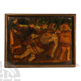
Persian Painting Depicting Nader Shah Slaying DeveTimeLine Auctions Ltd.4.6(184)See Sold PriceMar 07, 2024
Hand Tinted Photo - Tower of David - American ColonyLevy Auction House4.3(11)See Sold PriceFeb 27, 2024
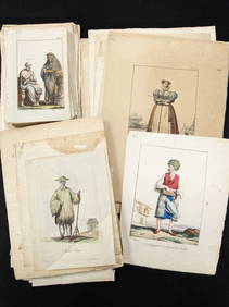
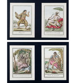
Large collection of hand colored plates depicting costumes and fashion from various cultures aroundTremont Auctions4.5(298)See Sold PriceFeb 25, 2024
An early Dutch hand colored engraving map by Georg Balthasar Probst (1732-1801)Ostantix Auctions4.4(11)See Sold PriceFeb 27, 2024
18th Century Hess Germany Hand colored Engraved MapGlobal Auctions Company4.3(36)See Sold PriceMar 03, 2024
A 19TH CENTURY HAND COLOURED MAP OF ORKNEY AND SHETLANDHutchinson Scott Auctioneers4.4(42)See Sold PriceFeb 28, 2024
An old tapestry depicting a European scene, from early 18th-century FranceAlma4.3(59)See Sold PriceMar 03, 2024
19th Century Antique Chinese Hetian Jade Hand Carved Dragon Bangle BraceletBidhaus4.3(773)See Sold PriceMar 03, 2024
La Nubia ed Abissinia. Red Sea Ethiopia Sudan Eritrea Arabia. ZATTA 1785 mapJasper524.5(9.9k)See Sold PriceFeb 28, 2024
Johnson's Africa. Colonies & tribes. Liberia Nile Delta Cape Colony 1866 mapJasper524.5(9.9k)See Sold PriceFeb 28, 2024
EARLY PORCELAIN TEAPOT, CUP & PITCHERPridham's Auctions & Appraisals4.7(223)See Sold PriceMar 02, 2024
James Sowerby (1757 - 1822) - Set of 8 Botanical Prints - Heath Cudweed - Saxifraga Nivalis -Proverde Auctions4.3(3)See Sold PriceFeb 28, 2024
James Sowerby (1757 - 1822) - Set of 8 Botanical Prints - Birthwort, Aristolochia clematitis -Proverde Auctions4.3(3)See Sold PriceFeb 28, 2024
James Sowerby (1757 - 1822) - Set of 10 Botanical Prints -Proverde Auctions4.3(3)See Sold PriceFeb 28, 2024
James Sowerby (1757 - 1822) - Set of 10 Botanical Prints - Common Sea-Buckthorn - Orobanche RapumProverde Auctions4.3(3)See Sold PriceFeb 28, 2024
James Sowerby (1757 - 1822) - Set of 10 Botanical Prints - Orobanche Common Lesser - CentrolepisProverde Auctions4.3(3)See Sold PriceFeb 28, 2024
James Sowerby (1757 - 1822) - Set of 10 Botanical Prints - Potentilla anserina - Poa aquatica -Proverde Auctions4.3(3)See Sold PriceFeb 28, 2024
SAMUEL GOUPIL, LONDON. AN EARLY 18TH CENTURY WEIGHT DRIVEN BRASS LANTERN CLOCKHutchinson Scott Auctioneers4.4(42)See Sold PriceJul 12, 2024
ROBERT PARKINGSON, LANCASTER. AN EARLY 18TH CENTURY OAK CASED 11” 30-HOUR LONGCASE CLOCKHutchinson Scott Auctioneers4.4(42)See Sold PriceJul 12, 2024
Natural 1.5 ctw Princess Diamond Halo Ring 14k White GoldPacific Global Auction3.9(286)See Sold PriceJul 27, 2024