SoldDoggett's Map of U.S. with railroad lines 1847Title: Map of the United States to Accompany Doggett's Rail Road Guide Author: Doggett, John Description: Lithographed map, folding. 46.5x59 cm. (23½x18½").Map of the United States to the Rocky MounSee Sold Price
SoldMap of U.S. & railroad lines 1875Heading: (Map - United States) Author: Title: New map of the American overland route, showing its connections, and land grants of 30,000,000 acres Place Published: Chicago Publisher:Rand, McNally & CSee Sold Price
Pocket Map of U.S. Railroad Lines in 1856Pocket Map of U.S. Railroad Lines in 1856 295. [MAP]. FISHER, Richard S. (compiler). Dinsmore’s Complete Map of thSee Sold Price
SoldFisher Railroad Map of USFisher, Richard S. (19th Century). Pocket Map of U.S. Railroad Lines in 1856 Lithograph with original hand color. New York: John G. Wells, 1856. 27" x 32 1/2" sheet, 36 1/2" x 42" framed.See Sold Price
SoldMissouri Pacific Railroad Lines U.S. MapMissouri Pacific Railroad Lines U.S. Map 17" x 30.75" Nicely FramedSee Sold Price
SoldCommercial Map of the US, Principal Lines of RailroadCommercial Map of the United States Showing The Principal Connecting Lines of Railroad David M Warrens 1879, Common School Geography 11.75 x 9.75 inches No Reserve: This lot starts at $1 and has no reSee Sold Price
Large map of U.S. Railroads 1918Title: General Railway Map Engraved Expressly for the Official Guide of the Railways and Steam Navigation Lines of the United States... Author: ** Description: Engraved map, outline color, sectioned &See Sold Price
MAPS - Western US, Railroads. Rand McNallyWestern United States, Railroads. Rand McNally& Co., [Lot of 2] Map of the Chicago, Rock Island & Pacific Railway and Connections [and] Map Exhibiting the Leading Transportation Lines of the Pacific CSee Sold Price
Map of US Military Railroad, Julius Bien 1866 Steel EngMap of United States Military Railroad showing the railroad operated during the war from 1862-1866 as military lines.. col., steel engraved. NY: Julius Bien, 1866100 mile scaleDimensions: 25" X 38"InvSee Sold Price
SoldMitchell: Railroad & Steamboat Map of the US, 1887Map: 1887 Mitchell Railroad and Steamboat Map of the US -- Railroad Map of the United States, Showing the through Lines of Communication from the Atlantic to the Pacific. Together with the Various SteSee Sold Price
Sold1886 Mitchell/Bradley Railroad and Steamboat Map of theTitle: 1886 Mitchell/Bradley Railroad and Steamboat Map of the US -- Railroad Map of the United States Together with the Various Steamship Lines along the Seaboard Date: 1886, Philadelphia CartographeSee Sold Price
SoldAN ATLANTIC COAST LINE RAILROAD MAP DATED 1938An Atlantic Coast Line railroad map of the Eastern U.S. from New York to Florida, inset with Cuba and the Bahamas, polychrome printing, copyright dated 1938. We happily provide seamless in-house packiSee Sold Price
SoldFolding Rarilroad map of U.S. c.1880Title: Map of the Atchison, Topeka and Santa Fe Railroad and its Leased Lines Author: Rand, McNalley Description: Folding lithographed map. 61x94 cm. (24x37").Railroads of whole U.S., with emphasis ofSee Sold Price
SoldRailroad map of U.S. 1883Heading: Author: Rand, McNally & Co. Title: The Burlington Route / Correct Map of the Chicago, Burlington & Quincy R.R. and Connecting Lines Place Published: Chicago Publisher: Date Published: <See Sold Price
SoldAN ATLANTIC COAST LINE RAILROAD STEAMSHIP MAPThe full color cardstock placard map of the Eastern U.S. seaboard from Boston to Miami, signed The Matthews-Northrup Co. We happily provide seamless in-house packing and shipping services on nearly evSee Sold Price
SoldRailroad map of western U.S. 1882Heading: Author: Rand, McNally & Co. Title: Central Pacific R.R. and Leased Lines; Southern Pacific R.R. and Connections. September 1882. A.N. Turner, General Manager. R.H. Goodman, Gen'l Pass. & TktSee Sold Price
Sold1944 Western Pacific Railroad Pictorial Map of WesternTitle/Content of Map: 1944 Western Pacific Railroad Pictorial Map of Western US with Illustrations -- From San Francisco along the line of Western Pacific Railroad to Salt Lake City Date: 1944, DenverSee Sold Price
SoldEastern US Railroad Pass Group (113468)Lot of 5 different. Best is a Lehigh Valley Railroad pass from 1894, that has a map on reverse! Others: Atlantic Coast Line Railroad Company (1906); Delaware and Hudson Railroad (1932); Western MarylaSee Sold Price
SoldMAPS, Mexico, U.S. GovernmentMexico, Mexican-American War. U.S. Gov., [Lot of 2] Plan of the Battle of Buena-Vista, Fought February 22nd and 23rd 1847 [and] Survey of the Mexican Lines of Defence at Cerro Gordo, and the Lines ofSee Sold Price
1847 Map U.S. Army Battles of Mexico"Battles of Mexico Line of Operations of the U.S. Army Under the Command of Major General Winfield Scott on the 19th and 20th of August 1847". Surveyed by Maj. Turnbull, Capt. McClellan, and Lieut. HaSee Sold Price
SoldRand McNally US and Southern Canada Railroad MapFolded colored map in 6.5" x 4" brown cover. Back cover has an illustration of a biplane, pilot and 2 military officers. No publishing date found; rail lines shown but no highways for autos. PossiblySee Sold Price
Rand McNally US and Southern Canada Railroad Map 59732Folded colored map in 6.5" x 4" brown cover. Back cover has an illustration of a biplane, pilot and 2 military officers. No publishing date found; rail lines shown but no highways for autos. PossiblySee Sold Price
SoldTwo Pocket Maps of California (117240)Two pocket maps: "Complete Map of California," "Showing principal automobile roads," (handwritten, "after 1909"). Electric lines, railroads, M.O. post office, banks, rivers, canals, and last U.S. CensSee Sold Price
SoldTwo Pocket Maps of California (117240)Two pocket maps: "Complete Map of California," "Showing principal automobile roads," (handwritten, "after 1909"). Electric lines, railroads, M.O. post office, banks, rivers, canals, and last U.S. CensSee Sold Price
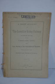
Connotton Valley RY Account of Construction and Equipment-1881JM Hobby Supply and Railroad Artifact Auctions4.4(127)See Sold PriceFeb 24, 2024
1875 Rand Avery and Co. Map of Express Companies and Railroads of the USA and CanadaJM Hobby Supply and Railroad Artifact Auctions4.4(127)See Sold PriceFeb 24, 2024
1892 Adams and Bowles New Road Map of the State of New YorkJM Hobby Supply and Railroad Artifact Auctions4.4(127)See Sold PriceFeb 24, 2024
American Express/New York Central Railroad Map of the United States-1934JM Hobby Supply and Railroad Artifact Auctions4.4(127)See Sold PriceFeb 24, 2024
Crams Colored Railway Map and Shippers Guide of South Dakota 1908-1909JM Hobby Supply and Railroad Artifact Auctions4.4(127)See Sold PriceFeb 24, 2024
Crams Railroad Map of New York-1881JM Hobby Supply and Railroad Artifact Auctions4.4(127)See Sold PriceFeb 24, 2024
Hammonds Map of Kentucky and Tennessee Railroads-1910JM Hobby Supply and Railroad Artifact Auctions4.4(127)See Sold PriceFeb 24, 2024
Rand McNally Railroad Map of Colorado-1929JM Hobby Supply and Railroad Artifact Auctions4.4(127)See Sold PriceFeb 24, 2024
Rand McNally Railroad Map of Washington-1906JM Hobby Supply and Railroad Artifact Auctions4.4(127)See Sold PriceFeb 24, 2024
Rand McNally Township County and Railroad Map of Illinois-1879JM Hobby Supply and Railroad Artifact Auctions4.4(127)See Sold PriceFeb 24, 2024
Rand McNally/Santa Fe Railroad Map of Iowa-1912JM Hobby Supply and Railroad Artifact Auctions4.4(127)See Sold PriceFeb 24, 2024
Oregon Short Line RR April 1899 Public TimetableJM Hobby Supply and Railroad Artifact Auctions4.4(127)See Sold PriceFeb 24, 2024
Pair of Early Railroad Maps - 1862 Pittsburgh, Ft. Wayne & Chicago Railway and 1873 PennsylvaniaRail & Road Auctions4.6(165)See Sold PriceMar 07, 2024
Mostly U.S., Some Canada Maps etc (40 Pcs)Grant Zahajko Auctions, LLC4.8(1k)See Sold PriceMar 06, 2024
2011 Liberia $5 History of Railroads Flam Line Silver Coin NGC PF69 Ultra CameoBK Auctions4.7(1.4k)See Sold PriceFeb 25, 2024