SoldDe l'Isle (Guillaume) Atlas NouveauDe l'Isle (Guillaume) Atlas Nouveau,23 maps only, (of 46 listed in manuscript contents table), most of France, but also India, North Africa, Eastern Europe and Scandinavia, engraved maps, withSee Sold Price
De Lisle (Guillaume) Atlas NouveauDe l'Isle (Guillaume) Atlas Nouveau,additional engraved title by R. de Hooghe, printed title in red and black with engraved vignette, 108 double-page engraved maps, some also folding, all butSee Sold Price
Delisle, Guillaume Atlas NouveauContenant toutes les parties du Monde. Ou sont exactement Remarquées les Empires, Monarchies, Royaumes, Etats, Republiques &c., Amsterdam: Jean Covens & Corneille Mortier, [c.1745]. Folio, (530 xSee Sold Price
SoldDelisle, Guillaume Atlas NouveauContenant toutes les parties du Monde. Ou sont exactement Remarquées les Empires, Monarchies, Royaumes, Etats, Republiques &c., Amsterdam: Jean Covens & Corneille Mortier, [c.1745]. Folio, (530 x 3See Sold Price
Sold(Maps and Charts, North America), Delisle, Guillau(Maps and Charts, North America), Delisle, Guillaume (1675-1726), Carte Particuliere de L'Amerique Septentrionale, Amsterdam: Covens and Mortier [1740], the key map from Atlas Nouveau, showing eighteeSee Sold Price
SoldGuillaume de l'Isle HAND-COLORED ENGRAVED MAPGuillaume de l'Isle HAND-COLORED ENGRAVED MAP BOURDELOIS PERICORD 1714 France Horloge Atlas Nouveau Saintonge Angoumoi Limosin Quercy Agenois Bazadois Medoc Aunis Guillaume de l'Isle HAND-COLORED ENGRSee Sold Price
SoldCOVENS and MORTIER / DELISLE. Atlas Nouveau, cCOVENS and MORTIER / DELISLE. Atlas Nouveau, contenant Toutes les Parties du Monde . . . Par Guillaume de l'Isle. 63 double-page or folding engraved maps; hand-colored in outline. Folio, 540x340 mm, eSee Sold Price
SoldGuillaume de L'isle Hand Colored Map of FranceLe Gouvernement General de Guienne et Gascogne. Author: Guillaume de I'Isle Hand Colored Published: Atlas Nouveau Contenant Toutes les Parties du Monde, c.1733, de l'lsle/Covens &See Sold Price
SoldDe l'Isle (Guillaume) [Atlas]De l'Isle (Guillaume) [Atlas],20 fine engraved double-page maps, hand-coloured in ouline, including a world map, Europe, 'Moscovie', Spain, America, Italy, Greece and Asia, a few small holes oSee Sold Price
DELISLE, Guillaume. Atlas Novus. Atlas Noveau contDELISLE, Guillaume. Atlas Novus. Atlas Noveau contenant toutes les parties du monde &c. Introduction à la géographie, par le Sieur Sanson d'Abbeville, Géographe Ordinaire du Roi. Amsterdam: CSee Sold Price
SoldDelisle (Guillaume) [Composite World Atlas], lackingDelisle (Guillaume) [Composite World Atlas], lacking title, manuscript contents list, 76 double page copper engraved maps, some folding, many outlined in colour, depicting Europe, the Americas, AfricaSee Sold Price
SoldNordamerika "America Septentrionalis in suasNordamerika "America Septentrionalis in suas praecipuas partes divisa, ad usum serenissimi Burgundiae Ducis". Grezkolorierte Kupferstichkarte nach Guill. de Lisle aus dem Atlas nouveau von Pieter MortSee Sold Price
Sold(ATLAS) DELISLE, GUILLAUME. A bound collection of 28(ATLAS) DELISLE, GUILLAUME A bound collection of 28 engraved maps, hand-colored in outline, largely after Delisle (Paris, 1745), but with examples by Nicholas Sanson and Robert de Vaugondy as well. FoSee Sold Price
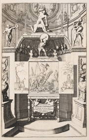
Guillaume de l’Isle, ‘Atlas Novus […]’ & 5 Framed Maps,Guillaume de l’Isle (1675-1726) – French Cartograph ‘Atlas Novus ad Usum Serenissimi Burgundiae Ducis’ Published by Covens & Mortier, Amsterdam, 1730 Engraved copper title by Romeyn de HoogheSee Sold Price
De l'Isle and Buache. Atlas GéographiqueDe l'Isle (Guillaume) and Phillipe Buache. Atlas Géographique des Quatre Parties du Monde,engraved title and contents leaf, 37 maps (including double-hemisphere world, and plan of Paris) withSee Sold Price
Sold1781 DELISLE GUILLAUME (1675 - 1726) BUACHE PHILIPPE1781 DELISLE GUILLAUME (1675 - 1726) BUACHE PHILIPPE (1700 - 1773) DESAUCHE JEAN-CLAUDE INCISIONE colorata "Carte de l'isle et royaume de Sicile" (cm 48 x 58,5) tratta dal libro Atlas geographique etSee Sold Price
Sold1781 DELISLE GUILLAUME (1675 - 1726) BUACHE PHILIPPE1781 DELISLE GUILLAUME (1675 - 1726) BUACHE PHILIPPE (1700 - 1773) DESAUCHE JEAN-CLAUDE INCISIONE colorata "Carte de l'isle et royaume de Sicile" (cm 48 x 58,5) tratta dal libro Atlas geographique etSee Sold Price
1781 DELISLE GUILLAUME (1675 - 1726) BUACHE PHILIPPE1781 DELISLE GUILLAUME (1675 - 1726) BUACHE PHILIPPE (1700 - 1773) DESAUCHE JEAN-CLAUDE INCISIONE colorata "Carte de l'isle et royaume de Sicile" (cm 48 x 58,5) tratta dal libro Atlas geographique etSee Sold Price
SoldWorld.- De L'Isle (Guillaume) Mappemonde a l'usage duWorld.- De l'Isle (Guillaume) Mappemonde a l'usage du Roy, double-hemisphere world map with large armorial cartouche, engraved map with outline hand-colouring, 450 x 670 mm. (17 3/4 x 26 1/2 in), trimSee Sold Price
SoldAfrica.- De L'Isle (Guillaume) Carte de la Barbarie deAfrica.- De L'Isle (Guillaume) Carte de la Barbarie de la Nigritie et de la Guinée, map of western Africa from Barbary, Nigeria, and Guinea to below the equator, with numerous tent encampments deSee Sold Price
SoldIndia.- De L'Isle (Guillaume) Carte des Cotes deIndia.- De L'Isle (Guillaume) Carte des Cotes de Malabar et de Coromandel, map of Southern India and Northern Ceylon, that extends to the Maldive Islands, and the northern tip of Sri Lanka, engravingSee Sold Price
SoldSri Lanka.- De L'Isle (Guillaume) Carte de l'Isle deSri Lanka.- De L'Isle (Guillaume) Carte de l'Isle de Ceylan Dressee sur les Observations de Mrs. de l'Academie Royale des Sciences, large map of the island with part of India in the upper left corner,See Sold Price
SoldRussia.- De L'Isle (Guillaume) Carte de TartarieRussia.- De L'Isle (Guillaume) Carte de Tartarie Dressee sur les Relations de Plusieurs Voyageurs de Differentes Nations et sur Quelques Observations..., map showing from Eastern Ukraine and Crimea toSee Sold Price
SoldIndia.- De L'Isle (Guillaume) Carte des Cotes deIndia.- De L'Isle (Guillaume) Carte des Cotes de Malabar et de Coromandel, detailed map of India with part of Sri Lanka in the lower right corner and decorative title cartouche, engraving with outlineSee Sold Price
COVENS & MORTIER 1745 MAP OF THE GLOBEThomaston Place Auction Galleries4.4(389)See Sold PriceFeb 24, 2024
Chatelain - Map of the Americas and Details and Insets of Government CounselsTrillium Antique Prints & Rare Books4.5(30)See Sold PriceFeb 24, 2024
Chatelain - 3 Maps of the British Isles (England, Ireland, Scotland)Trillium Antique Prints & Rare Books4.5(30)See Sold PriceFeb 24, 2024
1760 MAP CARTE PARTICULIERE DE L'ISLE DE JUAN FERNANDES antique Robinson CrusoeJasper524.5(9.8k)See Sold PriceFeb 27, 2024
William III.- Chevalier (Nicolas) Histoire de Guillaume III, first edition, Amsterdam, 1692.Forum Auctions4.3(53)See Sold PriceFeb 29, 2024
1764 Bellin Map of Eastern Guadeloupe in the Lesser Antilles -- Partie Orientale de l'Isle de laJasper524.5(9.8k)See Sold PriceFeb 27, 2024
1764 Bellin Map of Mari-Galante Near Guadeloupe -- Carte de l'Isle de Mari-GalanteJasper524.5(9.8k)See Sold PriceFeb 27, 2024
1764 Bellin Map of St. Kitts -- Carte de l'Isle St. ChristopheJasper524.5(9.8k)See Sold PriceFeb 27, 2024
1764 Bellin Map of Western Guadeloupe in the Lesser Antilles -- Partie Occidentale de l'Isle de laJasper524.5(9.8k)See Sold PriceFeb 27, 2024
1764 Bellin Map of Antigua -- Carte de l'Isle d'Antigue Situee par la Latitude 17 Degres et par laJasper524.5(9.8k)See Sold PriceFeb 27, 2024
1845 Delisle/Bauche Map of Martinique -- Carte de l'Isle de la Martinique Colonie Francoise de l'uneJasper524.5(9.8k)See Sold PriceFeb 27, 2024
Map of the Count of Flanders, 1700 by Gillaume de Lisle, ParisAntiques Online Auctions4.6(410)See Sold PriceMar 14, 2024
Map of Turkey from Arabic and Persia, 1701 by Gillaume de Lisle, ParisAntiques Online Auctions4.6(410)See Sold PriceMar 14, 2024
Antique Map of Poland, 1700 by Guillaume De Lisle, ParisAntiques Online Auctions4.6(410)See Sold PriceMar 14, 2024
John Senex Map of Louisiana & Mississippi RiverWillow Auction House4.5(284)See Sold PriceMar 14, 2024


![De l'Isle (Guillaume) [Atlas] (1 of 1)](https://p1.liveauctioneers.com/410/21797/7511414_1_x.jpg?height=282&quality=70)

![Delisle (Guillaume) [Composite World Atlas], lacking (1 of 6)](https://p1.liveauctioneers.com/1569/142037/71905061_1_x.jpg?height=282&quality=70&version=1557752183)


![Guillaume de l’Isle, ‘Atlas Novus […]’ & 5 Framed Maps, (1 of 10)](https://p1.liveauctioneers.com/1670/80631/41928129_1_x.jpg?height=282&quality=70&version=1445256227)