SoldColton Railroad map of the West 1886Title: Map Showing the Atchison, Topeka and Santa Fe Railroad System with its Connections Author: Colton, G.W. & C.B. Description: Lithographed map with outline color. 54x8z cm. (21¼x32").Detailed maSee Sold Price
Colton Railroad map of the West 1886Title: Map Showing the Atchison, Topeka and Santa Fe Railroad System with its Connections Author: Colton, G.W. & C.B. Description: Lithographed map with outline color. 54x8z cm. (21¼x32").Detailed maSee Sold Price
SoldColton Railroad map of the West 1891Title: Map Showing the Atchison, Topeka and Santa Fe Railroad System with its Connections Author: Colton, G.W. & C.B. Description: Lithographed map with outline color. 41x83 cm. (16x32½").Detailed maSee Sold Price
* COLTON, G.W. and C.B. Colton's New railroad Map of* COLTON, George Woolworth. (1827-1901) and Charles B. COLTON (1832-1916) Colton's Map of the United States of America, The British Provinces, Mexico and the West West Indies. New York: G. W. and C. BSee Sold Price
West IndiesTitle/Content of Map: West Indies Date Printed: 1857 Cartographer: COLTON, J.H. Size: 11.8X14.8 Map showing towns, bays, topography, railroads (Cuba) and covers from the FL Peninsula & all the West InSee Sold Price
SoldWest IndiesTitle/Content of Map: West Indies Date Printed: 1856 Cartographer: Colton, J.H. Size: 11.8X14.8 Map showing towns, bays, topography, railroads (Cuba) and covers from the FL Peninsula & all the West InSee Sold Price
SoldFOUR MAPS OF INDIAN TERRITORY AND SOUTH WEST, 19TH CEN.Includes an 1872 Gray's Atlas map of Indian Territory, by G.W. & C.B. Colton, 13.75 x 17 inches. An A.A. Grant 'Railroad and County Map of Indian Terr.,' 17.25 x 23.5 inches. Two similar Wells, FargoSee Sold Price
SoldColton's map of the states and territories west of theColton's map of the states and territories west of the Mississippi River to the Pacific Ocean showing the overland routes, projected railroad lines, col. NY: 1874Dimensions: 26" X 39"Inv.27See Sold Price
Map of the Richmond & Louisville Railroad 1882Heading: Author: Colton, G.W. and C.B. Title: Map of the Richmond and Louisville R.R. Connecting the Railroads of Virginia with the Railroads of Kentucky on the Shortest Route East and West from theSee Sold Price
Map of the Richmond & Louisville Railroad 1882Heading: Author: Colton, G.W. and C.B. Title: Map of the Richmond and Louisville R.R. Connecting the Railroads of Virginia with the Railroads of Kentucky on the Shortest Route East and West from theSee Sold Price
SoldWest IndiesTitle: West Indies Publication Date: 1857 Cartographer: COLTON, J.H.Publisher: J.H. COLTON & CO. Size: 11.8Height - 14.8Width Map showing towns, bays, topography, railroads (Cuba) and covers from theSee Sold Price
Great 1857 Colton Railroad map of New HampshireVery nicely colored vintage map of Vermont with railroad lines featured prominently. From the uncommon 1857 Colton General Atlas. (See description of 1857 Colton atlas in Item 215-22). Map shows roadsSee Sold Price
Nice 1857 Colton Railroad map of VermontBeautifully colored map of Vermont with railroad lines featured very prominently. From the uncommon 1857 Colton General Atlas. (See previous item description about the 1857 Colton atlas). Highly detaiSee Sold Price
Colton: Antique Railraod Map of the United States, 1887Title: Map Showing The Pacific Railways and Their Branches. Prepared for the United States Pacific Railway Commission. Detailed 1887 Colton railroad map with color-coded routes Map maker: G. W. & C.B.See Sold Price
SoldRand Mcnally & Co.'s Railroad Map Of West TexasRailroad Map of West Texas Rand, McNally & Co. c. 1880, 21 x 14.25 in Please note that this lot has a confidential reserve. When you leave a bid in advance of the auction, submit your maximum. Jasper5See Sold Price
SoldGeorge Colton RAILROAD & TOWNSHIP MAP OF MASSACHUSETTSDetails: COLTON, George W. (1827-1901) & Charles B. (1832-1916). Colton's Railroad & Township Map of Massachusetts, Rhode Island, Connecticut with parts of Maine, New Hampshire, Vermont & New York. NSee Sold Price
Rare separate issue of Colton map of West 1849Heading: Author: Colton, Joseph Hutchins Title: Map of California, Oregon, Texas, and the Territories adjoining with Routes &c Place Published: New York Publisher:J.H.Colton Date Published:See Sold Price
SoldRare separate issue of Colton map of West 1849Heading: Author: Colton, Joseph Hutchins Title: Map of California, Oregon, Texas, and the Territories adjoining with Routes &c Place Published: New York Publisher:J.H.Colton Date Published:See Sold Price
SoldNorthern Pacific Railroad Co. Map, 1886Promotional Map for Washington, Idaho & the Northwest 120. [MAP]. RAILROAD. NORTHERN PACIFIC RAILROAD COMPANY. Sectional Map Showing the Lands of Northern Pacific Railroad Co. in Eastern Washington anSee Sold Price
SoldColton's Railroad abd Township Map, Ohio 1851Colton's Railroad & Township Map of the State of Ohio by G. W. & C. B. Colton & Company 1851. Its in its original cover. The map is a fold out that comes out of the cover. Cover is rough but the map iSee Sold Price
Sold5 Pennsylvania Folding Maps Incl. Colton 1889 Rai5 Pennsylvania Folding Maps Incl. Colton 1889 Railroad map of PA and New Jersey-- Dimensions: ---See Sold Price
Sold2 J. Colton mapsJ. H. Colton- 1). ''Colton's Railroad & Township Map of the State of Ohio''- engraved folding map including the decorative border, 1852. 24 x 27«'' 2). ''Colton's Traveler's Map of the United StateSee Sold Price
SoldColton's Map of the State of New York 1857Heading: Author: Colton, J. H. Title: Colton's Railroad & Township Map of the State of New York with Parts of Adjoining States & Canada Place Published: New York Publisher:J.H. Colton Date PubliSee Sold Price
Sold1868 Colton's Railroad & Township Map of Vermont- h/c1868 Colton's Railroad & Township Map of Vermont- h/c folding pocket map- back board missing, stains, tearsSee Sold Price
Central Railroad of New Jersey Map of Sandy Hook Route-ca. 1903JM Hobby Supply and Railroad Artifact Auctions4.4(127)See Sold PriceFeb 24, 2024
Northern Pacific RR Washington and Northern Idaho Map Folder-1941JM Hobby Supply and Railroad Artifact Auctions4.4(127)See Sold PriceFeb 24, 2024
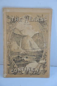
Chicago Burlington and Quincy RR The Heart of the Continent Book-1882JM Hobby Supply and Railroad Artifact Auctions4.4(127)See Sold PriceFeb 24, 2024
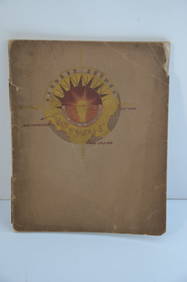
Chicago Milwaukee and St Paul RY Why and Wherefore Book-1886JM Hobby Supply and Railroad Artifact Auctions4.4(127)See Sold PriceFeb 24, 2024
Southern Pacific RR Book West By South-Half South-1890JM Hobby Supply and Railroad Artifact Auctions4.4(127)See Sold PriceFeb 24, 2024
Union Pacific RR Across The Continent West From Omaha, NE Book-April 2, 1868JM Hobby Supply and Railroad Artifact Auctions4.4(127)See Sold PriceFeb 24, 2024
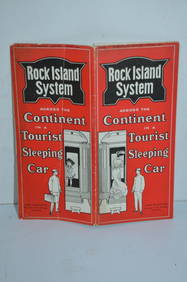
Chicago Rock Island and Pacific RY August 1903 Westbound Edition Public TimetableJM Hobby Supply and Railroad Artifact Auctions4.4(127)See Sold PriceFeb 24, 2024
1888 Hand Book of the Pennsylvania Lines Containing Maps of Principal Cities - First EditionRail & Road Auctions4.6(165)See Sold PriceMar 07, 2024
1853 Colton's Railroad & Township Map of Massachusetts, Rhode Island, and ConnecticutRail & Road Auctions4.6(165)See Sold PriceMar 07, 2024
Pair of Early Railroad Maps - 1862 Pittsburgh, Ft. Wayne & Chicago Railway and 1873 PennsylvaniaRail & Road Auctions4.6(165)See Sold PriceMar 07, 2024
Three Delaware & Hudson Canal Company Railroad Annual Passes - 1884, 1885, and 1886Rail & Road Auctions4.6(165)See Sold PriceMar 08, 2024
Rand McNally Railroad Map Cabinet w/ 21 Railroad MapsRail & Road Auctions4.6(165)See Sold PriceMar 08, 2024
Hist. of Indian wars of the Far West - Massacres of the MountainsJasper524.5(9.9k)See Sold PriceFeb 27, 2024
Map of Part of the West Indies, Etc., Showing the Exact Position Of The U.S. War Steamer SanJasper524.5(9.9k)See Sold PriceFeb 27, 2024
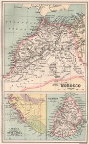
West Africa. Liberia Sahara Senegambia Guinea. Mountains of Kong COLTON 1869 mapJasper524.5(9.9k)See Sold PriceFeb 28, 2024
North west Africa. Liberia inset. Sahara Senegambia Guinea. COLTON 1863 mapJasper524.5(9.9k)See Sold PriceFeb 28, 2024
MOROCCO LIBERIA & MAURITIUS. Sierra Leone. BARTHOLOMEW 1886 old antique mapJasper524.5(9.9k)See Sold PriceFeb 28, 2024
EARLY COLONIAL WEST AFRICA. Empires of Sokoto Gando Mas.Tribes.Fellatah 1886 mapJasper524.5(9.9k)See Sold PriceFeb 28, 2024