SoldCARY, JOHN. A New Map of Nova Scotia, NewfoundCARY, JOHN. A New Map of Nova Scotia, Newfoundland &c. Double-page engraved map, 515x600 mm, wide margins; hand-colored. London, 1807 All items are offered for sale subject to Swann Galleries' standarSee Sold Price
Cary (John) A New Map of Nova Scotia,-. Cary (John) A New Map of Nova Scotia, Newfoundland &c., engraved map of the Gulf of St Laurence, and the coasts of Newfoundland, Nova Scotia, New Brunswick, etc., with full original hand-coSee Sold Price
SoldCanada.- Cary (John) A New Map of Upper & Lower Canada;NO RESERVE Canada.- Cary (John) A New Map of Upper & Lower Canada; A New Map of Nova Scotia, Newfoundland &c., two maps of Canada from Cary's 'New Universal Atlas', engravings with hand-colouring, eacSee Sold Price
Cary: Antique Map of Nova Scotia & Newfoundland, 1807Title/Content of Map: A New Map of Nova Scotia, Newfoundland &c. Cartographer: John Cary Place & Date: London / 1807 Size: 20 3/8" x 18" Condition: original color; light overall age toning; minor browSee Sold Price
Cary: A New Map of Nova Scotia, Newfoundland, 1807Map: A New Map of Nova Scotia, Newfoundland &c. Cartographer: John Cary Place & Date: London / 1807 Size: 20 3/8" x 18" The superbly detailed map of Newfoundland, Nova Scotia, part of New Brunswick anSee Sold Price
SoldCary (John) Nova Scotia, Newfoundland &c.Cary (John) Nova Scotia, Newfoundland &c.the Gulf of St Laurence, and the coasts of Newfoundland, Nova Scotia, New Brunswick, etc., engraved map, with full original hand-colouring, 460 x 520mmSee Sold Price
SoldCanada.- Gibson (John) A New and Correct Map of theCanada.- Gibson (John) A New and Correct Map of the Isles of New Found Land, Cape Breton &c., with the Provinces of Nova Scotia, engraved map on laid paper with watermark of a crown and the initials GSee Sold Price
SoldRobert de Vaugondy. A New Map of CanadaRobert de Vaugondy (Gilles & Didier) After. A New Map of Canada, Also the North Parts of New England and New York, with Nova Scotia and Newfound Land,with inset map of the Great Lakes, froSee Sold Price
SoldGroup of 4 mapsGroup of 4 maps 1). Johann Baptist Homanno- ''Ducatus Brabantiae Nova Tabula''; 2). John Cary- ''A New Map of United Provinces, Comprehending Holland, Zealand, Utrecht, Gelders, Over Yssel, FrieslandSee Sold Price
New Brunswick & Nova Scotia 1888Title/Content of Map: New Brunswick & Nova Scotia 1888 Date Printed: 1888 Material/Medium: paper Size: approx. 14x11 inches Additional Info: John C. Lonngren & Son Standard Atlas of the World Reserve:See Sold Price
New Brunswick & Nova Scotia 1888Title/Content of Map: New Brunswick & Nova Scotia 1888 Date Printed: 1888 Material/Medium: paper Size: approx. 14.5x11.5 inches Additional Info: John C. Lonngren & Son Standard Atlas of the World ReseSee Sold Price
New Brunswick & Nova Scotia 1888Title/Content of Map: New Brunswick & Nova Scotia 1888 Date Printed: 1888 Material/Medium: paper Size: approx. 14x11 inches Additional Info: John C. Lonngren & Son Standard Atlas of the World Reserve:See Sold Price
New Brunswick & Nova Scotia 1888Title/Content of Map: New Brunswick & Nova Scotia 1888 Date Printed: 1888 Material/Medium: paper Size: approx. 14x11 inches Additional Info: John C. Lonngren & Son Standard Atlas of the World Reserve:See Sold Price
New Brunswick & Nova Scotia 1888Title/Content of Map: New Brunswick & Nova Scotia 1888 Date Printed: 1888 Material/Medium: paper Size: approx. 14x11 inches Additional Info: John C. Lonngren & Son Standard Atlas of the World Reserve:See Sold Price
Sold18th C. Hand-Colored Map of New EnglandAn 18th C. hand-colored engraved map of New England, Nova Scotia, New France, or Canada, with the Islands of Newfoundland, Cape Breton, St. John's, by Jacques-Nicholas Bellin. Framed under glass. MatSee Sold Price
SoldThomas Kitchin Map 1758A Map by Thomas Kitchin with a cartouche in the lower right that reads “A Map of New England, and Nova Scotia; and part of New York, Canada, and New Britain & the adjacent Islands of New Found LandSee Sold Price
SoldTallis. American, Australasian & other mapsTallis (John) a mixed group of American, Australasian and other maps,including Nova Scotia, Canada & New Brunswick, Panama, British Guyana, South Australia, Van Diemen's Island, Polynesia, theSee Sold Price
Provinces of New Brunswick, Nova Scotia & Prince EdwardTitle/Content of Map: Provinces of New Brunswick, Nova Scotia & Prince Edward Island. Date Printed: 1890 Cartographer: BARTHOLOMEW, JOHN & CO. Size: 15.8X11.25 "By J. Bartholomew, F.R.G.S." 61 From BaSee Sold Price
Sold1808 Maritimes MapHand-coloured copperplate engraving, issued in John Cary’s New Universal Atlas (London, 1808), showing Nova Scotia, Newfoundland, Prince Edward Island, and New Brunswick. Matted in handsome wooSee Sold Price
SoldWalker (John and Alexander) United StatesWalker (John and Alexander) Map of the United States and the Provinces of Upper & Lower Canada, New Brunswick and Nova Scotia, engraved map on 4 sheets, unjoined, with original hand-colouringSee Sold Price
Bowen: Antique Map of Gulf of St. Lawerence, 1752Title: A New & Accurate Map of the Islands of Newfoundland, Cape Briton, St. John and Anticosta; Together with the Neighbouring Countries of Nova Scotia, Canada &c...1752 Bowen Gulf of St. Lawerence wSee Sold Price
Thomson: Antique Map of Canada & Nova Scotia, 1817TITLE/CONTENT OF MAP: 'Canada and Nova Scotia [or British dominions in America]' The New Brunswick / Maine border predates the Aroostook War of 18381839, as a result of which the present border was seSee Sold Price
SoldThomson: Antique Map of Canada & Nova Scotia, 1817Title/Content of Map: Canada and Nova Scotia. Date Printed: 1817 Cartographer: THOMSON, JOHN & CO. Size (inches): 16.1x22 No.43 (unnumbered) from Thomson's New General Atlas 1817. W. Dassauville engr.See Sold Price
"Canada and Nova Scotia" by John Thomson. British NorthTITLE/CONTENT OF MAP: 'Canada and Nova Scotia [or British dominions in America]' The New Brunswick / Maine border predates the Aroostook War of 18381839, as a result of which the present border was seSee Sold Price
LATE 18TH C. VERY LARGE CHART OF NORTHEAST CANADA BY DES BARRES (1721-1824), 1780, FRAMEDThomaston Place Auction Galleries4.4(394)See Sold PriceFeb 24, 2024
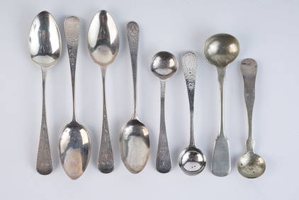
GROUPING OF STERLING & COIN SILVER SPOONSJohn McInnis Auctioneers,LLC4.5(505)See Sold PriceFeb 24, 2024
17th Century Hand Colored Engraved Map of GermanyGlobal Auctions Company4.3(36)See Sold PriceMar 03, 2024
Map: A 19thC engraved map titled Gloucestershire from the Best Authorities, after John Cary. Approx.Claydon Auctioneers Ltd4.3(125)See Sold PriceFeb 26, 2024
Map: A 19thC engraved and hand coloured map of Buckingham titled A New Map of BuckinghamshireClaydon Auctioneers Ltd4.3(125)See Sold PriceFeb 26, 2024
Map: A 19thC engraved map of West Riding, titled A Map of the North Part of the West Riding ofClaydon Auctioneers Ltd4.3(125)See Sold PriceFeb 26, 2024
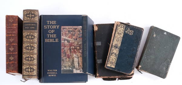
1711 GREEK BIBLE ILLUSTRATED w/ MAPS VELLUM BOUND antique NEW TESTAMENTJasper524.5(9.9k)See Sold PriceFeb 27, 2024
1772 GREEK BIBLE NEW TESTAMENT antique BIBLIA LATIN text MAP NOVUM TESTAMENTUMJasper524.5(9.9k)See Sold PriceFeb 27, 2024
Fielding (Henry) The Works, with An Essay on His Life and Genius by Arthur Murphy, 10 vol., newForum Auctions4.4(54)See Sold PriceFeb 29, 2024
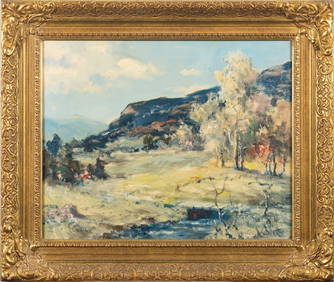
American Impressionist Original Oil Painting The Creek in Spring, framed c. 1950'sJasper524.5(9.9k)See Sold PriceFeb 28, 2024
Guthrie, William 1812 Antique Map. Spain and PortugalAlbion Auctions4.7(341)See Sold PriceMar 01, 2024