SoldCarte ancienne : - Dept. de l'Isère , RégionCarte ancienne : - Dept. de l'Isère , Région de l'Est n°37 Gravure aquarellée - Tiré de l'Atlas National illustré des 86 départements et des possessions de la FranceSee Sold Price
Sold2 framed map book plates2 framed map book plates including Map of France, Spain and Portugal, c. 1860; & Dept. De L'Isere from Atlas National Illustre. Foxing; creases. Largest measures 18 inches x 23 inches.See Sold Price
MAP19TH C. COLORED FRENCH MAP TITLED "DEPT. DE L'ISERE", ATLAS NATIONAL ILLUSTRE. SCRATCHES TO FRAME. FOXING. 18 INCHES HIGH X 23 INCHES WIDE. All property is sold "AS IS", "WHERE IS", and ALL SALES ARESee Sold Price
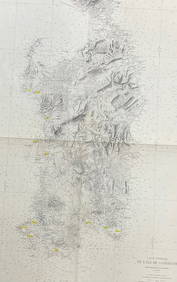
208: [France]. 2 Levassuer Maps From Atlas National Il[France]. 2 Levassuer Maps From Atlas National Illustre [c1852]. ++ Dept. De L'Isere. ++ Dept. Du Lot. Each matted in gilt frame; approx. 20 x 26 inches. Moderate foxing and soiling, else very good inSee Sold Price
2 framed map book plates2 framed map book plates including Map of France, Spain and Portugal, c. 1860; & Dept. De L'Isere from Atlas National Illustre. Foxing; creases. Largest measures 18 inches x 23 inches.See Sold Price
1708 Chatelain Map of Ireland -- Carte Ancienne etTitle: 1708 Chatelain Map of Ireland -- Carte Ancienne et Moderne de l'Irlande, avec Quelques Remarques sur son Gouvernement et sur l'Etat Present de Cette Isle Cartographer: H Chatelain Year / Place:See Sold Price
1708 Chatelain Map of Ireland -- Carte Ancienne etTitle: 1708 Chatelain Map of Ireland -- Carte Ancienne et Moderne de l'Irlande, avec Quelques Remarques sur son Gouvernement et sur l'Etat Present de Cette Isle Cartographer: H Chatelain Year / Place:See Sold Price
Carte manuscrite de l’ItalieCarte manuscrite de l’Italie Région de Savona Milieu XVIIIe. Deux couleurs. 23 x 35 cm.See Sold Price
Carte manuscrite de l’ItalieCarte manuscrite de l’Italie Région de Gavi, Octagio, Arma, Ovada, Capriata… Milieu XVIIIe. Aquarellée. 33 x 29 cm.See Sold Price
Sold1838 Map of Italy and SicilyCarte de L'Italie Ancienne and de L'Illyrie et de La Sicilie par Delamanche 1838See Sold Price
SoldChatelain. Ancient Greece and Greek EmpireChatelain (Henri Abraham) Cronologie Historique des Rois, et Differents Etats de l'Ancienne Grece,with Carte Historique, Cronologique, Geographique de l'Empire Grec, the former with a map of GSee Sold Price
SoldMap Book - RECUELL de CARTES GEOGRAPHIQUESMap Book - RECUELL de CARTES GEOGRAPHIQUES, De L'ANCIENNE GRECE "Au Voyage du Jeune Annacharsis" Troisieme Edition, Paris, 1790 - some maps torn & some pages missingSee Sold Price
Sold1753 Robert de Vaugondy Map of Egypt -- Carte deTitle/Content of Map: 1753 Robert de Vaugondy Map of Egypt -- Carte de L'Egypte Ancienne et Moderne… Cartographer: G Robert de Vaugondy Year/Place: 1753 Size: 25.1 X 18.3 in. This is a large, attracSee Sold Price
SoldBrue: Antique Map of Northern Italy & the Alps, 1875TITLE/CONTENT OF MAP: 'Carte Physique et Politique de l'Italie de la Region des Alpes et des Provinces Autrichiennes sur l'Adriatique' A physical and political map of Northern Italy and the Alps incluSee Sold Price
'Carte de l'Egypte Ancienne et Moderne' 18th C MapCarte de l'Egypte Ancienne et Moderne' Map. Large antique 18th C. atlas map, printed on thick, good quality paper with original outline hand colour/color and decorative title cartouche. Artist/CartogrSee Sold Price
Sold1762 MAP OF EGYPT BY RIGOBERT BONNE, PARIS, FRAMED"Carte de l'Egypt, Ancienne et Moderne, Dresse sur plusieurs Cartes Manus crites, assijeties aux observations Astronomique, Combinees avec les Itineraires Anciens et Modernes." Cartouche in the form oSee Sold Price
'Carte de l'Egypte Ancienne et Moderne' Map'Carte de l'Egypte Ancienne et Moderne' Map. Large antique 18th century atlas map, printed on thick, good quality paper with original outline hand colour/color and decorative title cartouche. Artist/CSee Sold Price
'Carte de l'Egypte Ancienne et Moderne' 18th C Map'Carte de l'Egypte Ancienne et Moderne' Map. Large antique 18th century atlas map, printed on thick, good quality paper with original outline hand colour/color and decorative title cartouche. Artist/CSee Sold Price
1753 Robert de Vaugondy Map of Egypt -- Carte deTitle: 1753 Robert de Vaugondy Map of Egypt -- Carte de L'Egypte Ancienne et Moderne… Date: 1753 Cartographer: G Robert de Vaugondy Size: 25.1 X 18.3 in. Additional Information: This is a large, attSee Sold Price
SoldMap of Egypt 1753Heading: (Egypt) Author: De Vaugondy, Robert Title: Carte de L'Egypte Ancienne et Moderne Place Published: Paris Publisher: Date Published: 1753 Description: Copper-engravedSee Sold Price
Carte de l'Egypte Ancienne et Moderne. SANTINI / ROBERTTITLE/CONTENT OF MAP: 'Carte de l'Egypte Ancienne et Moderne Dressée sur Celle du R.P. Sicard et autres assujetties aux observations astronomiques. Par le Sr. Robert de Vaugondy. À Venise par P. SanSee Sold Price
Santini / Vaugondy: Antique Map of Egypt, 1784Title/Content of Map: 'Carte de l'Egypte Ancienne et Moderne Dressée sur Celle du R.P. Sicard et autres assujetties aux observations astronomiques. Par le Sr. Robert de Vaugondy. À Venise par P. SanSee Sold Price
SoldBonne (Rigobert) Carte de l'Egypte,Bonne (Rigobert) Carte de l'Egypte, Ancienne et Moderne,Egypt, with decorative title vignette of a waterfall and a crocodile (uncoloured), engraved map with original hand-colouring, 440 x 305mSee Sold Price
Carte de l'Egypte Ancienne et Moderne. Nile valley. Sinai. VAUGONDY 1753 mapTITLE OF MAP (NOT PRINTED ON THE PAGE):'Carte de l'Egypte Ancienne et Moderne, dressee sur celle du R.P. Sicard et autres, assujetties aux observations astronomiques, par le Sr. Robert de Vaugondy G&#See Sold Price
LARGE EARLY 18TH C. DUTCH CHART OF UPPER NORTH AMERICA, PIERRE MORTIER (1661-1711), FRAMEDThomaston Place Auction Galleries4.4(386)See Sold PriceFeb 24, 2024
Map of St. Kitts and Nevis Depot de la Marine, Paris, 1758Global Auctions Company4.3(36)See Sold PriceMar 03, 2024
1764 Bellin Map of Mari-Galante Near Guadeloupe -- Carte de l'Isle de Mari-GalanteJasper524.5(9.8k)See Sold PriceFeb 27, 2024
1764 Bellin Map of St. Kitts -- Carte de l'Isle St. ChristopheJasper524.5(9.8k)See Sold PriceFeb 27, 2024
1764 Bellin Map of Antigua -- Carte de l'Isle d'Antigue Situee par la Latitude 17 Degres et par laJasper524.5(9.8k)See Sold PriceFeb 27, 2024
1845 Delisle/Bauche Map of Martinique -- Carte de l'Isle de la Martinique Colonie Francoise de l'uneJasper524.5(9.8k)See Sold PriceFeb 27, 2024
Carte de l'Afrique propre, de la Numidie… North Africa. LAPIE 1829 old mapJasper524.5(9.8k)See Sold PriceFeb 28, 2024
Carte de L'Algérie et de la Régence de Tunis' ANDRIVEAU-GOUJON Algeria 1850 mapJasper524.5(9.8k)See Sold PriceFeb 28, 2024
SUB-SAHARAN AFRICA. 'Ancienne Ethiopie'. Ancient Ethiopia. MALLET 1683 old mapJasper524.5(9.8k)See Sold PriceFeb 28, 2024
L'Afrique Françoise ou du Senegal'. French West Africa. DE L’ISLE 1727 mapJasper524.5(9.8k)See Sold PriceFeb 28, 2024
CARTE GENERALE DE L' ILE DE SARDAIGNE / PARIS 1889Churchill Galleries3.7(213)See Sold PriceFeb 26, 2024
Barthelemy, Jean 1790 Map. Greece - Essa sur la Bataille de PlateeAlbion Auctions4.6(336)See Sold PriceMar 01, 2024
Barthelemy, Jean 1790 Map. Greece - Plan de L'AcademieAlbion Auctions4.6(336)See Sold PriceMar 01, 2024
Barthelemy, Jean 1790 Map. Greece - Essai sur les Environs de DelphesAlbion Auctions4.6(336)See Sold PriceMar 01, 2024


![208: [France]. 2 Levassuer Maps From Atlas National Il (1 of 0)](https://p1.liveauctioneers.com/dist/images/placeholder.jpg?height=282&quality=70)