Sold(CANADA.) Wyld, James. A Map of the Province o(CANADA.) Wyld, James. A Map of the Province of Upper Canada. Engraved folding map, 585x885 mm, ample margins; hand-colored in outline; slight offsetting from the cartouche. London, 1838 This map is rSee Sold Price
MAP, Eastern Canada & Maine, WyldEastern Canada & Maine. James Wyld, A New Map of the Province of Lower Canada, Describing All the Seigneuries, Townships, Grants of Land, &c. Compiled from Plans Deposited in the Patent Office Quebec;See Sold Price
SoldJames Wyld MAP OF THE PROVINCE OF CANADA AND PARTOF THE UNITED STATES; WITH THE RAILWAYS, ROADS AND CANALS BY JAMES WYLD, GEOGRAPHER TO THE QUEEN AND H.R.H. PRINCE ALBERT. CHARING CROSS, EAST, LONDON, Four Doors from Trafalgar Square. c. 1850. LinenSee Sold Price
SoldWYLD, JAMES. A New Map of the Province of LoweWYLD, JAMES. A New Map of the Province of Lower Canada. Two-sheet engraved map, 580x885 mm, top and bottom margin close, others wide; hand-colored in outline; a few cellotape repairs on verso with resSee Sold Price
SoldPair of Early 19th Century Maps of CanadaPair of maps titled "A Map of the Province of Upper Canada" (1838) and "A Map of the Province of Lower Canada" (1840) by James Wyld, London. Maps measure 23.5" x 37" and exhibit hand-colored highlightSee Sold Price
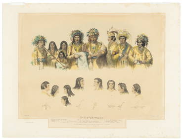
[MAP]. BOUCHETTE. Lower & Upper Canada.... 1831243. [MAP]. BOUCHETTE, Joseph, Jun. [Joseph Bouchette, Sr. & James Wyld]. To His Most Excellent Majesty King William IVth. This Map of the Provinces of Lower & Upper Canada, Nova Scotia, New BSee Sold Price
SoldWYLD, JAMES. The Province of Canada.WYLD, JAMES. The Province of Canada. Engraved 24-section case map, 675x990 mm overall; hand-colored in outline; some minor spotting and browning, slightly toned; lacking the case. London, [1850] ShowsSee Sold Price
SoldCary (John) - New Universal Atlas,engraved title and 55 double or folding map sheets, numbered 1 to 60, bound with 6 additional maps by James Wyld , comprising Upper Canada, Lower Canada, Sketch of the Niagara River (mounted on versoSee Sold Price
SoldWyld (James) - The Dominion of Canada,a reduction of the map prepared & issued under the direction of the Minister of Railways & Canals (1882) , with iset map of the Atlantic with North America adnd Europe, lower left, lithograohed map wiSee Sold Price
SoldNorth America.- Wyld (James) The British Possessions inNO RESERVE North America.- Wyld (James) The British Possessions in North America and the United States with the Hudson's Bay Territories, map showing Canada and the US, including the Canadian arctic nSee Sold Price
Zatta: Canada bet. James Bay & Ottawa RiverMap: La parte Occidentale della Nuova Francia o Canada. Cartograper: Zatta Place / Date: Venice / 1778 Size: 17 1/2" x 13 1/2" Condition: Original color. light overall age toning and slight browning aSee Sold Price
SoldLarge Wyld map of U.S. 1839Heading: Author: Wyld, James Title: Map of the United States; and the Provinces of Upper & Lower Canada, New Brunswick, and Nova Scotia. Compiled from the Latest Surveys and other authentic informatiSee Sold Price
SoldColton.Map of the United StatesColton (J.H., publisher) Colton's Map of the United States,The Canadas &c., engraved map, original outline hand-colouring, 695 x 860mm., New York, Johnson & Brownrigg, 1859 § Wyld (JaSee Sold Price
MAP - Eastern Canada. ZattaEastern Canada. Antonio Zatta, La Parte Occidentale della Nuova Francia o Canada, 1785 (circa). Hand Color. This is an important map of the region between James Bay, Lake Mistassini (Lac Mistassine),See Sold Price
Zatta: New France bet. Ottawa River & James Bay 1778Map: La parte Occidentale della Nuova Francia o Canada. Cartographer: Zatta Place & Date: Venice / 1778 Size: 17 1/2" x 13 1/2" Condition: Original color; light overall age toning and slight browningSee Sold Price
"La parte Occidentale della Nuova Francia o Canada". QCTITLE/CONTENT OF MAP: 'La parte Occidentale della Nuova Francia o Canada' "The western part of New France or Canada". The map shows part of western Quebec and north eastern Ontario between James Bay,See Sold Price
La parte Occidentale della Nuova Francia o Canada. QCTITLE/CONTENT OF MAP: 'La parte Occidentale della Nuova Francia o Canada' "The western part of New France or Canada". The map shows part of western Quebec and north eastern Ontario between James Bay,See Sold Price
Provinces of Ontario and Quebec Dominion of CanadaTitle: Provinces of Ontario and Quebec Dominion of Canada Publication Date: 1883 Cartographer: GRAY, FRANK A. Publisher: STEDMAN & BROWN/O.W. GRAY & SON Dimension: 14.75Height - 11.8Width 158-159 fromSee Sold Price
SoldIndia.- Wyld (James) Map of the Countries betweenIndia.- Wyld (James) Map of the Countries between England and India Designed to shew the Over-Land and Sea Routes to the East..., map of Europe and Asia between Britain and India, with the MediterraneSee Sold Price
SoldWyld (James) Map of the Superficial GeologyWyld (James) Map of the Superficial Geology of the British Isles...with the Line of Railways,engraved map with original hand-colouring in outline, 1305 x 1015mm., dissected and linen-backed, sSee Sold Price
SoldWyld (James) Map of North AmericaWyld (James) Map of North America,engraved map in 4 parts, original outline hand-colouring, dissected and linen-backed, 1800 x 1700mm., original cloth slip-case with paper labels, 1838.See Sold Price
SoldMiddle East .- Wyld (James) Map of Syria Ancient andMiddle East .- Wyld (James) Map of Syria Ancient and Modern, second edition, engraved with hand-colouring in outline, 986 X 662mm., lightly browned, linen-backed and dissected, folding into original cSee Sold Price
SoldWyld (James) Map of London and Visitor's Guide toWyld (James) Map of London and Visitor's Guide to the Great Exhibition 1851,engraved folding map with original hand-colouring, borders with vignette views of London, uncoloured, 560 x 950mm.,See Sold Price
Sold(CENTRAL AMERICA.) Wyld, James. Map of Central America(CENTRAL AMERICA.) Wyld, James. Map of Central America Shewing the Different Lines of Atlantic & Pacific Communication. Large hand-colored engraved map of Central America with an inset of the IsthmusSee Sold Price
Ohio and Pennsylvania RR 2nd Annual Report-March 4, 1850JM Hobby Supply and Railroad Artifact Auctions4.4(126)See Sold PriceFeb 24, 2024
1875 Rand Avery and Co. Map of Express Companies and Railroads of the USA and CanadaJM Hobby Supply and Railroad Artifact Auctions4.4(126)See Sold PriceFeb 24, 2024
Grand Trunk Railroad Across the Continent Through Canada Book-1917JM Hobby Supply and Railroad Artifact Auctions4.4(126)See Sold PriceFeb 24, 2024
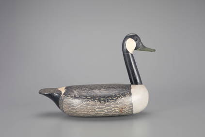
Rare Canada Goose Decoy by James A. "Jim" Currier (1886-1969)Copley Fine Art Auctions4.5(40)See Sold PriceFeb 24, 2024
Canada Goose Decoy by George "Skippy" Barto (1880-1959)Copley Fine Art Auctions4.5(40)See Sold PriceFeb 24, 2024
High-Head Canada Goose Decoy by Otto Garren (1890-1968)Copley Fine Art Auctions4.5(40)See Sold PriceFeb 24, 2024
LARGE LATE 17TH C. DUTCH CHART OF CANADA, GREAT LAKES, NEW FRANCE, LABRADOR, HUDSON BAY, BY PIERREThomaston Place Auction Galleries4.4(386)See Sold PriceFeb 24, 2024
MATTHEWS c1856 Map Of Upper Canada Ontario Indian Land Agency Divisions Scarce!Luis Porretta Fine Arts4.3(10)See Sold PriceMar 02, 2024
DUNLEVIE c1856 Map Counties Of Gaspe & Bonaventure Quebec Canada SCARCE! #1Luis Porretta Fine Arts4.3(10)See Sold PriceMar 02, 2024
SALVATORE COLACICCO (Italy/England/Canada, 1935-), "A British Man O' War"., Oil on board, 24" xEldred's4.7(409)See Sold PriceFeb 27, 2024
[MAP]. [ALBRIZZI, Giambatista, 1698-1777]. Carta Geografica...Potter & Potter Auctions4.6(539)See Sold PriceMar 07, 2024
Rosi ODonnell Signed Self-Portrait Art Custom Framed Display JSAMynt Auctions4.6(680)See Sold PriceFeb 26, 2024
Audubon, Imperial Folio - Canada Lynx. 16Trillium Antique Prints & Rare Books4.5(30)See Sold PriceFeb 24, 2024
WEST AFRICA Explorers' routes Senegal Ashanti. Mountains of Kong. SDUK 1857 mapJasper524.5(9.8k)See Sold PriceFeb 28, 2024
WEST AFRICA I Explorers' routes Senegal Ashanti Ivory Gold Coast. SDUK 1851 mapJasper524.5(9.8k)See Sold PriceFeb 28, 2024
WEST AFRICA showing early explorers' routes & Mountains of Kong. SDUK 1844 mapJasper524.5(9.8k)See Sold PriceFeb 28, 2024
Cooke, George 1801 Antique Map. United States of AmericaAlbion Auctions4.6(336)See Sold PriceMar 01, 2024
Robert de Vaugondy - Map of Canada - Mer de l' Ouest or Sea of the West and a Northwest PassageProverde Auctions4.3(3)See Sold PriceFeb 28, 2024


![[MAP]. BOUCHETTE. Lower & Upper Canada.... 1831 (1 of 10)](https://p1.liveauctioneers.com/514/38480/16487090_1_x.jpg?height=282&quality=70&version=1363614971)


![[MAP]. [ALBRIZZI, Giambatista, 1698-1777]. Carta Geografica... (1 of 1)](https://p1.liveauctioneers.com/928/318880/171361280_1_x.jpg?height=282&quality=70&version=1707501302)