Soldc1909 Map Montana W/Railroad Lines Butte/BillingsOriginally a Rand-Mcnally west pocket map of Montana that has been removed from it's little folder and has been displayed on foam board under shrink wrap. Measures 21" x 28" and has a couple of shortSee Sold Price
SoldMontana & Yellowstone National Park Map c1902For your consideration is a double page map of Montana & Yellowstone National Park, Wyoming, circa 1902. This rare map shows Montana county lines, rivers, lakes, mountains, geysers, roads, and other dSee Sold Price
Montana & Yellowstone National Park Map c1902For your consideration is a double page map of Montana & Yellowstone National Park Wyoming, c1902. This rare map shows Montana county lines, rivers, lakes, mountains, geysers, roads and other detailsSee Sold Price
SoldThree Turn of the 19th C. Montana County MapsThis lot offers you three late 1800's - early 1900's Montana county line maps. The lot includes a 1897-00, 24 county map, 1901-1904, 26 county map, and finally, a 1911, 29 county map. The 1897, and 19See Sold Price
SoldRand, McNally Montana Railway Map 1901Featured in this lot we have a Rand, McNally & Co.'s Montana Railway map copyright 1901. The map shows Montana split by red county lines with railroads marked across the piece. The map features railroSee Sold Price
SoldRand McNally Standard Map of Montana c1920For your consideration is a Rand McNally Standard Map of Montana from the Rand McNally & Company, Chicago, circa 1920. The map shows Montana split by green county lines with railroads marked across thSee Sold Price
SoldSchool Wall Map of MontanaThis is a vintage school wall map of Montana. The map shows the county lines, roads and cities. Also shown on the map are lakes and rivers and federal lands such as National Forests. The map is markedSee Sold Price
Sold1951 Large Map Of Montana Railroad RoutesFor your consideration is this large fold out map of railroad lines in Montana from 1951, published by the Board of Railroad Commissioners and copy-righted by McGill-Warner Co., St. Paul, Minnesota. TSee Sold Price
SoldRailroad Commission Map of Montana, 1908 [166812]1908 Railroad Commission of Montana map, 41x53". Color state borders and railroad lines. Tape repairs, small edge tears and wear. Please inspect. Montana Stuart Mackenzie Montana Ephemera CollectionSee Sold Price
Sold1938 Official Railroad Commission Map of MontanaThis item is an Official Map of Montana - "Published by Board of Railroad Commissioners". The map displays a legend and layout for all of the rail lines running through the state of Montana at that tiSee Sold Price
Sold1908 Railroad Commission Map of MontanaThis is an original Rare 1908 Large Map of Montana Railroad Commission. Railroad Commission Map of Montana Copyright, 1908, by Rand, McNally & Co Engravers, Chicago. The map features Railroad lines suSee Sold Price
Sold1921 Railroad Commission Map of MontanaThis is a 1921 Railroad Commission Map of Montana. The map shows the existing railroad railroad lines for the Billings and Central Montana Railway, the Oregon Short Line Railroad, Butte Anaconda & PacSee Sold Price
1800's County Map Of Montana, ID, WA.In this lot is a county map of Montana on one side and Idaho and Washington on the other side. The maps are printed on one sheet of paper that is creased in the center. The maps show rail lines, townsSee Sold Price
Grouse Mountain Mining Co. Maps Troy, Montana (120605)This is a set of three mining maps of the Silver Grouse Mining claims out of Troy, Montana. Two are blue lines. Bimetallic mining. 1936 dates.C.H. Barkdull.Date: Country if not USA: State: MontanaCitySee Sold Price
Grouse Mountain Mining Co. Maps Troy, Montana (120605)This is a set of three mining maps of the Silver Grouse Mining claims out of Troy, Montana. Two are blue lines. Bimetallic mining. 1936 dates.C.H. Barkdull.Date: Country (if not USA): State: MontanaCiSee Sold Price
Sold1927 Rand McNally Montana Railroad Commercial MapFeatured in this lot we have a Rand McNally Montana commercial railroad map originating from 1927. The map displays the state of Montana split with numbered grey lines depicting the railroads. The mapSee Sold Price
SoldMontana Tourist MemorabiliaThis lot is Montana Tourist Memorabilia. There are 40 Public Lands in Montana maps of different areas, 3 Charles M. Russell National Wilderness Refuge maps, 1 Northern Pacific Yellowstone Park Line brSee Sold Price
SoldLOT OF VINTAGE EPHEMERA - TRAVEL GUIDES, MAPS, BROIncl, Greyhound 1940 World's Fair Map, Portland Oregon Picture Book, Montana Travel Guides, New York Day Line Guide Book, Alaska Maps, More!See Sold Price
SoldMobil Line Passenger Car 7.5" Gauge Live SteamThis is a 7.5" gauge live steam passenger car. The passenger car came from the James Edgerley collection of the OR&W Railroad in Bozeman, Montana. The car features a wooden body with windows on both sSee Sold Price
Maps Related to a Proposed Rail Line: Kush-Ta-KaOriginal black ink on linen (and an original blue-line copy): "Projected Location of the Kush-Ta-Ka Souterhn Railway", 1" = 2000', by J.L. McPherson (undated, c1909), about 30 x 60", the original copySee Sold Price
Maps Related to a Proposed Rail Line: Kush-Ta-KaOriginal black ink on linen (and an original blue-line copy): "Projected Location of the Kush-Ta-Ka Souterhn Railway", 1" = 2000', by J.L. McPherson (undated, c1909), about 30 x 60", the original copySee Sold Price
SoldReport on Union Pacific R.R. with map 1868Title: Report of G.M. Dodge, chief engineer, to the Board of Directors on a branch railroad line from the Union Pacific Railroad to Idaho, Montana, Oregon, and Puget's Sound. Author: Dodge, G[renvilleSee Sold Price
Sold1883 Montana Territory MapThis is an 1883 map of the Montana Territory. The map is marked "Department of the Interior General Land Office N.C. McFarland, Commissioner Montana Territory 1883". The map shows the distinct countySee Sold Price
SoldJ. J. Stoner, Birds-eye map of Helena, MontanaJ. J. Stoner, Birds-eye map of Helena, Montana, J.J. Stoner (American, 19th c.), "Bird's Eye View of Helena, 1883", illustrated and with index of points of interest, hand-colored engraving, publishedSee Sold Price
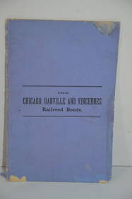
Chicago Danville and Vincennes RR Gold Bond Prospectus Book-1872JM Hobby Supply and Railroad Artifact Auctions4.4(126)See Sold PriceFeb 24, 2024
1875 Rand Avery and Co. Map of Express Companies and Railroads of the USA and CanadaJM Hobby Supply and Railroad Artifact Auctions4.4(126)See Sold PriceFeb 24, 2024
1892 Adams and Bowles New Road Map of the State of New YorkJM Hobby Supply and Railroad Artifact Auctions4.4(126)See Sold PriceFeb 24, 2024
American Express/New York Central Railroad Map of the United States-1934JM Hobby Supply and Railroad Artifact Auctions4.4(126)See Sold PriceFeb 24, 2024
Crams Colored Railway Map and Shippers Guide of South Dakota 1908-1909JM Hobby Supply and Railroad Artifact Auctions4.4(126)See Sold PriceFeb 24, 2024
Crams Railroad Map of New York-1881JM Hobby Supply and Railroad Artifact Auctions4.4(126)See Sold PriceFeb 24, 2024
Hammonds Map of Kentucky and Tennessee Railroads-1910JM Hobby Supply and Railroad Artifact Auctions4.4(126)See Sold PriceFeb 24, 2024
Rand McNally Railroad Map of Colorado-1929JM Hobby Supply and Railroad Artifact Auctions4.4(126)See Sold PriceFeb 24, 2024
Rand McNally Railroad Map of Washington-1906JM Hobby Supply and Railroad Artifact Auctions4.4(126)See Sold PriceFeb 24, 2024
Rand McNally Township County and Railroad Map of Illinois-1879JM Hobby Supply and Railroad Artifact Auctions4.4(126)See Sold PriceFeb 24, 2024
Rand McNally/Santa Fe Railroad Map of Iowa-1912JM Hobby Supply and Railroad Artifact Auctions4.4(126)See Sold PriceFeb 24, 2024
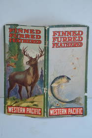
Western Pacific RR Finned Furred Feathered Brochure-1912JM Hobby Supply and Railroad Artifact Auctions4.4(126)See Sold PriceFeb 24, 2024
Union Pacific RR July 1899 Public TimetableJM Hobby Supply and Railroad Artifact Auctions4.4(126)See Sold PriceFeb 24, 2024
1888 Hand Book of the Pennsylvania Lines Containing Maps of Principal Cities - First EditionRail & Road Auctions4.6(165)See Sold PriceMar 07, 2024
Early 1990s Chicago Transit Authority Fiberglass Line MapRail & Road Auctions4.6(165)See Sold PriceMar 08, 2024
SOUTHERN AFRICA Monomotapa (Mutapa Kingdom) Cafrerie (Kaffraria) MALLET 1683 mapJasper524.5(9.8k)See Sold PriceFeb 28, 2024
Francis McNally - Antique Map of Nebraska, Kansas, Dakota, Colorado & MontanaProverde Auctions4.3(3)See Sold PriceFeb 28, 2024


![Railroad Commission Map of Montana, 1908 [166812] (1 of 1)](https://p1.liveauctioneers.com/2699/299063/159201768_1_x.jpg?height=282&quality=70&version=1692045182)