SoldBradshaw (George) - Map of Canals, Navigable Rivers,in the Midland Counties of England; Map of Canals, Situated in the Counties of Lancaster, York, Derby and Chester; Map of Canals, Navigable Rivers, Railways , in the Southern Counties of England, 2 laSee Sold Price
SoldBradshaw (G.) 3 maps of Canals, Railways etcBradshaw (George) Map of Canals, Navigable Rivers, Rail Roads &c., in the Midland Counties of England; Map of Canals, Situated in the Counties of Lancaster, York, Derby and Chester; Map of Canals, NSee Sold Price
SoldEngland.- Bradshaw (George) BradshawEngland.- Bradshaw (George) Bradshaw's Map of Canals, Navigable Rivers, Rail Road &c. in the Midland Counties of England from Actual Survey, said to be the second edition, enlarged to accommodate theSee Sold Price
Waterways & Railways.- Bradshaw (George) Lengths &Waterways & Railways.- [Bradshaw (George)] Lengths & Levels to Bradshaw's Maps of Canals, Navigable Rivers, and Railways, folding engraved frontispiece map, offsetting on to title, finger-marks, 1832See Sold Price
Map of the Canals, Navigable Rivers, Railways, &cAuthor: Bradshaw, George Description: Engraved map, hand-colored. On three sheets, approx. 94.5x186 cm. overall, backed with linen and sectioned for folding, housed in period solander case of calf tooSee Sold Price
SoldSalis Bradshaw's CanalsSalis (Henry Rodolphe de) Bradshaw's Canals and Navigable Rivers of Enland and Wales. A Handbook of Inland Navigation...tipped-in maps and 2 folding maps in pocket at end, original cloth, giltSee Sold Price
Bradshaw (George, publisher) Map of Canals in theBradshaw (George, publisher) Map of Canals in the Midland Counties of England; Map of Canals Situated in the Counties of Lancaster, York, Derby and Chester…, engraved maps, original hand colouring iSee Sold Price
Large map of English canals and railways 1830Title: Map of the Canals, Navigable Rivers, Railways, &c. in the Southern Counties of England. From Actual Survey Shewing the Heights of the Pools on the Lines of Navigation also the Planes on the RaiSee Sold Price
SoldLarge map of English canals and railways 1830Title: Map of the Canals, Navigable Rivers, Railways, &c. in the Southern Counties of England. From Actual Survey Shewing the Heights of the Pools on the Lines of Navigation also the Planes on the RaiSee Sold Price
SoldRailways.- - Lengths & Levels to Bradshaw's Maps ofFrom Actual Survey, Dedicated to Thomas Telford, first edition , folding engraved map frontispiece, 1832 bound with at front , Lengths and Levels to Bradshaw's Maps of the Canals, Navigable Rivers, anSee Sold Price
SoldDaw (M.E.) The British IslesDaw (M.E.) The British IslesCompiled from Government Ordnance... showing Railways, Mail & Turnpike Roads, with the Navigable Rivers & Canals, engraved map (transfer lithograph), with bright orSee Sold Price
SoldDaw (M.E.) The British IslesDaw (M.E. Surveyor) The British Isles, Compiled from Government Ordnance... showing Railways, Mail & Turnpike Roads, with the Navigable Rivers & Canals, engraved map (transfer lithograph), witSee Sold Price
SoldRoyal Commission on Canals and Waterways. Eight foldingRoyal Commission on Canals and Waterways. Eight folding maps of canals and waterways, maps comprise 'Map of the Canal Systems and Navigable Rivers of Scotland', 'Map of the Canals and Navigable RiversSee Sold Price
Great Britain showing all the railways…. DOWER. 4 sheets. 133x95cm c1863 mapTitle: "Great Britain showing all the railways…". DOWER. 4 sheets. 133x95cm c1863 map Description: Map of Great Britain showing all the railways & railway stations, the canals, navigable riversSee Sold Price
Irving (Theodore) The Conquest of Florida,Priestley (Joseph) Historical Account of the Navigable Rivers, Canals, and Railways, engraved frontispiece map and hand-coloured folding section at end, half-title, occasional water-staining,See Sold Price
SoldPRIESTLEY (JOSEPH) HISTORICAL ACCOUNT OF THEPRIESTLEY (Joseph) Historical Account of the Navigable Rivers, Canals and Railways throughout Great Britain, London: Longman, Rees et al 1831, 4to, frontispiece, half title, map and folding plate at eSee Sold Price
SoldBritish Isles.- Loader (T.B.) T.B. Loader's ScientificBritish Isles.- Loader (T.B.) T.B. Loader's Scientific and Commercial Map of England, and Wales; in which are Delineated the Canals, Rail-Roads & Navigable Rivers ... together with the Geology and PriSee Sold Price
SoldCary's New Map of England and WalesCary (John) Cary's New Map of England and Wales, With Part of Scotland,On which are carefully laid down-All the Direct and Principal Crofs Roads, the Course of the Rivers and Navigable Canals,See Sold Price
SoldBBRI Cary (John) Cary's New Map of England and WalBBRI Cary (John) Cary's New Map of England and Wales, With Part of Scotland,On which are carefully laid down-All the Direct and Principal Crofs Roads, the Course of the Rivers and Navigable CaSee Sold Price
SoldCary (John) New Map of England and Wales,Cary (John) New Map of England and Wales, With Part of Scotland,On which are carefully laid down All the Direct and Principal Cross Roads, the Course of the Rivers and Navigable Canals, CitiesSee Sold Price
SoldCary's New Map of England and WalesCary (John) Cary's New Map of England and Wales, With Part of Scotland,On which are carefully laid down All the Direct and Principal Crofs Roads, the Course of the Rivers and Navigable Canals,See Sold Price
SoldCary (John) New Map of England and WalesCary (John) New Map of England and Wales, with part of Scotland,On which are carefully laid down-All the Direct and Principal Crofs Roads, the Course of the Rivers and Navigable Canals, CitiesSee Sold Price
SoldCary (John) New Map of England and WalesCary (John) New Map of England and Wales, with part of Scotland,On which are carefully laid down-All the Direct and Principal Crofs Roads, the Course of the Rivers and Navigable Canals, CitiesSee Sold Price
SoldCary (John) New and Correct English AtlasCary (John) Cary's New Map of England and Wales, With Part of Scotland,On which are carefully laid down-All the Direct and Principal Crofs Roads, the Course of the Rivers and Navigable Canals,See Sold Price
David George Van Vliet (US,20C) oil paintingBroward Auction Gallery4.7(292)See Sold PriceMar 17, 2024
MAP OF SALZBURG BY GEORGE BRAUN & FRANS HOGENBURG. 1588Thomaston Place Auction Galleries4.4(393)See Sold PriceFeb 24, 2024
Alton S. Tobey, Building the Panama CanalLotus International Auctions, LLC4.6(153)See Sold PriceMar 03, 2024
Three Delaware & Hudson Canal Company Railroad Annual Passes - 1884, 1885, and 1886Rail & Road Auctions4.6(165)See Sold PriceMar 08, 2024
A "Red Book" of the Greatest War of History 1914North American Artifact Auctions4.7(198)See Sold PriceApr 20, 2024
Group of 15 Printed or Lithographed Items, including: litho...Potter & Potter Auctions4.6(545)See Sold PriceMar 07, 2024
A MAP OF THE STRAND OF THE NORTH SIDE OF CHANNEL OF RIVER ANNA LIFFE, 1811 Engraving, 680 x 480mmAdam's Auctioneers4.3(5)See Sold PriceFeb 27, 2024
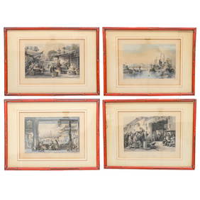
Hand-Colored Engravings of Thomas Allom Drawings, Group of FourNorthgate Gallery, Inc.4.5(36)See Sold PriceMar 02, 2024
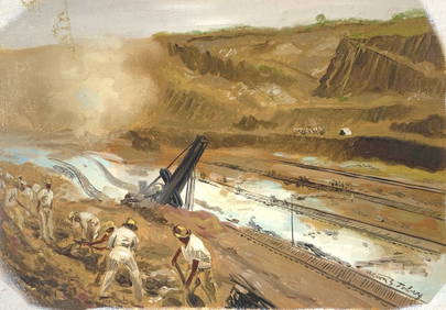
Schomburgk - The Comuti or Taquiare (Taquiari) Rock on the River EssequiboTrillium Antique Prints & Rare Books4.5(32)See Sold PriceFeb 24, 2024
WEST AFRICA Explorers' routes Senegal Ashanti. Mountains of Kong. SDUK 1857 mapJasper524.5(9.9k)See Sold PriceFeb 28, 2024
Cooke, George 1801 Antique Map. United States of AmericaAlbion Auctions4.7(341)See Sold PriceMar 01, 2024
Goode, George Brown 1884 Lot of 4 Natural History & Meteorology MapsAlbion Auctions4.7(341)See Sold PriceMar 01, 2024
John Senex Map of Louisiana & Mississippi RiverWillow Auction House4.5(289)See Sold PriceMar 14, 2024
Hudson River Map & North American Postcards, 45Auctions at Showplace4.6(740)See Sold PriceFeb 13, 2025


![[Rackham] The King of the Golden River, signed (1 of 8)](https://p1.liveauctioneers.com/188/319561/171942023_1_x.jpg?height=282&quality=70&version=1708206299)


