Marc Chagall-Limited Edition -Paris Opera Ceiling after ChagallArt Legacy Auctions4.5(223)See Sold PriceFeb 24, 2024
Salvador Dali Pantagruel Limited Edition Lithograph Hand signed and numberedArt Legacy Auctions4.5(223)See Sold PriceFeb 24, 2024
Pablo Picasso Bouquet of Peace Collection Domaine Picasso Limited Edition on paper.Art Legacy Auctions4.5(223)See Sold PriceFeb 24, 2024
A RARE MAXFIELD PARRISH JACK AND THE BEANSTALK PRINTSoulis Auctions4.8(953)See Sold PriceFeb 24, 2024
LARGE MECHANICAL PRINT 'STARS' AFTER MAXFIELD PARRISHSoulis Auctions4.8(953)See Sold PriceFeb 24, 2024
Heinrich Aldegrever, etc. 15 old master prints. 16th-17th centuries. Aldegrever works include "ManTremont Auctions4.5(297)See Sold PriceFeb 25, 2024
SoldBlackie & Weller 1882 Mixed Lot of 5 MapsIncl Japan, France, Central Europe, Spain and Portugal, Brazil. Lithograph Maps Published 1882 by Blackie & Son, London for "The Comprehensive Atlas & Geography of the World" by W. G. Blackie. Maps bySee Sold Price
SoldBlackie & Weller 1882 Lot of 5 Maps of AfricaIncl "Africa" Continent "Marocco Algeria and Tunis" Egypt/Nubia/Abyssinia "Western Africa" and "South Africa" Lithograph Maps Published 1882 by Blackie & Son, London for "The Comprehensive Atlas & GeoSee Sold Price
Blackie & Weller 1882 Lot of 5 Maps of South AmericaIncl South America, Venezuela/Colombia, Brazil, Peru/Bolivia, and Argentina/Chile. Lithograph Maps Published 1882 by Blackie & Son, London for "The Comprehensive Atlas & Geography of the World" by W.See Sold Price
Blackie & Weller 1882 Lot of 5 Maps of South AmericaIncl South America, Venezuela/Colombia, Brazil, Peru/Bolivia, and Argentina/Chile. Lithograph Maps Published 1882 by Blackie & Son, London for "The Comprehensive Atlas & Geography of the World" by W.See Sold Price
SoldBlackie & Weller 1882 Lot 7 Maps of South America etcIncl South America, Venezuela/Colombia, Brazil, Peru/Bolivia, and Argentina/Chile. Also North Atlantic and Pacific Ocean. Lithograph Maps Published 1882 by Blackie & Son, London for "The ComprehensiveSee Sold Price
SoldBlackie & Weller 1882 Lot of 4 Maps. UK & IrelandIncl Ireland South Part, Scotland South Part, British Islands and The North Sea, and England & Wales. Lithograph Maps Published 1882 by Blackie & Son, London for "The Comprehensive Atlas & Geography oSee Sold Price
SoldBlackie & Weller 1882 Lot of 6 Maps of EuropeIncl Europe Continent, France, Central Europe, German Empire West Sheet, German Empire East Sheet, and The Austrian Empire. Lithograph Maps Published 1882 by Blackie & Son, London for "The ComprehensiSee Sold Price
SoldBlackie & Weller 1882 Lot of 3 Maps of the USAAtlantic States, Valley of Mississippi, and United States of North America. Lithograph Maps Published 1882 by Blackie & Son, London for "The Comprehensive Atlas & Geography of the World" by W. G. BlacSee Sold Price
SoldBlackie & Weller 1882 Lot of 3 Maps of CanadaIncl British North America, Province of Ontario, Provinces of Quebec etc. Lithograph Maps Published 1882 by Blackie & Son, London for "The Comprehensive Atlas & Geography of the World" by W. G. BlackiSee Sold Price
Blackie & Weller 1882 Lot of 6 Maps of EuropeIncl Europe Continent, France, Central Europe, German Empire West Sheet, German Empire East Sheet, and The Austrian Empire. Lithograph Maps Published 1882 by Blackie & Son, London for "The ComprehensiSee Sold Price
Blackie & Weller 1882 Lot of 4 Maps. UK & IrelandIncl Ireland South Part, Scotland South Part, British Islands and The North Sea, and England & Wales. Lithograph Maps Published 1882 by Blackie & Son, London for "The Comprehensive Atlas & Geography oSee Sold Price
Blackie & Weller 1882 Lot of 4 Maps. UK & IrelandIncl Ireland South Part, Scotland South Part, British Islands and The North Sea, and England & Wales. Lithograph Maps Published 1882 by Blackie & Son, London for "The Comprehensive Atlas & Geography oSee Sold Price
Blackie & Weller 1882 Lot of 8 European MapsIncl Russia South, Russia in Europe, Italy North, Italy South, Switzerland, Belgium/Netherlands, Denmark, and Mediterranean. Lithograph Maps Published 1882 by Blackie & Son, London for "The ComprehensSee Sold Price
SoldMaps 1819-1911 Mixed Lot of 12 MapsIncl Rome, Yellowstone Park, Europe, Denmark, Switzerland, France, South Africa, West Africa, Austro-Hungary and Italy. Examples by Chambers, Encyclopaedia Britannica, Blackie/Weller, Sidney Hall andSee Sold Price
SoldMaps 1842-1920. Mixed Lot of 10Incl British Isles, Canada, Australia, Turkey/Greece, Persia, Syria, Asia Continent, Turkey in Asia, and Russia in Asia. Examples by Blackie/Weller, Starling, Stanford, and Gross. Paper Size: Up to 27See Sold Price
SoldBlackie & Weller 1882 Map of The World HemispheresLithograph Map Published 1882 by Blackie & Son, London for "The Comprehensive Atlas & Geography of the World" by W. G. Blackie. Maps by Edward Weller. Centre fold as issued. Paper Size: 21.5 x 15 inchSee Sold Price
SoldBlackie & Weller 1882 Map of MexicoLithograph Map Published 1882 by Blackie & Son, London for "The Comprehensive Atlas & Geography of the World" by W. G. Blackie. Maps by Edward Weller. Centre fold as issued. Paper Size: 21.5 x 15 inchSee Sold Price
SoldMaps 19th Cent. Mixed Lot of 6Lot of 6 Steel Engraved Maps. Incl Persia, Holy Land, Battle of Alma, Scotland, and England/Wales. Examples by Chambers, SDUK, William Collins, Weller and Rapkin. Paper Size: Up to 16 x 13.5 inch (40See Sold Price
SoldBlackie & Weller 1882 Map of the North Pole"North Circumpolar Regions" Lithograph Map Published 1882 by Blackie & Son, London for "The Comprehensive Atlas & Geography of the World" by W. G. Blackie. Maps by Edward Weller. Paper Size: 15 x 11 iSee Sold Price
SoldBlackie & Weller 1882 Map of the East Indies, Indonesia"The Indian Archipelago" Lithograph Map Published 1882 by Blackie & Son, London for "The Comprehensive Atlas & Geography of the World" by W. G. Blackie. Maps by Edward Weller. Centre fold as issued. PSee Sold Price
SoldThe Times 1895 Mixed Lot of 5 MapsIncl Isothermal and Wind Chart, West Africa, Caucasus, Religions of the World, and Atlantic Ocean. Lithograph Maps Published 1895, London for "The Times Atlas" Paper Size: 16 x 10.5 inch (41 x 27cm) aSee Sold Price
SoldBlackie & Weller 1882 Pair Maps of USA & North America"The United States of North America, Pacific States" and "North America" Lithograph Maps Published 1882 by Blackie & Son, London for "The Comprehensive Atlas & Geography of the World" by W. G. BlackieSee Sold Price
The Times 1895 Mixed Lot of 5 MapsIncl Isothermal and Wind Chart, West Africa, Caucasus, Religions of the World, and Atlantic Ocean. Lithograph Maps Published 1895, London for "The Times Atlas" Paper Size: 16 x 10.5 inch (41 x 27cm) aSee Sold Price
SoldBlackie & Weller 1882 Pair of Maps of IndiaIndia and India South Part. Lithograph Maps Published 1882 by Blackie & Son, London for "The Comprehensive Atlas & Geography of the World" by W. G. Blackie. Maps by Edward Weller. Centre fold as issueSee Sold Price
NILE VALLEY. Upper & Lower. Egypt Sinai Nubia Sudan Abyssinia. BLACKIE 1882 mapJasper524.5(9.9k)See Sold PriceFeb 28, 2024
MAGHREB. North Africa. Marocco Algeria and Tunis. BLACKIE 1882 old antique mapJasper524.5(9.9k)See Sold PriceFeb 28, 2024
Blackie (Pub) 1882 Folio Map. West USA - Pacific StatesAlbion Auctions4.6(341)See Sold PriceMar 01, 2024
Blackie (Pub) 1882 Folio Map. Chinese Empire and JapanAlbion Auctions4.6(341)See Sold PriceMar 01, 2024
Blackie (Pub) 1882 Folio Map. East Indies - Indian ArchipelagoAlbion Auctions4.6(341)See Sold PriceMar 01, 2024
Blackie (Pub) 1882 Folio Map. United States of North AmericaAlbion Auctions4.6(341)See Sold PriceMar 01, 2024
Blackie (Pub) 1882 Folio Map. West India Islands & Central AmericaAlbion Auctions4.6(341)See Sold PriceMar 01, 2024
Blackie (Pub) 1882 Folio Map. World on Mercators ProjectionAlbion Auctions4.6(341)See Sold PriceMar 01, 2024
Blackie (Pub) 1882 Pair of Folio Maps. Italy - North & SouthAlbion Auctions4.6(341)See Sold PriceMar 01, 2024
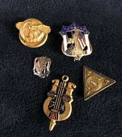
Vintage Liberty Sons And Daughters Mixed Lot Of 5Rapid Estate Liquidators and Auction Gallery4.5(1.1k)See Sold PriceFeb 27, 2024