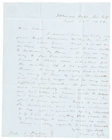
1952 ROBERT F. KENNEDY HANDWRITTEN LETTERJohn McInnis Auctioneers,LLC4.6(502)See Sold PriceFeb 25, 2024
CASED PRESENTATION HALF HULL MODEL OF THE BARQUE "HAWTHORNBANK" Last Quarter of the 19th CenturyEldred's4.7(409)See Sold PriceFeb 27, 2024
Lot Of 14 Jack Daniels And Country Club Glass Spirit BottlesRbfinearts4.4(571)See Sold PriceFeb 24, 2024
PR OF 17TH C. SPANISH BRASS CANDLESTICKSThomaston Place Auction Galleries4.4(386)See Sold PriceFeb 24, 2024
Lake Shore and Michigan Southern RR Special Excursions Timetable-July 7-13, 1892JM Hobby Supply and Railroad Artifact Auctions4.4(126)See Sold PriceFeb 24, 2024
Tiffany & Co. Sterling Silver Corkscrew Bottle OpenerSJ Auctioneers4.5(165)See Sold PriceMar 03, 2024
Rolls Royce Landau c1950s Gin/ Scotch TantalusPasadena Antique Auctions4.3(6)See Sold PriceMar 10, 2024
SoldBetts, John (published by). Betts’s Map of the GoldBetts, John (published by). Betts’s Map of the Gold Regions of Australia. Lithographed map, 340 x 450 mm, handcoloured in outline, the gold regions highlighted in yellow, with inset map of theSee Sold Price
SoldCards. Betts (John) - The Interrogatory Game of Britishthe set of 144 question cards, instruction booklet with specially published folding map of the British Isles bound in, lacking counters, engraved map with original hand-colouring, 310 x 240mm., a fewSee Sold Price
Sold1853 Topographical Map of CaliforniaJohn B. Trask published by Britton and Rey, San Francisco 17 1/2" x 23 1/2" a rare California Gold Rush pocket map with annotations by original owner detailing his SHIPPING DETAILS: Shipping availableSee Sold Price
SoldNorth America map w/ Cal. Gold Regions 1850Heading: Author: Smith, John Calvin Title: Map of North America, by J. Calvin Smith Place Published: New York Publisher:J. Disturnell Date Published: 1850 Description: Folding lSee Sold Price
Sold1871 Incidents of Travel in Central AmericaIncidents of Travel in Central America, Chiapas, and Yucatan by John L. Stephens. Published by New York: Harpers & Brothers (1871). Publishers original embossed black cloth hardback with gold gilt. CoSee Sold Price
Australia - Historical and Statistical Account OfAustralia - Historical and Statistical Account Of New South Wales: including a visit to the Gold Regions, and a description of the Mines Books - by John Dunmore Lang. Published by Longman, London, 185See Sold Price
SoldGold & Silver Mining with map of Grass ValleyHeading: Author: Phillips, John Arthur Title: The Mining and Metallurgy of Gold and Silver Place Published: London Publisher:E. & F.N. Spon Date Published: 1867 Description:See Sold Price
Sold(2) EARLY FRAMED ENGLISH MAPS: HEREFORDSHIRE BY MORDENIn matching gold stick frames, matted and glazed, including: "Herford Shire" (County Herefordshire) by Robert Morden, copperplate engraving with hand coloring, published by Abel Swale and John ChurchiSee Sold Price
(2) EARLY FRAMED ENGLISH MAPS: HEREFORDSHIRE BY MORDENIn matching gold stick frames, matted and glazed, including: "Herford Shire" (County Herefordshire) by Robert Morden, copperplate engraving with hand coloring, published by Abel Swale and John ChurchiSee Sold Price
SoldPhelps's Travellers' Guide with New US Map 1850Gold embossed leather cover. Published by Ensign & Thayer. 70 pp. Condition: Good, toning, folds, separations to folds, tears to map. (see photographs)See Sold Price
Sold1850 North Carolina Map Thomas CowperthwaitPublished in 1850 by Thomas Cowperthwait & Co., this map has old fold creases, is in good condition, framed, 14" wide by 11 1/2" tall plus the borders, Gold Region insert. Condition: acid markings, foSee Sold Price
England & Wales.- Betts (John) Betts's new Map ofEngland & Wales.- Betts (John) Betts's new Map of England & Wales compiled from the latest parliamentary documents, engraving with outline hand-colouring, 800 x 685 mm (31 1/2 x 27 in), dissected andSee Sold Price
SoldCalifornia Gold Rush Map Published in 1849.California Gold Rush Map Published in 1849. "Lawson's Map from Actual Survey of theSee Sold Price
SoldDutchess County NY wall map published by John E.Dutchess County NY wall map published by John E. Gillette, Philadelphia 1858 - some fraying of paper near top, otherwise good condition.See Sold Price
SoldMaps: Two maps of Devon, comprising an 18thC handMaps: Two maps of Devon, comprising an 18thC hand coloured road strip map, published in John Owen & Emanuel Bowen's Britannia Depicta or Ogilby Improv'd; and a road strip map depicting the continuatioSee Sold Price
SoldTwo Astronomical Gamesincludes "Astronomical Recreation" published by John Betts:London - a colorfully lithographed folding paper on cloth board with original sleeve along with a boxed card game "Game of the Universe" withSee Sold Price
Sold1805 John Stockdale/John Cary Map of IrelandDESCRIPTION: A Map of Ireland divided into Provinces and Counties from the best Authorities. Hand colored copper engraved map. Published by John Stockdale March 6, 1805. Engraved by John Cary (1754-18See Sold Price
Part of Kent, early 18th century hand coloured map,Part of Kent, early 18th century hand coloured map, published by John Pine, 1739, framed and glazed, 63cm excluding the frameSee Sold Price
SoldMaps: Two 18thC maps of Bedfordshire, comprising a handMaps: Two 18thC maps of Bedfordshire, comprising a hand coloured road strip map, published in John Owen & Emanuel Bowen's Britannia Depicta or Ogilby Improv'd; and a hand coloured map depicting the coSee Sold Price
SoldMaps: Two 18thC maps of Bedfordshire, comprising a handMaps: Two 18thC maps of Bedfordshire, comprising a hand coloured road strip map, published in John Owen & Emanuel Bowen's Britannia Depicta or Ogilby Improv'd; and a hand coloured map depicting the coSee Sold Price
SoldMaps: Two 18thC maps of Bedfordshire, comprising a handMaps: Two 18thC maps of Bedfordshire, comprising a hand coloured road strip map, published in John Owen & Emanuel Bowen's Britannia Depicta or Ogilby Improv'd; and a hand coloured map depicting the coSee Sold Price
4 J. Tallis MapsJohn Tallis & Co., English, 1817-1876. A collection of Four engraved maps published by John Tallis & Company including the United States, British America, West Canada, and East Canada and New BrunswicSee Sold Price
Sold1819 Map of Boston Published "John Giltales"1819 Map of Boston Published "John Giltales" Philadelphia, This 26 1/8" x 32" sight map is framed under glass, blue watercolor outlining of counties, some staining in upper 1/3 of the map, not taken oSee Sold Price
SoldEncyclopaedia Perthensis 1816 Pair of Celestial MapsCopper Engraved Map Published 1816 by John Brown, Edinburgh for "Encyclopaedia Perthensis; Or Universal Dictionary of the Arts, Sciences, Literature, &c" by John Brown. Paper Size: 9.5 x 6 inch (24 xSee Sold Price
17TH C. MAP OF THE BERKSHIRES BY JOHN SPEED, FRAMEDThomaston Place Auction Galleries4.4(386)See Sold PriceFeb 24, 2024
Gould - Sparkling-tail Hummingbird with Nest & EggsTrillium Antique Prints & Rare Books4.5(30)See Sold PriceFeb 24, 2024
Gould - Red-billed Azure-crown HummingbirdTrillium Antique Prints & Rare Books4.5(30)See Sold PriceFeb 24, 2024
Gould - Rufous Flame-bearer HummingbirdTrillium Antique Prints & Rare Books4.5(30)See Sold PriceFeb 24, 2024
Gould - Little Hummingbird with Nest & EggsTrillium Antique Prints & Rare Books4.5(30)See Sold PriceFeb 24, 2024
1850 California gold rush letter from Fred Snyder to brotherPBA Galleries4.7(381)See Sold PriceMar 07, 2024
NORTHERN AFRICA. Morocco Tunisia Algeria. Caravan routes. RAPKIN/TALLIS 1851 mapJasper524.5(9.8k)See Sold PriceFeb 28, 2024
WEST AFRICA. British Cameroons & Togoland mandates. Gold Coast Nigeria 1947 mapJasper524.5(9.8k)See Sold PriceFeb 28, 2024
WEST AFRICA. French. Gold Coast Ghana. inset Gambia; Sierra Leone 1920 mapJasper524.5(9.8k)See Sold PriceFeb 28, 2024
Colonial & French West Africa. Gold Coast Dahomey Upper Volta. TIMES 1922 mapJasper524.5(9.8k)See Sold PriceFeb 28, 2024
North & West Africa. Dahomey. Gold Coast. Military Territory. THE TIMES 1922 mapJasper524.5(9.8k)See Sold PriceFeb 28, 2024
FRENCH WEST AFRICA Nigeria Gold Coast Rio de Oro Portuguese Guinea 1912 mapJasper524.5(9.8k)See Sold PriceFeb 28, 2024
NORTHERN AFRICA. Morocco Tunisia Algeria. Caravan routes.TALLIS/RAPKIN 1851 mapJasper524.5(9.8k)See Sold PriceFeb 28, 2024
NORTHERN AFRICA. Morocco Tunisia Algeria. Caravan routes. RAPKIN/TALLIS 1851 mapJasper524.5(9.8k)See Sold PriceFeb 28, 2024
Churchill & Nieuhof 1744 Folio Map. Cape of Good Hope, South AfricaAlbion Auctions4.6(336)See Sold PriceMar 01, 2024
Churchill & Nieuhof 1744 Folio Map. Batavia Indonesia East IndiesAlbion Auctions4.6(336)See Sold PriceMar 01, 2024