1952 ROBERT F. KENNEDY HANDWRITTEN LETTERJohn McInnis Auctioneers,LLC4.6(502)See Sold PriceFeb 25, 2024
CASED PRESENTATION HALF HULL MODEL OF THE BARQUE "HAWTHORNBANK" Last Quarter of the 19th CenturyEldred's4.7(409)See Sold PriceFeb 27, 2024
Lot Of 14 Jack Daniels And Country Club Glass Spirit BottlesRbfinearts4.4(571)See Sold PriceFeb 24, 2024
PR OF 17TH C. SPANISH BRASS CANDLESTICKSThomaston Place Auction Galleries4.4(386)See Sold PriceFeb 24, 2024
Lake Shore and Michigan Southern RR Special Excursions Timetable-July 7-13, 1892JM Hobby Supply and Railroad Artifact Auctions4.4(126)See Sold PriceFeb 24, 2024
Tiffany & Co. Sterling Silver Corkscrew Bottle OpenerSJ Auctioneers4.5(165)See Sold PriceMar 03, 2024
Rolls Royce Landau c1950s Gin/ Scotch TantalusPasadena Antique Auctions4.3(6)See Sold PriceMar 10, 2024
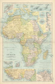
SoldBacon (G.W.) - New Large-Scale Map of South Africa,with 5 insets of Durban & Port Natal, Port Elizabeth, Plan of Salisbury, Environs of Cape Town, and general map of Africa with most of Europe of Asia, colour-printed map, 475 x 650mm., a split on oneSee Sold Price
SoldLondon.- Bacon (George W.) Bacon's New Large-ScaleLondon.- Bacon (George W.) Bacon's New Large-Scale Atlas of London and Suburbs..., complete with title, contents, three sets of index, key map of London, 25 double-page maps, six geological maps of LoSee Sold Price
SoldBACON (G W & Co) Bacon's New Large Scale Ordance SurveyBACON (G W & Co) Bacon's New Large Scale Ordance Survey Atlas of London and Suburbs, 1880, large folio, double page index plan of London, and 25 coloured double page sheets including railways, all inSee Sold Price
SoldLondon.- Bacon (George W.) Bacon's New Large ScaleLondon.- Bacon (George W., publisher) Bacon's New Large Scale Atlas of London and Suburbs with Supplementary Maps, Letterpress Descriptions and Alphabetical Index, complete with title, contents, threeSee Sold Price
SoldLondon.- Bacon (George W., publisher) Bacon's New LargeLondon.- Bacon (George W., publisher) Bacon's New Large Scale Atlas of London and Suburbs with Supplementary Maps, Letterpress Descriptions and Alphabetical Index, complete with title, contents, threeSee Sold Price
Sold19th Century GW Bacon New Map of London LargeGW Bacon, "New Map of London," 19th century. This large engraved map of London is from Cassel's "Old and New London." Dimensions: Sight; height: 28 1/2 in x width: 39 1/2 in. Framed; height: 30 1/2 inSee Sold Price
SoldBacon (G.W., publisher) New Map of London, DividedBacon (G.W., publisher) New Map of London, Divided into Half Mile Squares & Circles,large map showing from Westbourne Park and Notting Hill to Bow and the Millwall Docks, lithograph, with someSee Sold Price
SoldLondon.- Bacon (George W.) New Large-Scale Ordnance***Please note, the description of this lot has changedLondon.- Bacon (George W.) New Large-Scale Ordnance Atlas of London & Suburbs with Supplementary Maps..., title, contents, two index maps, one foSee Sold Price
SoldBritish Isles.- Bacon (George W.) New Large Scale*** Please note, the description of this lot has changed ***British Isles.- Bacon (George W., publisher) New Large Scale Ordnance Atlas of the British Isles..., 104 hand-coloured double-page lithograpSee Sold Price
SoldBritain.- Bacon (George W.) New Large-Scale Atlas of the British Isles, 1893.Britain.- Bacon (G. W.) New Large-Scale Atlas of the British Isles, 4 charts and 99 maps or plans with contemporary hand-colouring, some light spotting to first few pp., contemporary half calf, gilt,See Sold Price
SoldBritain.- Bacon (George W.) New Large Scale OrdnanceBritain.- Bacon (George W.) New Large Scale Ordnance Atlas of the British Isles with Plans of Towns, title, Letterpress Descriptions, Alphabetical Indexes and census Tables of 1881, 104 colour lithogrSee Sold Price
SoldBacon (G.) Ordnance Atlas of the British IslesBacon (George W.) New Large Scale Ordnance Atlas of the British Isles,including Ireland, title and 102 map sheets, complete, including county and regional maps, numeorous town and city plans,See Sold Price
Bacon's New Shilling Map of LondonBacon (G.W., publisher) Bacon's New Shilling Map of London and Illustrated Guide. (North),large folding map, partly hand-coloured, 2 double-page plain maps, illustrations, advertisements, largSee Sold Price
Antique “Bacon’s Birds-eye View of South Africa” MAntique “Bacon’s Birds-eye View of South Africa”, circa 1900. An interesting birds-eye view map of South Africa, originally a large lithographed folding map. Place names and relief show in a wonSee Sold Price
SoldBACON (G W)New Large-Scale Atlas of the British Isles, with Plans of Towns. London 1892, 4to, with coloured maps, city and town plans, lower board detachedSee Sold Price
Bacons Motor Road Map: England & Wales. South c.1920sBacons Motor Road Map. England & Wales. South Sheet. Scale Eight Miles to One Inch Publisher. G.W. Bacon & Co, Ltd. Showing Roads, Railways, & Distances. Folding, gauze mounted color road map in greySee Sold Price
Bacons Motor Road Map: England & Wales. South c.1920sBacons Motor Road Map. England & Wales. South Sheet. Scale Eight Miles to One Inch Publisher. G.W. Bacon & Co, Ltd. Showing Roads, Railways, & Distances. Folding, gauze mounted color road map in greySee Sold Price
Bacons Motor Road Map: England & Wales. South c.1920sBacons Motor Road Map. England & Wales. South Sheet. Scale Eight Miles to One Inch Publisher. G.W. Bacon & Co, Ltd. Showing Roads, Railways, & Distances. Folding, gauze mounted color road map in greySee Sold Price
Bacons Motor Road Map: England & Wales. South c.1920sBacons Motor Road Map. England & Wales. South Sheet. Scale Eight Miles to One Inch Publisher. G.W. Bacon & Co, Ltd. Showing Roads, Railways, & Distances. Folding, gauze mounted color road map in greySee Sold Price
Bacons Motor Road Map: England & Wales. South c.1920sBacons Motor Road Map. England & Wales. South Sheet. Scale Eight Miles to One Inch Publisher. G.W. Bacon & Co, Ltd. Showing Roads, Railways, & Distances. Folding, gauze mounted color road map in greySee Sold Price
Bacons Motor Road Map: England & Wales. South c.1920sBacons Motor Road Map. England & Wales. South Sheet. Scale Eight Miles to One Inch Publisher. G.W. Bacon & Co, Ltd. Showing Roads, Railways, & Distances. Folding, gauze mounted color road map in greySee Sold Price
Americas.- Sayer (Robert) and John Bennett. A New MapAmericas.- Sayer (Robert) and John Bennett. A New Map of the Whole Continent of America, Divided into North and South and West Indies, large-scale 4 sheet map, with extensive details and rococo-styleSee Sold Price
SoldDe l'Isle (Guillaume) - L'Asie divisée en sesthe continent of Asia, from the Black Sea to Japan, with the Horn of Africa and the northern tip of New Holland, large decorative title and scale cartouches to upper corners, engraved map with originaSee Sold Price
SoldLarge framed 19th Century hand coloured canvas backedLarge framed 19th Century hand coloured canvas backed Bacons new map of London, printed by G.W. Bacon and Co. Ltd, 26.5ins x 33.5insSee Sold Price
Southern Africa Cape of Good Hope-Madagascar ADMIRALTY sea chart 1935 (1955) mapJasper524.5(9.8k)See Sold PriceFeb 28, 2024
SOUTH CENTRAL AFRICA. Shows Zambesi river as circular! WELLER 1863 old mapJasper524.5(9.8k)See Sold PriceFeb 28, 2024
Northern & Southern Africa. Maghreb. Orange River Sovereignty. HALL 1854 mapJasper524.5(9.8k)See Sold PriceFeb 28, 2024
SOUTHERN AFRICA. Congo British/Portuguese/German East Africa Rhodesia 1912 mapJasper524.5(9.8k)See Sold PriceFeb 28, 2024
WEST AFRICA. French. Gold Coast Ghana. inset Gambia; Sierra Leone 1920 mapJasper524.5(9.8k)See Sold PriceFeb 28, 2024
Africa. Congo Free Trade Area. British South Africa Company. STANFORD 1896 mapJasper524.5(9.8k)See Sold PriceFeb 28, 2024
Colonial Southern Africa. British Portuguese German. Madagascar. TIMES 1895 mapJasper524.5(9.8k)See Sold PriceFeb 28, 2024
Afrique. Pays des Hottentots #50. Namibia South Africa VANDERMAELEN 1827 mapJasper524.5(9.8k)See Sold PriceFeb 28, 2024
Northern & Southern Africa. Maghreb. Orange River Sovereignty. HALL 1856 mapJasper524.5(9.8k)See Sold PriceFeb 28, 2024
South Namibia coast. Walvis Bay-Orange River ADMIRALTY sea chart 1881 (1954) mapJasper524.5(9.8k)See Sold PriceFeb 28, 2024
East coast of Africa from the Cape… South Africa Mozambique. CHILD 1745 mapJasper524.5(9.8k)See Sold PriceFeb 28, 2024
AFRICA NW & SOUTH. Maghreb. Cape Colony electoral divisions. JOHNSTON 1906 mapJasper524.5(9.8k)See Sold PriceFeb 28, 2024
Africa. Congo Free Trade Area. British South Africa Company. STANFORD 1894 mapJasper524.5(9.8k)See Sold PriceFeb 28, 2024
Afrique. Pays des Hottentots #51. Botswana South Africa. VANDERMAELEN 1827 mapJasper524.5(9.8k)See Sold PriceFeb 28, 2024
SOUTHERN AFRICA & MALAY ARCHIPELAGO. Cape Colony Indonesia &c. BUTLER 1888 mapJasper524.5(9.8k)See Sold PriceFeb 28, 2024
AFRICA French Congo State Soudan Nile Delta Suez canal by GW BACON 1898 mapJasper524.5(9.8k)See Sold PriceFeb 28, 2024
NAMIBIA. South West Africa protectorate. HARMSWORTH 1920 old antique map chartJasper524.5(9.8k)See Sold PriceFeb 28, 2024
MEDITERRANEAN.Tunisia & Libyan coast.Sicily.Gulf of Sirte.BARTHOLOMEW 1952 mapJasper524.5(9.8k)See Sold PriceFeb 28, 2024
Colonial Southern Africa. British Portuguese German. Madagascar. TIMES 1900 mapJasper524.5(9.8k)See Sold PriceFeb 28, 2024
Coste Occidentale d’Afrique…' Namibia South Africa Angola coast BELLIN 1746 mapJasper524.5(9.8k)See Sold PriceFeb 28, 2024