SoldBacon (G.) Ordnance Atlas of the British IslesBacon (George W.) New Large Scale Ordnance Atlas of the British Isles,including Ireland, title and 102 map sheets, complete, including county and regional maps, numeorous town and city plans,See Sold Price
SoldBritain.- Bacon (George W.) New Large-Scale Atlas of the British Isles, 1893.Britain.- Bacon (G. W.) New Large-Scale Atlas of the British Isles, 4 charts and 99 maps or plans with contemporary hand-colouring, some light spotting to first few pp., contemporary half calf, gilt,See Sold Price
SoldBritain.- Bacon (George W.) New Large Scale OrdnanceBritain.- Bacon (George W.) New Large Scale Ordnance Atlas of the British Isles with Plans of Towns, title, Letterpress Descriptions, Alphabetical Indexes and census Tables of 1881, 104 colour lithogrSee Sold Price
SoldBritish Isles.- Bacon (George W.) New Large Scale*** Please note, the description of this lot has changed ***British Isles.- Bacon (George W., publisher) New Large Scale Ordnance Atlas of the British Isles..., 104 hand-coloured double-page lithograpSee Sold Price
SoldBACON (G W)New Large-Scale Atlas of the British Isles, with Plans of Towns. London 1892, 4to, with coloured maps, city and town plans, lower board detachedSee Sold Price
SoldBook : A 1904 edition of ' Bacon's Popular Atlas of theBook : A 1904 edition of ' Bacon's Popular Atlas of the British Isles ' edited by G. W. Bacon and published by G. W. Bacon & Co Ltd , London . Please Note - we do not make reference to the condition oSee Sold Price
SoldBook : A 1904 edition of ' Bacon's Popular Atlas of theBook : A 1904 edition of ' Bacon's Popular Atlas of the British Isles ' edited by G. W. Bacon and published by G. W. Bacon & Co Ltd , London . £100 - 150See Sold Price
SoldA BACON'S POPULAR LEATHER BOUND ATLAS depicting theA BACON'S POPULAR LEATHER BOUND ATLAS depicting the British Isles.See Sold Price
Bacon's Motor Road Map of Scotland c.1930s Cloth BackedBacons Motor Road Map, Scotland Scale 8 Miles = 1 Inch, c.1930s Publisher. G.W. Bacon & Co, Ltd. Price on cover 4s.0d. Blue boards 8x5 inches. Folded colour map 39x29 inches. Cloth (Gauze) Backed. NOTSee Sold Price
Bacons Motor Road Map: England & Wales. South c.1920sBacons Motor Road Map. England & Wales. South Sheet. Scale Eight Miles to One Inch Publisher. G.W. Bacon & Co, Ltd. Showing Roads, Railways, & Distances. Folding, gauze mounted color road map in greySee Sold Price
SoldMap, James George BingleyJames George Bingley (British, 1840-1920), "The Isle of Man," copper-engraved map with hand-coloring, published by G. Virtue, 1833, this could be a later print, overall (with frame): 15"h x 17.25"wSee Sold Price
SoldAtlases, British Isles, Camden (William), Britannia: orAtlases, British Isles, Camden (William), Britannia: or a Chorographical Description of the Flourishing Kingdoms of England, Scotland, and Ireland and the Islands Adjacent; From the Earliest AntiquitySee Sold Price
SoldAtlases.- British Isles.- Laurie (Richard H.) Laurie'sAtlases.- British Isles.- Laurie (Richard H., publisher) Laurie's New Traveller's Companion and Guide through the Roads of England and Wales, including Great part of Scotland; with a General Map, andSee Sold Price
Atlases.- British Isles.- Camden (William) Camden'sAtlases.- British Isles.- Camden (William) Camden's Britannia Abridg'd with Improvements and Continuations to this present time, 2 vols., engraved portrait frontispiece and title page to each volume,See Sold Price
SoldOrdnance Survey.- the British IslesOrdnance Survey.- a bound collection of the British Isles,the complete set of 40 sheets for England and Wales, each in 2 editions (except the Isle of Man in the earlier edition only) for 1906-See Sold Price
British Isles.- Ordnance SurveyOrdnance Survey,c.139 ordnance survey maps, the majority c.550 x 820mm., and the reverse, and a few c.630 x 820mm., covering the North of England, Scotland, the Midlands, Wales, East Anglia,See Sold Price
SoldAtlas.- New Large Atlas Of The British IslesNew Large Scale Atlas Of The British Isles,100 lithographed double-page maps, hand-coloured, slight browning in margins, original blind-stamped cloth, gilt, rubbed folio, some splitting alongSee Sold Price
SoldPhilips Atlas of the British Isles circa 1890 includingPhilips Atlas of the British Isles circa 1890 including sixty County mapsSee Sold Price
SoldBritish Isles.- Ordnance Survey MapsOrdnance Survey Maps,collection of ordnance survey maps, several linen-backed with illustrated covers, the majority of England and Wales, with c.15 of Scotland, and 2 of Ireland, comprising mSee Sold Price
SoldPhilip, George C1895 Lot of 6 British County MapsIncl Derbyshire, Shropshire, Warwickshire, Northumberland, Hampshire, and Cumberland. Lithograph Maps Published C1895 by George Philip & Son, London for "Phillips' Atlas of the British Isles" Centre fSee Sold Price
SoldPhilip, George C1895 Lot of 7 British County MapsIncl Scotland, Scotland Railways, South Wales, North Wales and British Isles. Lithograph Maps Published C1895 by George Philip & Son, London for "Phillips' Atlas of the British Isles" Centre fold as iSee Sold Price
SoldPhilip, George C1895 Lot of 6 British County MapsIncl Surrey, Yorkshire South East, Yorkshire North East, Wiltshire, Norfolk, Bedfordshire. Lithograph Maps Published C1895 by George Philip & Son, London for "Phillips' Atlas of the British Isles" CenSee Sold Price
SoldPhilip, George C1895 Maps of Devon, Cornwall Dorset (3)Lithograph Maps Published C1895 by George Philip & Son, London for "Phillips' Atlas of the British Isles" Centre fold as issued. Paper Size: 14.5 x 10 inch (37 x 25cm) Closed centre fold split on CornSee Sold Price
SoldPhilip, George C1895 Lot of 6 British County MapsIncl Worcestershire, Yorkshire North West, Somersetshire, Cheshire, Sussex, and Westmorland. Lithograph Maps Published C1895 by George Philip & Son, London for "Phillips' Atlas of the British Isles" CSee Sold Price
LATE 17TH C. FRENCH MAP OF THE NEW WORLD BY ALEXIS-HUBERT JAILLOT (1632-1712)Thomaston Place Auction Galleries4.4(393)See Sold PriceFeb 24, 2024
ATTR TO LIBERTY COMPANY ARTS CRAFTS COPPER MIRRORAntique Arena Inc.4.5(878)See Sold PriceFeb 24, 2024
ARTS AND CRAFTS HAMMERED LAMP BY FREDRICK FIFIELDAntique Arena Inc.4.5(878)See Sold PriceFeb 24, 2024
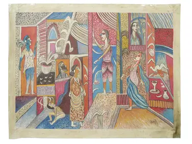
Francis Bacon Mixed Media on Heavy paperArt Antique Auction Gallery4.5(213)See Sold PriceMar 05, 2024
J. C. Armitage "Ionicus" (British, 1913-1998) Signed Watercolor and Pencil Golf Art IllustrationsHoch LTD.4.6(79)See Sold PriceFeb 25, 2024
Joshua Charles (J.C.) Armitage "Ionicus" (British, 1913-1998) P. G. Wodehouse, Drones Club, Mayfair,Hoch LTD.4.6(79)See Sold PriceFeb 25, 2024
Chatelain - 3 Maps of the British Isles (England, Ireland, Scotland)Trillium Antique Prints & Rare Books4.5(32)See Sold PriceFeb 24, 2024
De Jode, Rare, pub. 1593 - Map of the British Isles [England, Scotland, Ireland] (Angliae Scotiae etTrillium Antique Prints & Rare Books4.5(32)See Sold PriceFeb 24, 2024
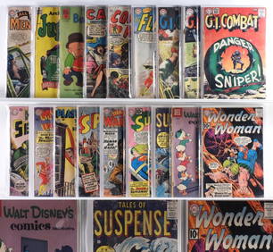
18 Atlas DC Quality Comics Golden Silver Age GroupBruneau & Co. Auctioneers4.5(491)See Sold PriceFeb 24, 2024
Stanford, Edward 1901 Large Map. Geological Map of the British IslesAlbion Auctions4.6(341)See Sold PriceMar 01, 2024
Stanford, Edward 1901 Large Map. Hydrographical Map of the British IslesAlbion Auctions4.6(341)See Sold PriceMar 01, 2024
Stanford, Edward 1901 Large Map. Stereographical Map of The British IslesAlbion Auctions4.6(341)See Sold PriceMar 01, 2024
Five boxed 1:144 scale limited edition die-cast models of passenger and commercial airliners by ...Bonhams4.1(320)See Sold PriceMar 01, 2024
George G Fryer (UK,19C) oil painting antiqueBroward Auction Gallery4.7(292)See Sold PriceMay 19, 2024
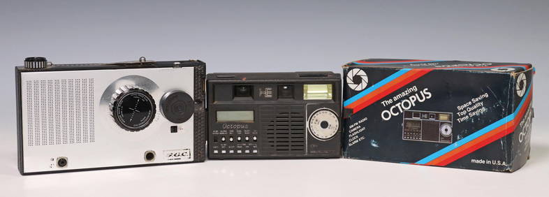
(3) RADIOS WITH BUILT IN CAMERAS, 2 RADIOS OPERATEAustin Auction Gallery4.7(1.2k)See Sold PriceApr 12, 2024


![De Jode, Rare, pub. 1593 - Map of the British Isles [England, Scotland, Ireland] (Angliae Scotiae et (1 of 2)](https://p1.liveauctioneers.com/6581/319571/171593327_1_x.jpg?height=282&quality=70&version=1707853304)