SoldANTIQUE MAPS OF POLISH LITUANIA & DANZIG, 2,ANTIQUE HAND COLORED MAPS OF POLISH LITUANIA & DANZIG, 2, 18" X 21" & 19" X 21":"Carte Du Grand Duche De Lituaniae" by Tobias Majero after Nieprzecki's 1749 map of Lithuania, 18 1/2" x 21 1/2" image;See Sold Price
SoldDelaporte: Antique Map of Poland Reserve, 1787Title/Content of Map: Poland Reserve Date Printed: 1787 Cartographer: Joseph Delaporte Material/Medium: Paper Size: 9 1/2" x 7 1/4" From the Atlas Ou Collection De Cartes. Geographiques Pour L'intelliSee Sold Price
RUSSIA / POLAND / LITUANIA VILNO UNIVERSITY MEDAL 1828ANTIQUE IMPERIAL RUSSIAN / POLISH /LITHUANIAN 250th ANNIVERSARYOF FOUNDATION OF VILNO UNIVERSITY MEDAL 1828. ENGRAVER F. TOLSTOY . BRONZE . 2 1/2" DIAM .See Sold Price
RUSSIA / POLAND / LITUANIA VILNO UNIVERSITY MEDAL 1828ANTIQUE IMPERIAL RUSSIAN / POLISH /LITHUANIAN 250th ANNIVERSARYOF FOUNDATION OF VILNO UNIVERSITY MEDAL 1828. ENGRAVER F. TOLSTOY . BRONZE . 2 1/2" DIAM .See Sold Price
RUSSIA / POLAND / LITUANIA VILNO UNIVERSITY MEDAL 1828ANTIQUE IMPERIAL RUSSIAN / POLISH /LITHUANIAN 250th ANNIVERSARYOF FOUNDATION OF VILNO UNIVERSITY MEDAL 1828. ENGRAVER F. TOLSTOY . BRONZE . 2 1/2" DIAM .See Sold Price
RUSSIA / POLAND / LITUANIA VILNO UNIVERSITY MEDAL 1828ANTIQUE IMPERIAL RUSSIAN / POLISH /LITHUANIAN 250th ANNIVERSARYOF FOUNDATION OF VILNO UNIVERSITY MEDAL 1828. ENGRAVER F. TOLSTOY . BRONZE . 2 1/2" DIAM .See Sold Price
RUSSIA / POLAND / LITUANIA VILNO UNIVERSITY MEDAL 1828ANTIQUE IMPERIAL RUSSIAN / POLISH /LITHUANIAN 250th ANNIVERSARYOF FOUNDATION OF VILNO UNIVERSITY MEDAL 1828. ENGRAVER F. TOLSTOY . BRONZE . 2 1/2" DIAM .See Sold Price
SoldNew York Antique Maps (2)Plan of City of New York by Lyne, c. 1900. Map of Provinces of New York and New Jersey by Sauthier, 1878 edition. 26" x 19 1/2".See Sold Price
SoldJohnson's Italy Antique Map (2 map frames), 1861Title/Content of Map: 1861 Johnson's Italy Map (2 map frames) -- Johnson's Northern Italy on sheet with Johnson's Southern Italy Date Printed: 1861, New York Cartographer: Johnson & Browning Size: 24See Sold Price
SoldCaspian Sea Antique Maps (2 parts)Caspian Sea map in two separate parts, north and south:. Carte Marine de la Mer Caspiene. Guillaume Delisle, Paris, 18th Century. Engravings uncolored. Center fold as issued.19 3/4" x 26".See Sold Price
SoldAntique Polish 3 Enamel Badges Medals 1918Antique Polish 2 enamel badges , medals . Dated 1918 . Largest approx . 2" ( 5 cm ) Good condition .See Sold Price
SoldAntique Polish 3 Enamel Badges Medals 1918Antique Polish 2 enamel badges , medals . Dated 1918 . Largest approx . 2" ( 5 cm ) Good condition .See Sold Price
SoldAntique World Maps (2)Double Hemisphere world map, Johnson & Ward, 1860s. Mercator's Projection world map, Colton, New York, 1855.See Sold Price
Sold2 antique maps, Northeast, & Arctic, includes "Carte2 antique maps, Northeast, & Arctic, includes "Carte Generale des Découvertes de l'Amiral de Fonte et autres Navigateurs Espagnols, Anglois et Russes pour la recherche du Passage a la Mer du Sud.See Sold Price
Sold2 antique maps, New Jersey, revolutionary war map, "A2 antique maps, New Jersey, revolutionary war map, "A plan of the Northern part of New Jersey, showing the positions of the American & British Armies After crossing the North River (Hudson River) in 1See Sold Price
Sold2 Antique Maps, c. 1600, Florence & YorkshireTwo Antique Handcolored Maps, c. 1600, Florence by Don Stephano, late 16th c. & Yorkshire by John Speed, early 17th c. {ACGQ7041/2} (TC ) Dimensions: Florence 13.5 x 18.5, framed 20x25; the YorkshireSee Sold Price
SoldHAND COLORED ENGRAVED MAPS ANTIQUE 2HAND COLORED ENGRAVED MAPS, ANTIQUE, 2:Framed. Date of printings unknown.See Sold Price
Sold2 antique maps sold together, North America and Ameriqu2 antique maps sold together, North America and Amerique Meridionale, approx. sight size 12" x 17" eachSee Sold Price
Sold(2) antique maps of Europe by Nicolas De Fer(2) antique maps of Europe by Nicolas De Fer, "Les Suisses, Leurs Sujets et Leurs Alliez", black and white map, 1715 and "Le Golfe De Venise", hand-colored map, 1716, by Nicolas De Fer and P. StarckmaSee Sold Price
Sold*2 ANTIQUE MAPS"Crams New Pictorial and Railroad Map of the United States and Territories", published 1894 by George F. Cram, approximate size 23" x 34", frame 30 1/2" x 41 1/2", and "Atlantic Ocean, Its Islands & CSee Sold Price
Sold2 Antique Maps Of The United States 1853, WorldRe-listed for non payment by Scott Zientarski. One called the new map of North America is in poor condition. Rand McNally Chart of the World on Mercator's Projection. Columbia Series64.5" x 49.5"See Sold Price
Bradford: Set of 2 Antique Maps, World in HemispheresTitle/Content of Map: Set of 2 Maps together World in globular projection by Bradford Date Printed: 1835 Cartographer: T.G. Bradford Material/Medium: Paper Size: 9 1/2" x 13" each A comprehensive AtlaSee Sold Price
Sold2 Antique Maps of Charleston, 16 x 22, & 18 x 24inches2 Antique Maps of Charleston, 16 x 22, & 18 x 24inchesSee Sold Price
17TH C. ANTIQUE MAP SIEGE OF LA ROCHELLE, FRANCE, FRAMEDThomaston Place Auction Galleries4.4(393)See Sold PriceFeb 24, 2024
18TH C. ANTIQUE MAP: FRENCH & INDIAN WAR, FRAMEDThomaston Place Auction Galleries4.4(393)See Sold PriceFeb 24, 2024
Willem Blaeu, Etc. 17th C. Antiquarian Maps, 2Auctions at Showplace4.6(740)See Sold PriceMar 17, 2024
Battle of the Nile: Disposition of the English & French Fleets, at the Commencement of the Action,Trillium Antique Prints & Rare Books4.5(32)See Sold PriceFeb 24, 2024
Hamilton - Engraving of a Painting from a Grecian Vase. 2Trillium Antique Prints & Rare Books4.5(32)See Sold PriceFeb 24, 2024
First Copy of Gautier's Le Roman de la Momie - 13 Original Watercolors by George Barbier (2 VolumesTrillium Antique Prints & Rare Books4.5(32)See Sold PriceFeb 24, 2024
Wilson - Wood Thrush, Red-breasted Thrush or Robin, & Nuthatches. 2Trillium Antique Prints & Rare Books4.5(32)See Sold PriceFeb 24, 2024
1800 MUNGO PARK TRAVELS to AFRICA 2 VOLS w/ MAP antique in ENGLISHJasper524.5(9.9k)See Sold PriceFeb 27, 2024
1816 MAP NORTHERN PART OF RUSSIA or MUSCOVY in EUROPE copper engraving ANTIQUEJasper524.5(9.9k)See Sold PriceFeb 27, 2024
1856 ARCTIC EXPLORATIONS 2nd GRINNEL EXPEDITION 2 v. E.KANE antique ILLUSTRATEDJasper524.5(9.9k)See Sold PriceFeb 27, 2024
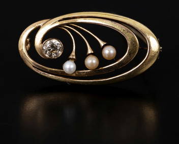
A Victorian brooch with a half-moon pattern studded with diamondsAlma4.3(59)See Sold PriceMar 03, 2024
Frigate Tropicbird Flying fish Albacore Bonito Dorado Tuna Waterspout 1746Jasper524.5(9.9k)See Sold PriceFeb 28, 2024
World War 2 Europe Battle of the Atlantic 1939-43 Axis Expansion limits 1959 mapJasper524.5(9.9k)See Sold PriceFeb 28, 2024
Operation Torch Nov 1942-May 1943. World War 2. Western Mediterranean 1966 mapJasper524.5(9.9k)See Sold PriceFeb 28, 2024
ANTIQUE ROMAN ARMORIAL VELLUM BINDING, 1744, ILLUSTRATED WITH AN ANTIQUE MAP BY FLORUSNY Elizabeth 4.2(86)See Sold PriceMar 03, 2024
Antique Map of The Kingdom of Spain, 1701 PrintAntiques Online Auctions4.6(415)See Sold PriceMar 14, 2024
Antique Map of Poland, 1700 by Guillaume De Lisle, ParisAntiques Online Auctions4.6(415)See Sold PriceMar 14, 2024
Antique Map of France, 1703 by Gillaume Del Isle PrintAntiques Online Auctions4.6(415)See Sold PriceMar 14, 2024