SoldAntique Map of Panama Canal"Plano General del Trazado Canal del Panama". Good condition with age toning, some small crease separations, etc. Folds as issued. Circa late 19th/ early 20th C. 12.25" x 53.75"See Sold Price
SoldHarmsworth: Antique Map of the Caribbean, 1907TITLE/CONTENT OF MAP: 'West Indies and Central America : Industries and Communications; Inset maps of Panama Canal; Bermudas; Kingston; Havana; Windward Islands' DATE PRINTED: 1907 IMAGE SIZE: ApproxSee Sold Price
Tallis / Rapkin: Antique Map of Panama Isthmus, 1849Title/Content of Map: 'Isthmus of Panama' The map indicates, in pink, five routes for "proposed railway and canal communications" connecting the Atlantic/Caribbean & Pacific oceans. Two of the proposeSee Sold Price
West Indies & Caribbean. Panama Canal. Relief. THE TIMES 1922 old vintage mapTITLE/CONTENT OF MAP: 'The West Indies' DATE PRINTED: 1922 IMAGE SIZE: Approx 44.5 x 57.5cm, 17.5 x 22.5 inches (Large); Please note that this is a folding map. TYPE: Antique atlas map CONDITION: GoodSee Sold Price
Tallis/Rapkin: Antique Map of Panama Isthmus, 1849Isthmus of Panama' The map indicates, in pink, five routes for "proposed railway and canal communications" connecting the Atlantic/Caribbean & Pacific oceans. Two of the proposed routes pass through PSee Sold Price
West Indies & Caribbean. Panama Canal. Relief. THE TIMES 1922 old vintage mapTITLE/CONTENT OF MAP: 'The West Indies' DATE PRINTED: 1922 IMAGE SIZE: Approx 44.5 x 57.5cm, 17.5 x 22.5 inches (Large); Please note that this is a folding map. TYPE: Antique atlas map CONDITION: GoodSee Sold Price
Authentic Vintage 1928 - Panama Canal MapAuthentic Vintage 1928 - Panama Canal Map **|**|** This is a beautiful, 87 year old map of Panama Canal. The details are crisp and the aged color has a perfect antique feel. The map is large - measuriSee Sold Price
Tallis/Rapkin: Antique Map of the Panama Isthmus, 1849Isthmus of Panama' The map indicates, in pink, five routes for "proposed railway and canal communications" connecting the Atlantic/Caribbean & Pacific oceans. Two of the proposed routes pass through PSee Sold Price
Central America and West Indies. Nicaragua & Panama Canal. THE TIMES 1900 mapTITLE/CONTENT OF MAP: 'Central America and West Indies' DATE PRINTED: 1900 IMAGE SIZE: Approx 41.5 x 54.0cm, 16.25 x 21.25 inches (Large); Please note that this is a folding map. TYPE: Antique colourSee Sold Price
Central America and West Indies. Nicaragua & Panama Canal. THE TIMES 1900 mapTITLE/CONTENT OF MAP: 'Central America and West Indies' DATE PRINTED: 1900 IMAGE SIZE: Approx 41.5 x 54.0cm, 16.25 x 21.25 inches (Large); Please note that this is a folding map. TYPE: Antique colourSee Sold Price
SoldANTIQUE PAPERBACK WORLD ATLAS CIRCA 1914Published by Geographical Publishing Company Chicago. Special feature on Panama Canal with map. 19" X 24" $100 - $200 Please contact us for high resolution images of this lot.See Sold Price
SoldAntique Personal Leather Notebooks(1) Laid & Lee's Diary and Time-Saver 1906. Black embossed leather cover. Includes daily date pages, maps, government info, moon changes, Panama Canal progress, etc. Unused. 5 5/8" x 2 7/8". (2) C. J.See Sold Price
Sold4pc Book Lot. 1). Pinkerton's Voyages & Travels.4pc Book Lot. 1). Pinkerton's Voyages & Travels. 2). Joseph Pennell's Pictures Panama Canal. 3). Mental Flower Garden. 4)The United States Coast Survey. Last book has fold out maps. -- Dimensions: ---See Sold Price
PANAMA. Isthmus, Republic, Canal zone & profile. RANDTITLE/CONTENT OF MAP: 'Isthmus of Panama; Inset Republic of Panama; Profile of Canal' DATE PRINTED: 1912 IMAGE SIZE: Approx 34.0 x 27.0cm, 13.25 x 10.5 inches (Large) TYPE: Antique colour (color) atlaSee Sold Price
(4) MITCHELL ATLAS MAPS, PANAMA CANAL, C.1884(lot of 4) Unframed atlas maps, Samuel Augustus Mitchell (United States, 1790-1868), c.1884, including: (1) North and South Carolina, with inset map of Charleston harbor and plan of Charleston, 12.5"hSee Sold Price
SoldMaps, Panama Canal, 1904[Panama Canal]. Various contributors. Report Of The Isthmian Canal Commission 1899-1901. Wash: GPO, 1904. 4to. 2 Vols. 688pp. 86 maps complete and text providing locations, costs, and other logisticsSee Sold Price
Sold2 framed Antique Photos, Panama Canal & Balboa CanalBoth photos frames measure approx. 6 X 16See Sold Price
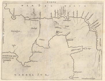
SoldTirion: Antique Map of Panama, 1750Map: Kaart van de Landengte van Panama Cartographer: Tirion Place & Date: Amsterdam / 1750 Size: 11 7/8" x 10 5/8" Condition: b&w; overall age toning and minor spotting A beautifully designed and highSee Sold Price
Tallis: Antique Map of Panama, 1853Title/Content of Map: Panama by Tallis, circa 1853 Date Printed: 1853 Cartographer: John Tallis Material/Medium: Lithograph Dimensions: 10.5" x 14" Original lithograph by John Tallis & Company of LondSee Sold Price
Tallis: Antique Map of Panama, 1853Map: Panama: Honduras to New Granada Date Printed: 1853 Cartographer: Tallis Material/Medium: lithograph Size: 10 3/4" x 14" Original lithograph by John Tallis & Company of London, c. 1853. Map vignetSee Sold Price
SoldMap of Panama Canal ZoneHeading: (Panama) Author: Baxter, William M. Title: General Map of the Panama Canal Place Published: [Boston] Publisher:William M. Baxter, Jr. / Rand Avery Supply Co. Date Published: c.1915See Sold Price
Antique Enamel Panama Canal Belt Buckle C 1915Antique Enamel Panama Canal Belt Buckle C 1915. With a shield reading, "The Land Divided the World United." Circa 1915. Measures 3 inches in width.See Sold Price
SoldNicholas Sanson Antique Map of Brittany, FranceNicholas Sanson antique map "Le Canal de France ou La Manche". Framed map "La Bretagne Generalite de Nantes". Dimensions: Art: 21" H x 31" W; Frame: See Sold Price
SoldCARIBBEAN CENTRAL AMERICA. Industry & Comms; PanamaTITLE/CONTENT OF MAP: 'West Indies and Central America : Industries and Communications; Inset maps of Panama Canal; Bermudas; Kingston; Havana; Windward Islands' This map is folding hence the centrefoSee Sold Price
Evelyn Metzger (NY,Brazil,1911-2007) oil paintingBroward Auction Gallery4.8(277)See Sold PriceApr 14, 2024
Pre-Columbian Mochica Pottery Vessel, Possibly From 600 ADRbfinearts4.4(571)See Sold PriceFeb 24, 2024
Pre-Columbian Vulture Pottery Vessel, Damaged And Repaired, Madden Lake 1974Rbfinearts4.4(571)See Sold PriceFeb 24, 2024
Pre-Columbian Black And White Ware Pottery Footed Fruit BowlRbfinearts4.4(571)See Sold PriceFeb 24, 2024
Pre-Columbian Chimu Inca Blackware Stirrup Vessel With Two BirdsRbfinearts4.4(571)See Sold PriceFeb 24, 2024
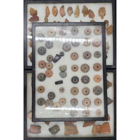
Lot Of Large Display Boxes Of Pottery Fragments, Stone Points, And Spindle Whorls From Madden LakeRbfinearts4.4(571)See Sold PriceFeb 24, 2024
Group of 15 Printed or Lithographed Items, including: litho...Potter & Potter Auctions4.6(539)See Sold PriceMar 07, 2024
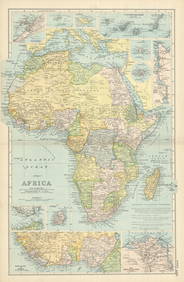
A23 United States in the Caribbean Denoyer-Geppert Social Science MapsJasper524.5(9.8k)See Sold PriceFeb 27, 2024
Carte du Canal de Mosambique…. Madagascar Bonne Esperance. BONNE 1780 mapJasper524.5(9.8k)See Sold PriceFeb 28, 2024
Le Canal de Mosambique, l'Isle de Madagascar… Mozambique. Africa. BONNE 1788 mapJasper524.5(9.8k)See Sold PriceFeb 28, 2024
Le Canal de Mosambique, l'Isle de Madagascar… Mozambique. Africa. BONNE 1790 mapJasper524.5(9.8k)See Sold PriceFeb 28, 2024
AFRICA French Congo State Soudan Nile Delta Suez canal by GW BACON 1898 mapJasper524.5(9.8k)See Sold PriceFeb 28, 2024
Poster "Les jardins de Paris", illustrated map and plan of Paris with its parcs, gardens, monuments,Proverde Auctions4.3(3)See Sold PriceFeb 28, 2024
1915 Glimpses Of The Panama Canal Photo BookRapid Estate Liquidators and Auction Gallery4.5(1.1k)See Sold PriceFeb 29, 2024