ATLAS of ANTIENT GEOGRAPHY by SAMUEL BUTLER 1843John McInnis Auctioneers,LLC4.6(502)See Sold PriceFeb 24, 2024
18TH C. ANTIQUE MAP: FRENCH & INDIAN WAR, FRAMEDThomaston Place Auction Galleries4.4(386)See Sold PriceFeb 24, 2024
Rand McNally Railroad Map Cabinet w/ 21 Railroad MapsRail & Road Auctions4.6(165)See Sold PriceMar 08, 2024
Keith Haring - Ink on New York Map, Best Buddies, Inscribed, Signed, and DatedSapphire Auction Gallery4(67)See Sold PriceMar 02, 2024
LATE 17TH C. FRENCH MAP OF THE NEW WORLD BY ALEXIS-HUBERT JAILLOT (1632-1712)Thomaston Place Auction Galleries4.4(386)See Sold PriceFeb 24, 2024
Central Railroad of New Jersey Map of Sandy Hook Route-ca. 1903JM Hobby Supply and Railroad Artifact Auctions4.4(126)See Sold PriceFeb 24, 2024
Lot of Six Mixed Atlas Box Cars-HO Scale-New in BoxJM Hobby Supply and Railroad Artifact Auctions4.4(126)See Sold PriceFeb 25, 2024
Rand McNally/Santa Fe Railroad Map of Iowa-1912JM Hobby Supply and Railroad Artifact Auctions4.4(126)See Sold PriceFeb 24, 2024
NICOLAES VISSCHER (NETHERLANDS, 1618-1709) MAP OF THE NEW WORLDThomaston Place Auction Galleries4.4(386)See Sold PriceFeb 24, 2024
17TH C. WORLD MAP BY NICOLAES VISSCHER (NETHERLANDS, 1618-1709)Thomaston Place Auction Galleries4.4(386)See Sold PriceFeb 24, 2024
Lot of Six Mixed Atlas Cabooses-HO Scale-New in BoxJM Hobby Supply and Railroad Artifact Auctions4.4(126)See Sold PriceFeb 25, 2024
Antique Map : Greece - 1860'sAntique Map : Greece - 1860's by Henrico Kiepert from Atlas Antiquus. Hand-Tinted. Size : 18" x 14.25"See Sold Price
Antique Map : Greece - 1860'sAntique Map : Greece - 1860's by Henrico Kiepert from Atlas Antiquus. Hand-Tinted. Size : 18" x 14.25"See Sold Price
SoldAntique Map : Greece - 1860'sAntique Map : Greece - 1860's by Henrico Kiepert from Atlas Antiquus. Hand-Tinted. Size : 18" x 14.25"See Sold Price
Antique Map : Greece - 1860'sAntique Map : Greece - 1860's, Graecia by Henrico Kiepert from Atlas Antiquus, Hand-Tinted. Size : 14" x 18.25"See Sold Price
Antique Map : Greece - 1860'sAntique Map : Greece - 1860's, Graecia by Henrico Kiepert from Atlas Antiquus, Hand-Tinted. Size : 14" x 18.25"See Sold Price
Antique Map : Greece - 1860'sAntique Map : Greece - 1860's, Graecia by Henrico Kiepert from Atlas Antiquus, Hand-Tinted. Size : 14" x 18.25"See Sold Price
Antique Map : Greece - 1860'sAntique Map : Greece - 1860's by Henrico Kiepert from Atlas Antiquus. Hand-Tinted. Size : 18" x 14.25"See Sold Price
Mitchell, Cowperthwait: Antique Map of Greece, 1864Title: Map of Greece by Mitchell, Cowperthwait, and DeSilver Date: 1864 Medium: Hand Colored Lithograph Dimensions (inches): 17 x 14 Condition: Good Condition Samuel Augustus Mitchell (1790-1860) waSee Sold Price
SoldLOT OF 10 MITCHELL WORLD MAPSLOT OF 10 MITCHELL WORLD MAPS. 1. 1860-SPAIN, FRANCE AND PORTUGAL. 2. 1860-AUSTRIAN EMPIRE, ITALIAN STATES, TURKEY AND GREECE. 3. 1874-AUSTRIAN EMPIRE, ITALIAN STATES, TURKEY AND GREECE. 4. 1860-NOVASee Sold Price
Sold2 ANTIQUE MAPS GREECE & ASIA2 ANTIQUE MAPS GREECE & ASIA: 2 pieces total to include 1) D'Anville 1762 map of Greece titled "Graeciae Antiquae Specimen Geographicum", inset map upper left, cartouche lower left, sight size 20 3/4"See Sold Price
2 ANTIQUE MAPS GREECE & ASIA2 ANTIQUE MAPS GREECE & ASIA: 2 pieces total to include 1) D'Anville 1762 map of Greece titled "Graeciae Antiquae Specimen Geographicum", inset map upper left, cartouche lower left, sight size 20 3/4"See Sold Price
SoldRuscelli: Antique Map of Greece, 1561Map: Tabula Europae X (authentic Antique Map of Greece) Cartographer: Girolamo Ruscelli Illustrator: Girolamo Ruscell Edition: First Edition Date: 1561 Size: 7.25 x 9.75 inches Authentic sixteenth cenSee Sold Price
SoldFries: Antique Map of Greece, 1541Title/Content of Map: 1541 Fries Map of Greece -- Europae Tabula Decima Continet Macedoniam, Epyrum, Achaiam, Peloponesum, & Cretam Insulam Date Printed: 1541, Vienna Cartographer: T Fries Size: 12.8See Sold Price
Fries: Antique Map of Greece & Balkans, 1541Map: 1541 Fries Map of Greece and Balkans -- Tabula Nova Graeciae, Sclavoniae, & Bulgariae Cartographer: T Fries Year / Place: 1541, Vienna Map Dimensions: 12.8 x 15.8 in. Condition: Very Good. ClearSee Sold Price
Seutter: Antique Map of Greece Peloponnesian PeninsulaTitle/Content of Map: Greece's Peloponnesian Peninsula (Morea) by Seutter Date Printed: c1740 Cartographer: Matthaus Seutter Material/Medium: Paper Size: 19" x 23" Original hand colored copperplate enSee Sold Price
Millar: Antique Map of Greece & Asia Minor, 1768Title/Content of Map: 1768 Millar Map of Greece, Macedonia and Asia Minor -- A Correct Map of Ancient Greece Date Printed: 1768 c. Cartographer: G Millar Size: 14.3 x 9.3 in. Condition: Fair. Nice strSee Sold Price
Stackhouse: Antique Map of Greece, 1783Title/Content of Map: Greece by Stackhouse Date Printed: 1783 Cartographer: Thomas Stackhouse Material/Medium: Paper Size: 16" x 20" Original hand color, copperplate engraved. Published in London in 'See Sold Price
SoldLotter: Antique Map of Greece & Aegean Islands, 1770Map: Graecia Nova et Mare Aegeum Cartographer: Conrad Lotter Place & Date: Augsburg / 1770 (circa) Size: 22 3/4" x 19 3/4" Condition: repair at lower end of fold with minor loss at the bottom center bSee Sold Price
SoldSDUK: Antique Map of Greece, Ionian Islands, 1845Title/Content of Map: 'GREECE'. United States of the Ionian Islands. Peloponnese Cyclades. Date Printed: 1845 Image Size: Approx 33.5 x 39.5cm, 13.25 x 15.5 inches (Large) Type: Antique steel engravedSee Sold Price
Vandermaelen: Antique Map of Greece, 1827TITLE/CONTENT OF MAP: 'Europe - Grèce - No 27 ' Greece, the Aegean and the western part of Turkey. The United States of the Ionian Islands, then a British Protectorate, are showed coloured green as aSee Sold Price
Mawman: Antique Map of Greece, Boeotia, 1791Map: Greece: Boeotia Date: 1791 Maker: J. Mawman Medium: Original copper engraving Size: 10 1/4" x 15 1/4" From the 1791 "Maps, Plans, Views, and Coins Illustrative of the Travels of Anacharsis the YoSee Sold Price
de Fer: Antique Map of Greece, 1705From the scarce 1723 edition of de Fer’s Petit Nouveau Atlas comes this charming and detailed map of Greece and the Grecian Islands. Depicts just a hint of the vast number of islands that help makeSee Sold Price
Mawman: Antique Map of Greece, The Hellespont, 1791Title/Content of Map: Greece: The Hellespont, Thracian Chersonesus & Troas, 1791 Date Printed: 1791 Cartographer: J. Mawman Material/Medium: Engraving Size: 10 1/4" x 15 1/4" Original copper engravingSee Sold Price
Mawman: Antique Map of Greece, Sparta, 1791Title/Content of Map: Greece: Sparta & Environs, 1791 Date Printed: 1791 Cartographer: J. Mawman Material/Medium: Engraving Size: 10 1/4" x 15 1/4" Original copper engraving from the 1791 book Maps, PSee Sold Price
17TH C. ANTIQUE MAP SIEGE OF LA ROCHELLE, FRANCE, FRAMEDThomaston Place Auction Galleries4.4(386)See Sold PriceFeb 24, 2024
18TH C. ANTIQUE MAP: FRENCH & INDIAN WAR, FRAMEDThomaston Place Auction Galleries4.4(386)See Sold PriceFeb 24, 2024
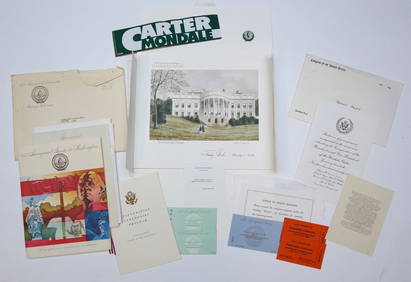
1977 INAUGURATION of PRESIDENT JIMMY CARTERJohn McInnis Auctioneers,LLC4.6(502)See Sold PriceFeb 25, 2024
Framed Hand Colored Antique Map of the Department of Nord, FranceDonny Malone Auctions4.5(1.7k)See Sold PriceMar 04, 2024
Jesenske & Mucha's Ballady a Pisne - Ornately Bound Volume with Frontispiece illustrated by MuchaTrillium Antique Prints & Rare Books4.5(30)See Sold PriceFeb 24, 2024
Western Africa by Edward Weller. Early British/French settlements 1860 old mapJasper524.5(9.8k)See Sold PriceFeb 28, 2024
Africa. Mauritius, Bourbon (Reunion) & Natal by Edward Weller 1860 old mapJasper524.5(9.8k)See Sold PriceFeb 28, 2024
Africa inc. discoveries of Livingstone Barth Vogel Chadda Exp. SWANSTON 1860 mapJasper524.5(9.8k)See Sold PriceFeb 28, 2024
Cooke, George 1801 Antique Map. United States of AmericaAlbion Auctions4.6(336)See Sold PriceMar 01, 2024
Barthelemy, Jean 1790 Map. Greece - Essa sur la Bataille de PlateeAlbion Auctions4.6(336)See Sold PriceMar 01, 2024
Barthelemy, Jean 1790 Map. Greece - Plan de L'AcademieAlbion Auctions4.6(336)See Sold PriceMar 01, 2024
Barthelemy, Jean 1790 Map. Greece - Essai sur les Environs de DelphesAlbion Auctions4.6(336)See Sold PriceMar 01, 2024
Elias Fries (1794 - 1878) - Set of 4 Mushroom Prints - Cantarellus Aurantiacus - Merulius LacrymansProverde Auctions4.3(3)See Sold PriceFeb 28, 2024
Elias Fries (1794 - 1878) - Set of 4 Mushroom Prints - Agaricus Rubescens - Polyporus FomentariusProverde Auctions4.3(3)See Sold PriceFeb 28, 2024
Francis McNally - Antique Map of Ohio, Indiana & KentuckyProverde Auctions4.3(3)See Sold PriceFeb 28, 2024
Francis McNally - Antique Map of Washington, Oregon, Idaho, Nevada, Utah & ArizonaProverde Auctions4.3(3)See Sold PriceFeb 28, 2024
Antique Map of Poland, 1700 by Guillaume De Lisle, ParisAntiques Online Auctions4.6(407)See Sold PriceMar 14, 2024