Gothic Revival Stained Glass Window of The ResurrectionSchmidt's Antiques Inc. Since 19114.8(440)See Sold PriceMar 02, 2024
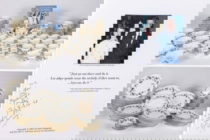
THE FITZGERALD FAMILY TEA and DINNER SERVICEJohn McInnis Auctioneers,LLC4.5(505)See Sold PriceFeb 25, 2024
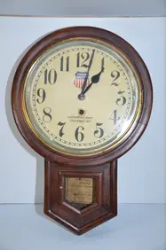
Union Pacific RR Cheyenne, WY Locomotive Shop ClockJM Hobby Supply and Railroad Artifact Auctions4.4(127)See Sold PriceFeb 24, 2024
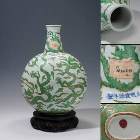
A CHINESE PORCELAIN GREEN ENAMELED DRAGON MOON FLASK BIANHUBerkeley Auction Gallery4.4(16)See Sold PriceMar 03, 2024
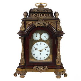
Antique George III Musical Bracket Clock by Hare LondonHill Auction Gallery 4.7(1k)See Sold PriceFeb 28, 2024
No Reserve Early 20th century French / Flemish Design Tapestry 6 ft 2 in x 4 ft 9 in (1.87 m x 1.44Nazmiyal Auctions4.4(36)See Sold PriceFeb 25, 2024
Central Anatolia Konya Antique Rug 4 ft 8 in x 3 ft 8 in (1.42 m x 1.11 m)Nazmiyal Auctions4.4(36)See Sold PriceFeb 25, 2024
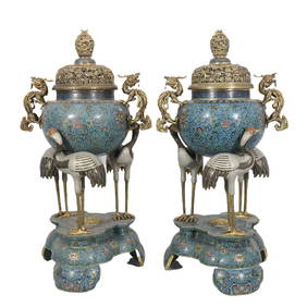
PAIR MAGNIFICENT AND LARGE CLOISONNE ENAMEL CRANES INCENSE BURNERSBerkeley Auction Gallery4.4(16)See Sold PriceMar 03, 2024
From Davide Halevim Collection Antique Persian Mohtashem Kashan Rug 10'11" x 7'10" (3.32 m x 2.38 m)Nazmiyal Auctions4.4(36)See Sold PriceFeb 25, 2024
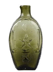
RARE COVENTRY GLASS WORKS MASONIC FLASKJohn McInnis Auctioneers,LLC4.5(505)See Sold PriceFeb 25, 2024
Empire by Buccellati Italy Sterling Silver Flatware Set 99 pieces DinnerBidhaus4.3(773)See Sold PriceFeb 25, 2024
SoldAntique large A New Map of XVII Provinces of LowAntique large A New Map of XVII Provinces of Low Germanic. By J. Speed. Copper plate engraving. Circa 17th C. Measures 17" tall x 21" wide. Was originally purchased at Jonathan Potter., LTD, London. BSee Sold Price
SoldFramed Antique C.1849 Large PROVINCE OF NEW YORK MAP BYDetails: Framed large c.1849 Sauthier map after original engraving of the Province of New York in 1779 by Vaughan. Detailed chorographical map of Province of New York and western Province of New HampSee Sold Price
LOW COUNTRIES - SPEED, John.LOW COUNTRIES - SPEED, John. A New Mape of Ye XVII Provinces Of Low Germanie. (London), George Humble, 1654. (40 x 52 cm). Attractive hand-coloured engraved map in the second state. First published inSee Sold Price
SoldAntique Hand Colored Paper Map: Low CountriesAntique Hand Colored Paper Map: Low CountriesAntique hand colored paper map; titled "A New Map of the United Provinces, Comprehending Holland, Zealand, Utrecht, Gelders ... " engraved by John Cary datSee Sold Price
SoldXVII PROVINCES OF LOW GERMANY MAP FROM A BOOKMAP OF XVII PROVINCES OF LOW GERMANY 16 1/2" X 21" TAKEN FROM A BOOK:Taken from a book with text on the reverse side. Two-sided glass, framed. (rev.20070316)See Sold Price
SoldJohn Speede (1552-1629) British. "A New Map of ye XV11John Speede (1552-1629) British. "A New Map of ye XV11 Provinces of Low Germanie", Engraving, 17" x 21.5".See Sold Price
SoldLarge Antique Map Italy John Senex Engraving 1708Large Antique Map "A New Map of Italy" John Senex (English 1678-1740) & John Maxwell, Hand Colored Engraving, 1708. (BNPP3413)(AC) Dimensions: Map: 26" h x 40" wFrame: 39" h x 52" w x 1" d Provenance:See Sold Price
John Speede (1552-1629) British. "A New Map of ye XV11John Speede (1552-1629) British. "A New Map of ye XV11 Provinces of Low Germanie", Engraving, 17" x 21.5".See Sold Price
SoldColton Large Antique Map of New JerseyColton's Larger Township Map of New Jersey. G.W. & C.B. Colton, New York, 1897. Separately issued, folds as issued. Sight 37" x 25 1/2", frame overall 40 3/4" x 28 1/2".See Sold Price
SoldNew York Antique Maps (2)Plan of City of New York by Lyne, c. 1900. Map of Provinces of New York and New Jersey by Sauthier, 1878 edition. 26" x 19 1/2".See Sold Price
New Zealand North Island. New Ulster Map, 1863TITLE/CONTENT OF MAP: 'New Zealand North Island New Ulster or Eaheinomauwe' DATE PRINTED: 1863 IMAGE SIZE: Approx 45.0 x 32.5cm, 17.75 x 12.75 inches (Large) TYPE: Antique map with original outline coSee Sold Price
SDUK: Antique Map of New York City, 1847Title/Content of Map: 'NEW YORK' Antique town city map plan. Manhattan Brooklyn Jersey. Date Printed: 1847 Image Size: Approx 33.0 x 39.0cm, 13 x 15.25 inches (Large) Type: Antique steel engraved mapSee Sold Price
SDUK: Map of New York City, 1847Title/Content of Map: 'NEW YORK', Antique town city map plan. Manhattan Brooklyn Jersey Date Printed: 1847 Image Size: Approx 33.0 x 39.0cm, 13 x 15.25 inches (Large) Type: Antique steel engraved mapSee Sold Price
SDUK: Antique Map City Plan of New York City, 1847Title/Content of Map: 'NEW YORK' Antique town city map plan. Manhattan Brooklyn Jersey. Date Printed: 1847 Image Size: Approx 33.0 x 39.0cm, 13 x 15.25 inches (Large) Type: Antique steel engraved mapSee Sold Price
SoldSDUK: Antique Map of Portugal, 1845TITLE/CONTENT OF MAP: 'PORTUGAL' Provinces. Algarve Alentejo Estremadura Beira etc. DATE PRINTED: 1845 IMAGE SIZE: Approx 37.5 x 27.5cm, 14.75 x 10.75 inches (Large) TYPE: Antique steel engraved map wSee Sold Price
SoldCanadian MapA 1782 J. Bew (London) Map of the Northern United States and Canada. Hand colored engraving entitled "A New & Accurate Map of the Province of Canada in North America". Wear and even discoloration, cenSee Sold Price
SoldBRITISH INDIA 'Eastern Provinces'. Ceylon BurmahTITLE/CONTENT OF MAP: 'India the Eastern Provinces; Inset Map of the Island of Ceylon' DATE PRINTED: 1863 IMAGE SIZE: Approx 45.5 x 31.0cm, 18 x 12.25 inches (Large) TYPE: Antique map with original ouSee Sold Price
SoldBRITISH INDIA. 'The North West Provinces & Oude'.TITLE/CONTENT OF MAP: 'India the North West Provinces and Oude' DATE PRINTED: 1863 IMAGE SIZE: Approx 31.5 x 44.5cm, 12.5 x 17.5 inches (Large) TYPE: Antique map with original outline colour CONDITIONSee Sold Price
SoldRare Original 18th century large map of New England. "ARare Original 18th century large map of New England. "A Map of the Most Inhabited Part of New England Containing the Provinces of Massachusetts Bay and New Hampshire with the Colonies of Connecticut aSee Sold Price
SoldLarge Arrowsmith map of Mexico 1810Heading: Author: Arrowsmith, Aaron Title: A New Map of Mexico and Adjacent Provinces Compiled from Original Documents by A. Arrowsmith 1810 additions to 1816 Place Published: London Publisher: DSee Sold Price
SoldLG DATED 1860 ANTIQUE MAP OF NEW YORK STATE 3256Large map of New York State from the original surveys. Dimensions: 69"H x 73"W Age: dated 1860 Material: Paper on CanvasSee Sold Price
SoldArrowsmith's large map of Mexico 1810Heading: Author: Arrowsmith, Aaron Title: A New Map of Mexico and Adjacent Provinces Compiled from Original Documents by A. Arrowsmith 1810 Place Published: London Publisher: Date Published:See Sold Price
SoldArrowsmith's large map of Mexico 1810Heading: Author: Arrowsmith, Aaron Title: A New Map of Mexico and Adjacent Provinces Compiled from Original Documents by A. Arrowsmith 1810 Place Published: London Publisher: Date Published:See Sold Price
Sold1778 PROVINCE of NEW JERSEY FRAMED MAPAntique map of New Jersey, issued by William Faden in 1778 and drawn from Bernard Ratzer’s survey made in 1769 just prior to the American Revolutionary War. This is a second edition that includes thSee Sold Price
D'Entrecasteaux - Australia: Coasts of Van Diemen's Land (New Holland). 9Trillium Antique Prints & Rare Books4.5(33)See Sold PriceFeb 24, 2024
D'Entrecasteaux - Australia: Chart of Van Diemen's Land (New Holland). 3Trillium Antique Prints & Rare Books4.5(33)See Sold PriceFeb 24, 2024
D'Entrecasteaux - Map of Australia (New Holland), New Zealand, and southern Asia and surroundingTrillium Antique Prints & Rare Books4.5(33)See Sold PriceFeb 24, 2024
Audubon, NYSE Best Watercolor Ed - Pair: Brown Pelican & Reddish EgretTrillium Antique Prints & Rare Books4.5(33)See Sold PriceFeb 24, 2024
1738 RUSSIA SIBERIA & GREAT TARTARY Description illustrated ANTIQUE in ENGLISHJasper524.5(9.9k)See Sold PriceFeb 27, 2024
Antique Large Unisex Black Melanite Garnet & Gold Mourning RingJasper524.5(9.9k)See Sold PriceFeb 28, 2024
Afrique. Pays des Hottentots #50. Namibia South Africa VANDERMAELEN 1827 mapJasper524.5(9.9k)See Sold PriceFeb 28, 2024
South Namibia coast. Walvis Bay-Orange River ADMIRALTY sea chart 1881 (1954) mapJasper524.5(9.9k)See Sold PriceFeb 28, 2024
Afrique. Pays des Hottentots #51. Botswana South Africa. VANDERMAELEN 1827 mapJasper524.5(9.9k)See Sold PriceFeb 28, 2024
Clarke & Neele 1815 Map. Europe - Recent Political ChangesAlbion Auctions4.7(341)See Sold PriceMar 01, 2024
New England Amberina Swirl Glass Low Handled MugMatthew Bullock Auctioneers4.7(1.9k)See Sold PriceMar 02, 2024
A LARGE ERRATA BOOK INDIAN MAPS AND STUDIES including the provinces of Bengal, Cossimbuzar Island, THannam's Auctioneers Ltd4.3(399)See Sold PriceFeb 27, 2024
Robert de Vaugondy - Map of Canada - Mer de l' Ouest or Sea of the West and a Northwest PassageProverde Auctions4.3(3)See Sold PriceFeb 28, 2024