SoldAntique Framed Map of North America / USAAntique Framed Map of North America / USA. Measures 21.5 x 17 inches.See Sold Price
SoldWalker, John 1815 Antique Map of North America. USACopper Plate Published 1815, London for "The Universal Gazetteer: Being a Concise Description" [Walker's Geography] by John Walker. Folds as issued. Paper Size: 10 x 8 inch (25 x 20cm) Minor toning/ofSee Sold Price
SoldBarlow 1807 Antique Map of North America. USA CanadaCopper Engraved Map Published 1807 by Brightly & Kinnersley, Bungay, England for "A General View of the World, Geographical, Historical and Philosophical" by The Rev. E. Blomfield. Maps Engraved by BaSee Sold Price
SoldFRAMED ANTIQUE MAP OF NORTH AMERICA BY BRUEParis, Adrien-Hubert Brue (1786-1832), 1820; "Carte Generale des Etats-Unis, l'Amerique Septentrionale, par A.M. Brue, Geographe de S.A.R. Monsieno, a Paris. Chez d'Auteur. Decembre 1820." From AtlasSee Sold Price
SoldAntique Framed map of east coast of North AmericaAntique Framed map of east coast of North America, dated 1783, 23" x 20"See Sold Price
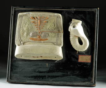
SoldEarly Hand Colored Map North America by T ConderAntique framed hand colored early map of North America. Top left image of Native man and foliage, reads "North America agreeable to the most approved Maps and Charts, by Thomas Condor" Frame: 14 3/4 iSee Sold Price
SoldNORTH AMERICA COLORED MAP, C. 1763, POSTLETHWAYTFramed antique map c. 1770, "North America, Plate 1" from the publication "Dictionary of Trade and Commerce" by Malachy Postlethwayt (British, 1707-1767), hand colored, also reading "North America, PeSee Sold Price
SoldNORTH AMERICA COLORED MAP, C. 1763, POSTLETHWAYTFramed antique map c. 1770, "North America, Plate III" and "Part of North America, Plate IV", from the publication "Dictionary of Trade and Commerce" by Malachy Postlethwayt (British, 1707-1767), handSee Sold Price
SoldAntique Explorers Map of North America, 1903Title/Content of Map: 'North America' USA CANADA MEXICO: Explorers routes: Cabot Cortes Baffin Hudson Drake Date Printed: 1903 Image Size: Approx 38.5 x 28.0cm, 15.25 x 11 inches (Large); Please noteSee Sold Price
Antique Framed Map1623 North America Map.Dimension: Approximately L 27.5in(69.8cm) X W 23in(58.4cm) with FrameApproximately L 23.5in(59.7cm) X W 18.75(47.6cm) without FrameSee Sold Price
SoldANTIQUE NORTH AMERICA MAP C. 1780, WILLIAM GUTHRIEFramed antique map, c. 1780, "A General Map of North America from the best Authorities", believed to be from "A New Geographical, Historical, and Commercial Grammar and Present State of the Several KiSee Sold Price
Sold2pcs Decorative Antique Maps FRAMED GEOGRAPHY MADE EASYDetails: 2pcs Decorative Antique Maps FRAMED GEOGRAPHY MADE EASY JEDIDIAH MORSE 1798 Map Of North America & World Map American Universal Geography Collectible This group features 3 matted and framedSee Sold Price
SoldJan Jansson Hand Colored Old Map of North AmericaJan Jansson (Johannes Janssonius; Dutch, 1588-1664). Framed antique etching print of North America. Titled AMERICA SEPTENTRIONALIS. Hand colored. Unknown printing date in two sheets joined in the middSee Sold Price
Ettling: Antique Map of USA SOUTH EAST, 1863TITLE/CONTENT OF MAP: 'United States of North America (Eastern & central)' USA SOUTH EAST. Florida Georgia Carolina coast Bahamas DATE PRINTED: 1863 IMAGE SIZE: Approx 44.5 x 32.0cm, 17.5 x 12.5 incheSee Sold Price
Antique German Map of Western North America 1862"Vereinigte Staaten von Nordamerika". Lithograph von E. Serth after Tr. Bromme for "Tr. Bromme's Hand Atlas", 1862. Original hand coloring. Map shows the western part of the USA with major towns and cSee Sold Price
Antique German Map of Western North America 1862"Vereinigte Staaten von Nordamerika". Lithograph von E. Serth after Tr. Bromme for "Tr. Bromme's Hand Atlas", 1862. Original hand coloring. Map shows the western part of the USA with major towns and cSee Sold Price
SoldAntique German Map of Western North America 1862"Vereinigte Staaten von Nordamerika". Lithograph von E. Serth after Tr. Bromme for "Tr. Bromme's Hand Atlas", 1862. Original hand coloring. Map shows the western part of the USA with major towns and cSee Sold Price
Ettling: Antique Map of USA Plains, 1863TITLE/CONTENT OF MAP: 'United States of North America North West sheet' USA PLAINS Minnesota/Nebraska Territories 'Kanzas' ND SD WY MT The routes proposed for trans-continental railroads are shown, inSee Sold Price
Ettling: Antique Map of USA South, 1863TITLE/CONTENT OF MAP: 'United States of North America South West sheet' USA SOUTH. Texas New Mexico. Gadsden purchase shown as Arizona The map shows routes "Proposed for the Pacific Railroad". The easSee Sold Price
SDUK: Antique Map of Lake Superior, 1846Title/Content of Map: 'NORTH AMERICA, SHEET lV., Lake Superior' Canada USA Ontario Michigan. Fur trading posts. Date Printed: 1846 Image Size: Approx 33.5 x 41.0cm, 13.25 x 16 inches (Large) Type: AntSee Sold Price
SDUK: Antique Map of Lake Superior, Canada, 1846Title/Content of Map: 'NORTH AMERICA, SHEET lV., Lake Superior' Canada USA Ontario Michigan. Fur trading posts. Date Printed: 1846 Image Size: Approx 33.5 x 41.0cm, 13.25 x 16 inches (Large) Type: AntSee Sold Price
Ettling: Antique Map of Civil War USA, 1863Title/Content of Map: 'United States of North America (Eastern & central)' The map depicts the United States as divided in the early part of the Civil War between the Union states, the Confederate staSee Sold Price
NORTH AMERICA EAST. Canada USA. Canal Profiles. 1830TITLE/CONTENT OF MAP: 'NORTH AMERICA, CANADA AND THE UNITED STATES; inset canal profiles; table of 1830 census' Date: 1846 IMAGE SIZE: Approx 38.5 x 33.5cm, 15.25 x 13.25 inches (Large) TYPE: AntiqueSee Sold Price
SoldLAKE SUPERIOR. Canada USA Ontario Michigan. Fur tradingTITLE/CONTENT OF MAP: 'NORTH AMERICA, SHEET lV., Lake Superior' DATE PRINTED: 1846 IMAGE SIZE: Approx 33.5 x 41.0cm, 13.25 x 16 inches (Large) TYPE: Antique steel engraved map with original outline haSee Sold Price
Two (2) Antique 18th C. Copper Engraved Framed Maps - America & EuropeMagnusson Art Group4.5(50)See Sold PriceMar 14, 2024
Arrowsmith & Lewis - Map of North AmericaTrillium Antique Prints & Rare Books4.5(30)See Sold PriceFeb 24, 2024
Arrowsmith & Lewis - Map of LouisianaTrillium Antique Prints & Rare Books4.5(30)See Sold PriceFeb 24, 2024
Arrowsmith & Lewis - Map of the United StatesTrillium Antique Prints & Rare Books4.5(30)See Sold PriceFeb 24, 2024
Mckenney & Hall - Two Octavo Volumes of Text with Rare Plate of Billy BowlegsTrillium Antique Prints & Rare Books4.5(30)See Sold PriceFeb 24, 2024
McKenney & Hall, Folio, Rare - 5 Native American LithographsTrillium Antique Prints & Rare Books4.5(30)See Sold PriceFeb 24, 2024
McKenney & Hall, Folio, Rare - Chono-Ca-Pe, An Ottoe ChiefTrillium Antique Prints & Rare Books4.5(30)See Sold PriceFeb 24, 2024
McKenney & Hall, Folio, Rare - Se-Quo-YahTrillium Antique Prints & Rare Books4.5(30)See Sold PriceFeb 24, 2024
McKenney & Hall, Folio, Rare - Po-Ca-Hon-TasTrillium Antique Prints & Rare Books4.5(30)See Sold PriceFeb 24, 2024
McKenney & Hall, Folio, Rare - Hunting the BuffaloeTrillium Antique Prints & Rare Books4.5(30)See Sold PriceFeb 24, 2024
Audubon - 8 Quadruped LithographsTrillium Antique Prints & Rare Books4.5(30)See Sold PriceFeb 24, 2024
Audubon, Imperial Folio - American Cross Fox. 6Trillium Antique Prints & Rare Books4.5(30)See Sold PriceFeb 24, 2024
Audubon, Imperial Folio - Canada Lynx. 16Trillium Antique Prints & Rare Books4.5(30)See Sold PriceFeb 24, 2024
Karl Bodmer - A Young Mandan Indian. 24Trillium Antique Prints & Rare Books4.5(30)See Sold PriceFeb 24, 2024
Karl Bodmer - Assinboin Indians. 32Trillium Antique Prints & Rare Books4.5(30)See Sold PriceFeb 24, 2024
Karl Bodmer - Scalp Dance of the Minatarres. 27Trillium Antique Prints & Rare Books4.5(30)See Sold PriceFeb 24, 2024
Blackie (Pub) 1882 Folio Map. West USA - Pacific StatesAlbion Auctions4.6(341)See Sold PriceMar 01, 2024
Blackie (Pub) 1882 Folio Map. United States of North AmericaAlbion Auctions4.6(341)See Sold PriceMar 01, 2024
Map of United States of North America, 1785Antiques Online Auctions4.6(410)See Sold PriceMar 14, 2024