SoldLaurie and Whittle Map of Southern DominionsA New and General Map of Southern Domininions ...viz North and South Carolina, Georgia and Bordering Indian Countries..dated 1794...* possibly a later copySee Sold Price
SoldA New and General Map of the SouthernDominions Belonging to The United States of America, etc. Published by Laurie and Whittle, London, 1794, large hand-colored in outline engraved map, with insets of Charlestown and St. Augustine, TooleSee Sold Price
SoldLate 18th Century Map of the Southeastern United StatesLate 18th Century Map of the Southeastern United StatesA New and General Map of the Southern Dominions Belonging to the United States of America, viz: North Carolina, South Carolina, and Georgia: withSee Sold Price
SoldLaurie & Whittle/ PublishersLaurie & Whittle/ Publishers, "A New and General Map of the Southern Dominions Belonging to the United States of America, viz: North Carolina, South Carolina, and Georgia: with The Bordering Indian CoSee Sold Price
SoldThomas Kitchin, (English, 1719-1784)Thomas Kitchin, (English, 1719-1784), "A New and General Map / of the Southern Dominions Belonging to / the United States of America, / viz North Carolina, South Carolina, / and Georgia: / with the BoSee Sold Price
SoldMap, "Southern Provinces of the United States"Map, "Southern Provinces of the United States" drawn and engraved for Thomnon's New General Atlan - 1817 - 51 1/2" x 21 1/2"See Sold Price
SoldMap, Southern Provinces of the United StatesMap, Southern Provinces of the United Stateshand colored engraving, Plate 57 from John Thomson's NEW GENERAL ATLAS (Edinburgh: John Thomson & Co., 1817), upper left carries Hudson River view. PresenteSee Sold Price
SoldThomson: Antique Map of Southeastern United States 1817Southern Provinces of the United States A beautiful exemplar of the southern United States map from Thomson's New General Atlas, with a lovely inset view of "Characteristic Scenery of the Hudson RiverSee Sold Price
Map of Southern Scotland.Title: Map of Southern Scotland. Artist: Thompson Medium:Paper Dimensions: 26" X 21" Description: Map of Southern Scotland, drawn and engraved for Thomson's New General Atlas. Dated 1817. Hand coloredSee Sold Price
SoldMap, "The Southern Provinces of the United States"Map, "The Southern Provinces of the United States" hand colored engraving, Plate 57 from John Thomson's NEW GENERAL ATLAS (Edinburgh: John Thomson & Co., 1817). Presented in wooden frame. DOA 22 x 29See Sold Price
1817 Map of Southern ScotlandAuthor: Thompson Title: 1817 Map of Southern Scotland Medium: Ink on Paper Dimensions: 26''X21" Map of Southern Scotland drawn and engraved for Thompson's New General Atlas. Dated 1817. Inset of ScottSee Sold Price
Mitchell: Antique Map of Southern New England, 1870County Map of Massachusetts, Connecticut, and Rhode Island. The beautifully detailed and colored county map of southern New England from the 1870 edition of Mitchell's popular New General Atlas of theSee Sold Price
SoldMap of the Southern HemisphereMap of the Southern Hemisphere: Projected on the plane of the horizon of London. Thomson's New General Atlas 1816. Hand-colored engraving. Size: 23.5" x 21", 60 x 53 cm (sight); 33" x 30", 84 x 76 cmSee Sold Price
Sold1816 FRAMED MAP OF THE SOUTHERN HEMISPHERE BYGEORGE BUCHMAN FOR THOMPSONS NEW GENERAL ATLAS, SOME FOXING AND DISCOLORATION, 23 3/4" X 20 1/2".See Sold Price
SoldMap of the Southern Province of U.S. 1817An Antique Hand-Colored Map of the Southern Provinces of the United States, 1817, from Thomson's New General Atlas, copper-engraved map, sheet 21 1/2 in. x 28 3/4 inSee Sold Price
Sold4 Southern States Maps, TN, KY, VA & NC1st item: "County Map of Kentucky and Tennessee", by Samuel Augustus Mitchell, Jr., drawn and engraved by William H. Gamble, 1867. From "Mitchell's New General Atlas" by Samuel Augustus Mitchell, Jr.See Sold Price
Sold1886 Bradley map of FloridaAntique hand colored map of Florida, with counties delineated by color, and inset map of the southern portion of Florida. Published by M. Bradley in Mitchell’s 1887 New General Atlas. Shows forts, rSee Sold Price
1886 Bradley map of FloridaAntique hand colored map of Florida, with counties delineated by color, and inset map of the southern portion of Florida. Published by M. Bradley in Mitchell’s 1887 New General Atlas. Shows forts, rSee Sold Price
SoldGrouping of Early 19th Century MapsGrouping of maps from Thomson's New General Atlas" (1814-1821). Map titles include North Africa/South Africa, South America, Austrian Dominions, Germany, China, Egypt/Abyssinia, Persia, Southern HinduSee Sold Price
SoldColton: Antique Map of Southern Italy, 1859Southern Italy with Sicily & Sardinia and insert of Malta 1859 H.J. Colton 17 1/2" x 15" Hand colored and engraved. Published in New York in Colton's 'General Atlas'. Please note that this lot has a cSee Sold Price
Southern Part of Ireland Map 1817Drawn and engraved for Thomson's New General Atlas 1817. Together with a print map "A Balloon View of London." 20 1/2"h x 24"wSee Sold Price
SoldUnframed Map Engraving Spanish North AmericaUnframed Map Engraving Spanish North America - Southern Part - drawn & engraved for Thomson's New General Atlas - 1816 - 21 1/4" x 28 1/2"See Sold Price
Colton: Antique Map of Southern Regions, 1861Map: Southern Regions Date Printed: 1861 Cartographer: J. H. Colton Material/Medium: Paper Size: 14" x 17 1/4" Hand colored engraved Map. From 'Colton's General Atlas'. Published in New York. Please nSee Sold Price
Thomson: Map of British India South/North, 1814British India Southern Part/British India Northern Part. A paired set of British India maps from Thomson's New General Atlas, both both beautifully detailed and colored. The Northern India map includeSee Sold Price
Michigan Southern and Northern Indiana RR 14th Annual Report-February 28, 1869JM Hobby Supply and Railroad Artifact Auctions4.4(126)See Sold PriceFeb 24, 2024
1876 and 1878 Montclair & Greenwood Lake Railway Annual PassesRail & Road Auctions4.6(165)See Sold PriceMar 08, 2024
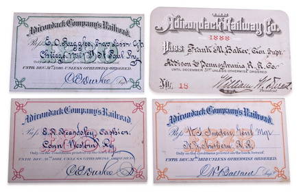
Four Adirondack Railroad Annual Passes - 1878, 1880, 1881, and 1888Rail & Road Auctions4.6(165)See Sold PriceMar 08, 2024
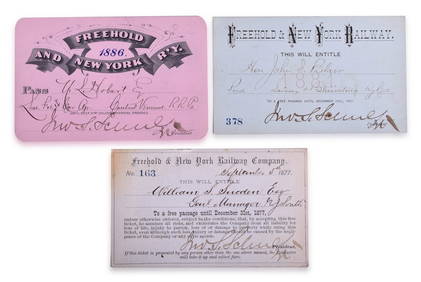
Three Freehold & New York Railway Annual Passes - 1877, 1881, and 1886Rail & Road Auctions4.6(165)See Sold PriceMar 08, 2024
1873 and 1877 Atlantic & Great Western Railroad Annual PassesRail & Road Auctions4.6(165)See Sold PriceMar 08, 2024
1867 Map of the Railroads of The State of New YorkRail & Road Auctions4.6(165)See Sold PriceMar 08, 2024
D'Entrecasteaux - Map of Australia (New Holland), New Zealand, and southern Asia and surroundingTrillium Antique Prints & Rare Books4.5(30)See Sold PriceFeb 24, 2024
Arrowsmith & Lewis - Map of PolynesiaTrillium Antique Prints & Rare Books4.5(30)See Sold PriceFeb 24, 2024
Arrowsmith & Lewis - Map of North AmericaTrillium Antique Prints & Rare Books4.5(30)See Sold PriceFeb 24, 2024
Arrowsmith & Lewis - Map of the World on Mercator's ProjectionTrillium Antique Prints & Rare Books4.5(30)See Sold PriceFeb 24, 2024
Arrowsmith & Lewis - Map of LouisianaTrillium Antique Prints & Rare Books4.5(30)See Sold PriceFeb 24, 2024
Arrowsmith & Lewis - Map of the United StatesTrillium Antique Prints & Rare Books4.5(30)See Sold PriceFeb 24, 2024
1816 MAP SOUTHERN PART OF RUSSIA or MUSCOVY in EUROPE copper engraving ANTIQUEJasper524.5(9.8k)See Sold PriceFeb 27, 2024
West Indies Islands. Guadaloupe. | Mariegalante &C. | Antigua.Jasper524.5(9.8k)See Sold PriceFeb 27, 2024
SOUTHERN AFRICA.Inset Ascension Is.; European colonies 1914;St Helena 1920 mapJasper524.5(9.8k)See Sold PriceFeb 28, 2024
Robert H Labberton - Map of The Territory of the Present United States - The territory of theProverde Auctions4.3(3)See Sold PriceFeb 28, 2024