SoldA Map of Britain, As it was Devided in the Tyme oA Map of "Britain, As it was Devided in the Tyme of the English Saxons...," John Speede, the original circa 1611 and later, hand colored engraving, framed and matted, "Britain, As It Was Devided in thSee Sold Price
SoldSpeed map of Saxon Britain 1611Heading: (Great Britain) Author: Speed, John Title: Britain as it was Devided in the Tyme of the Englishe-Saxons Especially during their Heptarchy Place Published: London Publisher:Sudbury & HumbleSee Sold Price
SoldSpeede map of Anglo-Saxon Britain, [ca. 1610-1646[Britain]. John Speede. Britain As It Was Devided In The Tyme Of The Enlishe Saxons Especially During Their Heptarchy. Double-page engraved map of England, Wales, and Scotland. Lon: John Sudbury and GSee Sold Price
SoldSpeed (John) Britain as it was Devided in the tymeSpeed (John) Britain as it was Devided in the tyme of the Englishe Saxons,map of Great Britain, strapwork cartouche containing title, inset coats of arms and 2 panels depicting Saxon leaders sSee Sold Price
SoldBritain as it was Devided in the Tyme of the EnglAuthor: Speed, John Copper-engraved map, hand-colored; flanked by figures of 14 kings (7 per side). Speeds map of early Britain, with the notable feature of depictions of 14 kings from the 6th and 7thSee Sold Price
SoldSpeed (John) - Britain As It Was Devided in the Tyme of1st issue, inset coats-of-arms and 2 panels depicting Saxon leaders such as Ethelbert, Edwin and Ethelwolfe, engraved map with original hand-colouring, 390 x 515mm., english text verso with woodcut inSee Sold Price
SoldSpeed (John) - Britain As It Was Devided in the Tyme ofstrapwork title cartouche, and two panels of 14 vignettes of Saxon Kings including Ethelbert, Edwin and Ethelwolf, engraved map with hand-colouring, 385 x 510mm., woodcut initial verso by William HallSee Sold Price
SoldBritish Isles.- Speed (John) Britain as it was DevidedBritish Isles.- Speed (John) Britain as it was Devided in the Tyme of the English Saxons especially during their Heptarchy, decorative map of the British Isles with compass rose and numerous rhumb linSee Sold Price
SoldBritish Isles.- Speed (John) Britain as it was devidedBritish Isles.- Speed (John) Britain as it was devided in the tyme of the Englishe Saxons especially during their Heptarchy, decorative map of the British Isles with compass rose and numerous rhumb liSee Sold Price
British Isles.- Speed (John) Britain as it was DevidedBritish Isles.- Speed (John) Britain as it was Devided in the Tyme of the English Saxons especially during their Heptarchy, decorative map of the British Isles with compass rose and numerous rhumb linSee Sold Price
SoldJohn Speed (1552-1629) British. "Britain, As it Was,John Speed (1552-1629) British. "Britain, As it Was, Devided in the Tyme of the Englishe Saxons Especially During their Haptarchy [sic]", Coloured Map, showing details on the reverse, 15" x 20".See Sold Price
*Emanuel Bowen Map of Great Britain & Ireland & oEmanuel Bowen unframed coloured engraving, Map of Great Britain & Ireland, 13 x 16 ins. a Map of Dunkirk and 7 assorted maps of France. THIS LOT IS SUBJECT TO 5% IMPORT DUTY ON THE HAMMER PRICE AND PRSee Sold Price
SoldJohn Speed (1552-1629) - Coloured engraving - Map of “John Speed (1552-1629) - Coloured engraving - Map of “Britain as it was devided.....”, 15ins x 19.75ins, published by Thomas Bassett & Richard Chiswell, in gilt moulded frame and glazedSee Sold Price
SoldSpeed (John) Britain As It Was Devided in the tymeSpeed (John) Britain As It Was Devided in the tyme of the Englishe Saxons especially during their Heptarchy,1st edition, British Isles and outline eastern Ireland, bordered with 7 cartouches oSee Sold Price
SoldSpeed (John) Britain As It Was Devided in the TymeSpeed (John) Britain As It Was Devided in the Tyme of the Englishe Saxons Especially During Their Heptarchy,with strapwork title cartouche, and 2 panels of 14 vignettes of Saxon Kings includinSee Sold Price
Speed (John) - Britain As It Was Devided in the Tyme ofBritain As It Was Devided in the Tyme of the Englishe Saxons Especially During Their Heptarchy, with strapwork title cartouche, and two panels of 14 vignettes of Saxon Kings including Ethelbert, EdwinSee Sold Price
MAP - Britain. CassiniBritain. Giovanni Maria Cassini, Le Isole Britanniche Antiche cioe' la Britannia Maggiore o sia Albione e la Britannia Minore o sia Ivernia, 1799 (dated). Hand Color. An attractive engraving of the BrSee Sold Price
SoldEngraved hand colored maps, Scotland, Britain(Lot of 3) Framed engraved hand colored maps, 18th and 19th centuries, ''O Rcadum et Schetlandiae,'' an English map, including Lincolnshire Derby, Stafford, Notingham, and ''The Occidental and OrientaSee Sold Price
Gray's Atlas Map Great Britain and Ireland.Title/Content of Map: Gray's Atlas Map Great Britain and Ireland. Cartographer: GRAY, ORMANDO W. Date: 1873 Publisher: O.W. GRAY & SON Size: 15.5Height - 11.75Width Map of the continent of Europe on rSee Sold Price
Silk textile map of Great BritainSilk textile map of Great Britain, 1816, embroidery on silk with reverse painted glass, fading, some discoloration. 17 1/2 x 13 1/2'' (o), or 15 5/8 x 14 7/8'' with glassSee Sold Price
Textile map of Great BritainTextile map of Great Britain, 1816, embroidery on silk with reverse painted glass, fading and some discoloration. 17 1/2 x 13 1/2'' (o), 15 5/8 x 14 7/8'' with glassSee Sold Price
SoldSPEED, JOHN. Britain As it was Devided.SPEED, JOHN. Britain As it was Devided. Double-page engraved map, 390x510 mm, margins apparently trimmed but ample, English text on verso; few short closed tears at edges with several just reaching inSee Sold Price
SoldSpeed (John) - Britain As It Was Devided in the Tywith strapwork title cartouche, and 2 panels of 14 vignettes of Saxon Kings including Ethelbert, Edwin and Ethelwolf, engraved map with hand-colouring, 385 x 510mm., English text verso with woodcut iSee Sold Price
SoldMap of the Anglo-Saxon Heptarchy. By J.Speed. PublishedMap of the Anglo-Saxon Heptarchy. By J.Speed. Published London, 1612-1627 Copperplate Engraving in Later Hand Colour. "Britain As It Was Divided In The Tyme Of Englishe: Saxons" From: Theatre Of The ESee Sold Price
Ohio and Pennsylvania RR 2nd Annual Report-March 4, 1850JM Hobby Supply and Railroad Artifact Auctions4.4(127)See Sold PriceFeb 24, 2024
General Books - Four Maps of Great Britain Designed by Matthew Paris About A.D. 1250TimeLine Auctions Ltd.4.6(183)See Sold PriceMar 08, 2024
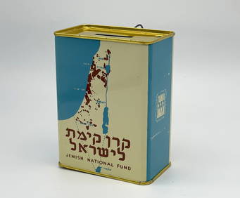
Jewish National Fund Collection Box - Great BritainLevy Auction House4.3(11)See Sold PriceFeb 27, 2024
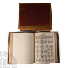
Numismatic Books - Rudding's Coinage of Britain Vol I-III, Plus SuplementTimeLine Auctions Ltd.4.6(183)See Sold PriceMar 09, 2024
WEST AFRICA Explorers' routes Senegal Ashanti. Mountains of Kong. SDUK 1857 mapJasper524.5(9.9k)See Sold PriceFeb 28, 2024
WEST AFRICA I Explorers' routes Senegal Ashanti Ivory Gold Coast. SDUK 1851 mapJasper524.5(9.9k)See Sold PriceFeb 28, 2024
WEST AFRICA showing early explorers' routes & Mountains of Kong. SDUK 1844 mapJasper524.5(9.9k)See Sold PriceFeb 28, 2024
[BATTLE OF BRITAIN]: CROWLEY-MILLING DENIS (1919-1996)International Autograph Auctions Europe S.L.4.4(52)See Sold PriceMar 14, 2024


![[BATTLE OF BRITAIN]: CROWLEY-MILLING DENIS (1919-1996) (1 of 2)](https://p1.liveauctioneers.com/1458/320148/172030843_1_x.jpg?height=282&quality=70&version=1708367366)


