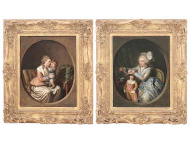
18TH C FRENCH PAINTINGS BY PIERRE ALEXANDRE WILLEAntique Arena Inc.4.5(878)See Sold PriceMar 09, 2024
A fine pair probably Bohemian Austria Amphora RSTK rococo bustsOstantix Auctions4.4(11)See Sold PriceFeb 28, 2024
Victorian Gilt Rococo Still Life Watercolour Signed L. Wells 1856Passion For Antiques4(24)See Sold PriceFeb 25, 2024
ORIGINAL MINIATURE OIL PAINTING FLOWERS VASEMarnie Collection Auction4.5(70)See Sold PriceMar 10, 2024
A Correct Map and Chart of the Peninsula of India, donePrinted for Wm Herbert, London, 1780 59 cm x 83 cm Laid paper, a light greenish gray. Title on lower right is in a decorative rococo cartouche festooned with flowers. Presents mountains, rivers, interSee Sold Price
Malham: Antique Map of the West India Islands, 1797Title/Content of Map: A Correct Chart of the West India Islands engraved for Malham's Naval Gazetteer Date Printed: 1797 Cartographer: Malham, John Size (inches): 9 x 7 Antique nautical chart showingSee Sold Price
Rollinson: A Correct Map Chart of the Baltic Sea, 1797Map: A Correct Chart of the Baltic Sea Maker: Spotswood and Nancrede, Rollinson Size: Octavo - 9.25 H x 7.30 W Inches Published: Boston, 1797 "Engraved for Malhams Naval Gazetteer. Rollinson sculpt. NSee Sold Price
SoldCorrect Chart of the Baltic Sea,Title/Content of Map: Correct Chart of the Baltic Sea, Date: 1797 Cartographer: ROLLINSON. Size: 9.25X7.3 "engraved for Malhams Naval Gazetteer. Rollinson sculpt. N. York." Please note that this lot hSee Sold Price
Correct Chart of the Southern Coasts of Africa,Title/Content of Map: Correct Chart of the Southern Coasts of Africa, Cartographer: ROLLINSON. Date: 1797 Publisher: SPOTSWOOD AND NANCREDE Size: 9.25Height - 9.1Width "from the Equator to the Cape ofSee Sold Price
SoldCorrect Chart of the West Coast of Africa,Title/Content of Map: Correct Chart of the West Coast of Africa, Date: 1797 Cartographer: CALLENDER, B. Size: 9.25X9.1 "Engraved for Malhams Naval Gazetteer." Please note that this lot has a confidentSee Sold Price
BRITISH EMPIRE Route Chart to India, Far East, Australia & New Zealand 1909 mapTITLE/CONTENT OF MAP: 'Route Chart to India and the East on Mercators projection' DATE PRINTED: 1909 IMAGE SIZE: Approx 24.5 x 33.5cm, 9.5 x 13.25 inches (Large); Please note that this is a folding maSee Sold Price
Correct Chart of the Southern Coasts of Africa,Title/Content of Map: Correct Chart of the Southern Coasts of Africa, Date: 1797 Cartographer: ROLLINSON. Size: 9.25X9.1 "from the Equator to the Cape of Good Hope. Engraved for Malhams Naval GazetteeSee Sold Price
SoldWilliam Faden "Map of the Peninsula of India…" 1792**Originally Listed At $300** William Faden (British, 1749-1836), "A Map of the Peninsula of India from the 19th Degree North Latitude to Cape Comorin, MDCCXCII" - published in London, 1792. An antiquSee Sold Price
SoldIndia.- Faden (William) A Map of the Peninsula of IndiaIndia.- Faden (William) A Map of the Peninsula of India from the 19th Degree North Latitude to Cape Comorin, impressive two sheet map of the Indian subcontinent, extending from Bombay and Aurungabad,See Sold Price
Sold-. Scott (F. H.) A Map of the Peninsula of India C-. Scott (F. H.) A Map of the Peninsula of India Comprising the Whole of the Madras Presidency and Portions of theAdjacent Territories of Bengal and Bombay, engraved map, outline colouring, diSee Sold Price
William Faden "Map of the Peninsula of India…" 1792William Faden (British, 1749-1836), "A Map of the Peninsula of India from the 19th Degree North Latitude to Cape Comorin, MDCCXCII" - published in London, 1792. An antique 2-sheet map of India, with oSee Sold Price
William Faden "Map of the Peninsula of India…" 1792**Originally Listed At $300** William Faden (British, 1749-1836), "A Map of the Peninsula of India from the 19th Degree North Latitude to Cape Comorin, MDCCXCII" - published in London, 1792. An antiquSee Sold Price
SoldWalker (J & C) Map of the Peninsula of IndiaWalker (John & Charles) engravers. Map of the Peninsula of India, comprising the whole of the Madras Presidency, and portions of the adjacent territories of Bengal and Bombay,second edition, eSee Sold Price
William Faden "Map of the Peninsula of India…" 1792**Originally Listed At $300** William Faden (British, 1749-1836), "A Map of the Peninsula of India from the 19th Degree North Latitude to Cape Comorin, MDCCXCII" - published in London, 1792. An antiquSee Sold Price
SoldFaden A Map of the Peninsula of IndiaFaden (William) A Map of the Peninsula of India from the 19th degree north latitude to Cape Comorin,second edition, engraved map on 2 sheets, unjoined, with original hand-colouring in outline,See Sold Price
Unknown, "A Map of the Peninsula of India containingUnknown, "A Map of the Peninsula of India containing the Coasts of Malabur and Coromandel," 1781, H. - 15 3/8 in., W. - 12 3/4 in.See Sold Price
SoldIndia.- Wyld (James) Map of the Peninsula of India,India.- Wyld (James) Map of the Peninsula of India, from the 19th Degree of North Latitude, to Cape Comorin, large two-sheet map of India with part of Ceylon in the lower right, engraving with some ouSee Sold Price
SoldIndia.- Wyld (James) Map of the Peninsula of India,India.- Wyld (James) Map of the Peninsula of India, from the 19th Degree of North Latitude, to Cape Comorin, large two-sheet map of India with part of Ceylon in the lower right, engraving with some ouSee Sold Price
The Peninsula of India. South sheet. Mysore TravancoreTITLE/CONTENT OF MAP: A map of the Peninsula of India, from the 19th degree north latitude to Cape Comorin [South sheet] The top image on the right hand side shows the entire map. To view a close up oSee Sold Price
Sold(INDIA.) Scott, Francis Henry. Map of the Peninsula of(INDIA.) Scott, Francis Henry. Map of the Peninsula of India, Comprising the Whole of the Madras Presidency, and Portions of the Adjacent Territories of Bengal and Bombay. Large extremely detailed hanSee Sold Price
The Peninsula of India. South sheet. Mysore TravancoreTITLE/CONTENT OF MAP: A map of the Peninsula of India, from the 19th degree north latitude to Cape Comorin [South sheet] The top image on the right hand side shows the entire map. To view a close up oSee Sold Price
SoldIndia.- Faden (William) A Map of the Peninsula ofIndia.- Faden (William) A Map of the Peninsula of India,engraved map with hand-colouring, on two sheets joined, 985 x 830mm., surface dirt and browning, some handling creases, repaired tears,See Sold Price
The Peninsula of India. North sheet. Marhatta NizamTITLE/CONTENT OF MAP: [A map of the Peninsula of India, from the 19th degree north latitude to Cape Comorin - North sheet] The top image on the right hand side shows the entire map. To view a close upSee Sold Price
New and Correct Map of North America With the West India Islands,Jasper524.5(9.9k)See Sold PriceFeb 27, 2024