4 map biblios by RV Tooley, plus 2 otherTitle: Four map bibliographies by Tooley, plus two others Author: Tooley, Ronald Vere Description: Includes: By Tooley: The Mapping of America. 3rd Impression. Holland Press, [1988]. * Collector's GuiSee Sold Price
Sold4 books (5 vols) References for maps of Africa et[Reference]. 4 Titles (5 Vols). 4to. Wraps except for last. Very good condition. ++ R.V. Tooley. Maps Of Africa: A Selection of Printed Maps from the Sixteenth to the Nineteenth Centuries. 2 Parts, ''See Sold Price
Sold6 map reference books (7v). Tooley, Skelton, othe[Reference]. 5 Titles (7 Vols). Vp:vp. 4to/Folio. First five in wraps, last two cloth in dj. Very good condition. ++ R.V. Tooley. Printed Maps Of America. 2 Parts. Vol 7, Nos. 68-69 of ''Map CollectorSee Sold Price
SoldNew Land. Four Years in the Arctic RegionAuthor: Sverdrup, Otto Description: 2 volumes. xvi, 496; xii, 504 pp. Plates & illustrations from photographs; folding map facing p.466 of Vol. II, plus 4 folding maps (on 2 sheets) loose in rear endpSee Sold Price
SoldUNION TOWNSHIP MAP PLUS 4 EARLY ENGRAVINGSUNION TOWNSHIP MAP PLUS FOUR EARLY ENGRAVINGS ALSO MAPS OF RUTHERFORD & CARLSTADT. MAP PAGES ARE 13 3/4 IN X 17 1/4 IN LARGEST ENGRAVING IS 5 1/2 IN X 6 3/4 INSee Sold Price
SoldAmerica.- Annual Register (The)..., vol.1-67 plus 2America.- Annual Register (The)..., vol.1-67 plus 2 Index vol., a few early vol. later editions, vol.6 (1763) with 4 folding engraved maps at end including 'A New Map of the British Dominions of NorthSee Sold Price
Seiroku, Noma. The Arts of Japan, 2 Volumes. TokySeiroku, Noma. The Arts of Japan, 2 Volumes. Tokyo. 1972-4. Folio, hard cover with dust jacket. Volume I: Ancient to Medieval. 1972. 236 pp. with 198 illustrations, many in full color, plus 4 maps; VoSee Sold Price
SoldCarli. Lettres Americaines. 1788Carli, Comte Giovanni R.: LETTRES AMERICAINES.... Paris. 1788. Two volumes. xxii, [2], 520; [4], 536pp. plus folding map. 8vo. Full period marbled sheep, boards rolled in gilt, labels and decoration tSee Sold Price
SoldMendelssohn.South African BibliographyMendelssohn (Sidney) South African Bibliography, 2 vol., ex-library copy with stamps, 1910 § Du Rietz (R.) Bibliotheca Polynesiana, Oslo, 1969 § Tooley (R.V.) Maps and Map-makers, New York, 19See Sold Price
Sold5 Framed Engravings and Map5 Framed Engravings and Map including; (4) 19th c. French engravings - Saint Roch, st Geneveir, both 14 3/4" x 18 3/4" Battle of Creary and Battle of Agincourt both 14" x 19 1/2", plus Topographical mSee Sold Price
SoldColton's Atlas of the World, Illustrating PhysicaAuthor: Colton, George W. Volume 1 only (of 2). With 61 hand-colored maps (2 are double-page), plus insets, and 1 plate with 4 maps not colored, all on 59 map-sheets; steel-engraved plate before titleSee Sold Price
SoldColton's Atlas of the World, Illustrating Physica2 volumes. Vol. I with 57 total hand-colored maps, 2 are double-page, plus insets, and 1 plate with 4 maps not colored. Vol. II with 35 total hand-colored maps and charts (2 are double-page), plus insSee Sold Price
SoldAntique Maps Reference x 12A collection of about a dozen books on antique maps including 1) Tooley: Maps and Map-Makers 2) Lister: Old Maps & Globes 3) Potter: Antique Maps 4) Gohm Maps and Prints 5) Investing in Maps 6) MorelaSee Sold Price
Sold(PA Turnpike) 41 cards + booklet on the Pennsylvani(PA Turnpike) 41 cards + booklet on the Pennsylvania Turnpike. 1940s. Includes 18 linen cards + 2 duplicates, 1 trip, and 4 of the map; 23 later "chromes", plus an accordian souvenir booklet of back tSee Sold Price
SoldHistory of Herodotus by Rawlinson finely boundTitle: The History of Herodotus Author: Rawlinson, George Description: 4 volumes. 2 folding maps, 1 folding diagram, plus numerous illustrations and maps within text. 21.5x14.5 cm. (8½x5½"), half blSee Sold Price
SoldHasted (Edward) A History and Topographical SurveyHasted (Edward) A History and Topographical Survey of the County of Kent,4 vol., first edition, 43 maps/plans plus 54 engraved plates only, contemporary half calf, vol. 1 & 3 recased, vol.See Sold Price
SoldLANG, CECIL. The Mighty Mahseer and Other Fis[LANG, CECIL.] The Mighty Mahseer and Other Fish; or, Hints to Beginners on Indian Fishing. Second Edition. By Skene Dhu [pseud.]. 25 plates (numbered 1-2 and 4-25 plus one unnumbered); folding map (pSee Sold Price
Sold3 map reference books: Tooley, LANDMARKS, 2 other[Reference]. 3 Titles. Folio. Hardcover in dj. Very good or better condition. ++ Landmarks Of Mapmaking. Selection by R.V. Tooley, text by Charles Brickner. (Oxford): Wordsworth, (1981). Several foldiSee Sold Price
SoldGoss / Tooley. 2 map reference books[Reference]. 2 Titles. Near fine in vg djs. ++ R.V. Tooley. The Mapping Of America. Index compiled by Douglas Matthews. (Lon): Holland Press, (1985). 4to. Covers dozens of 16th-19th century maps thatSee Sold Price
SoldWWII US KOREAN JAPANESE LOT FLAGS MAPS PLUS WW2WWII lot to include 1) Small, very well made Australian silk flag measuring 12 X 17 inches 2) US Army Air Corps silk pillow shame for MacDill Field 3) US Navy Pillow Shame titled Sweetheart 4) US ArmySee Sold Price
Sold1753 Homann Map Of ScandinaviaJ. Homann, 1753 Nurnberg, 19.2 x 22.4 in. Beautiful map of Scandinavia, the Baltic States plus parts of Russia to Moscow. As is typical of Homann maps, there is a fantastic amount of topographical andSee Sold Price
SoldCanada C1880's Lot of 7 Antique Maps by Letts, BaconSet of 4 on 4 sheets, plus 1 general map. Lithograph Maps Published 1880's, London for "Letts's Popular Atlas" Together with 2 others by Bacon. Paper Size: up to 17 x 14 inch (43 x 36cm) Good conditioSee Sold Price
Early Golf at Edinburgh & Leith: The Account BookAuthor: Hamilton, David Description: 2 editions. Each being: [4], 51 pp. Illustrated with 3 mounted folding plates including a photo, a facsimile page and a map; plus a woodcut vignette. One copy bounSee Sold Price
SoldTravel Hand-Books 19th Century (3)Group of three nineteenth century travel handbooks. Includes: 1) Baedeker's Northern Germany. 1873. 294 pp. plus maps. Measures 6.375 in. x 4.25 in. x .75 in. 2) Murray's Hand-Book Northern Italy. 189See Sold Price
Illinois Central RR October 2, 1901 Public TimetableJM Hobby Supply and Railroad Artifact Auctions4.4(127)See Sold PriceFeb 24, 2024
(3) SMALL CANTON COVERED SERVING BOWLSThomaston Place Auction Galleries4.4(393)See Sold PriceFeb 24, 2024
(6) VINTAGE CHINESE FOLDING FANS (2 IN LACQUERED BOXES)Thomaston Place Auction Galleries4.4(393)See Sold PriceFeb 24, 2024
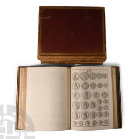
Numismatic Books - Rudding's Coinage of Britain Vol I-III, Plus SuplementTimeLine Auctions Ltd.4.6(183)See Sold PriceMar 09, 2024
Lot of 3 Large Imari Porcelain plate plus 2 small lided dishes made in JapanAuction Wallstreet4.5(51)See Sold PriceMar 02, 2024
Rand McNally Railroad Map Cabinet w/ 21 Railroad MapsRail & Road Auctions4.6(165)See Sold PriceMar 08, 2024
BENRUS x BEAMS PLUS TYPE 2 CLASS A Stainless Steel Mens Watch Pre-OwnedBidhaus4.3(762)See Sold PriceFeb 26, 2024
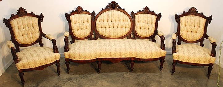
Exceptional Matching 7 Piece John Jeliff Victorian Parlor SuiteRalph Fontaine Heritage Auctions Inc.4.7(236)See Sold PriceFeb 25, 2024
Hiroto Norikane (B. - 1948): black Cat - 20 (Facination -2)Jasper524.5(9.9k)See Sold PriceFeb 28, 2024
Hiroto Norikane (B. - 1948): Black Cat - 20 (Facination -1)Jasper524.5(9.9k)See Sold PriceFeb 28, 2024
1856 ARCTIC EXPLORATIONS 2nd GRINNEL EXPEDITION 2 v. E.KANE antique ILLUSTRATEDJasper524.5(9.9k)See Sold PriceFeb 27, 2024
Grande Baroque Wallace Sterling Silver Long Lobster Seafood Set Wilton PlatterMynt Auctions4.6(697)See Sold PriceFeb 26, 2024
THE ANTIQUE ILLUSTRATED BOOK "1856 ARCTIC EXPLORATIONS: SECOND GIRNEL EXPEDITION 2" BY E. KANENY Elizabeth 4.2(86)See Sold PriceMar 03, 2024
1792 OLD INDIA HISTORY ANTIQUE ILLUSTRATED WITH MAPS OF THE EIGHTEENTH CENTURY IN FRENCHNY Elizabeth 4.2(86)See Sold PriceMar 03, 2024