Sold3 maps of Russia/Empire, c1561-1778[Russia]. 3 engraved maps, very good condition. ++ Girolamo Ruscelli. Moschovia Nuova Tavola. Double-page, slight tone in center fold, some reinforcement on verso. [Venice, c1561]. 7 x 9 1/4 in. ShowsSee Sold Price
Sold3 Southern Maps, incl. 2 Antonio Zatta 1778, SC 1796Three (3) Southern Maps, including two (2) Antonio Zatta 1778, one (1) South Carolina 1796. 1st-2nd items: Two (2) Antonio Zatta (Italian, fl. 1757-1797) maps of Virginia, Maryland, and the Carolinas,See Sold Price
Sold3 Maps, incl: L’Ancien Et Le Nouveau Mexique...[North America/Mexico]. 2 Maps. ++ Rigobert Bonne. L’Ancien Et Le Nouveau Mexique, Avec La Floride Et La Basse Louisiane Partie Occidentale. [Ca. 1778 - 1780’s]. Map number “117” in margin atSee Sold Price
3 maps of Alaska and Bering's Strait by BonneTitle: Three maps of Alaska and Bering's Strait Author: Bonne, Rigobert Description: Includes: Carte de la Côte N.O. de l'Amerique et de la Côte N.E. de l'Asie, reconnues en 1778 et 1779. Les PartieSee Sold Price
SoldSaabye (Hans Egede) Greenland: being extracts froSaabye (Hans Egede) Greenland: being extracts from a Journal...1770 to 1778...translated from the German, first English edition, folding map, 3 pp. adbertisments at enf, bookplate of Canford SSee Sold Price
Zatta: Map of Jamaica, 1778Map: La Giammaica Cartographer: Zatta Place & Date: Venice / 1778 Size: 16 3/4" x 12 1/2" The splendid map of Jamaica on a scroll from Zatta's 1778 12-sheet version of Mitchell's landmark map of NorthSee Sold Price
Zatta: Antique Map of Jamaica, 1778Map: La Giammaica Cartographer: Zatta Place & Date: Venice / 1778 Size: 16 3/4" x 12 1/2" Condition: outline color; light overall age toning The splendid map of Jamaica on a scroll from Zatta's AtlantSee Sold Price
Sold1778 Engraved Map of North American by ZattaAntonio Zatta (1757-87), Italy. The piece is well-executed and detailed showing details of the United States and Canada. Good overall condition. Sight size: H13 1/8" W18 3/4" (without the frame)See Sold Price
SoldM. De SartineM. De Sartine , "Carte D'Une Partie Des Côtes De La Floride et de la Louisiane Contenant Le Cours du Mississippi", 1778, engraved map, 17 1/2 in. x 24 1/2 in., sight 15 3/4 in. x 23 1/4 in., attractiSee Sold Price
Zatta: Antique Map of Majorca & Ibiza, 1778Map: Isole di Majorca, d'Ivica, et di Formentera Cartographer: Zatta Place & Date: Venice / 1778 Size: 16 3/8" x 12 1/2" Condition: outline color for the islands; wash for the cartouche. light overallSee Sold Price
SoldCarte de Troubles de L'AmériqueCarte de Troubles de L'Amérique Engraved map with hand-coloring, 1778. 28 x 20 3/4 in. (sight), 34 1/2 x 27 1/2 in. (frame).See Sold Price
Sold-. Hasted (Edward) The History and Topographical S-. Hasted (Edward) The History and Topographical Survey of the County of Kent,vol. 1-3, only, of 4, maps and plates, contemporary calf, rubbed, boards detached, folio, Canterbury, 1778-1780; sSee Sold Price
SoldThe History of America, William Robertson[Leather Bindings], The History of America, William Robertson, 2 volumes, 1778, with four maps by Thomas Kitchin, and The History of the Reign of the Emperor Charles V..., 3 volumes, 1769, all 5 volumSee Sold Price
SoldZatta PARTIE OCCIDENTALE DELLA NUOVA FRANCIA O CANADADetails: ZATTA, Antonio (fl.1757-1797). La Partie Occidentale della Nuova Francia o Canada. Venice: Antonio Zatta, [1778-1788]. Engraved map, period hand-colouring in outline. Sheet size: 14 3/4 x 22See Sold Price
Zatta: Antique Map of Majorca, Ibiza & Formentera, 1778Map: Isole di Majorca, d'Ivica, et di Formentera Cartographer: Zatta Place & Date: Venice / 1778 Size: 16 3/8" x 12 1/2" Condition: outline color for the islands; wash for the cartouche. light overallSee Sold Price
Sold2 maps: Delaware Bay/River & Hudson River, 1778.[United States: Mid-Atlantic]. M. de Sartine. 2 engraved maps on one sheet. (1) Carte De La Baye Et Riviere De Delaware. 22 1/2 x 16 3/8. With 8 paragraphs of French text. (2) Carte De L'Entree De LaSee Sold Price
SoldGrouping of 18th Century Indentures-Furnace Related.Grouping of 9 velum indentures related to Warwick and Reading Furnaces in Pennsylvania. Documents date: 1761, 1778, 1779(2), 1782(2), and 1792(3). Sold with vellum draught map showing Warwick furnaceSee Sold Price
Zatta: Map of Acadia and New England, 1778Map: L'Acadia, le Provincie di Sagadahook e Main, la Nuova Hampshire, la Rhode Island, e parte di Massachusset e Connceticut Cartographer: Zatta Place & Date: Venice / 1778 Size: 16 3/4" x 12 1/2" ConSee Sold Price
SoldTwo Maps by Rigobert Bonne (1727-1794, Paris), "CarteTwo Maps by Rigobert Bonne (1727-1794, Paris), "Carte de la Louisiane et de Floride," 1778, Mounted, H. - 15 3/4 in., W. - 10 in., (2 Pcs.)See Sold Price
SoldHAND COLORED MAPS OF CANADAHAND COLORED MAPS OF CANADA, INCLUDING ONE ATTRIBUTED TO CARY'S "ATLAS", 2, C. 1778-1800:19" x 23 1/4" and 11 3/4" x 15 1/2"; unframed. Ex. Collection Nancy and the late G. Mennen Williams.See Sold Price
Sold[Baskerville Imprint] Characteristicks of Men, 1778Shaftesbury, Anthony Ashley Cooper, Earl of. CHARACTERISTICKS OF MEN, MANNERS, OPINIONS, TIMES. IN THREE VOLUMES. THE FIFTH EDITION. Birmingham: John Baskerville, 1778. 3 vols, with engraved portraitSee Sold Price
SoldTHOMAS KITCHIN (ENGLISH 1718-1784) ENGRAVED MAP OFTHOMAS KITCHIN (ENGLISH 1718-1784) ENGRAVED MAP OF MEXICO AND NEW SPAIN FROM ROBERTSON HISTORY OF AMERICA 1778. SIGHT 11 X 14 3/4"; FRAMED AND GLAZED 16 1/2 X 20 1/4"See Sold Price
Vintage Map of D' AwfoskeeVintage Map of D' Awfoskee Vintage map of D' Awfoskee river in South Carolina. Written in French. Address marked: ""Chez le Rouge; Rue des Gds Augustine, 1778."" 30'' L x 21 3/4'' WSee Sold Price
Sold1 piece. Hand-Colored Engraved Map. Depot General1 piece. Hand-Colored Engraved Map. Depot General de la Marine, pub. Carte d'Une Partie de Cotes de la Floride et de la Louisane." [Paris], 1778. 17 1/4 x 23 3/4 inches; 438 x 603 mm, trimmed to 1 plaSee Sold Price
DUNLEVIE c1856 Map Counties Of Gaspe & Bonaventure Quebec Canada SCARCE! #1Luis Porretta Fine Arts4.3(10)See Sold PriceMar 02, 2024
United States Map with American Flag 3-D Wall Mount PaintingWeatherham Estate Treasures3.9(157)See Sold PriceFeb 29, 2024
1938 American Armies and Battlefields by the American Battle Monuments CommissionNorth American Artifact Auctions4.6(182)See Sold PriceApr 20, 2024
Chatelain - 3 Maps of the British Isles (England, Ireland, Scotland)Trillium Antique Prints & Rare Books4.5(30)See Sold PriceFeb 24, 2024
1675 ELZEVIER JULIUS CAESAR antique ILLUSTRATED w/ MAPS ROMAN HISTORYJasper524.5(9.8k)See Sold PriceFeb 27, 2024
1738 BIBLE in DUTCH ILLUSTRATED w/ MAPS antique MASSIVE FOLIO BIBLIAJasper524.5(9.8k)See Sold PriceFeb 27, 2024
Emory's Notes of a Military Reconnoissance larger issuePBA Galleries4.7(381)See Sold PriceMar 07, 2024
ANTIQUE 1686 OPERA OMNIA BY JOHN LIGHTFOOT TELLIMA BOUND FOLIO WITH ISRAEL MAPNY Elizabeth 4.3(84)See Sold PriceMar 03, 2024
Set of 3 Maps - Netherlands - Belgien - Switzerland - J. BarlowProverde Auctions4.3(3)See Sold PriceFeb 28, 2024
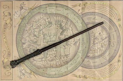
Universal Studios Harry Potter Wand BRapid Estate Liquidators and Auction Gallery4.5(1.1k)See Sold PriceFeb 28, 2024
Virginia and West Virginia Topography MapsRapid Estate Liquidators and Auction Gallery4.5(1.1k)See Sold PriceFeb 28, 2024


![[Baskerville Imprint] Characteristicks of Men, 1778 (1 of 8)](https://p1.liveauctioneers.com/3532/129264/65744573_1_x.jpg?height=282&quality=70&version=1539223604)