Marc Chagall-Limited Edition -Paris Opera Ceiling after ChagallArt Legacy Auctions4.5(223)See Sold PriceFeb 24, 2024
Salvador Dali Pantagruel Limited Edition Lithograph Hand signed and numberedArt Legacy Auctions4.5(223)See Sold PriceFeb 24, 2024
Pablo Picasso Bouquet of Peace Collection Domaine Picasso Limited Edition on paper.Art Legacy Auctions4.5(223)See Sold PriceFeb 24, 2024
A RARE MAXFIELD PARRISH JACK AND THE BEANSTALK PRINTSoulis Auctions4.8(953)See Sold PriceFeb 24, 2024
LARGE MECHANICAL PRINT 'STARS' AFTER MAXFIELD PARRISHSoulis Auctions4.8(953)See Sold PriceFeb 24, 2024
Heinrich Aldegrever, etc. 15 old master prints. 16th-17th centuries. Aldegrever works include "ManTremont Auctions4.5(297)See Sold PriceFeb 25, 2024
Sold6 19th c. hand-colored maps of Asia6 19th c. hand-colored maps of Asia- ''Map of Asia Showing Its Political Divisions''; ''Map of Hindoostan, Farther India, China and Tibet''; ''China''; ''Asia'' (2 copies); Russia in Asia and Tartary'See Sold Price
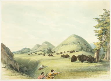
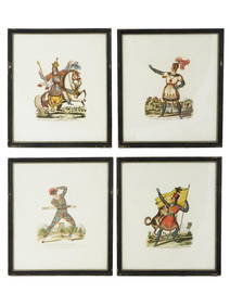
SoldBX FRAMED ITEMS 18TH C HANDCOLORED 2 ENGR OF A BULL ANDBX FRAMED ITEMS 18TH C HANDCOLORED 2 ENGR OF A BULL AND GOAT ENGR OF HORSES, 19TH C T. DOUGHTY HAND COLORED LITHO OF A GREAT TAILED SQUIRREL, 19TH C HAND COLORED LITHO OF PUPPIESSee Sold Price
SoldMAPS, 2, 19TH C., 12" X 16", CANADA & MICHIGANMAPS, TWO, 19TH C., 12" X 16", CANADA & MICHIGAN:Including 1 engraved by J. & C. Walker, "North America: Sheet V, The North West and Michigan Territories", published by Baldwin & Cradock, 1833, 12 1/2See Sold Price
SoldHAND COLORED MAPS OF CANADAHAND COLORED MAPS OF CANADA, INCLUDING ONE ATTRIBUTED TO CARY'S "ATLAS", 2, C. 1778-1800:19" x 23 1/4" and 11 3/4" x 15 1/2"; unframed. Ex. Collection Nancy and the late G. Mennen Williams.See Sold Price
Sold19th C.French Hand Colored Litho "Pendule de Gaudro19th C.French Hand Colored Litho "Pendule de Gaudron". A fine hand colored litho of a Mantel Clock.Litho is app.7 1/2" x 10 1/2" sight, Frame is app.21" x 18".See Sold Price
SoldPair 19th C.French Hand Colored Litho of Antique ChPair 19th C.French Hand Colored Litho of Antique Chairs. A fine pair of framed lithos. Each is app.5 1/2" wide and app.7 1/4". Frames are app.14" x 25 1/2" tall.See Sold Price
SoldAntique French Map of St. AugustineAntique French Map of St. Augustine, "Plan de la Ville et Port de St. Augustin", late 18th/early 19th c., hand-colored engraved map, sight 8 1/2 in. x 12 in., framed. Provenance: Estate of Faith K. TiSee Sold Price
Sold3 PC 19th c. HAND COLORED PA ENGRAVINGS + MAP1- Map of Pennsylvania from Johnson's Universal Cyclopedia c 1880s. Matted 19"x16". 2- Mauch Chunk and Mount Pisgah Hand Colored Wood engraving, 1872-74. Matted 12"x15". 3- The New Market Street BridgSee Sold Price
SoldA. Finley, Map of Louisiana, 19th c., hand-colored,A. Finley, Map of Louisiana, 19th c., hand-colored, framed, H.- 9 in., W.- 11 1/2 in.See Sold Price
SoldHand-Colored Map of Paris, 19th c. or later, 1564 orig.Hand-Colored Map of Paris, 19th Century or later reproduction, after the original dated 1564(SBAR2349) {PR} Measurements: Framed: 15" x 17 1/2" Condition: poorly engraved and paper badly browned.See Sold Price
Handcolored Ladies Fashion Litho 19th C FramedFrame Dims: 18 1/2" by 16 1/2" Image: 11" by 8 1/2"See Sold Price
Handcolored Ladies Fashion Litho 19th C FramedFrame Dims: 18 1/2" by 16 1/2" Image: 11" by 8 1/2"See Sold Price
SoldTwo Maps by Johnson & Ward, consisting of "Prussia,Two Maps by Johnson & Ward, consisting of "Prussia, Norway, Sweden, and Denmark," 19th c., hand colored, H.- 26 1/2 in., W.- 18 1/4 in.; together with Johnson & Ward, "West Indies," 1863-1866, hand coSee Sold Price
SoldMAP OF NEW ENGLAND AND NEW YORK BY ROBERTMARDEN, LATE 18TH OR EARLY 19TH C, HAND COLORED, EXCELLENT CONDITION. NEW FRAME, MAT AND UV GLASS. SIGHT SIZE 7" X 6", OVERALL 16 1/2" X 14 3/4".See Sold Price
Sold19thc Hand-colored Harper's Weekly Engravings, St.Pair of 1861 Harper's Weekly pages with hand-colored maps & engravings of river boats, The Mississippi River, St Louis & Jefferson City. Four hand-colored engravings total between 2 pages dated July 6See Sold Price
SoldTen Antique Maps of MississippiTen Antique Maps of Mississippi, 19th c., nine hand-colored, incl.: Arrowsmith & Lewis, 1812; Lucas Jr., 1823; Tanner, 1839; Bradford, 1835; Finley, 1827; Stone, 1839; and others, largest 11 1/2 in. xSee Sold Price
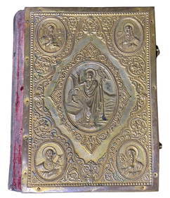
SoldLATE 19TH C. FRENCH FOLDING HAND FANGilt and Reticulated Opera Fan with hand colored litho and giltwork paper top covering, one end stick mounted with a tiny oval mirror, 10 1/2" x 20" when opened. Old repairs to end sticks, paper splitSee Sold Price
6 18th/19th C. Hand Colored Engraved MapsLot of six 18th/19th century hand colored engraved maps of Milanese states, Northern Asia, England and Wales, Turkey, Canada and Nova Belgica et Anglica, largest measures 21 1/4" h x 27" w. ProvenanceSee Sold Price
SoldTwo 19 C. Hand Colored Hondius Astrological MapsTwo late 19th Century hand-colored astrological maps (Henricus Hondius), 16 1/2" x 19" and 23 1/2" x 25 1/2", note watermark.See Sold Price
Sold(2) JOHN TALLIS ATLAS MAPS NORTH & SOUTH AMERICA(lot of 2) Framed hand-colored engravings on paper, maps of North and South America, mid 19th c., published in John Tallis's "Illustrated Atlas," drawn and engraved by John Rapkin, with illustrated viSee Sold Price
Sold19th c. Map19th c. map of New York, H.S. Tanner, hand-colored lithograph. Sight 12 1/2" x 15 1/4".See Sold Price
SoldPlanisphaerium Arteum Celestial MapFramed late 19th/ early 20th c. [after] Andreas Cellarius 12" x 15" hand colored engraved re-strike celestial map "Planisphaerium Arteum", overall size framed is 17 1/2" x 21". CONDITION: Map has no dSee Sold Price
Sold(16) 19TH C. MAPS OF THE WEST INDIES IN FOLIO,Including: "L'Isle de Ste. Domingue, et celle de Porto Rico", by Bonne, hand colored engraving,1778, 10" x 14 1/2"; PLUS "West Indies", Smith's Atlas, 1808, hand colored engraving, 1808, 11" x 14"; PLSee Sold Price
Sold(2) FRAMED MAPS - PROUTS NECK, MAINE & COUNTY MAYO,Lot of (2) Maps, incl: Map of Prouts Neck, Maine, 1976 by Yvonne L. O. Dickson, hand colored, with houses and historical highlights, in a gilded wooden frame, 24" x 28", glass cracked; and 19th c. MapSee Sold Price
(13) 19th C. Prints Great Homes of Britain PrintsEpic Auctions and Estate Sales4.6(210)See Sold PriceMar 02, 2024
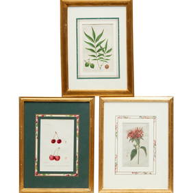
Pr. English 19th C. Floral Botanical PrintsEpic Auctions and Estate Sales4.6(210)See Sold PriceMar 02, 2024
Willem Blaeu, Etc. 17th C. Antiquarian Maps, 2Auctions at Showplace4.6(740)See Sold PriceMar 17, 2024
Map: A 19thC engraved and hand coloured map of South America. Published by the Society for theClaydon Auctioneers Ltd4.3(125)See Sold PriceFeb 26, 2024
Map: A 19thC engraved map titled Gloucestershire from the Best Authorities, after John Cary. Approx.Claydon Auctioneers Ltd4.3(125)See Sold PriceFeb 26, 2024
1816 MAP SOUTHERN PART OF RUSSIA or MUSCOVY in EUROPE copper engraving ANTIQUEJasper524.5(9.9k)See Sold PriceFeb 27, 2024
4 FRAMED HAND COLORED 19THC. ITALIAN ENGRAVINGS IN 2 FRAMES. ROME, FLORENCE, CAPO DI MONTE (28 1/4"Carlsen Gallery, Inc.4.6(164)See Sold PriceMar 03, 2024
Two Hand-Colored 19th Century Maps of New Orleans and Louisiana, Larger- H.- 12 1/2 in., W.- 15 1/2Crescent City Auction Gallery4.3(231)See Sold PriceMar 08, 2024
T. Rowlandson (19th C) Hand Colored Engravings (2)Keystone Auction LLC4.6(934)See Sold PriceMar 01, 2024
Rare 19thc Colton Map, Argentine Republic, Chile, Uruguay, PataguayConnoisseur Auctions3.9(336)See Sold PriceMar 16, 2024