18th C. Schreiber Maps incl. California as Island. (5)18th C. Schreiber Maps; circa 1750, nicely handcolored, matted, and framed; includes the World Atlas, America; Asia; Europe; and Africa. Note: Johann Georg Schreiber, a German cartographer and geograSee Sold Price
Sold18th C. Schreiber Maps incl. California as Island.18th C. Schreiber Maps incl. California as Island. circa 1750, nicely handcolored, matted, and framed; includes the World Atlas, America; Asia; Europe; and Africa. Note: Johann Georg Schreiber, a GermSee Sold Price
SoldTwo 18th/19th C. MapsTwo 18th/19th C. maps "Island of Tobago" from actual survey by "Thos Bowen" 1779; "Island of Dominca" by "Thus Bowen" both with French mat and gilt wood frames, both 9.5" x 7.5" sight size.See Sold Price
SoldEngraved map, Herman Moll, AmericaFramed hand-colored copper engraved map, ''America,'' c. 1732, by Herman Moll (German, 1654-1732), a depiction of North and South America with California depicted as an island, sight: 10.5''h x 8.25''See Sold Price
SoldLot of 5 Russia related maps, 18th c. and 19th c.Assorted maps relating to Russia, 5 items. 1st item - Map titled "The Northern Archipelago of New Difcover'd Islands in the Seas of Kamtschatka & Anadir" by T. Bowen, published by London Mag. May, 177See Sold Price
De Fer world map with insular California 1714Title: Mappe-Monde ou Carte Universelle par N. de Fer Author: De Fer, Nicolas Description: Copper-engraved map. Engraved by C. Inselin. 22.5x33.5 cm. (9x13¼").World map with California an island. TheSee Sold Price
SoldDe Fer world map with insular California 1714Title: Mappe-Monde ou Carte Universelle par N. de Fer Author: De Fer, Nicolas Description: Copper-engraved map. Engraved by C. Inselin. 22.5x33.5 cm. (9x13¼").World map with California an island. TheSee Sold Price
SoldAllard Map of America with California as Island, 1697Map: Allard Map of America with California as Island - Recentissima Novi Orbis sive Americae Septentrionalis et Meridionalis Tabula Cartographer: C. Allard Date: ca. 1697 Size: 19 x 22.5 inches Nice lSee Sold Price
SoldMark Catesby, "A Map of Carolina, Florida, and theMark Catesby, "A Map of Carolina, Florida, and the Bahama Islands," with the adjacent parts, 20th c., colored print after the 18th c. original, H.- 18 in., W.- 23 5/8 in.See Sold Price
Sold5 RARE H/C MANUSCRIPT/ACTUAL SURVEY MAP STOCKPORT NYLOT (5) RARE H/C MANUSCRIPT ACTUAL SURVEY MAP STOCKPORT NY W/ SECTION, BLOCK & LOT NAMED INCL. DELAWARE RIVER; ROAD TO FORT PENN, 18TH C. 19" X 24" W/ MANUSCRIPT LETTER TO SAMUEL PRESTON AUTHORIZING ASee Sold Price
5 - 17/18 C Etchings: Maps, Cities, Isfahan, ect.5 - 17th/18th Century Etchings of Maps, Cities, Battles: an Italian hand-colored folio map with center fold of the Island of Sardinia, "Isola Di Sardegna", A detailed view of Naghsh-e Jahan Square inSee Sold Price
SoldVan der Aa's Amerika California an IslandTitle: Amerika of de Niewe Weereld aller eerst door C. Kolumbus ondeckt en bevaren, int aer 1492 Author: Aa, Pieter van der Description: Copper-engraved map, later hand-coloring. 15.5x22.5 cm. (6x8-7/See Sold Price
Sold3 18th C. maps incl. R. Vaugondy and J. BaylyItem 1: Robert de Vaugondy hand colored map "Amerique septen trionale." French, 1750. 6 3/8" H x 6 1/2" W. Item 2: Robert de Vaugondy hand colored map "Mappe Monde" French, 1750. 6 3/8" H x 12 1/8" W.See Sold Price
SoldGroup of late 18th c./early 19th c. unframed maps incl.Group of late 18th c./early 19th c. unframed maps incl. some by Strahan & Cadell, J. Gibson, T. AikenSee Sold Price
18TH C. MAPS OF W. INDIES ISLANDS, 218TH C. MAPS OF W. INDIES ISLANDS, 2, ONE BY S. BELLIN, 18" X 25" - 23" X 25":All hand colored and unframed. S. Bellin, map of St. Lucia, No. 80, 1763, signed, c. 23" x 25 1/4" plate and paper; Map diSee Sold Price
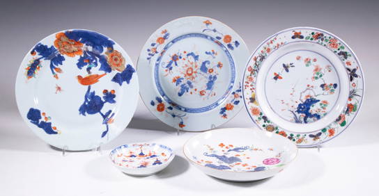
SoldChinese Export Famille Rose Porcelain TablewaresThree Chinese Export Famille Rose Porcelain Tablewares, 18th c., incl. covered teapot, h. 5 1/4 in.; covered cream jug, h. 5 1/4 in.; and gravy boat, l. 7 1/2 in. (3 pcs.)See Sold Price
Sold18th c Hand Drawn Map of Rhode Island18th c hand drawn & hand colored map of Rhode Island, framed, sight 9" x 7", folds, slight tearsSee Sold Price
Sold18TH C ENGRAVED MAP OF THE VIRGIN ISLANDS18TH C ENGRAVED MAP OF THE VIRGIN ISLANDS Map engraving of the Virgin Islands for the History of the West Indies by J Stockdale, 18th century. Size: 7 x 9"See Sold Price
SoldThree European Hand-Colored MapsThree Antique European Hand-Colored Maps , 18th c., incl.: "The Countie and Citie of Lyncolne Described with the Armes...", 15 in. x 20 in.; "Istria olim Iapidia", 15 in. x 19 1/2 in.; and "PrincipatuSee Sold Price
SoldThree Antique New Orleans MapsThree Antique New Orleans Maps, 18th c., incl. 2 from Bellin's Petit Atlas Maritime and one published by London Magazine, sights 7 1/2 in. x 9 in. to 8 1/2 in. x 11 3/4 in., framed alikeSee Sold Price
SoldExport Famille Rose Porcelain Tea ArticlesGroup of Chinese Export Famille Rose Porcelain Tea Articles, 18th c., incl. 4 saucers, dia. 4 5/8 in. to 4 7/8 in.; 2 teacups, dia. 2 3/4 in. and 3 1/2 in.; and a sugar bowl (lacking lid), dia. 3 1/8See Sold Price
c. 1636 America Map with California as an IslandHistoric Maps c. 1636 First State "America Septentrionalis" by Henricus Hondius Impressively Designed Map, California as an Island c. 1636 First State Map, "America Septentrionalis" by Henricus HondiuSee Sold Price
Soldc. 1730 MAP of America With California an IslandHistoric Maps Seutter’s Map of the Americas with California as an Island c. 1730 Colonial Era, Historic Hand-Colored Map titled, “NOVUS ORBIS SIVE AMERICA MERIDIONALIS ET SEPTENTRIONALIS...” bySee Sold Price
Sold5 Sheets of Maps incl: Islands in the Atlantic.[Central America/Various Islands]. 5 Sheets of Maps. Largest: 24 1/8” x 20 ¼”. Smallest: 15 ¾” x 12 ½”. Color (usually printed). Good to very good. ++ 1 Sheet, containing 3 Maps: Bahama IslSee Sold Price
18TH C. ENGLISH PEWTER PLATES & PLATTERS BY ROBERT NICHOLSONThomaston Place Auction Galleries4.4(393)See Sold PriceFeb 24, 2024
LATE 17TH C. FRENCH MAP OF THE NEW WORLD BY ALEXIS-HUBERT JAILLOT (1632-1712)Thomaston Place Auction Galleries4.4(393)See Sold PriceFeb 24, 2024
EARLY 18TH C. DUTCH CHART OF PACIFIC OCEAN BY FREDERIK DE WIT (1629-1706) WITH CALIFORNIA AS ANThomaston Place Auction Galleries4.4(393)See Sold PriceFeb 24, 2024
Le Canal de Mosambique, l'Isle de Madagascar… Mozambique. Africa. BONNE 1788 mapJasper524.5(9.9k)See Sold PriceFeb 28, 2024
Le Canal de Mosambique, l'Isle de Madagascar… Mozambique. Africa. BONNE 1790 mapJasper524.5(9.9k)See Sold PriceFeb 28, 2024
Partie Occidentale de l'Ancien Continent… W Africa Macaronesia. BONNE 1780 mapJasper524.5(9.9k)See Sold PriceFeb 28, 2024