Sold18th C. Engraved Map of "Anglesey"18th century, engraved map of "Anglesey", by John Speed, 15 1/2"h x 20 1/2"w (sight).See Sold Price
Sold18TH C ENGRAVED MAP - "Partie de l"Amerique18TH C ENGRAVED MAP - "Partie de l"Amerique Septentrionale.. le Cours de l'Ohio, la Nlle Angleterre; la Nlle York, le New Jersey, la Pensylvanie, le Maryland, la Virginie, la Caroline" de Vaugondy 175See Sold Price
Sold(2) 18TH C ENGRAVED MAPS - 'Hollandia Comitatus' by(2) 18TH C ENGRAVED MAPS - 'Hollandia Comitatus' by Willem Janszoon Blaeu (1571-1638), Amsterdam, circa 1635. The upper right corner inset with map of the isles Texel, Vlieland and Terschelling; PLUSSee Sold Price
Sold18TH C ENGRAVED MAP OF THE VIRGIN ISLANDS18TH C ENGRAVED MAP OF THE VIRGIN ISLANDS Map engraving of the Virgin Islands for the History of the West Indies by J Stockdale, 18th century. Size: 7 x 9"See Sold Price
(2) 18TH C ENGRAVED MAPS - 'Hollandia Comitatus' by(2) 18TH C ENGRAVED MAPS - 'Hollandia Comitatus' by Willem Janszoon Blaeu (1571-1638), Amsterdam, circa 1635. The upper right corner inset with map of the isles Texel, Vlieland and Terschelling; PLUSSee Sold Price
Sold18th C. Engraved Map of "Denbighshire"18th century, engraved map of "Denbighshire", by John Speed, 15 1/2"h x 20 1/2"w (sight). Losses along left edge.See Sold Price
Sold18th c. Engraved Map of Northern Africa"Mauritanie Tingitane, Getulie, Melanogetulie, et Nigritie." Measured from neatlines 13.75" x 9.5". A nice 18th century map of northern Africa, apparently once bound in a book. As-is.See Sold Price
Sold3 18th C. Engraved Maps of FranceLot of three engraved maps of France, 20 1/4"h x 24 1/2"w (largest). Creases and toning.See Sold Price
Sold(2) 18TH C ENGRAVED MAPS - "Neue Welt-Karte welche auf(2) 18TH C ENGRAVED MAPS - "Neue Welt-Karte welche auf zwoo Kugelflaechen die Haupt Theile der Erde . . . enthält". Homann Erben, Nürnberg. 1784. 19" x 22 3/4", vertical center fold; PLUS "EuropSee Sold Price
Early 18thc Engraved Maps, Road to LondonOriginal early 18th century engravings, Emanuel Bowen ( 1714 - 1767 ) "Map of the Road from London to Dover in Kent". 7 1/4" X 9 3/4" along with "Map of the Road from London to Hith." 7 1/4" X 4 3/4".See Sold Price
Early 18thc Engraved Maps, Road to LondonOriginal early 18th century engravings, Emanuel Bowen ( 1714 - 1767 ) "Map of the Road from London to Dover in Kent". 7 1/4" X 9 3/4" along with "Map of the Road from London to Hith." 7 1/4" X 4 3/4".See Sold Price
Early 18thc Engraved Maps, Road to LondonOriginal early 18th century engravings, Emanuel Bowen ( 1714 - 1767 ) "Map of the Road from London to Dover in Kent". 7 1/4" X 9 3/4" along with "Map of the Road from London to Hith." 7 1/4" X 4 3/4".See Sold Price
SoldEarly 18thc Engraved Maps, Road to LondonOriginal early 18th century engravings, Emanuel Bowen ( 1714 - 1767 ) "Map of the Road from London to Dover in Kent". 7 1/4" X 9 3/4" along with "Map of the Road from London to Hith." 7 1/4" X 4 3/4".See Sold Price
Early 18thc Engraved Maps, Road to LondonOriginal early 18th century engravings, Emanuel Bowen ( 1714 - 1767 ) "Map of the Road from London to Dover in Kent". 7 1/4" X 9 3/4" along with "Map of the Road from London to Hith." 7 1/4" X 4 3/4".See Sold Price
Early 18thc Engraved Maps, Road to LondonOriginal early 18th century engravings, Emanuel Bowen ( 1714 - 1767 ) "Map of the Road from London to Dover in Kent". 7 1/4" X 9 3/4" along with "Map of the Road from London to Hith." 7 1/4" X 4 3/4".See Sold Price
Early 18thc Engraved Maps, Road to LondonOriginal early 18th century engravings, Emanuel Bowen ( 1714 - 1767 ) "Map of the Road from London to Dover in Kent". 7 1/4" X 9 3/4" along with "Map of the Road from London to Hith." 7 1/4" X 4 3/4".See Sold Price
Early 18thc Engraved Maps, Road to LondonOriginal early 18th century engravings, Emanuel Bowen ( 1714 - 1767 ) "Map of the Road from London to Dover in Kent". 7 1/4" X 9 3/4" along with "Map of the Road from London to Hith." 7 1/4" X 4 3/4".See Sold Price
Early 18thc Engraved Maps, Road to LondonOriginal early 18th century engravings, Emanuel Bowen ( 1714 - 1767 ) "Map of the Road from London to Dover in Kent". 7 1/4" X 9 3/4" along with "Map of the Road from London to Hith." 7 1/4" X 4 3/4".See Sold Price
Early 18thc Engraved Maps, Road to LondonOriginal early 18th century engravings, Emanuel Bowen ( 1714 - 1767 ) "Map of the Road from London to Dover in Kent". 7 1/4" X 9 3/4" along with "Map of the Road from London to Hith." 7 1/4" X 4 3/4".See Sold Price
SoldMap: An 18thC engraved map of Buckinghamshire afterMap: An 18thC engraved map of Buckinghamshire after Pieter Van den Keere (1571-c. 1646). Approx. 3 1/2" x 4 3/4"See Sold Price
Early 18thc Engraved Maps, Road to LondonOriginal early 18th century engravings, Emanuel Bowen ( 1714 - 1767 ) "Map of the Road from London to Dover in Kent". 7 1/4" X 9 3/4" along with "Map of the Road from London to Hith." 7 1/4" X 4 3/4".See Sold Price
Early 18thc Engraved Maps, Road to LondonOriginal early 18th century engravings, Emanuel Bowen ( 1714 - 1767 ) "Map of the Road from London to Dover in Kent". 7 1/4" X 9 3/4" along with "Map of the Road from London to Hith." 7 1/4" X 4 3/4".See Sold Price
Early 18thc Engraved Maps, Road to LondonOriginal early 18th century engravings, Emanuel Bowen ( 1714 - 1767 ) "Map of the Road from London to Dover in Kent". 7 1/4" X 9 3/4" along with "Map of the Road from London to Hith." 7 1/4" X 4 3/4".See Sold Price
Early 18thc Engraved Maps, Road to LondonOriginal early 18th century engravings, Emanuel Bowen ( 1714 - 1767 ) "Map of the Road from London to Dover in Kent". 7 1/4" X 9 3/4" along with "Map of the Road from London to Hith." 7 1/4" X 4 3/4".See Sold Price
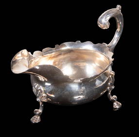
18TH C. WILLIAM GRUNDY STERLING SILVER SAUCE BOATThomaston Place Auction Galleries4.4(394)See Sold PriceFeb 24, 2024
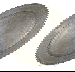
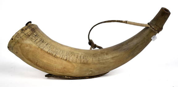
18TH C. ENGLISH PEWTER PLATES & PLATTERS BY ROBERT NICHOLSONThomaston Place Auction Galleries4.4(394)See Sold PriceFeb 24, 2024
EARLY 18TH C. DUTCH CHART OF PACIFIC OCEAN BY FREDERIK DE WIT (1629-1706) WITH CALIFORNIA AS ANThomaston Place Auction Galleries4.4(394)See Sold PriceFeb 24, 2024
EARLY 18TH C. MAP OF ITALY, FRAMEDThomaston Place Auction Galleries4.4(394)See Sold PriceFeb 24, 2024
18TH C. ANTIQUE MAP: FRENCH & INDIAN WAR, FRAMEDThomaston Place Auction Galleries4.4(394)See Sold PriceFeb 24, 2024
18TH C. GILT ALTAR FIGURE OF BODHISATTVAThomaston Place Auction Galleries4.4(394)See Sold PriceFeb 24, 2024
18th Century Hess Germany Hand colored Engraved MapGlobal Auctions Company4.3(36)See Sold PriceMar 03, 2024
Two (2) Antique 18th C. Copper Engraved Framed Maps - America & EuropeMagnusson Art Group4.5(53)See Sold PriceMar 14, 2024
Map: An 18thC engraved and hand coloured map of Buckinghamshire after Robert Morden. Approx. 8 1/4"Claydon Auctioneers Ltd4.3(125)See Sold PriceFeb 26, 2024
Map: An 18thC engraved and hand coloured map of Northamptonshire, with description ofClaydon Auctioneers Ltd4.3(125)See Sold PriceFeb 26, 2024
Map: An 18thC engraved and hand coloured map of North America and South America, titled DeClaydon Auctioneers Ltd4.3(125)See Sold PriceFeb 26, 2024
Map: An 18thC engraved map of Bedfordshire titled An Accurate Map of the County of Bedford DividedClaydon Auctioneers Ltd4.3(125)See Sold PriceFeb 26, 2024
Map: An 18thC engraved map titled A New and Improved Map of Oxfordshire.. after Thomas Kitchin.Claydon Auctioneers Ltd4.3(125)See Sold PriceFeb 26, 2024
ANTIQUE ROMAN ARMORIAL VELLUM BINDING, 1744, ILLUSTRATED WITH AN ANTIQUE MAP BY FLORUSNY Elizabeth 4.1(88)See Sold PriceMar 03, 2024