Sold1891 Map of Nantucket Island19th century map of Nantucket Island by Walker showing all villages and roads of the day. Framed. 24 x 32See Sold Price
SoldMap of Martha's Vineyard IslandLater copy of an 1891 map of Nantucket Island by George Walker. Map shows Tuckerneck, Siasconset, Polpis, etc. Nicely framed. Dimensions: 32" L x 23" H Weight: 8lbsSee Sold Price
SoldWalker's map of Nantucket." Later copy of a 1891 Walker's map of Nantucket. Showing the island as well as Tuckernuck and a sliver of Edgartown. The main roads are also shown. Matted and framed. 29"" tall x 38"" wide."See Sold Price
Sold1891 Map of Nantucket, George H. Walker19th Century lithographic map of Nantucket depicts detailed image of Nantucket Island with shoals. "MASSACHUSETTS PLATE No 10", signed "GEO H. WALKER & Co BOSTON, MA". Light age tone. Measures 19.5 HSee Sold Price
SoldMap of Nantucket IslandLater copy of an 1891 map of Martha's Vineyard by George Walker of Boston. Showing major roads of the day and villages of Edgartown, Cottage City, Tisbury, Chilmark and Chappaquidick. Nicely framed. DSee Sold Price
Map of Barnstable County, MassachusettsRestrike of an 1891 Walker's map of Barnstable county showing many Cape Cod towns including Chatham, Orleans, Brewster, Yarmouth, and Dennis. Also shows Nantucket Sound, Monomoy Island and highlightsSee Sold Price
Sold1891 George Walker Massachusetts Atlas Plate No. 10 Map of Nantucket1891 George Walker Massachusetts Atlas Plate No. 10 Map of Nantucket, copyright 1891 G.H. Walker & Co. Boston, Mass, showing Nantucket, Nantucket Sound, Tuckernuck and Muskeget Islands. Sight 19 iSee Sold Price
SoldNantucket mapGeorge Walker restrike from an 1891 chart showing Nantucket Island, Nantucket Sound and the edge of Edgartown, Martha's Vineyard. Details include Great Harbor, Tuckernuck Island, Sankaty Light, NantucSee Sold Price
SoldVintage Mid Century Aerial Photograph Collage Map of Nantucket IslandVintage Mid Century Aerial Photograph Collage Map of Nantucket Island, circa 1951, compiled by the U.S. Department of Agriculture, Production and Marketing Administration, constructed by overlaying aeSee Sold Price
SoldFramed Map of Nantucket Island Print by George Buctel, 1973Framed Map of Nantucket Island Print, drawn by George Buctel, 1973, by Mitchell's Book Corner, double matted and framed 15.5 in. x 20.25 in. Framed 20 in. x 25 in.See Sold Price
Sold20th Century Framed Map of Nantucket IslandFramed map of Nantucket Island. Map highlights include Sandy Point, Sankaty Head, Brant Point and Tuckanuck Island. Mounted into an ornate black Frame. 48 X 37. Condition: very good. 20th Century.See Sold Price
SoldScarce 1937 Map of Nantucket IslandScarce 1937 Map of Nantucket Island, from aerial survey made by, "The New England Cartographers, Inc.", with inset photo at Allen's Lobster Grill" 11 ¾ in. x 26 ½ in. Overall 15 ½ in. x 30 ½ in.See Sold Price
Scarce 1945 Highways, By-Ways and Not-Ways Map of Nantucket IslandScarce Highways, By-Ways and Not-Ways Map of Nantucket Island, by R. Newton Mayall, copyright 1945, showing the travel times, conditions and locations of the island's roads and lanes as well as historSee Sold Price
SoldFramed Map of NantucketFramed map of Nantucket island. Showing all villages and roads of the time. Copied from a 1890's original. Framed in wood with glass case. Dimensions: 32" L x 24" H Weight: 8lbs *This lot is part of aSee Sold Price
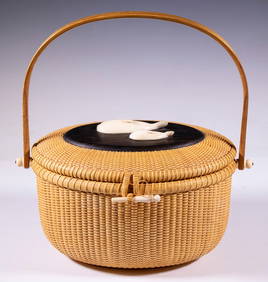
SoldA Nantucket basket purse by Jose Formoso Reyes1969, signed and dated to underside ''Made In / Nantucket / Jose Formoso Reyes / 1969'' with an outline map of Nantucket Island, oval-shaped with a hinged lid centering a plaque topped with a carved sSee Sold Price
SoldFred H. Gardner Nantucket Island MapProfessionally Framed Map of Nantucket Island, decorated with small illustrations of historic buildings with their dates of construction, farms, trees and animals. The map has simple cartography, showSee Sold Price
SoldJose Formoso Reyes Friendship Basket, circa 1960sJose Formoso Reyes (1902-1980) Basket, circa 1960s, the top adorned with a carved whale and dolphin, signed upon the base "Made in Nantucket, Jose Formoso Reyes" with outline map of Nantucket Island.See Sold Price
SoldPaul F. Reyes Large Open Swing Handle Nantucket BasketPaul F. Reyes (1938-2019) Large Open Swing Handle Nantucket Basket, signed upon the base "Made in Nantucket Paul F. Reyes, 1978" with traditional outline map of Nantucket Island Height 9 in. DiameterSee Sold Price
SoldMap of NantucketFramed map of Nantucket Island. After an original by des Barres by Haley and Steele of Boston. Nicely framed. The successful bidder will have the option of removing this item from the auction site beSee Sold Price
SoldNantucket Map in Burlwood FrameLarge map of Nantucket Island showing topography and area shoals fitted to a burlwood frame. Overall Dimensions: 42" L x 56" H Weight: 16lbsSee Sold Price
SoldRedstone Studios Oil on Canvas, "Map of NantucketRedstone Studios Oil on Canvas, "Map of Nantucket Island", including Muskeget Island, Tuckernuck Island and various points of interest including Brant Point Lighthouse, Sankaty Lighthouse, Great PointSee Sold Price
SoldMap of Nantucket.Matted and framed colored map of Nantucket island. Topography is in color with points of interest noted. Outer margins have bearings noted. Bottom of print has a statue and nautical miles legend. DimeSee Sold Price
Sold1940's Mayall Nantucket Island MapThe Highways, By-ways and Notways Nantucket Island Massachusetts original map. By R. Newton Mayall 38" x 24" condition good. Provenance: The Larry & Julia Pollock collection of Shaker Hgts Ohio. OrigiSee Sold Price
SoldAmerican neptune map of NantucketColored copy made from an original American Neptune map and chart of Nantucket Island. Nicely matted and framed in a quality gold moulding. 45 x 34.See Sold Price
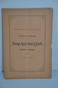
Chicago Rock Island and Pacific RR 11th Annual Report-April 1, 1891JM Hobby Supply and Railroad Artifact Auctions4.4(126)See Sold PriceFeb 24, 2024
LADIES LARGE OVAL NANTUCKET BASKET PURSE DECORATED WITH TWO WHALES BY DONNA CIFRANIC (1936-2022)Thomaston Place Auction Galleries4.4(389)See Sold PriceFeb 24, 2024
Vintage Framed Pine Island & Lacoste Island MapThe Benefit Shop Foundation Inc.4.3(2.9k)See Sold PriceMar 06, 2024
A Set of Treasure and Discovery Island Brochures.Van Eaton Galleries4.6(99)See Sold PriceMar 02, 2024
1822 MAP of LEEWARD ISLANDS GEOGRAPHICAL STATISTICAL HISTORICAL antique 17.5x22"Jasper524.5(9.8k)See Sold PriceFeb 27, 2024
1760 MAP CARTE PARTICULIERE DE L'ISLE DE JUAN FERNANDES antique Robinson CrusoeJasper524.5(9.8k)See Sold PriceFeb 27, 2024
1750 Bowen Map of Bermuda and St. Kitts -- A New & Accurate Map of Bermudas or Sommer's Islands...Jasper524.5(9.8k)See Sold PriceFeb 27, 2024
NORTH AFRICA. Algeria Morocco Tunis Tunisia Maghreb. BARTHOLOMEW 1891 old mapJasper524.5(9.8k)See Sold PriceFeb 28, 2024
Blackie (Pub) 1882 Folio Map. West India Islands & Central AmericaAlbion Auctions4.6(341)See Sold PriceMar 01, 2024
Vintage Framed Cat Island Nautical Map PrintRapid Estate Liquidators and Auction Gallery4.5(1.1k)See Sold PriceFeb 25, 2024
James Cook - Antique map Australia titled 'Gezigt van het Eil. Suffren'. Antique map of SuffrenProverde Auctions4.3(3)See Sold PriceFeb 28, 2024
Eastman Johnson - A Different Sugaring OffSeized Assets Auctioneers4.3(601)See Sold PriceFeb 27, 2024
Jan Pawlowski (American, b.1949) "Horse" Oil on CanvasMarket Auctions4.5(134)See Sold PriceMar 06, 2024
6 pcs Vintage Paper Maps. Vancouver Island, British Columbia. Upper Elk Creek Sheet. See pics.Crawford Family Auctions LLC4.5(119)See Sold PriceMay 25, 2024