Sold1858 Map Of Dutchess County New York1858 roll-up map of Dutchess County New York (John E. Gilletie, Publisher...Philadelphia). 59" x 64".See Sold Price
SoldAntique 1858 Wall Map,Dutchess County,NY Rhinebeck,EtcAntique 1858 Wall Map,Dutchess County,NY Rhinebeck,Etc. This Large detailed antique map of Dutchess county New York is dated 1858. This large map has lots of great little details including drawings anSee Sold Price
SoldRollup wall map of Dutchess County New York publishedRollup wall map of Dutchess County New York published by John E. Gillette, Philadelphia, 1858 - lithographed paper applied to canvas, several stains, several small holes approximately 1/2", but overalSee Sold Price
SoldWall map of Dutchess County New York from actualWall map of Dutchess County New York from actual surveys - John E. Gillette Phila. 1858 - 59" x 61". Poor condition with stains, losses, tears.See Sold Price
SoldWall map of Dutchess County New York by surveyor J.C.Wall map of Dutchess County New York by surveyor J.C. Sidney and published in 1850 by John E. Gillette. Some minor tears and staining but overall good condition. 40" x 58".See Sold Price
SoldAntique 1858 Wall Map of Columbia County,NY New YorkLarge antique c.1858 map of Columbia county New York. This large map has lots of great details. It is perfect for anyone interested in local Hudson Valley history. The dimensions are 57in x 66in x 1.5See Sold Price
Sold1858 J.H. FRENCH 2-FRAME MAP OF ULSTER COUNTY NY1858 map of Ulster County, New York surveyed by J.H. French. Two-framed in wood. Towns included are Woodstock, Kingston, Saugerties, Hurley, Marbletown, Rosendale, Esopes, part of Olive, part of RocheSee Sold Price
SoldColumbia & Dutchess County MapsLot of various Columbian & Dutchess County New York maps.See Sold Price
Soil Map New York Dutchess County SheetTitle/Content of Map: Soil Map New York Dutchess County Sheet Date: 1907 Cartographer: MOONEY, CHARLES N./H.L. BELDEN Publisher: U.S. DEPT. AGRICULTURE Size: 39Height - 27Width Area geologic map. ColoSee Sold Price
SoldTwo large folio Poughkeepsie NY maps entitled "Map ofTwo large folio Poughkeepsie NY maps entitled "Map of the City of Poughkeepsie Dutchess County, New York" - From surveys under the supervision of "READING PUBLISHING HOUSE and Theodore W. Davis, C.E."See Sold Price
Soldc1850 Dutchess County NY WALL MAP PoughkeepsieTitle: Dutchess County, New York Draughtsman/Cartographer/Surveyor: J. C. Sidney Publisher: John E. Gillett Printing Year: c1850 Dimensions: 42 inches x 58 inches Condition/Details: ThisSee Sold Price
SoldHISTORICAL ATLAS OF DUTCHESS COUNTY NEW YORKHISTORICAL ATLAS OF DUTCHESS COUNTY NEW YORK ILLUSTRATED - READING PUBLISHING HOUSE 1876. IN GOOD ESTATE CONDITION, FROM HOUSE IN STANFORDVILLE, N.Y. BEAUTIFUL MAPS AND ILLUSTRATIONS. HARD ATLAS TO FISee Sold Price
Antique Hand Colored Maps of Dutchess County, NY.Antique Hand Colored Maps of Dutchess County, NY. This lot includes three 19th century hand colored maps from the "Atlas of New York and Vicinity" by F.W. Beers. Includes one map of Hyde Park, one mapSee Sold Price
Antique Hand Colored Maps of Dutchess County, NYAntique Hand Colored Maps of Dutchess County, NY. This lot includes three 19th century hand colored maps from the "Atlas of New York and Vicinity" by F.W. Beers. Includes one map of Hyde Park, one mapSee Sold Price
Antique Hand Colored Maps of Dutchess County, NYAntique Hand Colored Maps of Dutchess County, NY. This lot includes three 19th century hand colored maps from the "Atlas of New York and Vicinity" by F.W. Beers. Includes one map of Pleasant Valley anSee Sold Price
Antique Hand Colored Maps of Dutchess County, NYAntique Hand Colored Maps of Dutchess County, NY. This lot includes three 19th century hand colored maps from the "Atlas of New York and Vicinity" by F.W. Beers. Includes one map of Pleasant Valley anSee Sold Price
Antique Hand Colored Maps of Dutchess County, NYAntique Hand Colored Maps of Dutchess County, NY. This lot includes three 19th century hand colored maps from the "Atlas of New York and Vicinity" by F.W. Beers. Includes one map of Hyde Park, one mapSee Sold Price
SoldAntique Hand Colored Maps of Dutchess County, NY.Antique Hand Colored Maps of Dutchess County, NY. This lot includes three 19th century hand colored maps from the "Atlas of New York and Vicinity" by F.W. Beers. Includes one map of Hyde Park, one mapSee Sold Price
Antique Hand Colored Maps of Dutchess County, NYAntique Hand Colored Maps of Dutchess County, NY. This lot includes three 19th century hand colored maps from the "Atlas of New York and Vicinity" by F.W. Beers. Includes one map of Hyde Park, one mapSee Sold Price
SoldMAP-ULSTER COUNTY, NY, J.H. FRENCH 1858FOLDING MAP - ULSTER COUNTY, NEW YORK, J.H. FRENCH 1858. 5' X 5'See Sold Price
SoldLarge Antique Hanging Map of Columbia County NY 1858Large Antique Hanging Map of Columbia County New York from 1858. Shows details and insets of towns and villages in Columbia county. Has a top piece made to hang on the wall. Has a beautiful patina andSee Sold Price
SoldWall map entitled "Map of Dutchess Co. New York fromWall map entitled "Map of Dutchess Co. New York from Actual Surveys, John E. Gillette, Publisher, 517, 519, 521, Minor Str. Philadelphia. 1858". Overall fair condition with tears, staining, paper lossSee Sold Price
SoldTown of Dover in Dutchess County, Atlas of New York byOriginal steel engraving by Augustus Mitchell, 1881. Map features city streets & railroads. Dimensions: 15” x 12”See Sold Price
Sold(NEW YORK – DUTCHESS COUNTY.) Large group of(NEW YORK – DUTCHESS COUNTY.) Large group of manuscript maps and surveys of properties in and around Fishkill and Wappingers Falls. Approximately 40 mostly manuscript land surveys on various wovSee Sold Price
1892 Adams and Bowles New Road Map of the State of New YorkJM Hobby Supply and Railroad Artifact Auctions4.4(126)See Sold PriceFeb 24, 2024
Crams Railroad Map of New York-1881JM Hobby Supply and Railroad Artifact Auctions4.4(126)See Sold PriceFeb 24, 2024
Crams Township and Railroad Map of New York-1890JM Hobby Supply and Railroad Artifact Auctions4.4(126)See Sold PriceFeb 24, 2024
Erie Railway Tourist Book/Magazine-1874JM Hobby Supply and Railroad Artifact Auctions4.4(126)See Sold PriceFeb 24, 2024
Vintage County Map Of NY State Plate EngravingThe Benefit Shop Foundation Inc.4.3(2.9k)See Sold PriceFeb 28, 2024
1855 Map of New York & Erie Railroad and 1917 Trespassing On Railway Property Is A MisdemeanorRail & Road Auctions4.6(165)See Sold PriceMar 07, 2024
Keith Haring - Ink on New York Map, Best Buddies, Inscribed, Signed, and DatedSapphire Auction Gallery4(67)See Sold PriceMar 02, 2024
1858 THE PIONEER BISHOP 1st EditionNorth American Artifact Auctions4.6(182)See Sold PriceApr 20, 2024
ANDREW RAYMOND JANSON OIL ON BOARD ADIRONDACKSCharleston Estate Services Ltd.4.5(58)See Sold PriceMar 03, 2024
Keith Haring Artwork Signed on a Shell Oil New York Road Map 18 in. x 24 in.Donny Malone Auctions4.5(1.7k)See Sold PriceMar 04, 2024
ELLEN STARBUCK (New York/France, 1858-1936), A lady and a cat sitting near a fireplace., Oil onEldred's4.7(409)See Sold PriceMar 13, 2024
ATTRIB William Birney (NY,OH,1858-1909) oil painting antiqueBroward Auction Gallery4.8(277)See Sold PriceMay 19, 2024
Black and white map of part of New York City (mostly Manhattan)Proverde Auctions4.3(3)See Sold PriceFeb 28, 2024
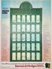
Map Inside Soho - Manhattan - New York Magazine 1974Proverde Auctions4.3(3)See Sold PriceFeb 28, 2024
The Newsday Magazine 1982 Marilyn Monroe AnniversaryRapid Estate Liquidators and Auction Gallery4.5(1.1k)See Sold PriceFeb 27, 2024
Laminated Unique Media New York City MapRapid Estate Liquidators and Auction Gallery4.5(1.1k)See Sold PriceFeb 29, 2024