SoldRare map of French & Indian War theatre, 1858Heading: (French & Indian War) Author: Anonymous Title: A Map of that Part of America that is now the Seat of War, from Quebeck to Fort Duquesne, comprehending the English Settlement on the Sea CoastSee Sold Price
L'italieReserve Reduced! Title: L'italie Date: c1700 Cartographer: ANONYMOUS Size (inches): 9.6X8.25 Small French atlas map, marked Liv.I, No.6. Shows ancient provinces of Italy. Reserve: $50.00 Jasper52 negoSee Sold Price
L'italieTitle: L'italie Cartographer: ANONYMOUS Publication Date: c1700 Size: Height: 9.6 Width: 8.25 Small French atlas map, marked Liv.I, No.6. Shows ancient provinces of Italy. Reserve: $75.00 Shipping: DSee Sold Price
La Romelie Et Les Environs De ConstantinopleTitle/Content of Map: La Romelie Et Les Environs De Constantinople Cartographer: ANONYMOUS Height (inches): 16.5 Width (inches): 21.6Year: 1725 Unidentified French atlas map showing the Dardenelles reSee Sold Price
Sold1833 French wine atlas map Maine et Loire1833 French wine atlas map Maine et Loire. Framed size 33"h x 29.5"wSee Sold Price
Sold1835 EXQUISITE French ATLAS Cartography MAPS Navigation1835 EXQUISITE French ATLAS Cartography MAPS Navigation Voyages Illustrated Monin Charles V. Monin was a 19th-century French cartographer who was one of the first Europeans to print maps under the priSee Sold Price
Sold1807 William Guthrie French ATLAS Illustrated MAPS1807 William Guthrie French ATLAS Illustrated MAPS Asia Africa France America Originally translated into French in 1801, William Guthrie’s “Geographical, Historical and Commercial Grammar’, hasSee Sold Price
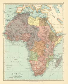
Sold1848 1st ed French ATLAS 95 Maps France Colonies1848 1st ed French ATLAS 95 Maps France Colonies Brittany Herault Illustrated A rare 19th-century French atlas published by Migeon and collected by Vuillemin. Each of these extremely desirable engraviSee Sold Price
Amerique SeptentrionaleTitle: Amerique Septentrionale Publication Date: c1850 Cartographer: ANONYMOUS Publisher: Dimension: 8.5 X 6.6 Polar projection. Texas in larger form.French school atlas map after Binet. Reserve: $40.See Sold Price
SoldV. LEVASSEUR FRENCH MAP ATLAS NATIONAL ILLUSTREV. LEVASSEUR, FRENCH MAP, ATLAS NATIONAL ILLUSTRE, 11" X 17", 'DEPT. DE VAR./REGION DU SUD':Under glass, matted, in a bird's eye maple frame. Laguillermie et Rainaud printmakers. Atlas National IllustSee Sold Price
SoldV. LEVASSEUR FRENCH MAP ATLAS NATIONAL ILLUSTREV. LEVASSEUR, FRENCH MAP, ATLAS NATIONAL ILLUSTRE, 1852, 11" X 17", 'DEPT. DE PUY DE DOME':Under glass, matted, in a bird's eye maple frame. The map proper is surrounded by elaborate decorative engravSee Sold Price
Sold1858 J H French map of Essex Co, NY on original1858 J H French map of Essex Co, NY on original rollers- minor looses at top corners 54” x 60”See Sold Price
SoldFrench Dauty wine atlas map Herault 1833French Dauty wine atlas map Herault region. 1833. Framed size 22.5"h x 30"wSee Sold Price
Sold1858 J.H. FRENCH 2-FRAME MAP OF ULSTER COUNTY NY1858 map of Ulster County, New York surveyed by J.H. French. Two-framed in wood. Towns included are Woodstock, Kingston, Saugerties, Hurley, Marbletown, Rosendale, Esopes, part of Olive, part of RocheSee Sold Price
SoldFrench Moselle wine atlas map circa 1833French Moselle region wine atlas map circa 1833. 22"h x 29.5"w framed.See Sold Price
2 early French maps "Atlas National Illustre" exce2 early French maps "Atlas National Illustre" excellent condition, 12" x 17" sight.See Sold Price
SoldFrench Haute Marne wine atlas map 1833French 1833 Haute Marne wine atlas map. Framed 24.5"h x 24.25"wSee Sold Price
Sold1742 FRENCH GUIENNE ET GASCOGNE ATLAS MAP1742 FRENCH GUIENNE ET GASCOGNE ATLAS MAP: Original 1742 map titled ''Le Gouvernament General de Guienne et Gascogne''. Publisher Amsterdam: Covens & Mortier. Hand colored engraved map showing settlemSee Sold Price
SoldMitchell's School Atlas 1858, hand-colored mapsTitle: Mitchell's School Atlas: Comprising the Maps and Tables Designed to Accompany Mitchell's School and Family Geography Author: Mitchell, [Samuel Augustus] Description: With 18 hand-colored maps (See Sold Price
Mitchell's School Atlas 1858, hand-colored mapsTitle: Mitchell's School Atlas Author: Mitchell, S[amuel] Augustus Description: With 18 hand-colored copper-engraved maps (5 are double-page), plus insets. 11¾x9½, original ¼ black calf & pictorialSee Sold Price
SoldMitchell's School Atlas 1858, hand-colored mapsTitle: Mitchell's School Atlas Author: Mitchell, S[amuel] Augustus Description: With 18 hand-colored copper-engraved maps (5 are double-page), plus insets. 11¾x9½, original ¼ black calf & pictorialSee Sold Price
SoldTwo Mercator / Hondius Maps2 (Gerard) Mercator atlas maps, 1619 French Edition, handcolored copperplate engravings on paper. 1st item: America "L'Amerique" by Joducus Hondius, Western Hemisphere - North and South America. ShowsSee Sold Price
SoldTANNER, Henry Schenck (1786-1858).* TANNER, Henry Schenck (1786-1858). A New Universal Atlas Containing Maps of the various Empires, Kingdoms, States and Republics of the World. Philadelphia: S. Augustus Mitchell, 1846. Folio (442 x 3See Sold Price
FRENCH WEST AFRICA. Senegal & Mauritanie/Mauritania. Dakar plan 1931 old mapJasper524.5(9.8k)See Sold PriceFeb 28, 2024
FRENCH COLONIAL CHAD & UBANGI-SHARI (C.A.R.). Oubangui-Chari Tchad 1931 mapJasper524.5(9.8k)See Sold PriceFeb 28, 2024
UPPER/HAUTE VOLTA. Burkina Faso. French West Africa. Ouagadougou plan 1929 mapJasper524.5(9.8k)See Sold PriceFeb 28, 2024
FRENCH WEST AFRICA. Afrique Occidentale Française. Saint-Louis, Senegal 1931 mapJasper524.5(9.8k)See Sold PriceFeb 28, 2024
FRENCH COLONIAL GUINEA. Guinee Française. Conakry city town ville plan 1929 mapJasper524.5(9.8k)See Sold PriceFeb 28, 2024
FRENCH WEST AFRICA. Afrique Occidentale Française. Saint-Louis, Senegal 1938 mapJasper524.5(9.8k)See Sold PriceFeb 28, 2024
FRENCH COLONIAL CHAD & UBANGI-SHARI (C.A.R.). Oubangui-Chari Tchad 1938 mapJasper524.5(9.8k)See Sold PriceFeb 28, 2024
FRENCH COLONIAL CHAD & UBANGI-SHARI (C.A.R.). Oubangui-Chari Tchad 1929 mapJasper524.5(9.8k)See Sold PriceFeb 28, 2024
FRENCH SUDAN (Now Mali). Soudan Français. Bamako city plan de la ville 1929 mapJasper524.5(9.8k)See Sold PriceFeb 28, 2024
Colonial & French West Africa. Gold Coast Dahomey Upper Volta. TIMES 1922 mapJasper524.5(9.8k)See Sold PriceFeb 28, 2024
FRENCH WEST AFRICA. Afrique Occidentale Française. Saint-Louis, Senegal 1929 mapJasper524.5(9.8k)See Sold PriceFeb 28, 2024
Africa. French West/Equatorial. Tanganyika Belgian Congo. STANFORD c1925 mapJasper524.5(9.8k)See Sold PriceFeb 28, 2024
FRENCH WEST AFRICA. Afrique Occidentale Française. Plan of Niger floods 1938 mapJasper524.5(9.8k)See Sold PriceFeb 28, 2024
FRENCH COLONIAL GUINEA. Guinee Française. Conakry city town ville plan 1931 mapJasper524.5(9.8k)See Sold PriceFeb 28, 2024
FRENCH WEST AFRICA. Senegal & Mauritanie/Mauritania. Dakar plan 1929 old mapJasper524.5(9.8k)See Sold PriceFeb 28, 2024
FRENCH SUDAN (Now Mali). Soudan Français. Bamako city plan de la ville 1938 mapJasper524.5(9.8k)See Sold PriceFeb 28, 2024
Colonial Africa North-West. British French. Nigeria Sahara. THE TIMES 1895 mapJasper524.5(9.8k)See Sold PriceFeb 28, 2024
Colonial Central Africa. Belgian Congo. French Equatorial Africa. TIMES 1922 mapJasper524.5(9.8k)See Sold PriceFeb 28, 2024
FRENCH WEST AFRICA. Afrique Occidentale Française. Plan of Niger floods 1929 mapJasper524.5(9.8k)See Sold PriceFeb 28, 2024
FRENCH SUDAN (Now Mali). Soudan Français. Bamako city plan de la ville 1931 mapJasper524.5(9.8k)See Sold PriceFeb 28, 2024
FRENCH WEST AFRICA Nigeria Gold Coast Rio de Oro Portuguese Guinea 1912 mapJasper524.5(9.8k)See Sold PriceFeb 28, 2024
UPPER/HAUTE VOLTA. Burkina Faso. French West Africa. Ouagadougou plan 1931 mapJasper524.5(9.8k)See Sold PriceFeb 28, 2024
Colonial Africa North-West. British French. Nigeria Sahara. THE TIMES 1900 mapJasper524.5(9.8k)See Sold PriceFeb 28, 2024
FRENCH WEST AFRICA. Senegal & Mauritanie/Mauritania. Dakar plan 1938 old mapJasper524.5(9.8k)See Sold PriceFeb 28, 2024