Sold1856 campaign map with slave states and freeHeading: Author: Reynolds, William C. Title: Reynold's Political Map of the United States. Designed to exhibit the Comparative Area of the Free and Slave States, and the Territory open to Slavery orSee Sold Price
SoldRARE ANTI-SLAVERY MAP - From the 1856 PresidentialRARE ANTI-SLAVERY MAP - From the 1856 Presidential Campaign: "Reynolds's Political Map of the United States Designed to Exhibit the Comparative Area of the Free and Slave States and the Territory OpenSee Sold Price
SoldRadefeld: Antique Map of U.S. Free & Slave States, 1849Map: Nord-Americanische Freistaaten 1849 Cartographer: Bibliographischen Instituts. / Radefeld Place & Date: Hildburghausen / 1849/1857 Size: 15" x 11 3/8" Condition: original outline color; overall aSee Sold Price
Sold(CIVIL WAR.) Stanford, Edward. Stanford’s Map of(CIVIL WAR.) Stanford, Edward. Stanford’s Map of the Seat of the War in America. Large lithographed case map of the eastern United States with an inset delineating the Slave States and the FreeSee Sold Price
Imprint: The Nature + Power of the Slave StatesBlack History 1856 "The Nature and Power of the Slave States" Imprint by Josiah Quincy re: Power the Slave States over the Free States June 5, 1856-Dated, "The Nature and Power of the Slave States" ImSee Sold Price
SoldImprint: The Nature + Power of the Slave StatesBlack History 1856 "The Nature and Power of the Slave States" Imprint by Josiah Quincy re: Power the Slave States over the Free States June 5, 1856-Dated, Imprint titled: "The Nature and Power of theSee Sold Price
SoldBuchanan, Frémont and Fillmore: 1856 Campaign ChBuchanan, Frémont and Fillmore: 1856 Campaign Chart. 30" x 37" hand-colored poster titledSee Sold Price
SoldBroadside, LLOYD’S NEW POLITICAL CHART, 18611861 “POLITICAL CHART” With Abe Lincoln & A Map of the United States, Showing the Free States, Border Slave States, Cotton States, and Territories in Different Colors 1861-Dated Civil War Period,See Sold Price
SoldThe North and the South: A Statistical ViewThe North and the South: A Statistical View of the Condition of the Free and Slave States, Chase, Henry & Sanborn, Charles W., John P. Jewett & Co., Boston, 1856 First. HC, brown cloth with gilt titleSee Sold Price
SoldWyld (James) - Map of the Southern States of NorthCivil War map indicationg the dividing line between the Free and Slave-Holding States, also railroadss completed and canals, lithographed map with extensive original hand-colouirng, 680 x 1200mm., disSee Sold Price
SoldOlmsted. A Journey in the Seaboard Slave States.[American History] Olmsted, Frederick Law. A Journey in the Seaboard Slave States. Dix & Edwards, New York, 1856. First edition. 8vo. Publisher's tooled brown cloth with gilt title on spine. No map. HSee Sold Price
SoldAN ANTEBELLUM MAP, "J. De Cordova's Map of the State ofAN ANTEBELLUM MAP, "J. De Cordova's Map of the State of Texas," NEW YORK, 1856, hand colored lithograph on paper, with hand inscribed pencil inscriptions, the campaign notes beginning near BrownsvilleSee Sold Price
SoldJohn C. Fremont Campaign Medal (104149)Obv.: John C. Fremont / Free Soil & Free Speech; Rev.: United States of America / spread eagle. Br., 28 mm, holed. Fremont was Republican nominee for President in 1856. the party had a platform of "FrSee Sold Price
Sold1850 WILLIAM H. SEWARD ALS Slave vs Free States!Autographs 1850-Dated Autograph Letter Signed "William H. Seward" The Compromise of 1850 Political Issues Prove Divisive one of Union vs Disunion / Slave States vs Free States WILLIAM H. SEWARD (1801-See Sold Price
SoldA Journey in the Seaboard Slave States, 1856Heading: Author: Olmsted, Frederick Law Title: A Journey in the Seaboard Slave States, With Remarks on Their Economy Place Published: New York Publisher:Dix & Edwards Date Published: 1856See Sold Price
Sold1856 Map of the State of FloridaApproved by the Surveyor General on October 1st, of 1856, this large format map of Florida was part of an annual report. Showing great detail of coastal regions and towns, with counties listed in largSee Sold Price
Sold1856 Free State Government in Kansas SpeechBlack History"Free State Government in Kansas with the Inaugural Speech and Message of Governor Robinson" March 4, 1856, "Organization of the Free State Government in Kansas with the InauSee Sold Price
Sold1856 Free State Government in Kansas SpeechBlack History"Free State Government in Kansas with the Inaugural Speech and Message of Governor Robinson" March 4, 1856, "Organization of the Free State Government in Kansas with the InauSee Sold Price
Arrowsmith: Antique Map of Northern Germany, 1828TITLE/CONTENT OF MAP: 'Northern Germany' States. Free Cities. Switzerland Austria. DATE PRINTED: 1828 IMAGE SIZE: Approx 25.5 x 31.0cm, 10 x 12.25 inches (Large) TYPE: Antique copperplate map CONDITIOSee Sold Price
Sold6 Various maps in a pvc tubeto include NOAA Saco Bay and Vicinity, The Heart of the Grand Canyon 1978, Delorme's Maine Political and Topographic, Map Of Kennebec Published by J. Chace Jr. & Co. 1856, Map of The State of Maine PuSee Sold Price
Sold1795 Philadelphia Patrician seeks Black “servant” inHeading: (1795 Philadelphia Patrician seeks Black “servant” in slave-free state) Author: North, Joseph Title: Philadelphia Patrician seeks Black “servant” in slave-free state Place Published:See Sold Price
Sold1856 United States Map by Thomas CowerthwaitA New Map of the United States drawn by Thomas Coweperthwait, published by Charles DeSilver c.1856 Philadelphia. The print is framed in simple dark wood. The print has minor discoloration spots from aSee Sold Price
Sold1856 MAP OF THE UNITED STATESpublished by J. H. Colton & Co., New York, 1856, mounted on linen, 52 x 60 in.See Sold Price
1856 MAP OF THE UNITED STATESpublished by J. H. Colton & Co., New York, 1856, mounted on linen, 52 x 60 in.See Sold Price
Chicago Milwaukee and St Paul RY Why and Wherefore Book-1886JM Hobby Supply and Railroad Artifact Auctions4.4(127)See Sold PriceFeb 24, 2024
1963 J.F.K. for US PRESIDENT RE-ELECTION MATERIALJohn McInnis Auctioneers,LLC4.5(505)See Sold PriceFeb 25, 2024
Vintage County Map Of NY State Plate EngravingThe Benefit Shop Foundation Inc.4.3(2.9k)See Sold PriceFeb 28, 2024
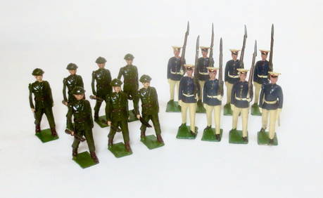
Britains from #1603 Irish Free State InfantryOld Toy Soldier Auctions USA4.8(1.1k)See Sold PriceMar 15, 2024
Britains from #1603 Irish Free State InfantryOld Toy Soldier Auctions USA4.8(1.1k)See Sold PriceMar 15, 2024
Midcentury Two-Tone "Colormates" Campaign Bedroom Set by Morris of CaliforniaBidhaus4.3(762)See Sold PriceFeb 23, 2024
Norman Thomas What Vermont Means To NY Campaign Poster Framed ReproductionMynt Auctions4.6(697)See Sold PriceFeb 24, 2024
[AFRICAN AMERICANA - EMANCIPATION PROCLAMATION]. Church Advocate. Vol. XXVII, No. 21. Lancaster, PA:Freeman's | Hindman4.4(1.6k)See Sold PriceFeb 27, 2024
Midcentury Yellow "Colormates" Campaign Lowboy Writing Desk by Morris of CABidhaus4.3(762)See Sold PriceFeb 28, 2024
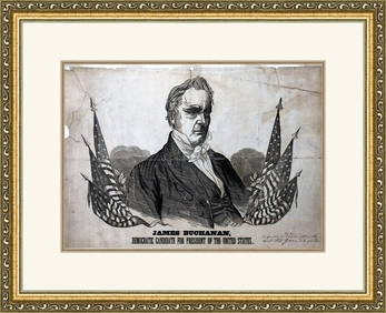
James Buchanan 1856 Campaign Poster Custom Gallery Framed ReproductionMynt Auctions4.6(697)See Sold PriceMar 01, 2024
Central Africa. Congo Free State Rhodesia German East Africa. STANFORD 1896 mapJasper524.5(9.9k)See Sold PriceFeb 28, 2024
WESTERN AFRICA.Kong Mountains.Caravan routes.Slave Coast.TALLIS/RAPKIN 1849 mapJasper524.5(9.9k)See Sold PriceFeb 28, 2024
Afrique. Pays des Hottentots #51. Botswana South Africa. VANDERMAELEN 1827 mapJasper524.5(9.9k)See Sold PriceFeb 28, 2024
CENTRAL AFRICA. Tanzania, Kenya, Angola, Zambia, Congo, Mozambique 1903 mapJasper524.5(9.9k)See Sold PriceFeb 28, 2024
WESTERN AFRICA.Kong Mountains.Caravan routes.Slave Coast.TALLIS/RAPKIN 1851 mapJasper524.5(9.9k)See Sold PriceFeb 28, 2024


![[AFRICAN AMERICANA - EMANCIPATION PROCLAMATION]. Church Advocate. Vol. XXVII, No. 21. Lancaster, PA: (1 of 3)](https://p1.liveauctioneers.com/197/319238/171468087_1_x.jpg?height=282&quality=70&version=1707520367)