Sold1855, MANUAL OF GEOGRAPHY with 8 Handcolored mapsHistoric Maps"MANUAL OF GEOGRAPHY...KEY TO MITCHELL'S..." Published date: 1855, MANUAL OF GEOGRAPHY, EMBRACING THE KEY TO MITCHELL'S SERIES OF OUTLINE MAPS. O.D., Case Hartford & John W. FulleSee Sold Price
Sold1855, MANUAL OF GEOGRAPHY with 8 Handcolored mapsHistoric Maps"MANUAL OF GEOGRAPHY...KEY TO MITCHELL'S..." Published date: 1855, MANUAL OF GEOGRAPHY, EMBRACING THE KEY TO MITCHELL'S SERIES OF OUTLINE MAPS. O.D., Case Hartford & John W. FulleSee Sold Price
Sold8 hand-colored lithographed maps by J.H. ColtonTitle: Eight hand-colored lithographed maps by J.H. Colton plus another Author: Colton, Joseph Hutchins Description: Includes: Colton's The United States of America. 1855. * The United States of AmeriSee Sold Price
SoldHAND COLORED ENGRAVED MAP, SPAIN AND PORTUGALHAND COLORED ENGRAVED MAP, "SPAIN AND PORTUGAL", 1773, FOR JOHN PAYNE'S "A NEW SYSTEM OF GEOGRAPHY". SIGHT 8 5/8 X 11 3/4"See Sold Price
SoldSchool Atlas to Cummings' Ancient & Modern GeograTitle: School Atlas to Cummings' Ancient & Modern Geography Author: Cummings & Hilliard Description: With 8 hand-colored (in outline) double-page or folding maps. 9½x6¼, original printed and decoratSee Sold Price
SoldMap with early reference to gold region 1849Title: No. 15 Map of Oregon and Upper California Engraved to Illustrate Mitchell's School and Family Geography. Author: Mitchell, S. Augustus Description: Lithographed map, hand-colored. 26.5x20.8 cm.See Sold Price
SoldHAND COLORED ENGRAVED MAP, NAPLES AND SICILY 1773HAND COLORED ENGRAVED MAP, "NAPLES AND SICILY" 1773, FOR JOHN PAYNE'S "A NEW SYSTEM OF GEOGRAPHY". SIGHT 12 1/2 X 8 1/2"See Sold Price
Antique Map of Northern Russia by William Darton, Jr.Antique Engraved Hand Colored Map of Northern Russia by William Darton, Jr. (1781–1854) from Atlas to Walker's Geography | London: Vernor & Hood, 1802 | Approx. Dimensions: 8.25" H x 9.75" W | WSee Sold Price
SoldS. AUGUSTUS MITCHELL, AN ENGRAVED MAP OF NORTH AMERICA,S. AUGUSTUS MITCHELL, AN ENGRAVED MAP OF NORTH AMERICA, HAND COLORED, 1839, for Mitchell's School and Family Geography. 10.25" x 8.25"See Sold Price
Sold4 maps, 18th-19th C. Italy + ancient geography.[Europe]. 4 engraved maps, hand-colored, double-page. ++ Homann. Novissima & Exactissima Totius Regni Neapolis. Southern Italy, including Naples, c.1740. 21 7/8 x 18 7/8 in. Tape repairs at top of verSee Sold Price
SoldMitchell's School Atlas 1855, w/ 18 colored mapsTitle: Mitchell's School Atlas: Comprising the Maps and Tables Designed to Accompany Mitchell's School and Family Geography Author: Mitchell, S[amuel] Augustus Description: With 18 hand-colored maps (See Sold Price
Sold1827, Atlas of Modern Geography by Samuel ButlerLondon: 1826, but with "Corrected to 1827" printed below in a smaller typeface, printed by Longman, Rees, Orme, Brown & Green. 8vo, 22 Maps hand-colored in outline and printed as folded 8.25" x 10.25"See Sold Price
Antique Map of Spain & Portugal by William Darton, Jr.Antique Engraved Hand Colored Map of Spain & Portugal by William Darton, Jr. (1781–1854) from Atlas to Walker's Geography | London: Vernor & Hood, 1802 | Approx. Dimensions: 7.5" H x 8.5" W | WiSee Sold Price
SoldJ.H. Colton, "The City of New Orleans," and "The CityJ.H. Colton, "The City of New Orleans," and "The City of Louisville," 1855, two hand-colored maps, framed, H.- 16 in., W.- 13 1/8 in.See Sold Price
SoldS. AUGUSTUS MITCHELL, AN ENGRAVED MAP OF NORTH AMERICA,S. AUGUSTUS MITCHELL, AN ENGRAVED MAP OF NORTH AMERICA, HAND COLORED, 1839, for Mitchell's School and Family Geography. 10 1/4" x 8 1/4"See Sold Price
McNally's Improved [School Atlas] 1855 color mapsTitle: An Improved System of Geography...Designed for Schools, Academies and Seminaries Author: McNally, Francis Description: With 29 hand-colored lithographed maps (1 double-page of U.S.). 11¾x9¾,See Sold Price
SoldMcNally's Improved [School Atlas] 1855 color mapsTitle: An Improved System of Geography...Designed for Schools, Academies and Seminaries Author: McNally, Francis Description: With 29 hand-colored lithographed maps (1 double-page of U.S.). 11¾x9¾,See Sold Price
Sold1 vol. Maury, M.F. The Physical Geography of the1 vol. Maury, M.F. The Physical Geography of the Sea. New York: Harper, 1855. First edition. 8vo, orig. publisher's brown cloth, gilt; some edge wear. 12 diagrams, maps & tables (incl. 8 fold. engraveSee Sold Price
SoldAN ANTIQUE MAP, "Map of Texas to Illustrate Olney'sAN ANTIQUE MAP, "Map of Texas to Illustrate Olney's School Geography," hand colored engraving. 11" x 8.50"See Sold Price
SoldJohnson's Map of Ireland 1855Johnson's Map of Ireland 1855, Colored plate no. 71. Hand colored New York 1855. Dimensions: 14 1/8" X 11 1/4". Note: Includes battlefields and their dates.Inv.79See Sold Price
SoldAN ANTIQUE MAP, "Map of Texas,"AN ANTIQUE MAP, "Map of Texas," hand colored engraving on paper, "McNally's System of Geography, Map No. 19," with smaller maps of "Vicinity of Galveston," and "Map of North Texas." 8.50" x 11"See Sold Price
Romey, C. et Jacobs, A. «La Russie ancienne et moderneParis: Furne, 1855. - [4], [VII], [1], 571 pp., 1 frontispiece, 16 ill., 1 maps; 27x18,8 cm.; 51x37 cm. (map). Six engraved illustrations with hand colored. 10 engraved illustration. Engraved map «RuSee Sold Price
Sold1855 Map of Georgetown and the City of Washington by J.H. ColtonColton's Georgetown and the city of Washington: the capital of the United States of America. Issued in 1855 by J. H. Colton (1800-1893). Hand colored. Frame size: 20 1/2" H x 24 3/4" W x 1 1/8" D. SigSee Sold Price
SoldMorse’s School Geography, "North America," c. 1846,Morse’s School Geography, "North America," c. 1846, hand colored, H.- 10 3/4 in., W.- 8 7/8 in.See Sold Price
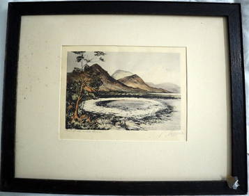
PHILIP NORMAN FSA Hand Colored Engraving c1910 Loch White Fairies SIGNED Listed ScotlandLuis Porretta Fine Arts4.3(10)See Sold PriceMar 02, 2024
OGILVY & BOWEN c1736 Original Map of Oxfordshire Berkshire Etc.Luis Porretta Fine Arts4.3(10)See Sold PriceMar 02, 2024
PIETER SCHENK / VALK / JANSSEN Hand Colored Map of Rhodes Greece ca1702 vgcLuis Porretta Fine Arts4.3(10)See Sold PriceMar 02, 2024
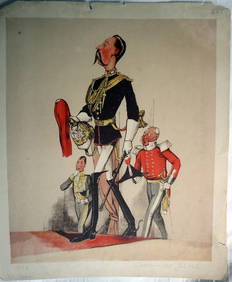
JOSEPH MARTIN KRONHEIM - "Captain Of The Blues" Early Colore Printing MilitaryLuis Porretta Fine Arts4.3(10)See Sold PriceMar 02, 2024
Battle of the Nile: Disposition of the English & French Fleets, at the Commencement of the Action,Trillium Antique Prints & Rare Books4.5(32)See Sold PriceFeb 24, 2024
William Simpson's Sketches at the Seat of War - Two Volumes with 81 Hand-colored LithographsTrillium Antique Prints & Rare Books4.5(32)See Sold PriceFeb 24, 2024
Mitchell - Map of the City of Washington (Washington, DC)Trillium Antique Prints & Rare Books4.5(32)See Sold PriceFeb 24, 2024
Wilson - Carolina Parrot & Flycatchers. 26Trillium Antique Prints & Rare Books4.5(32)See Sold PriceFeb 24, 2024
1834 Malte-Brun Map of the Caribbean -- West India IslandsJasper524.5(9.9k)See Sold PriceFeb 27, 2024
Great Horned Owl, Audubon, Royal Octavo hand-colored lithographPBA Galleries4.7(385)See Sold PriceMar 07, 2024
The Snowy Owl, Audubon, Royal Octavo hand-colored lithographPBA Galleries4.7(385)See Sold PriceMar 07, 2024
Rare 19thc Colton Map, Argentine Republic, Chile, Uruguay, PataguayConnoisseur Auctions3.9(336)See Sold PriceMar 16, 2024


![McNally's Improved [School Atlas] 1855 color maps (1 of 1)](https://p1.liveauctioneers.com/642/14971/4832104_1_x.jpg?height=282&quality=70&version=1202304736)
![McNally's Improved [School Atlas] 1855 color maps (1 of 1)](https://p1.liveauctioneers.com/642/15085/4887234_1_x.jpg?height=282&quality=70&version=1202496446)