Claude Monet French 1840 - 1926 Oil on canvas Painting Impressionism Renoir Manet Pissarro Era.International Art Auction Gallery4.4(163)See Sold PriceFeb 24, 2024
Antique American Hudson River School Sunset Landscape Framed Original Oil PaintingCurated Gallery Auctions4.6(131)See Sold PriceFeb 25, 2024
Robert William Wood (1889 - 1979) Texas BluebonnetsPremier Auction Galleries4.4(331)See Sold PriceMar 09, 2024
BIRGER SANDZEN (1871-1954) COLORADO OIL ON CANVAS 1936Soulis Auctions4.8(953)See Sold PriceFeb 24, 2024
George Adomeit (American 1879-1964) CAPE COD LandscapePremier Auction Galleries4.4(331)See Sold PriceMar 09, 2024
Vincent Van Gogh Dutch 1853-1890 Oil on canvas. Paul Gaugin, Cezanne, Degas EraInternational Art Auction Gallery4.4(163)See Sold PriceFeb 24, 2024
Renaissance Old Master Altarpiece Adoration Magi Oil Painting Christ Child Virgin Mary Wise MenHess Fine Auctions4.5(210)See Sold PriceMar 02, 2024
19TH C GERMAN OIL PAINTING BY EMIL ZSCHIMMER C 1872Antique Arena Inc.4.5(878)See Sold PriceFeb 24, 2024
JOHN CONSTABLE ANTIQUE ENGLISH CLOUDS OIL PAINTINGAntique Arena Inc.4.5(878)See Sold PriceFeb 24, 2024
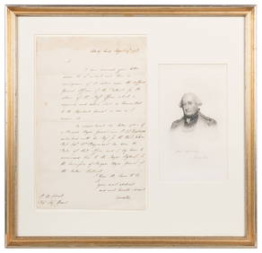
ATTRIBUTED TO GILBERT STUART (MA/RI/UK, 1755-1828)Thomaston Place Auction Galleries4.4(393)See Sold PriceFeb 24, 2024
Pablo Picasso Spanish 1881-1973 Oil On Canvas Painting Dali Magritte Braque Juan GrisInternational Art Auction Gallery4.4(163)See Sold PriceFeb 24, 2024
ATTRIB Francisco Miralles Y Galup (Spain,France,1848-1901) oil painting antiqueBroward Auction Gallery4.7(292)See Sold PriceMar 10, 2024
AMERICAN SCHOOL (Early 20th c) Two WorksJohn McInnis Auctioneers,LLC4.5(505)See Sold PriceFeb 25, 2024
Marc Chagall-Limited Edition -Paris Opera Ceiling after ChagallArt Legacy Auctions4.5(223)See Sold PriceFeb 24, 2024
1796 A General Chart on Mercator’s Projection, toThis fascinating large map, a double folio in black and white is an Exploration Chart of the Eastern Hemisphere which clearly traces the routes of the voyages of the Houghton diplomatic embassy missioSee Sold Price
SoldChart of English mission to China 1796Heading: Author: Barrow, John Title: A General Chart on Mercator's Projection, to Shew the Track of the Lion and Hindostan from England to the Gulph of Pekin in China, … also the Limits of the ChinSee Sold Price
SoldGeneral Chart on Mercators Projection. World. Cook's route. PAYNE 1798 old mapTITLE/CONTENT OF MAP: 'General Chart on Mercators Projection' DATE PRINTED: 1798 IMAGE SIZE: Approx 18.0 x 25.0cm, 7 x 9.75 inches (Medium) TYPE: Antique copperplate engraved map with original hand coSee Sold Price
SoldWalker, John 1795 Map of the World on Mercators Proj."General Chart on Mercators Projection" Copper Engraved Map Published 1795, London for "Elements of Geography, and of Natural and Civil History" by John Walker. Centre fold as published. Paper Size: 1See Sold Price
Sold(2) ENGRAVED MAPS ASIA & WORLD MERCATOR PROJECTION(lot of 2) Framed engravings on paper, maps, including: (1) "General Chart on Mercator's Projection," engraved for Payn's [Payne's] "Universal Geography," published by Low & Willis, New York, sight: 7See Sold Price
SoldEastern Hemisphere.- Asia.- Nicol (George) A GeneralNO RESERVE Eastern Hemisphere.- Asia.- Nicol (George, publisher) A General Chart on Mercator's Projection, to Shew the Track of the Lion and Hindostan from England to the Gulf of Pekin in China ..., lSee Sold Price
A general chart of the West India Islands… DELAROCHETTE/FADEN Caribbean 1796 mapTitle: A general chart of the West India Islands… DELAROCHETTE/FADEN Caribbean 1796 map Description: A general chart of the West India Islands with the adjacent coasts of the Spanish continent bSee Sold Price
SoldMap a General Chart of the World - London, 1797Map a General Chart of the World on Mercators Projection, published by G. Kearsly London, 1797See Sold Price
SoldChina Map 1796 Sir John BarrowChina Map 1796 Sir John Barrow A Chart on Merchant's Projection containing the track and soundings of the Lion^ the Hindoostan and Tenders from TURON-BAY in COCHIN-CHINA to the mouth of the Pei-Ho RivSee Sold Price
SoldEastern Hemisphere, Asia Map, Nichols, 1796engraved map titled A general chart to shew (sic) the Track of the Lion and Hindostan from England to the Gulph of Pekin, and of their Return to England, published by George Nicol, April 12th 1796, 24See Sold Price
SoldHand-colored 1796 map of West Indies,"A General Chart of the West India Islands…", by L. S. De La Rochette, London, 21-3/4 x 30-5/8 in. (sight); French mat with gilt and marbled borders, modern gilt wood frame. Not examined out of framSee Sold Price
A general chart of the West India Islands… DELAROCHETTE/FADEN Caribbean 1796 mapTITLE/CONTENT OF MAP: 'A general chart of the West India Islands with the adjacent coasts of the Spanish continent by L. S. De La Rochette' DATE PRINTED: 1796 IMAGE SIZE: Approx 55.5 x 78.0cm, 21.75 xSee Sold Price
A general chart of the West India Islands… DELAROCHETTE/FADEN Caribbean 1796 mapTITLE/CONTENT OF MAP: 'A general chart of the West India Islands with the adjacent coasts of the Spanish continent by L. S. De La Rochette' DATE PRINTED: 1796 IMAGE SIZE: Approx 55.5 x 78.0cm, 21.75 xSee Sold Price
SoldMap of West Indies from Mercator 1773"A new general chart for the West Indies of E Wright's projection on Mercator's chart," London: J. Mount & T. Page, ca. 1773. From "The English Pilot. The Fourth Book describing the West India NavigatSee Sold Price
SoldH. Moll Map of Sea Coast of EuropeHerman Moll, active in London, c. 1654-1732. Engraved Map entitled "A General Chart of the Sea Coast of Europe, Africa & America. According to E. Wrights or Mercator's Projection. By H. Moll GeographeSee Sold Price
SoldCaptain Joseph Smith Speer (English, d. 1837)Captain Joseph Smith Speer (English, d. 1837), "A General Chart of the West Indies By Captain J. S. Speer with Additions from the latest Navigators", London, Robert Wilkinson, 1796, with dedication "TSee Sold Price
Sold(Maps and Charts, West Indies), Delarochette, L. S(Maps and Charts, West Indies), Delarochette, L. S. d'Arcy, A General Chart of the West India Islands..., London: William Faden, September 22, 1796, with hand-colored borders, double page folio, matteSee Sold Price
SoldOstell's New General AtlasOstell's New General Atlas,double-hemisphere world, Chart of the World on Mercator's projection, and 28 further national and continental maps, complete, engraved maps with extensive originalSee Sold Price
SoldChart of the World On Mercators Projection, 1796Map: Chart of the World On Mercators Projection Maker: Thomas & Andrews, Morse/Doolittle (Sculp) Publisher: Boston, 1796 Size: Quarto - 7.30 H x 10.00 W Inches Small map of the world. Shows LouisianaSee Sold Price
SoldChart of the World on Mercators ProjectionCirca 1796 Lot of 2 Antique World Maps; Titles: "Chart of the World on Mercators Projection" (Doolittle, sculp.) Approximate size: 11" x 8-3/8". "Map of the World from the best Authorities" (DoolittleSee Sold Price
Chart of the World On Mercators Projection, 1796Map: Chart of the World On Mercators Projection Maker: Thomas & Andrews, Morse, Doolittle Date: 1796 Size: Quarto, 7.3 inches high x 10 inches wide "Doolittle Sculp: New-Haven" Small map of the world.See Sold Price
Chart of the World On Mercator's Projection.Title/Content of Map: Chart of the World On Mercator's Projection. Date: 1796 ca. Cartographer: DOOLITTLE, A. Size: 7.2X9.8 ...Doolittle Sculp. New-Haven Please note that this lot has a confidential rSee Sold Price
SoldOstell's New General AtlasOstell's New General Atlas,A New Edition, From a set of entirely new plates, on an enlarged scale, title and 30 maps, including double-hemisphere world, chart of the world on Mercator's projeSee Sold Price
SoldJedediah Morse chart of the WorldHeading: Author: Morse, Jedediah Title: Chart of the World on Mercators Projection Place Published: Boston Publisher:Thomas & Andrews Date Published: 1796 Description: EngrSee Sold Price
CORNWALLIS, Charles, 1st Marquess Cornwallis (1738-1805). S...Potter & Potter Auctions4.6(545)See Sold PriceMar 07, 2024
Arrowsmith & Lewis - Map of the World on Mercator's ProjectionTrillium Antique Prints & Rare Books4.5(32)See Sold PriceFeb 24, 2024
Carey, pub. 1796 - A Chart of the West IndiesTrillium Antique Prints & Rare Books4.5(32)See Sold PriceFeb 24, 2024
Carey, pub. 1796 - Map of the State of MarylandTrillium Antique Prints & Rare Books4.5(32)See Sold PriceFeb 24, 2024
Carey, pub. 1796 - Map of GeorgiaTrillium Antique Prints & Rare Books4.5(32)See Sold PriceFeb 24, 2024
Carey, pub. 1796 - Map of The State of South CarolinaTrillium Antique Prints & Rare Books4.5(32)See Sold PriceFeb 24, 2024
Carey, pub. 1796 - Map of KentuckyTrillium Antique Prints & Rare Books4.5(32)See Sold PriceFeb 24, 2024
Carey, pub. 1796 - Map of the Tennassee State formerly part of North Carolina (Tennessee)Trillium Antique Prints & Rare Books4.5(32)See Sold PriceFeb 24, 2024
1816 MAP SOUTHERN PART OF RUSSIA or MUSCOVY in EUROPE copper engraving ANTIQUEJasper524.5(9.9k)See Sold PriceFeb 27, 2024
1816 MAP NORTHERN PART OF RUSSIA or MUSCOVY in EUROPE copper engraving ANTIQUEJasper524.5(9.9k)See Sold PriceFeb 27, 2024
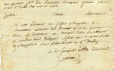
MARCEAU FRANCOIS SEVERIN: (1769-1796)International Autograph Auctions Europe S.L.4.5(52)See Sold PriceMar 14, 2024
1914 Memoires Du General Bro 1796-1844 SoftcoverRapid Estate Liquidators and Auction Gallery4.5(1.1k)See Sold PriceFeb 27, 2024