Sold1768 Thomas Jefferys Map NW Parts of Hudson Bay1768 Thomas Jefferys engraved folding map titled The Discoveries Made of the North West Parts of Hudson Bay by Capt. Smith in 1746 & 1747. Originally included in the book THE GREAT PROBABILITY OFSee Sold Price
SoldBraddock Mead and Thomas Jefferys/PublisherBraddock Mead (British, 1688-1757) and Thomas Jefferys/Publisher, "A Map of the most Inhabited part of New England containing the Provinces of Massachusets Bay and New Hampshire, with the Colonies ofSee Sold Price
Sold1774 Thomas Jefferys Map of New EnglandCa. 1774 A map of the most Inhabited part of New England containing the provinces of Massachusets Bay and New Hampshire with the Colonies of Conecticut and Rhode Island. Divided into Counties and TownSee Sold Price
SoldC. 1857 LITHOGRAPHIC MAP OF NORTH WEST CANADAA large lithographic map, "Map of the North West Part of Canada, Indian Territories & Hudson's Bay", Thomas Devine Surveyor and Cartographer (b. 1818, Ireland), circa 1857, folding marks and some foxiSee Sold Price
Sold(Maps and Charts, North America), Jefferys, Thomas(Maps and Charts, North America), Jefferys, Thomas (d. 1771), A Map of the Most Inhabited part of New England containing the Provinces of Massachusetts Bay and New Hampshire with the Colonies of ConecSee Sold Price
SoldMAP OF THE MOST INHABITED PARTS OF NEW ENGLANDBY THOMAS JEFFERYS, DATED 1774. INCLUDES MASS BAY, NH WITH THE COLONIES OF CT & RI. HAND COLORED, EXCELLENT CONDITION BUT SHOWS CREASES FROM FOLDING. SIGHT SIZE 41" X 39 1/2", OVERALL 43 3/4" X 42 1/4See Sold Price
Sold1775 JEFFREY'S BRITISH MAP BAY OF HONDURAS1775 JEFFREYS' BRITISH MAP BAY OF HONDURAS: Charted by Thomas Jefferys, Geographer to his Majesty. Published by Sayer, London 1775. Nautical chart covering parts of Honduras, Belize, Guatemala, El SalSee Sold Price
Jefferys Map of the East IndiesJEFFERYS, Thomas (1710 - 1771). The East Indies with the Roads, second edition. Engraved map with original hand color in two parts.London: Robert Sayer, 1768. 23 1/4" x 55" sheet.This impressive, largSee Sold Price
SoldJefferys / Sayer: Antique Map of Bay of Honduras, 1775Map: The Bay of Honduras Cartographer: Thomas Jefferys/Robert Sayer Place & Date: London / 1775 Size: 24 3/4" x 19 1/4" Condition: outline color; light overall age toning; several repaired marginal teSee Sold Price
Jefferys/Sayer: Bay of Honduras Map, 1775Map: The Bay of Honduras Cartographer: Thomas Jefferys/Robert Sayer Place & Date: London / 1775 Size: 24 3/4" x 19 1/4" A beautifully colored exemplar of Jeffery's superbly detailed chart of the Bay oSee Sold Price
Jefferys / Sayer: Antique Map Nicaragua/Costa Rica 1775Title/Content of Map: Part of the Provinces of Costa Rica and Nicaragua with the Lagunas Cartographer: Thomas Jefferys / Robert Sayer Place & Date: London / 1775 Size: 24 3/4" x 19 1/4" Condition: wasSee Sold Price
SoldHUDSON BAY: Canada. Route from Fort York toTITLE/CONTENT OF MAP: 'Map of Hudson Bay and Part of The Dominion of Canada; Inset map of Diagram showing the Route between Forty York, Hudson Bay and Liverpool' DATE PRINTED: 1881 IMAGE SIZE: ApproxSee Sold Price
SoldThomas Jeffreys 1774 Map of New EnglandNew England. Braddock Mead (c. 1688-1757) and Thomas Jefferys (1695-1771) A Map of the Most Inhabited Part of New England. London: Jefferys, 29 November 1774. Copper-plate engraved map on four separatSee Sold Price
SoldJEFFERYS, THOMAS. A Map of the most InhabitedJEFFERYS, THOMAS. A Map of the most Inhabited part of New England. Engraved 4-sheet map with horizontal sheets joined, 1080x1000 mm, wide margins; hand-colored in outline; scattered heavy browning, fiSee Sold Price
SoldPolar.- Admirality Hydrographic Office. Chart of thePolar.- Admiralty Hydrographic Office. Chart of the North Polar Sea, on a gnomonic projection, extending down to the 59th parallel, including Bristol Bay, Alaska, the northern part of Hudson Bay and GSee Sold Price
SoldWonderful Engraved Maps from Jefferys' American AtlasA Map Of Pennsylvania Exhibiting not only The Improved Parts of that Province, but also Its Extensive Frontiers... Thomas Jefferys (c. 1719 – 1771). Engraved map with original handcolor in part. LonSee Sold Price
SoldSCULL, William (after); and Thomas JEFFERYS. A MaSCULL, William (after); and Thomas JEFFERYS. A Map of Pennsylvania Exhibiting not only the Improved Parts of that Province, but also its Extensive Frontiers. [London: Sayer & Bennett, 1775].See Sold Price
SoldJefferys' 18th Century Map of The Province of QuebecA New Map of the Province of Quebec... Thomas Jefferys (c. 1719 – 1771). Copperplate engraved map with handcolor in part. London: Sayer & Bennett, 1776. 21 1/2 x 29 inches sheet.See Sold Price
SoldFirst English edition of Muller's map of the NW CoastThe Russian Discoveries, from the map published by the Imperial Academy of St. Petersburg. Thomas Jefferys (c. 1719 – 1771). Copperplate engraved map. London: Sayer & Bennett, 1775. 21 1/2 x 29 inchSee Sold Price
SoldJefferys' 18th Century Map of The Bay of HondurasThe Bay of Honduras. Thomas Jefferys (c. 1719 – 1771). Copperplate engraved map with handcolor in outline. London: Sayer & Bennett, 1776. 21 1/2 x 29 inches sheet. This area was hotly contested betwSee Sold Price
SoldCanada.- Jefferys (Thomas) - An Authentic Plan of thewith the Operations of the Siege of Quebec , with inset map showing part of the Upper River of St. Laurence, and an inset View of the Action gained by the English Sep. 13th 1759, engraved map, 340 x 5See Sold Price
SoldJefferys (Thomas) An Authentic Plan of the River SJefferys (Thomas) An Authentic Plan of the River St. Laurence from Sillery, to the Fall of Montmorenci,with the Operations of the Siege of Quebec, with inset map showing part of the Upper RiveSee Sold Price
Sold(Maps and Charts, New England), Jefferys, Thomas ((Maps and Charts, New England), Jefferys, Thomas (d. 1771), A Map of the Most Inhabited part of New England..., [London, c. 1774], three parts only, each matted and framed, each sight size 485 x 551 mSee Sold Price
SoldAntique colonial map by Thomas Jefferys after NicolasAntique colonial map by Thomas Jefferys after Nicolas Bellin, mid-18th-century map stretching from Boston north to Labrador. The fishing banks off Nova Scotia and Newfoundland are marked, with soundinSee Sold Price
LARGE LATE 17TH C. DUTCH CHART OF CANADA, GREAT LAKES, NEW FRANCE, LABRADOR, HUDSON BAY, BY PIERREThomaston Place Auction Galleries4.4(386)See Sold PriceFeb 24, 2024
18TH C. ANTIQUE MAP: FRENCH & INDIAN WAR, FRAMEDThomaston Place Auction Galleries4.4(386)See Sold PriceFeb 24, 2024
[WITCHCRAFT]. GLANVIL, Joseph (1636-1680). Saducismus Trium...Potter & Potter Auctions4.6(539)See Sold PriceFeb 24, 2024
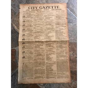
RARE 200 yr old Newspaper, City Gazette, Charleston SCConnoisseur Auctions4(333)See Sold PriceMar 02, 2024
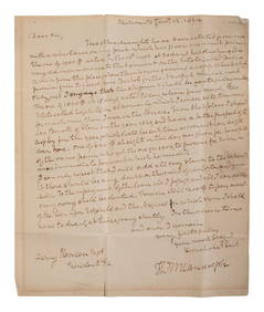
RANDOLPH, Thomas Mann (1768-1828), Virginia Governor and Thomas Jefferson's son-in-law. AutographFreeman's | Hindman4.4(1.6k)See Sold PriceFeb 27, 2024
Mckenney & Hall - Two Octavo Volumes of Text with Rare Plate of Billy BowlegsTrillium Antique Prints & Rare Books4.5(30)See Sold PriceFeb 24, 2024
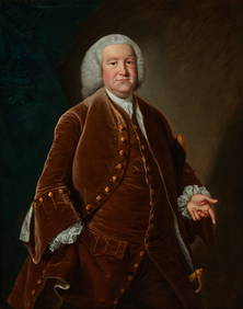
Attrib. to Thomas Hudson, Portrait of a gentlemanAndrew Jones Auctions4.7(206)See Sold PriceFeb 29, 2024
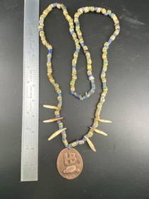
Hudson Bay Necklace with Trade Beads Indian Artifact ArrowheadMike Nichols Auctions4.4(456)See Sold PriceMar 03, 2024
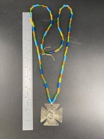
Hudson Bay Cross with Trade Beads Indian Artifact ArrowheadMike Nichols Auctions4.4(456)See Sold PriceMar 03, 2024
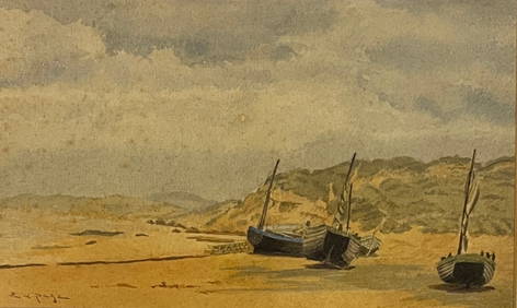
Ernest Lawson (1873 - 1939) American/Canada/FranceCutler Bay Auctions4.5(168)See Sold PriceFeb 29, 2024
Robert de Vaugondy - Map of Canada - Mer de l' Ouest or Sea of the West and a Northwest PassageProverde Auctions4.3(3)See Sold PriceFeb 28, 2024
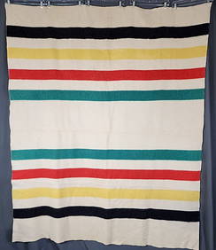
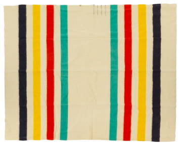
Hudson Bay Co. Wool Blanket, 7 ft. 8 in. x width 6 ft.Vogt Auction Texas4.5(597)See Sold PriceFeb 24, 2024
Herman Moll A New Map of Ye North Parts of AmericaWillow Auction House4.5(283)See Sold PriceMar 14, 2024


![[WITCHCRAFT]. GLANVIL, Joseph (1636-1680). Saducismus Trium... (1 of 4)](https://p1.liveauctioneers.com/928/317913/170625882_1_x.jpg?height=282&quality=70&version=1706650066)