Sold1680 Nova Totius Angliae, Scotiae, and Hiberniae- map1680 Nova Totius Angliae, Scotiae, and Hiberniae- map of England, Scotland, and Ireland by Frederico deWit, hand colored two sheet map, 20 by 23.5 inchesSee Sold Price
SoldWit (F de) Nova Totius Angliæ, ScotiæWit (Frederick de) Nova Totius Angliæ, Scotiæ, et Hiberniæ Tab.,British Isles, with title in banner form supported by sea creatures, upper right, engraved map with original hand-colouring in oSee Sold Price
England: Angliae Scotiae et Hiberniae Tab(ula)- Schottland - Irland. Nova totius Angliae Scotiae et Hiberniae tabula. Kupferstich mit Wappenkartusche, einer Nebenkarte der Shetland-Inseln, kl. Windrose und zeitgenöss. Grenz- und Flächenkolorit.See Sold Price
SoldAngliae, Scotiae, et Hiberniae MapHand colored and probably from the Latin text edition of Theatrum Orbis Terrarum by Ortelius, A. Matted and framed under glass. Sight image measuring 13-5/8" in height by 19-1/2" in width. All measureSee Sold Price
SoldAngliae, Scotiae, Et Hiberniae MapCirca 1575; hand colored map of England and Scotland by Abraham Ortelius (1527-1598), 19 x 13 1/2 in., framed.See Sold Price
Angliae, Scotiae, et Hiberniae MapHand colored and probably from the Latin text edition of Theatrum Orbis Terrarum by Ortelius, A. Matted and framed under glass. Sight image measuring 13-5/8" in height by 19-1/2" in width. All measureSee Sold Price
Angliae, Scotiae, et Hiberniae MapHand colored and probably from the Latin text edition of Theatrum Orbis Terrarum by Ortelius, A. Matted and framed under glass. Measures 23-5/8" in height by 29-1/2" in width with the sight image measSee Sold Price
Sold(BRITISH ISLES.) Wit, Frederick de. Novissima Prae(BRITISH ISLES.) Wit, Frederick de. Novissima Prae Caeteris Aliis Accuratissima Regnorum Angliae, Scotiae, Hiberniae. Engraved map of England, Scotland and Ireland. 23¾x20 inches sheet size, narrSee Sold Price
SoldDanckerts (Theodore) British IslesDanckerts (Theodore) Novissima et Accuratissima Totius Angliæ, Scotiæ et Hiberniæ Tabula,British Isles, Ireland, northern France, Belgium and Holland, large title cartouche with putti, water nSee Sold Price
SoldAngliae Scotiae et Hiberniae 1572 MapThe British Isles by Abraham Ortelius. The hand tinted copperplate engraved map has been nicely framed and with a reverse painted glass perimeter. Some slight discoloration consistent with age. OveralSee Sold Price
SoldAllard's Map of the British IslesALLARD, Carol (1648 - 1709).Accuratissima Angliae, Scotiae, et Hiberniae.Engraved map with hand color in three sheets.Amsterdam: 1690.21" x 46" sheet.Extremely rare map of the British Isles, publishedSee Sold Price
SoldHomann (J.B.) Magna BritanniaHomann (Johann Baptist) Magna Britannia, complectens Angliæ, Scotiæ et Hiberniæ Regna, engraved map with original hand-colouring, 495 x 585mm., central vertical fold, surface dirt, slight margSee Sold Price
SoldBritish Isles.- Ortelius (Abraham) Angliae, Scotiae, etBritish Isles.- Ortelius (Abraham) Angliae, Scotiae, et Hiberniae, sive Britannicar: Insularum Descriptio, map of the British Isles oriented with north to the right, with the north of France to the leSee Sold Price
British Isles.- Ortelius (Abraham) Angliae, Scotiae, etBritish Isles.- Ortelius (Abraham) Angliae, Scotiae, et Hiberniae, sive Britannicar: Insularum Descriptio, map of the British Isles oriented with north to the right, with the north of France to the leSee Sold Price
Soldc. 1570 Abraham Ortelius Map of Britain"Angliae, Scotiae, Et Hiberniae, Sive Britannicar: Insvlarvm Descriptio."; detailed map of the British Isles from the first "modern" atlas, Ortelius' Theatrum Orbis Terrarum; north oriented to the rigSee Sold Price
SoldMap of England, Scotland, Wales and IrelandMagna Britannia Complectens Angliae Scotiae Hiberniae Regna, hand colored. Sight size 19 1/4 x 23 inches. Matted and framed. Notice to bidders: Condition reports and additional photographs are provideSee Sold Price
Map of England, Scotland, Wales and IrelandMagna Britannia Complectens Angliae Scotiae Hiberniae Regna, hand colored. Sight size 19 1/4 x 23 inches. Matted and framed. Notice to bidders: Condition reports and additional photographs are provideSee Sold Price
SoldCAMDEN (William) Britannia, sive Florentissimorum,CAMDEN (William) Britannia, sive Florentissimorum, Regnorum Angliae, Scotiae, Hiberniae.., Amsterdam: W. Jansson 1617, 12mo, (142 x 93mm), with 44 (of 45) maps, lacking Suffolk, library stamps to versSee Sold Price
SoldBritain.- Hermannides (Rutgerus) Britannia magna, siveNO RESERVE Britain.- Hermannides (Rutgerus) Britannia magna, sive Angliae, Scotiae, Hiberniae et adjacentium insularum geographico-historica descriptio, engraved pictorial title, with 31 engraved foldSee Sold Price
SoldBritain.- Camden (William) Britannia, Amsterdam, WillemBritain.- Camden (William) Britannia, sive florentissimorum regnorum Angliae, Scotiae, Hiberniae, & insularum adjacentium... descriptio, title with woodcut device, 45 engraved regional and county mapsSee Sold Price
SoldBritain.- Camden (William) Britannia, sive florentiss.NO RESERVE Britain.- Camden (William) Britannia, sive florentiss. Regnorum Angliae, Scotiae, Hiberniae..., title with woodcut device, 18 folding engraved maps only, some light browning, small nicks anSee Sold Price
SoldBritain.- Camden (William) Britannia, 1617.Britain.- Camden (William) Britannia, sive florentissimorum regnorum Angliae, Scotiae, Hiberniae, & insularum adjacentium... descriptio, title with woodcut device, divisional half-titles, and 46 regioSee Sold Price
SoldBritain.- Hermannides (Rutgerus) Britannia magna, siveBritain.- Hermannides (Rutgerus) Britannia magna, sive Angliae, Scotiae, Hiberniae et adjacentium insularum geographico-historica descriptio, engraved pictorial title, with 32 engraved folding plans,See Sold Price
SoldBritain.- Camden (William) Britannia, Amsterdam, WillamBritain.- Camden (William) Britannia, sive florentiss. Regnorum Angliae, Scotiae, Hiberniae..., title with woodcut device, 19 folding engraved maps, some light browning, contemporary ink inscription tSee Sold Price
EARLY 18TH C. DUTCH CHART OF PACIFIC OCEAN BY FREDERIK DE WIT (1629-1706) WITH CALIFORNIA AS ANThomaston Place Auction Galleries4.4(393)See Sold PriceFeb 24, 2024
NICOLAES VISSCHER (NETHERLANDS, 1618-1709) MAP OF THE NEW WORLDThomaston Place Auction Galleries4.4(393)See Sold PriceFeb 24, 2024
MAP - PIETER SCHENK / VALK / JANSSEN Hand Colored superb Map Central Italy c1702Luis Porretta Fine Arts4.3(10)See Sold PriceMar 02, 2024
PIETER SCHENK / VALK / JANSSEN Hand Colored Map of Rhodes Greece ca1702 vgcLuis Porretta Fine Arts4.3(10)See Sold PriceMar 02, 2024
Nova Totius Full Color Geographical World MapThe Benefit Shop Foundation Inc.4.3(2.9k)See Sold PriceFeb 28, 2024
17th Century Hand Colored Engraved Map of GermanyGlobal Auctions Company4.3(36)See Sold PriceMar 03, 2024
Johann Homann Hand-Colored Map Engraving, c. 1730Auctions at Showplace4.6(740)See Sold PriceMar 17, 2024
Willem Blaeu, Etc. 17th C. Antiquarian Maps, 2Auctions at Showplace4.6(740)See Sold PriceMar 17, 2024
De Jode, Rare, pub. 1593 - Map of the British Isles [England, Scotland, Ireland] (Angliae Scotiae etTrillium Antique Prints & Rare Books4.5(32)See Sold PriceFeb 24, 2024
De Jode, Rare, pub. 1593 - Map of Italy (Italiae Totius Orbis olim Domatricis Nova ExactissTrillium Antique Prints & Rare Books4.5(32)See Sold PriceFeb 24, 2024
Map: A 17thC engraved and hand coloured map after Frederik de Wit (1630-1706) titled Nova Persiae,Claydon Auctioneers Ltd4.3(125)See Sold PriceFeb 26, 2024
1772 GREEK BIBLE NEW TESTAMENT antique BIBLIA LATIN text MAP NOVUM TESTAMENTUMJasper524.5(9.9k)See Sold PriceFeb 27, 2024
3 Vintage The World Lithographs, By JanssonThe Benefit Shop Foundation Inc.4.3(2.9k)See Sold PriceMar 13, 2024
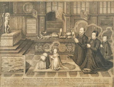
George VERTUE (1684 - 1756) BritishPridham's Auctions & Appraisals4.7(223)See Sold PriceMar 02, 2024
Galliae Regionis Nova Descriptio Hand Colored Map of France on Laid Paper, Ca. 16th Century, H 10" WDuMouchelles4.6(830)See Sold PriceMar 15, 2024


![De Jode, Rare, pub. 1593 - Map of the British Isles [England, Scotland, Ireland] (Angliae Scotiae et (1 of 2)](https://p1.liveauctioneers.com/6581/319571/171593327_1_x.jpg?height=282&quality=70&version=1707853304)