Sold1 piece. Partly Hand-Colored Engraved Celestial M1 piece. Partly Hand-Colored Engraved Celestial Map. Homann, Johann Baptist; Doppelmayer, Johann Gabriel. Hemisphaerium Coeli Boreale." Nuremberg, [1720]. 19 1/2 x 23 1/4 inches; 495 x 590 mm, marginSee Sold Price
Sold1 piece. Hand-Colored Engraved Celestial Map. Mid1 piece. Hand-Colored Engraved Celestial Map. Mid 17th-century. 12 1/4 x 14 3/4 inches; 311 x 375 mm. Old (orig.?) color. Clean. Framed. Depicts the constellation Perseus with Medusa in the center.See Sold Price
Sold1 piece. Partly Hand-Colored Engraved Map. Sayer,1 piece. Partly Hand-Colored Engraved Map. Sayer, Robert; Bennett, John, pub. The Seat of Action between The British and American Forces or, An Authentic Plan of The Western Part of Long Island, withSee Sold Price
Sold1 piece. Hand-Colored Engraved Celestial Map. Sch1 piece. Hand-Colored Engraved Celestial Map. Schenk, Peter. Plainsphaerum Coeleste." Amsterdam, [ca. 1705]. 19 1/2 x 22 1/4 inches; 495 x 565 mm, narrow margins. bright & generally clean. Full old (oSee Sold Price
Sold1 piece. Hand-Colored Engraved Celestial Map. Cen1 piece. Hand-Colored Engraved Celestial Map. Centre du Monde. Systemes de Ptolomee et de Ticho-Brahe." Paris, 1761. 15 1/2 x 22 inches; 393 x 558 mm, wide margins. Minor dust soiling & foxing, mainlySee Sold Price
Sold1 piece. Partly Hand-Colored Engraved Map. Faden,1 piece. Partly Hand-Colored Engraved Map. Faden, William. A Plan of The Operations of The King's Army under the Command of General Sir William Howe, K.B. in New York & East New Jersey, against The AmSee Sold Price
Sold1 piece. Hand-Colored Engraved Celestial Map. Hom1 piece. Hand-Colored Engraved Celestial Map. Homann, John Baptist. Planiglobi Terrestris cum Utroq. Hemisphaerio Caelesti Generalis Exhibito." Nuremberg, [ca. 1730]. 19 1/4 x 22 1/2 inches; 489 x 570See Sold Price
Sold1 piece. Partly Hand-Colored Engraved Map. [Janss1 piece. Partly Hand-Colored Engraved Map. [Jansson, Jan.] Magnae Britanniae et Hiberniae, Nova Descripto." Amsterdam, [ca. 1638-1646]. 17 x 21 3/8 inches (430 x 540 mm). Browned, split along center fSee Sold Price
Sold[MAPS] FER, NICOLAS DE [After] A New Map of the E[MAPS] FER, NICOLAS DE [After] A New Map of the East Indies Taken from M. de Fer's Map of Asia Engraved map partly colored by hand. 23 1/2 x 28 1/4 inches. Framed. [London: 18th century]See Sold Price
Sold3 pieces. Engraved Maps & Plans - Egypt: [Mercato3 pieces. Engraved Maps & Plans - Egypt: [Mercator/Hondius/Jansson Atlas?] Africae, Egyptum Inferiorem Exhibens." Ca. 1730. Partly hand-colored engraving. 9 3/4 x 14 1/2 inches (247 x 368 mm), wide maSee Sold Price
Sold1 piece. Hand Colored Engraved Map. Jansson, Jan1 piece. Hand Colored Engraved Map. Jansson, Jan. "Tabula Italia." Amsterdam, 1640. 18 x 21 1/4 inches; 457 x 540 mm. Margins repaired, small vertical tear at upper right edge. Vignette borders.See Sold Price
Sold1 piece. Hand-Colored Engraved Map. Moll, Herman.1 piece. Hand-Colored Engraved Map. Moll, Herman. A New and Exact Map of the Dominions of the King of Great Britain on Ye Continent of North America..." (London), 1715 [but 1755]. 24 x 40 inches; 610See Sold Price
Sold1 piece. Hand-Colored Engraved Map. Speed, John.1 piece. Hand-Colored Engraved Map. Speed, John. The Kingdom of Scotland." (London): Sudbury & Humble, 1610. 15 x 20 1/8 inches; 390 x 511 mm. Old (orig.?) color. Moderately age toned, margins occasioSee Sold Price
Sold1 piece. Hand-Colored Engraved Map. Chatelain, Hen1 piece. Hand-Colored Engraved Map. Chatelain, Henri Abraham. Carte tres Curieuse de la Mer du Sud." [Amsterdam], [ca. 1719]. 32 3/4 x 56 1/2 inches; 832 x 1435 mm, in 4 joined sheets mounted to bd. OSee Sold Price
Sold1 piece. Hand-Colored Engraved Map. A Map of Penn1 piece. Hand-Colored Engraved Map. A Map of Pennsylvania Exhibiting not only the Improved Parts of That Province,... Chiefly from the Late Map of W. Scull... La Pensilvanie en Trois Feuilles..." [ParSee Sold Price
Sold1 piece. Hand-Colored Engraved Map. De1 piece. Hand-Colored Engraved Map. Delisle, Guillaume. "L'Amerique Septentrionalis." Amsterdam: Covens and Mortier, [1730]. 18 7/8 x 22 7/8 inches; 480 x 580 mm, full margins. Old outline color, cartSee Sold Price
Sold1 piece. Hand-Colored Engraved Map. San1 piece. Hand-Colored Engraved Map. Sanson d'Abbeville, Nicolas. "Amerique Septentrionale." Paris: Pierre Mariette, 1669. 15 5/8 x 22 inches; 395 x 560 mm, margins. Small area of dampstaining in top cSee Sold Price
Sold1 piece. Hand-Colored Engraved Map. Montanus, Arno1 piece. Hand-Colored Engraved Map. Montanus, Arnold; Ogilby, John. Insulae Americanae in oceano Septentrionali, cum Terris adiacentibus." [London], [1671]. 11 1/4 x 14 1/4 inches; 285 x 362 mm, fullSee Sold Price
Sold1 piece. Hand-Colored Engraved Map. Speed, John.1 piece. Hand-Colored Engraved Map. Speed, John. Kent." London: Thomas Basset & Richard Chiswell, [1647]. 15 x 19 1/2 inches; 380 x 500 mm. Orig. color. Clean & bright, with minor age toning."See Sold Price
Sold1 piece. Hand-Colored Engraved Map. Me1 piece. Hand-Colored Engraved Map. Mercator, Gerard. "Taurica Chersones... Nostra Aetata Przecopsca et Gazara dicitur." [Duisburg], [1602]. 12 3/8 x 15 3/4 inches; 315 x 400 mm, full (?) margins. LigSee Sold Price
Sold1 piece. Hand-Colored Engraved Map Fragment. Moll1 piece. Hand-Colored Engraved Map Fragment. Moll, Herman. [A New and Exact Map of the Dominions of the King."] London: Thomas & John Bowles, 1715 [but 1755]. 21 1/4 x 14 inches; 238 x 355 mm. Orig. oSee Sold Price
Sold1 piece. Hand-Colored Engraved Map. Visscher, Nic1 piece. Hand-Colored Engraved Map. Visscher, Nicholas. Insulae Americanae in Oceano Septentrionali." [Amsterdam], [1698]. 18 1/8 x 22 1/2 inches; 460 x 572 mm, narrow margins. Slightly toned, minor sSee Sold Price
Sold1 piece. Hand-Colored Engraved Map. Me1 piece. Hand-Colored Engraved Map. Mercator, Gerard. "Islandia" [Iceland]. [Duisburg], [1602]. 11 x 17 1/8 inches; 280 x 435 mm, full (?) margins. Light age toning & minor offsetting, minor fissure aSee Sold Price
Sold1 piece. Hand Colored Engraved Map. Ogilby, John.1 piece. Hand Colored Engraved Map. Ogilby, John. The Continuation of the Road from London to Flambrugh." [London], [1675]. 13 3/4 x 17 1/2 inches; 249 x 445 mm. Clean. Framed."See Sold Price
VENET / DEBUCOURT (1755-1832) Set 3 x Aquatint Engraved Hunting Scenes 23" x 16"Luis Porretta Fine Arts4.3(10)See Sold PriceMar 02, 2024
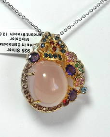
Natural Gems Multicolor Pendant /Brooch 26.35Ct 18k W/gM.D.CHJewelry Co.4.2(85)See Sold PriceFeb 24, 2024
Engraving on glass Johannes Kip La Ville de Londres Prospectus Londinensis City of LondonAuction Wallstreet4.5(47)See Sold PriceMar 02, 2024
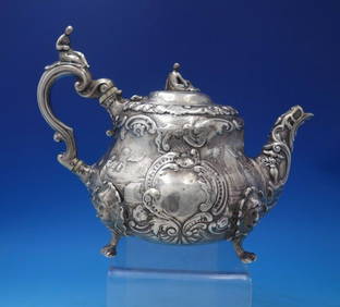
English Victorian Sterling Silver Tea Pot 3-D Finial Figural JapanesqueMynt Auctions4.6(680)See Sold PriceFeb 25, 2024
Unique 1 of 1 Custom 40mm Daytona 'Skeleton' Rolex by WPapps Family Liquidation4.3(355)See Sold PriceFeb 25, 2024
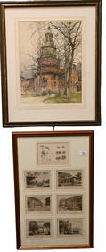
2 PIECES 19C ENGLISH COLORED ENGRAVINGS SIGNED WITH ORIGINAL HANCARVED FRAMESBidhaus4.3(747)See Sold PriceFeb 28, 2024
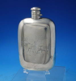
Wallace Sterling Silver Flask w/ Horse Drawn Carriage Rider 5.7 oztMynt Auctions4.6(680)See Sold PriceFeb 28, 2024
William Gale Sterling Silver Cruet Set Holder HH w/ Applied Rings c.1856Bidhaus4.3(747)See Sold PriceFeb 29, 2024
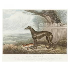
after Sydney R. Wombill (English, Late 19th/Early 20th century), Miss GlendyneLeland Little4.5(692)See Sold PriceFeb 29, 2024
Italian edition of Sanson's map of North America, 1677PBA Galleries4.7(381)See Sold PriceMar 07, 2024
1849 Orr & Co. Hand Colored Southern Germany MapMatthew Bullock Auctioneers4.7(1.8k)See Sold PriceMar 02, 2024
Hand Painted Navajo Native American Sand Wedding VaseRapid Estate Liquidators and Auction Gallery4.5(1.1k)See Sold PriceFeb 26, 2024


![[MAPS] FER, NICOLAS DE [After] A New Map of the E (1 of 1)](https://p1.liveauctioneers.com/292/8142/1390878_1_x.jpg?height=282&quality=70)