Sold1 piece. Engraved Map with Outline Color. Robert1 piece. Engraved Map with Outline Color. Robert de Vaugondy, Gilles & Didier. Etats-Unis de l'Amerique Septentrionale..." Paris: Boudet, 1785 (or later). 19 1/2 x 25 1/2 inches; 495 x 647 mm, full? mSee Sold Price
Sold1 piece. Engraved Map with Outline Color. Romans,1 piece. Engraved Map with Outline Color. Romans, Bernard. A General Map of The Southern British Colonies in America... North and South Carolina, Georgia, East and West Florida,..." [London], 1776. 20See Sold Price
Sold1 piece. Engraved Map with Out-Line Color. Scull,1 piece. Engraved Map with Out-Line Color. Scull, W. A Map of Pennsylvania Exhibiting not only The Improved Parts of that Province, but also its Extensive Frontiers..." London: Sayer & J. Bennett, 177See Sold Price
Sold1 piece. Engraved Map with Outline Color. Senex,1 piece. Engraved Map with Outline Color. Senex, John. A Map of Louisiana and of The River Mississippi." [London], [1719 or later.] 19 1/8 x 22 3/8 inches; 485 x 568 mm, margins. Slightly toned, someSee Sold Price
Sold1 piece. Engraved Map with Outline Color. Jaillot1 piece. Engraved Map with Outline Color. Jaillot, Charles Hubert Alexis. Amerique Septentrionale Divisee en ses Principales Parties..." Amsterdam: Pierre Mortier, [1695-1719]. 22 1/2 x 34 5/8 inches;See Sold Price
Sold1 piece. Engraved Map with Outline Color. Moll, H1 piece. Engraved Map with Outline Color. Moll, H. Carolina." (London), 1729. 7 3/4 x 10 3/4 inches; 197 x 273 mm - image size. Central & western parts of map dampstained. Framed."See Sold Price
Sold1 piece. Engraved Map with Outline Color. Fer, Ni1 piece. Engraved Map with Outline Color. Fer, Nicolas de. Le Cours du Nil, Suivant les Auteurs Modernes..." Paris, 1720. 18 1/4 x 25 3/4 inches (463 x 654 mm), full margins. Slightly toned. Orig. colSee Sold Price
Sold1 piece. Folding Engraved Map with Outline Color.1 piece. Folding Engraved Map with Outline Color. Tanner, H.S. Map of Pennsylvania and New Jersey." [Philadelphia], 1827. 21 x 27 1/2 inches; 553 x 698 mm. Generally light creasing along folds, clean.See Sold Price
Sold1 piece. Hand-Colored Engraved Map. De1 piece. Hand-Colored Engraved Map. Delisle, Guillaume. "L'Amerique Septentrionalis." Amsterdam: Covens and Mortier, [1730]. 18 7/8 x 22 7/8 inches; 480 x 580 mm, full margins. Old outline color, cartSee Sold Price
Sold1 piece. Hand-Colored Engraved Map. De1 piece. Hand-Colored Engraved Map. Delisle, Guillaume. "Carte du Paraguay, du Chili,.." Amsterdam: Covens and Mortier, [1730]. 19 5/8 x 22 5/8 inches; 498 x 575 mm. full margins. Outline color. SomeSee Sold Price
Sold2 pieces. Engraved Maps with Outline Color & Colo2 pieces. Engraved Maps with Outline Color & Color Cartouches. Zatta, Antonio: La Baja d'Hudson, Terra di Labrador e Groenlandia..." Venice, 1778. 12 1/2 x 16 1/2 inches; 317 x 419 mm, full margins. *See Sold Price
Sold[NETHERLANDS]. Robert de Vaugondy. Partie Sep[NETHERLANDS]. Robert de Vaugondy. Partie Septentrionale Du Duche De Brabant...1752. Double-page engraved map, outline color, cartouche also tastefully colored. 19 x 23 1/8. Not examined out of frameSee Sold Price
SoldCarte de la Virginie et du MarylandRobert de Vaugondy after Fry & Jefferson. engraved map with original hand-color in outline. Paris, 1755. 19 3/4 x 26 1/4 inches, 31 x 38 inches framed. Very fine example of Vaugondy's pre-RevolutionarSee Sold Price
SoldSamuel Dunn. China. 1774.[China]. Samuel Dunn. China, Divided into its Great Provinces, and the Isles of Japan. Double-page engraved map, 12 7/8 x 18 1/8 in. Lon: Robert Sayer, 1774 [1774-96]. Contemporary outline color. FainSee Sold Price
SoldLes Indes Orientales Ou Sount Distingues Les Empires etGilles Robert de Vaugondy. Paris: Vangundy, 1755. Engraved map with original hand color in outline. 26 x 19 1/2 inches sheet. A crisply engraved map describing India, Thailand, Cambodia, Vietnam, MalaSee Sold Price
Sold[Russian Map] 1780[Russian Map], The European and Asiatic Part of the Russian Empire, from d'Anville's maps, published for Robert Sayer's "General Atlas", 1780, engraved, with spare outline color, sheet 21 1/4 in. x 51See Sold Price
Sold5 pieces. Engraved Maps with Outline Color (4 map5 pieces. Engraved Maps with Outline Color (4 maps + text leaves). Chiquet, Jacques: L'Amerique Septentrionale." * "L'Amerique Meridonale." * "Estats de L'Empire... Sultan et Ottomans Empereur." * "EsSee Sold Price
Sold1 piece. Partly Hand-Colored Engraved Map. Sayer,1 piece. Partly Hand-Colored Engraved Map. Sayer, Robert; Bennett, John, pub. The Seat of Action between The British and American Forces or, An Authentic Plan of The Western Part of Long Island, withSee Sold Price
Sold[NORTH AMERICA]. Robert de Vaugondy. Paries D[NORTH AMERICA]. Robert de Vaugondy. Paries De L'Amerique Septent? qui comprend La Nouvelle France ou le Canada...[Paris]: 1755. Double-page engraved map, outline color, cartouche uncolored. 18 3/4 xSee Sold Price
Sold12 pieces. Engraved Maps - Egypt - British & Amer12 pieces. Engraved Maps - Egypt - British & American printings, ca. 1840s & 1850s. Folio & 4to sheets. 7 colored or with outline color. Scattered wear.See Sold Price
Sold[ITALY]. D'Anville. Tabula Italiae Antiquae G[ITALY]. D'Anville. Tabula Italiae Antiquae Geographica...1764. Double-page engraved map, outline color. 25 x 18 1/2. Fine condition, verso blank. This is a live auction at our physical auction gallerSee Sold Price
Sold1 piece. Hand-Colored Engraved Map. Speed, John.1 piece. Hand-Colored Engraved Map. Speed, John. The Kingdom of Scotland." (London): Sudbury & Humble, 1610. 15 x 20 1/8 inches; 390 x 511 mm. Old (orig.?) color. Moderately age toned, margins occasioSee Sold Price
Sold1 piece. Hand-Colored Engraved Map. Speed, John.1 piece. Hand-Colored Engraved Map. Speed, John. Kent." London: Thomas Basset & Richard Chiswell, [1647]. 15 x 19 1/2 inches; 380 x 500 mm. Orig. color. Clean & bright, with minor age toning."See Sold Price
SoldJohn Senex engraved map with outline color A New MapJohn Senex engraved map with outline color A New Map of the English Empire in America East Coast John Senex 1719 sight size 20 1/2" x 24 1/4" Provenance: Property from the Credit Suisse AmericanSee Sold Price
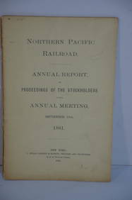
Northern Pacific RR 17th Annual Report-Version 1-September 15, 1881JM Hobby Supply and Railroad Artifact Auctions4.4(127)See Sold PriceFeb 24, 2024
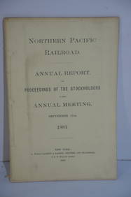
Northern Pacific RR 17th Annual Report-Version 2-September 15, 1881JM Hobby Supply and Railroad Artifact Auctions4.4(127)See Sold PriceFeb 24, 2024
Crams Railroad Map of New York-1881JM Hobby Supply and Railroad Artifact Auctions4.4(127)See Sold PriceFeb 24, 2024
Crams Township and Railroad Map of New York-1890JM Hobby Supply and Railroad Artifact Auctions4.4(127)See Sold PriceFeb 24, 2024
Hammonds Map of Kentucky and Tennessee Railroads-1910JM Hobby Supply and Railroad Artifact Auctions4.4(127)See Sold PriceFeb 24, 2024
Map: An 18thC engraved and hand coloured map of Buckinghamshire after Robert Morden. Approx. 8 1/4"Claydon Auctioneers Ltd4.3(125)See Sold PriceFeb 26, 2024
Map: A 17thC engraved and hand coloured map of Bedfordshire after Robert Morden. Approx. 12 1/2" xClaydon Auctioneers Ltd4.3(125)See Sold PriceFeb 26, 2024
Foulis.- Dryden (John, translator).- Virgilius Maro (Publius) The Works, 3 vol., Robert & AndrewForum Auctions4.3(53)See Sold PriceFeb 29, 2024
Oxfordshire.- P[lot] (R[obert]) The Natural History of Oxford-shire, being an Essay toward theForum Auctions4.3(53)See Sold PriceFeb 29, 2024
Ireland.- Smedley (Edward) Erin. A Georgraphical and Descriptive Poem, 2 parts in 1, first edition,Forum Auctions4.3(53)See Sold PriceFeb 29, 2024
COLONIES FRANÇAISES AFRIQUE. Africa Sénégambie Madagascar. LEVASSEUR 1856 mapJasper524.5(9.9k)See Sold PriceFeb 28, 2024
AFRIQUE. Africa. Decorative antique map/carte by Victor LEVASSEUR 1856 oldJasper524.5(9.9k)See Sold PriceFeb 28, 2024
Afrique…Nord-Ouest' & 'Inde' by Meissas. N Africa India Singapore 1861 old mapJasper524.5(9.9k)See Sold PriceFeb 28, 2024
Herman Moll A New Map of Ye North Parts of AmericaWillow Auction House4.5(289)See Sold PriceMar 14, 2024


![[NETHERLANDS]. Robert de Vaugondy. Partie Sep (1 of 1)](https://p1.liveauctioneers.com/179/10971/2682756_1_x.jpg?height=282&quality=70&version=1162265652)


![[Russian Map] 1780 (1 of 2)](https://p1.liveauctioneers.com/268/42534/18598062_1_x.jpg?height=282&quality=70&version=1372441964)


![[NORTH AMERICA]. Robert de Vaugondy. Paries D (1 of 1)](https://p1.liveauctioneers.com/179/10971/2682759_1_x.jpg?height=282&quality=70&version=1162265652)

![[ITALY]. D'Anville. Tabula Italiae Antiquae G (1 of 1)](https://p1.liveauctioneers.com/179/10971/2682741_1_x.jpg?height=282&quality=70&version=1162265652)


![Oxfordshire.- P[lot] (R[obert]) The Natural History of Oxford-shire, being an Essay toward the (1 of 1)](https://p1.liveauctioneers.com/5458/319736/171654562_1_x.jpg?height=282&quality=70&version=1708010439)


