Sold1 piece. Engraved Map with Out-Line Color. Scull,1 piece. Engraved Map with Out-Line Color. Scull, W. A Map of Pennsylvania Exhibiting not only The Improved Parts of that Province, but also its Extensive Frontiers..." London: Sayer & J. Bennett, 177See Sold Price
Sold1 piece. Engraved Map with Outline Color. Romans,1 piece. Engraved Map with Outline Color. Romans, Bernard. A General Map of The Southern British Colonies in America... North and South Carolina, Georgia, East and West Florida,..." [London], 1776. 20See Sold Price
Sold1 piece. Engraved Map with Outline Color. Senex,1 piece. Engraved Map with Outline Color. Senex, John. A Map of Louisiana and of The River Mississippi." [London], [1719 or later.] 19 1/8 x 22 3/8 inches; 485 x 568 mm, margins. Slightly toned, someSee Sold Price
Sold1 piece. Engraved Map with Outline Color. Jaillot1 piece. Engraved Map with Outline Color. Jaillot, Charles Hubert Alexis. Amerique Septentrionale Divisee en ses Principales Parties..." Amsterdam: Pierre Mortier, [1695-1719]. 22 1/2 x 34 5/8 inches;See Sold Price
Sold1 piece. Engraved Map with Outline Color. Moll, H1 piece. Engraved Map with Outline Color. Moll, H. Carolina." (London), 1729. 7 3/4 x 10 3/4 inches; 197 x 273 mm - image size. Central & western parts of map dampstained. Framed."See Sold Price
Sold1 piece. Engraved Map with Outline Color. Fer, Ni1 piece. Engraved Map with Outline Color. Fer, Nicolas de. Le Cours du Nil, Suivant les Auteurs Modernes..." Paris, 1720. 18 1/4 x 25 3/4 inches (463 x 654 mm), full margins. Slightly toned. Orig. colSee Sold Price
Sold1 piece. Folding Engraved Map with Outline Color.1 piece. Folding Engraved Map with Outline Color. Tanner, H.S. Map of Pennsylvania and New Jersey." [Philadelphia], 1827. 21 x 27 1/2 inches; 553 x 698 mm. Generally light creasing along folds, clean.See Sold Price
Sold1 piece. Hand-Colored Engraved Map. De1 piece. Hand-Colored Engraved Map. Delisle, Guillaume. "L'Amerique Septentrionalis." Amsterdam: Covens and Mortier, [1730]. 18 7/8 x 22 7/8 inches; 480 x 580 mm, full margins. Old outline color, cartSee Sold Price
Sold1 piece. Hand-Colored Engraved Map. De1 piece. Hand-Colored Engraved Map. Delisle, Guillaume. "Carte du Paraguay, du Chili,.." Amsterdam: Covens and Mortier, [1730]. 19 5/8 x 22 5/8 inches; 498 x 575 mm. full margins. Outline color. SomeSee Sold Price
Sold2 pieces. Engraved Maps with Outline Color & Colo2 pieces. Engraved Maps with Outline Color & Color Cartouches. Zatta, Antonio: La Baja d'Hudson, Terra di Labrador e Groenlandia..." Venice, 1778. 12 1/2 x 16 1/2 inches; 317 x 419 mm, full margins. *See Sold Price
Nolin's Double Hemisphere Map of the WorldMappe-Monde Carte Universelle de la Terre...J. B. Nolin (c.1657-1708). Engraved Map with hand color in outline. Paris, Ans 3 (1791). 21 x 27 1/2 inches sheet. Striking double hemisphere map of the WorSee Sold Price
Sold5 pieces. Engraved Maps with Outline Color (4 map5 pieces. Engraved Maps with Outline Color (4 maps + text leaves). Chiquet, Jacques: L'Amerique Septentrionale." * "L'Amerique Meridonale." * "Estats de L'Empire... Sultan et Ottomans Empereur." * "EsSee Sold Price
Sold12 pieces. Engraved Maps - Egypt - British & Amer12 pieces. Engraved Maps - Egypt - British & American printings, ca. 1840s & 1850s. Folio & 4to sheets. 7 colored or with outline color. Scattered wear.See Sold Price
Sold[NETHERLANDS]. Robert de Vaugondy. Partie Sep[NETHERLANDS]. Robert de Vaugondy. Partie Septentrionale Du Duche De Brabant...1752. Double-page engraved map, outline color, cartouche also tastefully colored. 19 x 23 1/8. Not examined out of frameSee Sold Price
Sold[ITALY]. D'Anville. Tabula Italiae Antiquae G[ITALY]. D'Anville. Tabula Italiae Antiquae Geographica...1764. Double-page engraved map, outline color. 25 x 18 1/2. Fine condition, verso blank. This is a live auction at our physical auction gallerSee Sold Price
Sold1 piece. Hand-Colored Engraved Map. Speed, John.1 piece. Hand-Colored Engraved Map. Speed, John. The Kingdom of Scotland." (London): Sudbury & Humble, 1610. 15 x 20 1/8 inches; 390 x 511 mm. Old (orig.?) color. Moderately age toned, margins occasioSee Sold Price
Sold1 piece. Hand-Colored Engraved Map. Speed, John.1 piece. Hand-Colored Engraved Map. Speed, John. Kent." London: Thomas Basset & Richard Chiswell, [1647]. 15 x 19 1/2 inches; 380 x 500 mm. Orig. color. Clean & bright, with minor age toning."See Sold Price
Sold1 piece. Hand-Colored Engraved Map. Bl1 piece. Hand-Colored Engraved Map. Bleau, Willem [& Jan]. "Comitatus Bentheim et Steinfurt." [Amsterdam], [ca. 1650]. 14 1/2 x 19 1/2 inches; 368 x 495 mm, margins. Generally clean. Old color. FramedSee Sold Price
Sold1 piece. Hand-Colored Engraved Map. Lotter, Tobia1 piece. Hand-Colored Engraved Map. Lotter, Tobias Conrad. Pensylvania, Nova Jersey et Nova York..." Augsburg, [ca. 1750]. 22 3/4 x 19 3/4 inches; 580 x 502 mm. Old (orig.?) color. Crease along centerSee Sold Price
Sold1 piece. Hand-Colored Engraved Map. (Bleau, Joan.1 piece. Hand-Colored Engraved Map. (Bleau, Joan.) Nova Aegypti Tabula." (Amsterdam), (1662). 17 1/4 x 20 1/2 inches (438 x 546 mm), full margins. Old or orig. color. Latin text on verso. Slightly toSee Sold Price
Sold1 piece. Hand-Colored Engraved Map. Me1 piece. Hand-Colored Engraved Map. Mercator, Gerard. "Italia." [Duisburg], [1602]. 14 9/16 x 18 1/2 inches; 370 x 470 mm, full (?) margins. Light age toning, some offsetting. Orig. color. Latin textSee Sold Price
Sold1 piece. Hand-Colored Engraved Map. Me1 piece. Hand-Colored Engraved Map. Mercator, Gerard. "Lithuania." [Duisburg], [1602]. 14 3/4 x 17 1/4 inches; 375 x 438 mm, full (?) margins. Light age toning & minor offsetting. Orig. color. Latin tSee Sold Price
Sold1 piece. Hand-Colored Engraved Map. Fuller, Thoma1 piece. Hand-Colored Engraved Map. Fuller, Thomas. Aegyptus Antiqua." [London], ca. 1650. 11 1/2 x 13 1/2 inches (292 x 342 mm), good (full?) margins. Minor wear & smudging. Old or orig. color."See Sold Price
Sold1 piece. Hand-Colored Engraved Map. Homann Heirs.1 piece. Hand-Colored Engraved Map. Homann Heirs. Mappa Geographica Regni Poloniae." Nuremberg, 1750. 18 3/4 x 21 3/8 inches; 476 x 542 mm. Later color? Slightly dusty. Framed."See Sold Price
Northern Pacific RR 17th Annual Report-Version 1-September 15, 1881JM Hobby Supply and Railroad Artifact Auctions4.4(127)See Sold PriceFeb 24, 2024
Northern Pacific RR 17th Annual Report-Version 2-September 15, 1881JM Hobby Supply and Railroad Artifact Auctions4.4(127)See Sold PriceFeb 24, 2024
1875 Rand Avery and Co. Map of Express Companies and Railroads of the USA and CanadaJM Hobby Supply and Railroad Artifact Auctions4.4(127)See Sold PriceFeb 24, 2024
Crams Railroad Map of New York-1881JM Hobby Supply and Railroad Artifact Auctions4.4(127)See Sold PriceFeb 24, 2024
Crams Township and Railroad Map of New York-1890JM Hobby Supply and Railroad Artifact Auctions4.4(127)See Sold PriceFeb 24, 2024
Hammonds Map of Kentucky and Tennessee Railroads-1910JM Hobby Supply and Railroad Artifact Auctions4.4(127)See Sold PriceFeb 24, 2024
Rand McNally Township County and Railroad Map of Illinois-1879JM Hobby Supply and Railroad Artifact Auctions4.4(127)See Sold PriceFeb 24, 2024
Grand Trunk Railroad Across the Continent Through Canada Book-1917JM Hobby Supply and Railroad Artifact Auctions4.4(127)See Sold PriceFeb 24, 2024
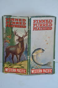
Western Pacific RR Finned Furred Feathered Brochure-1912JM Hobby Supply and Railroad Artifact Auctions4.4(127)See Sold PriceFeb 24, 2024
Oregon Short Line RR April 1899 Public TimetableJM Hobby Supply and Railroad Artifact Auctions4.4(127)See Sold PriceFeb 24, 2024
3 Piece sterling silver picture frames, (1) Cartier frame, engraved Cartier label on top, measuresNeely Auction4.6(224)See Sold PriceFeb 25, 2024
Hermes Kelly Elan Handbag Vaux Madame Deep Blue Silver Hardware B EngravedMynt Auctions4.6(697)See Sold PriceFeb 27, 2024
Ireland.- Smedley (Edward) Erin. A Georgraphical and Descriptive Poem, 2 parts in 1, first edition,Forum Auctions4.3(53)See Sold PriceFeb 29, 2024
COLONIES FRANÇAISES AFRIQUE. Africa Sénégambie Madagascar. LEVASSEUR 1856 mapJasper524.5(9.9k)See Sold PriceFeb 28, 2024
AFRIQUE. Africa. Decorative antique map/carte by Victor LEVASSEUR 1856 oldJasper524.5(9.9k)See Sold PriceFeb 28, 2024
Afrique…Nord-Ouest' & 'Inde' by Meissas. N Africa India Singapore 1861 old mapJasper524.5(9.9k)See Sold PriceFeb 28, 2024
Herman Moll A New Map of Ye North Parts of AmericaWillow Auction House4.5(289)See Sold PriceMar 14, 2024


![[NETHERLANDS]. Robert de Vaugondy. Partie Sep (1 of 1)](https://p1.liveauctioneers.com/179/10971/2682756_1_x.jpg?height=282&quality=70&version=1162265652)
![[ITALY]. D'Anville. Tabula Italiae Antiquae G (1 of 1)](https://p1.liveauctioneers.com/179/10971/2682741_1_x.jpg?height=282&quality=70&version=1162265652)